The Ultimate Swiss Alps Adventure & Hiking Guide: From Interlaken to Zermatt and Davos
The Swiss Alps are a hiker's paradise, offering some of the most breathtaking alpine scenery, glacier views, and turquoise lakes in the world. This is not just a guide; it's a meticulously planned Swiss Alps adventure road trip designed for the active traveler. We'll start by exploring the iconic Bernese Oberland—diving into the stunning trails and charming towns around Brienz, Grindelwald, and Lauterbrunnen Valley. From there, we journey to the majestic peaks of Zermatt and the historic trails of the Swiss National Park near Davos. Prepare your boots, pack your sense of adventure, and follow this guide to discover incredible public trails and roadside vistas in the Swiss Alps.
The Bernese Oberland: Hiking the Best of Brienz, Grindelwald, and Lauterbrunnen
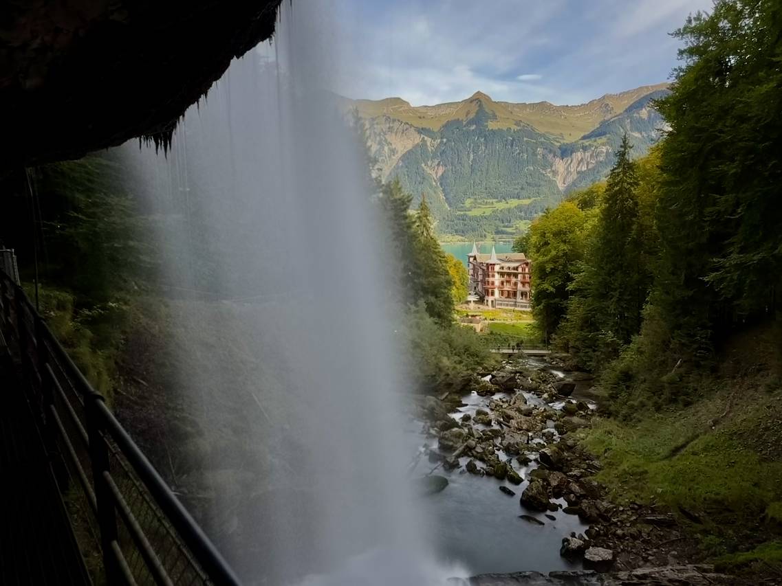
1. Giessbach Falls Trail: Hike Behind the Waterfall Near Brienz
Brienz is home to the stunning
Giessbach Falls Trail,
a must-do loop hike in the Bernese Oberland. This short trail allows you to explore the magnificent multi-tiered Giessbach Falls and offers a truly unique experience: walking directly behind the main waterfall cascade for breathtaking views over the turquoise waters of Lake Brienz (Brienzersee). Along the 2.7 km path, you'll find multiple waterfalls (cascades VII through XI) and pass the historic Grandhotel Giessbach (perfect for a scenic espresso break!). This is one of the area's best family-friendly hikes, combining spectacular waterfalls with views of the iconic hotel and lake. Note: Pre-paid parking reservations are required to access the trailhead at the Grand Hotel.
View the Giessbach Falls Trail
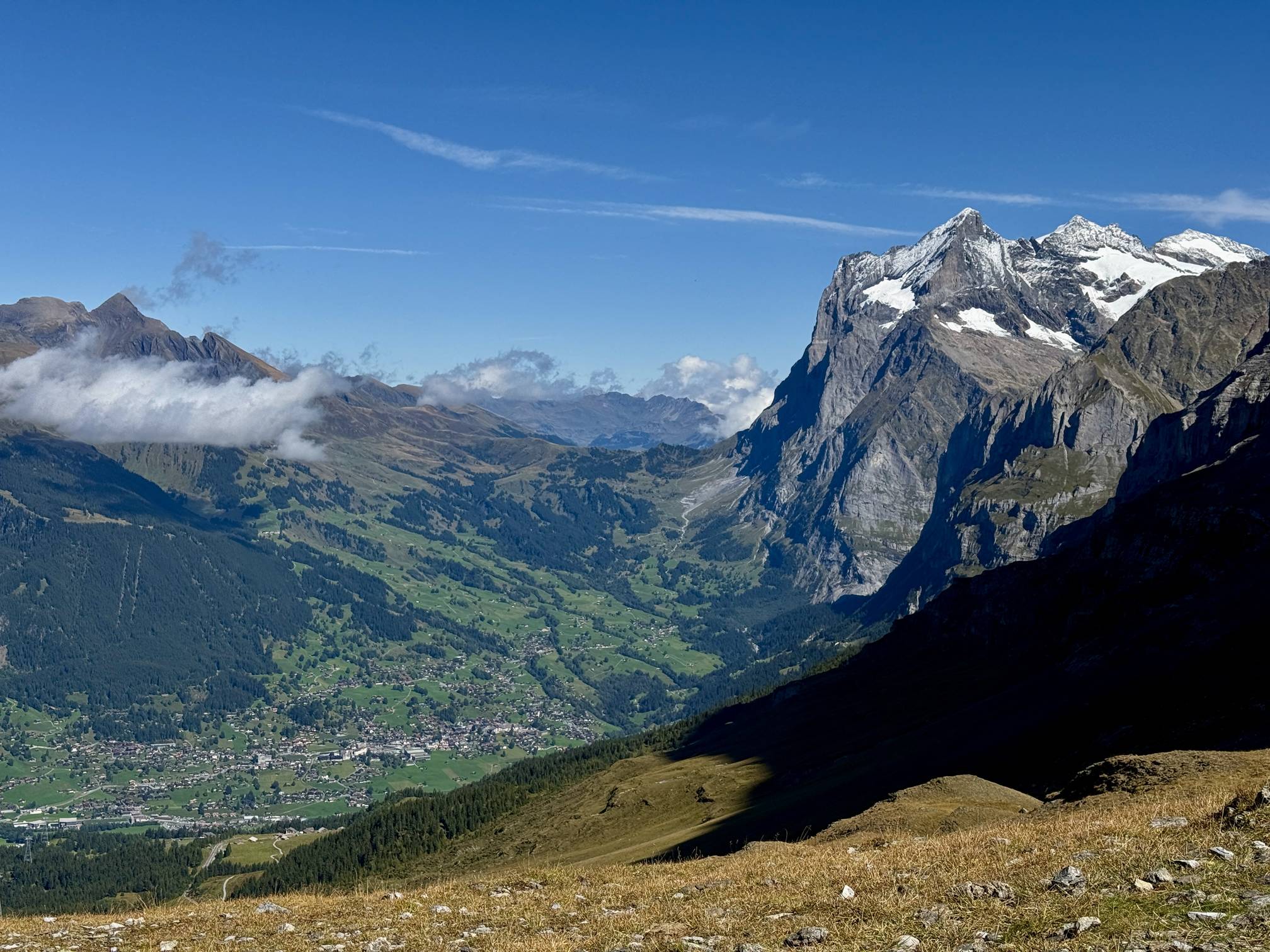
2. Eiger Trail & Eiger Walk: Panoramic Hiking Below the North Face
No visit to Grindelwald is complete without hiking the iconic
Eiger Trail.
This is favorite route of mine and combines the Eiger Walk and the Eiger Trail into one breathtaking 8.6 km journey from Kleine Scheidegg to Alpiglen. It delivers unparalleled views of the Eiger North Face towering 1,800 meters overhead and sweeping panoramas across the Lauterbrunnen and Grindelwald Vallies. Along the way, you'll traverse majestic alpine slopes, pass the turquoise waters of Fallbodensee, and might even spot wild ibex. This moderate hike is the quintessential Swiss Alps adventure, offering a unique chance to get up close to the Eiger Glacier and enjoy a celebratory espresso at Berghaus Alpiglen before taking the train back down to Grindelwald.
View Our Eiger Trail Guide
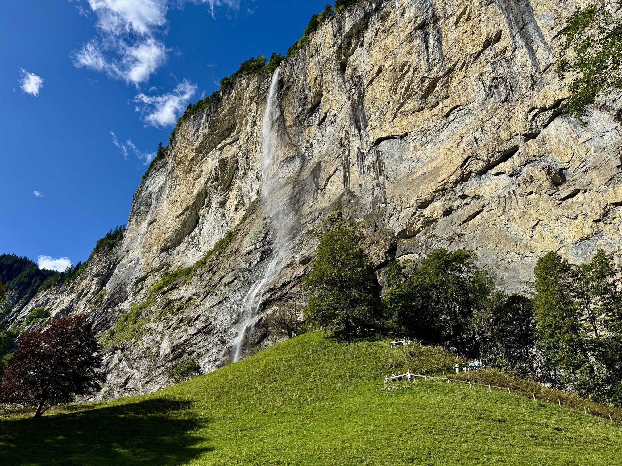
3. Staubbach Falls: Hike Through the Rock Tunnel in Lauterbrunnen Valley
Dominating the quaint village of Lauterbrunnen is
Staubbach Falls,
one of the most famous waterfalls in the valley, plunging an incredible 297 meters over a sheer glacial-carved cliff. This short, but steep walk is an essential stop for any Lauterbrunnen or Bernese Oberland itinerary. The highlight is the ascent via a trail that has been tunneled through the mountainside, leading you right up behind the powerful cascade. From this unique viewpoint, you'll feel the refreshing mist and enjoy a stunning bird's-eye view of the entire Lauterbrunnen Valley. Even if you don't hike up, the viewpoint at the base offers a universally-accessible look at this massive curtain of water.
Explore Staubbach Falls
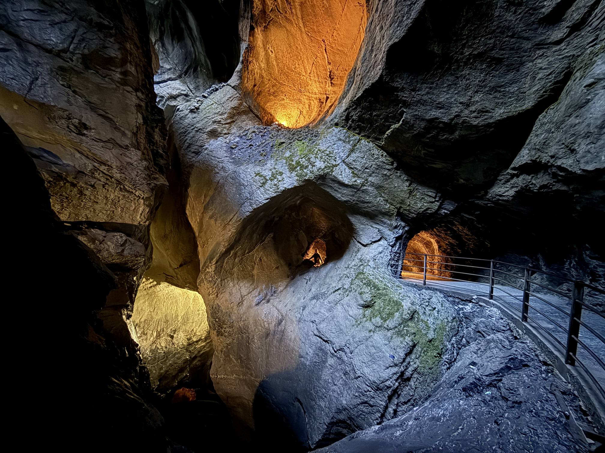
4. Trümmelbach Falls: Explore the Glacier Waterfalls Inside the Mountain
Located deep in the Lauterbrunnen Valley,
Trümmelbach Falls
is one of Switzerland's most astonishing natural sights. This is the only place in the world where you can view ten powerful, glacier-fed waterfalls hidden inside of a mountain. Up to 20,000 liters of water per second thunder through a narrow gorge, which you can access via a mechanical tunnel lift. The moderate, 1.3 km trail guides you through dimly-lit, carved rock chambers and tunnels, giving you a unique experience of the water's immense force. This is a must-see for anyone exploring the Bernese Oberland in Lauterbrunnen Valley, but be aware that the trail involves many stairs, is unsuitable for children under four, and requires an entrance fee.
Explore Trümmelbach Falls
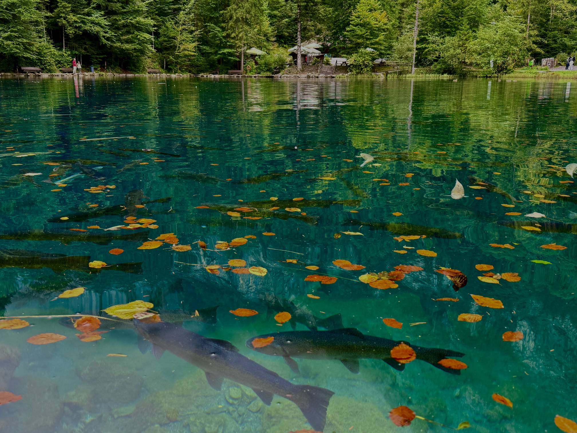
5. Blausee Nature Park: Road Trip Stop at the Crystal-Clear Blue Lake
As you transition from the Bernese Oberland toward Zermatt, the stunning
Blausee (Blue Lake)
is a mandatory stop. Famous for its exceptionally clear, vibrant turquoise waters fed by underground springs, this Nature Park offers a beautiful and easy 2.6 km loop walk. The accessible main path leads you past massive glacial erratics and to the lake's edge, where you can spot schools of trout and the submerged "Maid of Blausee" statue. The full loop crosses the Kander River to waterfalls, passes a trout farm, and cruises through a lush forest, making it a perfect, short break to stretch your legs. Note: Both parking and entry require separate fees, so plan for a morning or afternoon visit.
View the Blausee Trail
Ready to Explore the Bernese Oberland?
Explore more Bernese Oberland hikes on our interactive trail map.
See All Hikes in the Bernese Oberland
Don't let Google decide who you trust.
Zermatt: High Alpine Hiking Under the Iconic Matterhorn
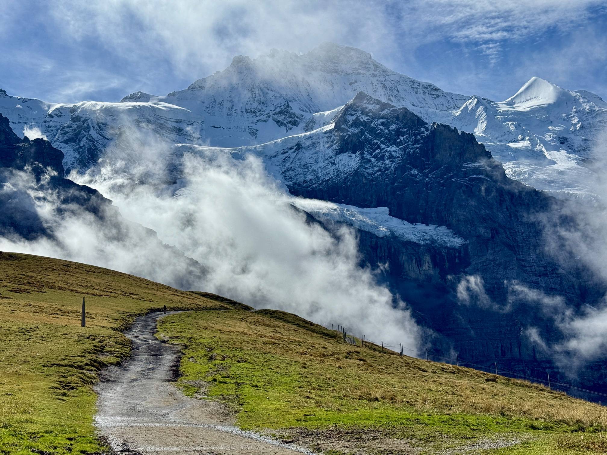
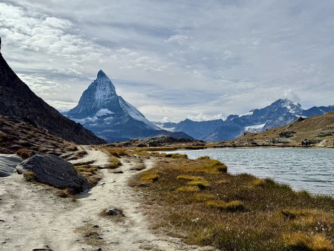
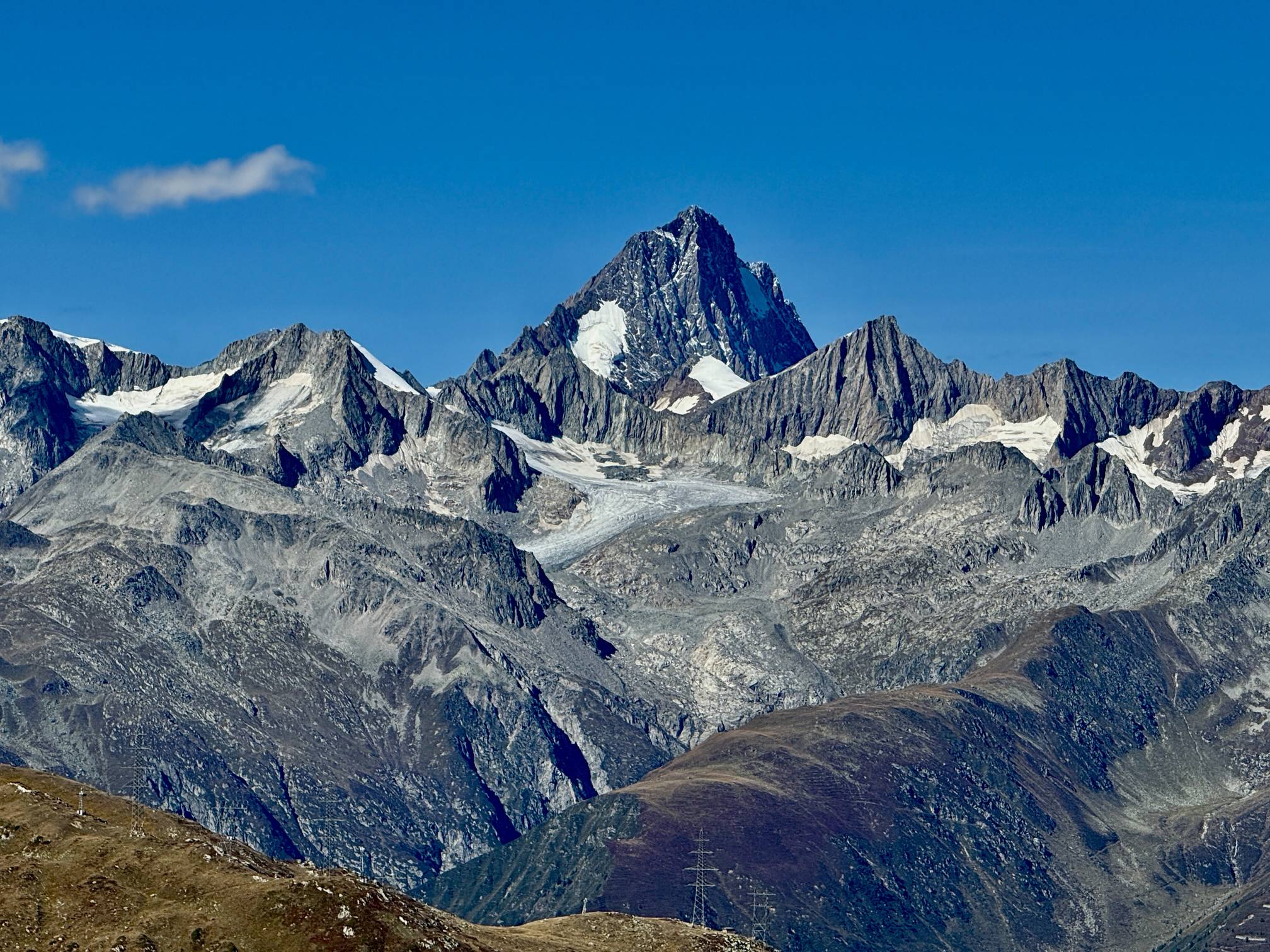
1. The Gornergrat Descent: Glacier Vistas and Matterhorn Reflections
For the ultimate scenic payoff with minimal uphill effort, the descent from
Gornergrat to Findelbach station
is unparalleled. Begin by riding the historic Gornergrat Bahn to the summit, where you are instantly greeted by the massive Monte Rosa massif and the sprawling Gorner Glacier. This moderate, 10.5 km (6.5 mi) hike is primarily downhill, delivering continuous, jaw-dropping views of the Matterhorn—most famously mirrored in the tranquil waters of the Riffelsee alpine lake. As you descend past Riffelberg and Riffelalp, you are immersed in the exposed alpine landscape, with panoramic scenes high above the Zermatt Valley before finally entering a beautiful larch forest near the end of your journey to the Findelbach station.
View the Gornergrat Trail
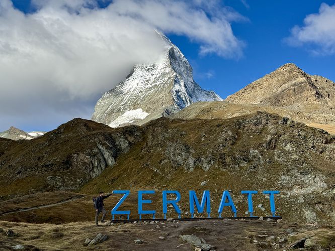
2. The Towering Matterhorn: Schwarzsee to Furi Hike
For a stunning perspective of the Matterhorn's sheer face and to gain a new appreciation for the vast
Gornergrat
region you just explored, the downhill 4.15 km (2.6 mi) hike from Schwarzsee to Furi is a must-see. Accessed via the Matterhorn Express gondola, this route begins with the Matterhorn towering immediately overhead. While the Matterhorn may occasionally duck out of view, this trail provides unparalleled vistas of the sprawling Monte Rosa massif,
Gornergrat (Gorner Ridge),
and the expansive Grenzgletscher glacier. After soaking in sweeping alpine meadows—and snapping a photo at the popular "Zermatt" sign near the start—the path winds pleasantly down through a beautiful larch forest, ending in the charming, quiet village of Furi for a well-deserved meal before taking the gondola back to Zermatt.
View the Schwarzsee to Furi Hike
Unlock App Features
Download Routes
Better Maps
Profile Bling
Become a
Supporter
today to unlock website and mobile app perks!
-
Unlock App Features
-
Download Routes
-
Better Maps
-
Profile Bling
Become a
Supporter
today to unlock website and mobile app perks!
Exploring Ticino's Mountain Pass Trails and Bellinzona Castles
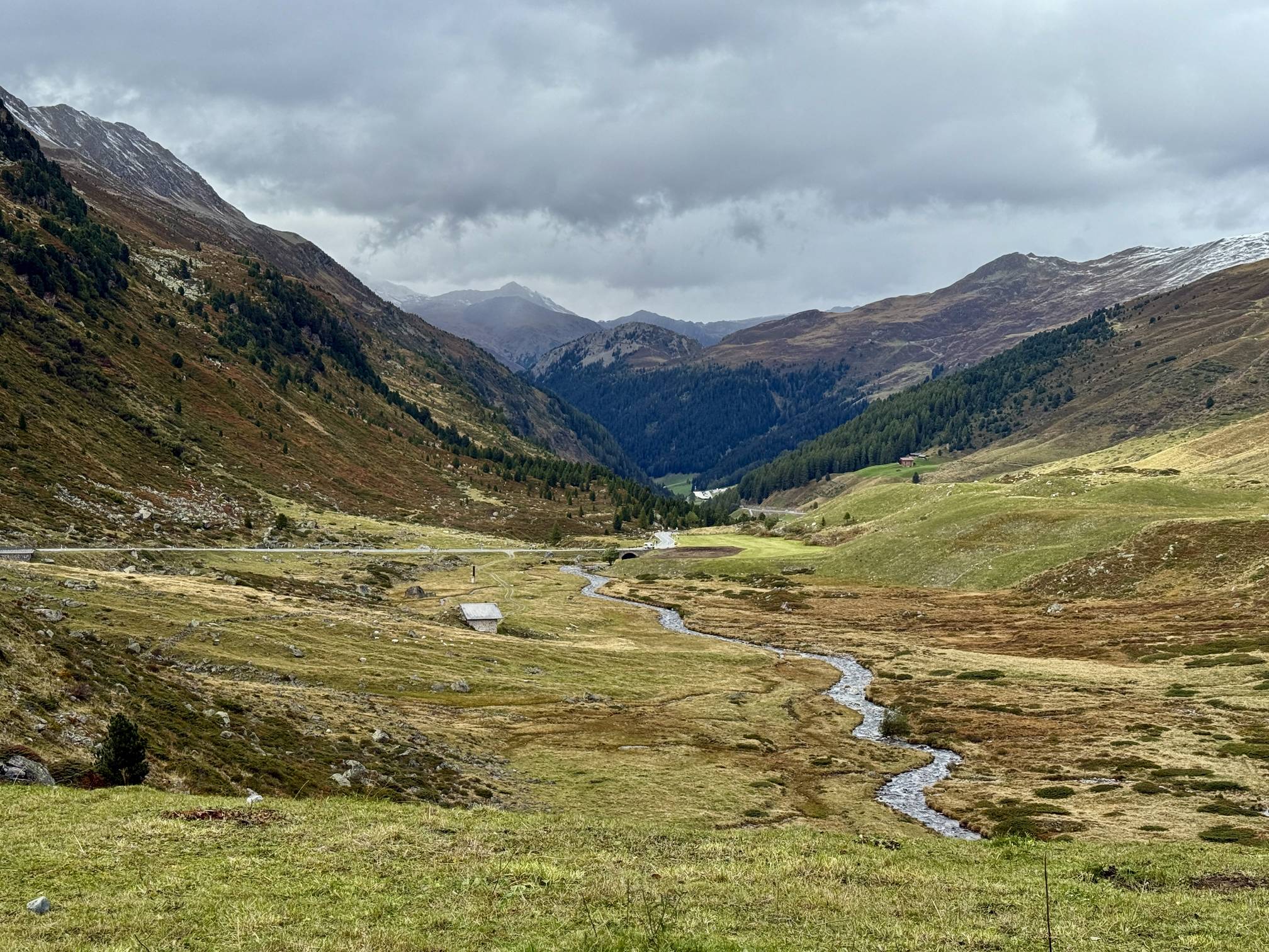
1. Nufenen Pass: A Short Hike to Griessee Glacier and Bernese Alps Views
As the second-highest paved mountain road in Switzerland, Nufenen Pass (Passo della Novena) offers easily accessible, world-class views where the cantons of Valais and Ticino meet. Though primarily a road trip highlight, this pass features a superb, short 0.7 km walk leading to a panoramic viewpoint. The trail provides dramatic overlooks of the glacial Griessee lake, the Griesgletscher glacier, and the jagged, towering peaks of the distant Bernese Alps, including the Finsteraarhorn. It's the perfect, moderate ascent to stretch your legs at 2,478 meters (8,130 feet) before continuing your descent into the warmer valleys of Ticino. Note: Always check conditions, as the pass is typically closed from November to May due to heavy snow.
Explore Nufenen Pass
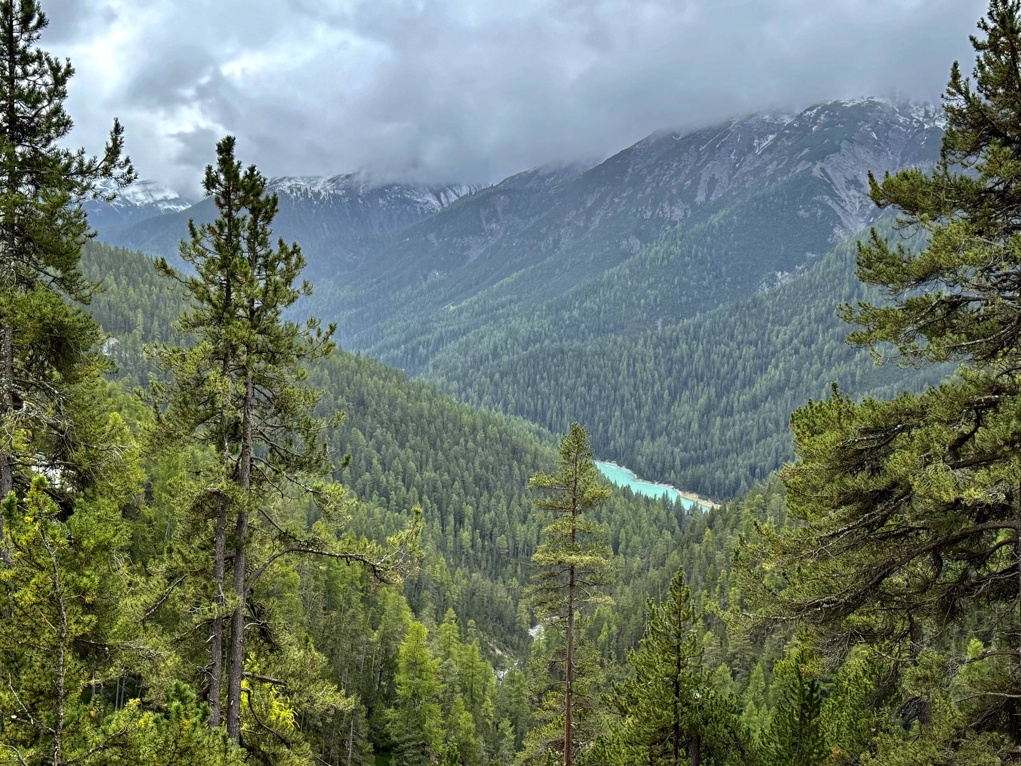
2. Gotthard Pass: Hike to Lago di Lucendro and Alpine Military Bunkers
The historic Gotthard Pass provides a fun combination of scenic beauty and military history at the gateway to Ticino. This short, moderate 2.3 km hike leads to a spectacular viewpoint high above Lago di Lucendro (Lake Lucendro). The trail offers breathtaking views of the pass, the large reservoir dam, and the surrounding alpine peaks. As you ascend, you'll pass abandoned Swiss military bunkers—a fascinating nod to the pass's strategic past—paired with modern wind turbines. While there's a paved, moderate path, more adventurous hikers can opt for a steep hillside route to reach the turquoise-hued lake vista before completing the loop back to the trailhead. Like Nufenen, this pass is generally accessible only between June and October.
View the Lake Lucendro Trail
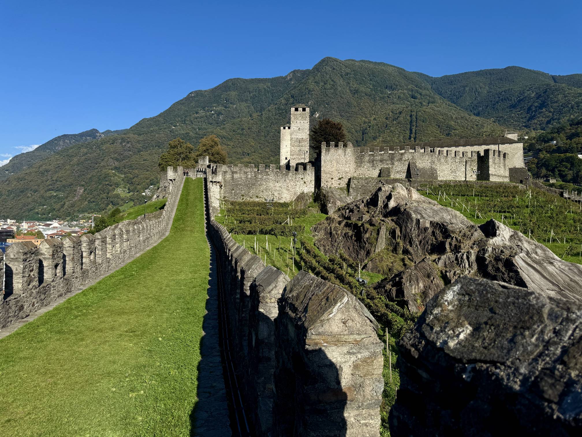
3. Castel Grande: A UNESCO Castle Walk in Bellinzona, Gateway to Ticino
Shift your adventure from mountain passes to the cultural heart of Ticino with a walk through Castel Grande, the oldest and grandest of Bellinzona's three UNESCO World Heritage Castles. This short, scenic 0.7 km route immerses you in over 6,000 years of history, which once commanded the key trade routes through the Alps. Access is a modern marvel, beginning with an elevator ride carved into the bedrock near Piazza del Sole. Once atop the fortress walls, you'll find breathtaking views of the city, the Ticino Valley, and the best vantage point to spot the other two historic castles, Montebello and Sasso Corbaro. It’s the perfect cultural complement to your Swiss adventure road trip.
View the Castel Grande Guide
Davos and the Eastern Alps: Scenic Lake Walks and Swiss National Park
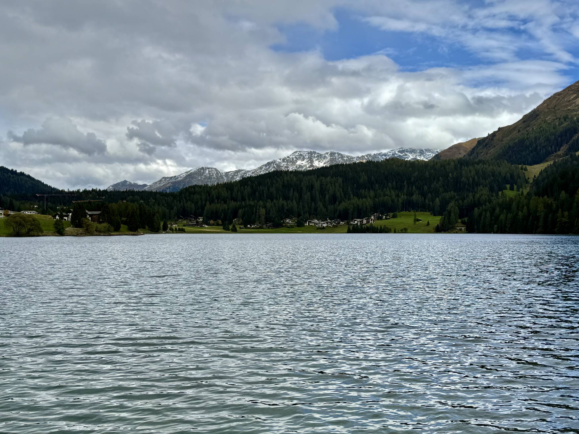
1. Lake Davos Seepromenade: Easy, Accessible Alpine Views in the Heart of Davos
For a relaxed dose of the Swiss Alps, the
Lake Davos Trail
(also known as the Seepromenade) is a perfect choice. This easy, flat 3.9 km loop circles the shimmering turquoise waters of Lake Davos (Davosersee), providing stunning, unobstructed views of the surrounding alpine peaks right in the heart of the city. The crushed stone path is universally accessible, making it ideal for every visitor, including those with wheelchairs or strollers. Keep an eye out during the warm months for grazing Swiss cows whose chiming bells add a charming, classic soundtrack to this beautiful walk. This promenade is a must-visit for a gentle, scenic experience in the Davos region.
View the Lake Davos Trail
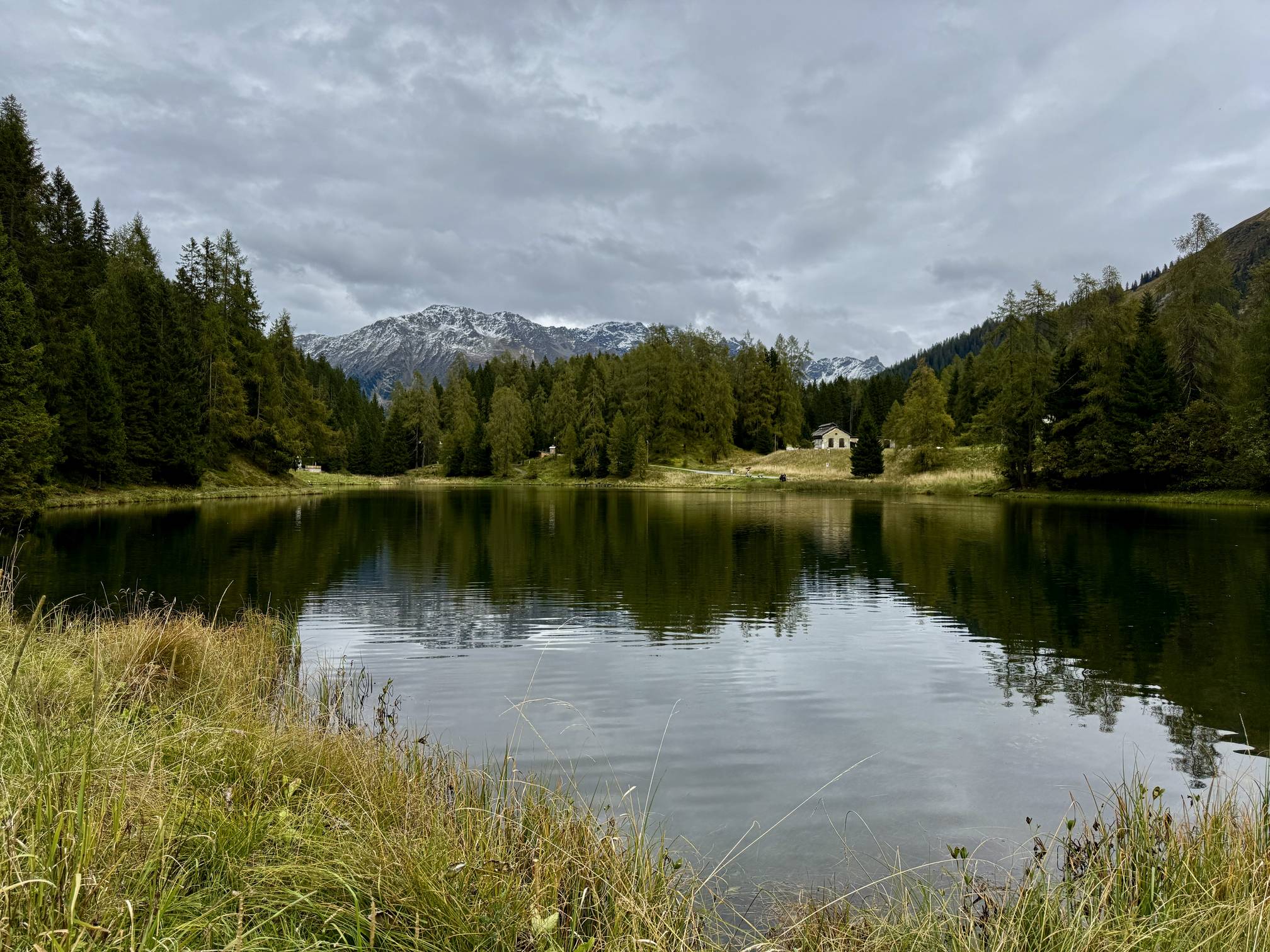
2. Schwarzsee Lake Trail: Serene Loop Walk to Pischahorn Views near Davos
For a bit of solitude and classic alpine scenery near Davos, the
Schwarzsee Lake Trail
is a perfect 1.1 km loop. This easy, serene walk circles the dark, glassy waters of the Black Lake (Schwarzsee), providing an immediate escape into nature. The trail offers spectacular, mirror-like reflections of the surrounding Swiss Alps—including clear views of the snow-capped Pischahorn. It's an ideal, family-friendly outing where you can enjoy a picnic, find a fun rope swing, and soak in the stillness of the Eastern Alps before continuing your journey. Start your hike from the Lareterstrasse public parking lot for direct access to this picturesque spot.
View the Schwarzsee Lake Trail
3. Grand Tour of Switzerland: Davos/Klosters
Experience one of the most magnificent panoramas on the Grand Tour of Switzerland with a brief stop at the western side of Flüela Pass. This viewpoint, easily accessible just a short drive from Davos and Klosters, provides a dramatic, high-alpine vista without requiring any hiking. From the roadside parking, it's a quick walk to capture the sheer scale of the Graubünden peaks and watch a large waterfall plunging into the valley. It's the perfect, universally-accessible spot for road trippers and photographers seeking an iconic Swiss Alps photo opportunity, especially at sunset. Remember to check seasonal closures, as the Pass is typically closed during winter.
View the Grand Tour: Davos/Klosters
4. Lai da Ova Spin: Turquoise Reservoir View of Swiss National Park
A phenomenal, low-effort stop for road trippers traversing the Engadine Valley or Ofen Pass is the Lai da Ova Spin Reservoir Overlook. This accessible roadside pull-off near Zernez offers a surreal, high-reward view of the reservoir's milky turquoise water, famously colored by glacial flour. Located right on the edge of the Swiss National Park, the viewpoint provides a dramatic contrast between the vivid water and the dark forests and towering peaks of the deep gorge. It's the perfect, universally-accessible spot to capture the essence of the Eastern Alps' intense colors without leaving the road.
Explore Lai da Ova Spin
Don't let Google decide who you trust.
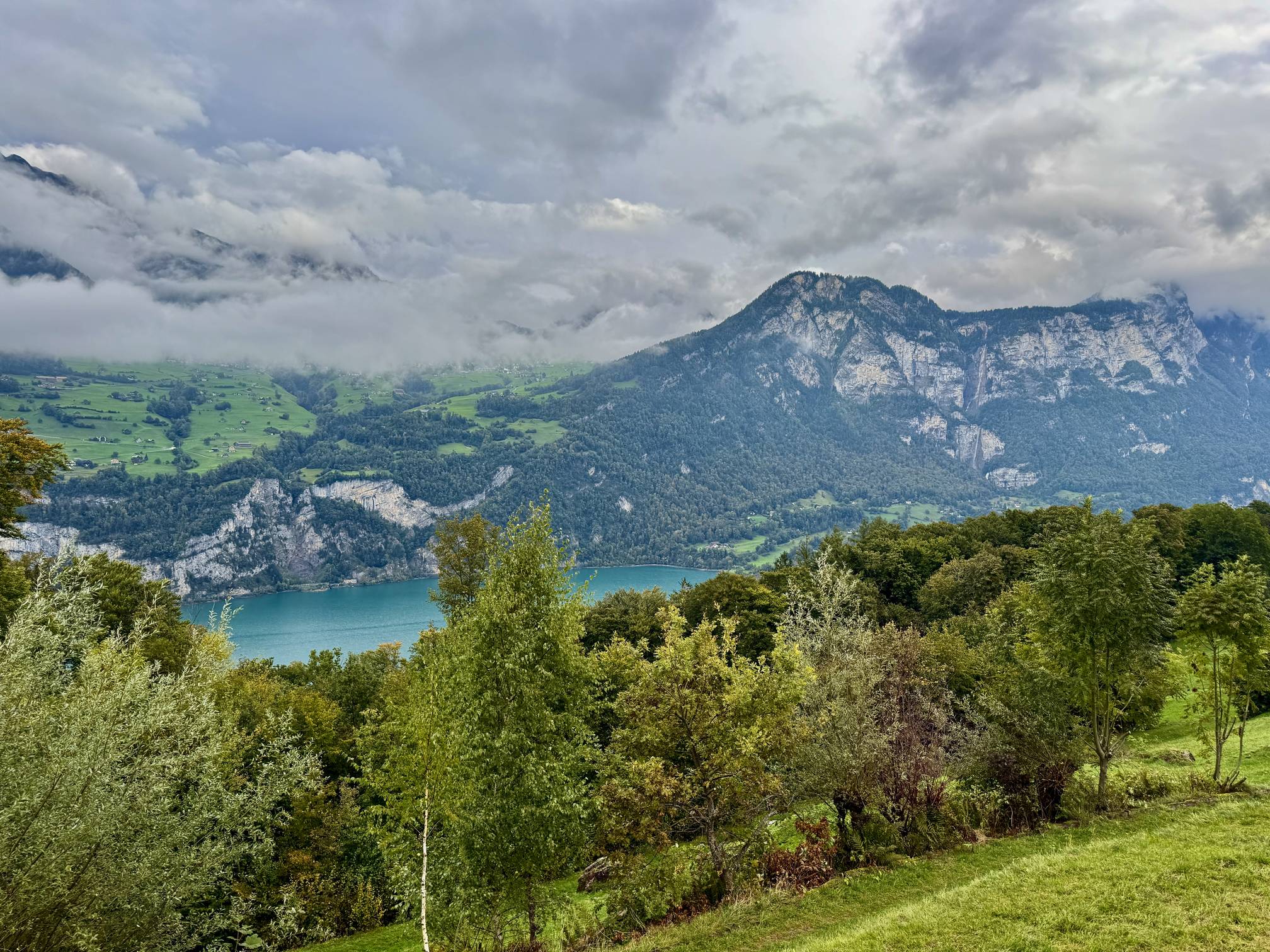
Walensee: Turquoise Waters, Epic Waterfalls, and the Paxmal Walk
1. Helsana Trail: Panoramic Views of Walensee and Seerenbach Falls
The
Helsana Trail loop
near Filzbach is a short, moderate 2.4 km hike that delivers a scenic reward for minimal effort. This moderate trail provides stunning panoramic overlooks of the deep turquoise waters of Walensee and the dramatic Alpine landscape. The main draw is the incredible, distant view of Seerenbach Falls (Seerenbachfälle), which, at 585 meters, is Switzerland's second-tallest waterfall, cascading down the cliff face across the lake. This scenic route is perfect for families, offering a mix of forest paths, open meadows, and unique features like a high-altitude viewpoint with a wooden horn.
Explore the Helsana Trail
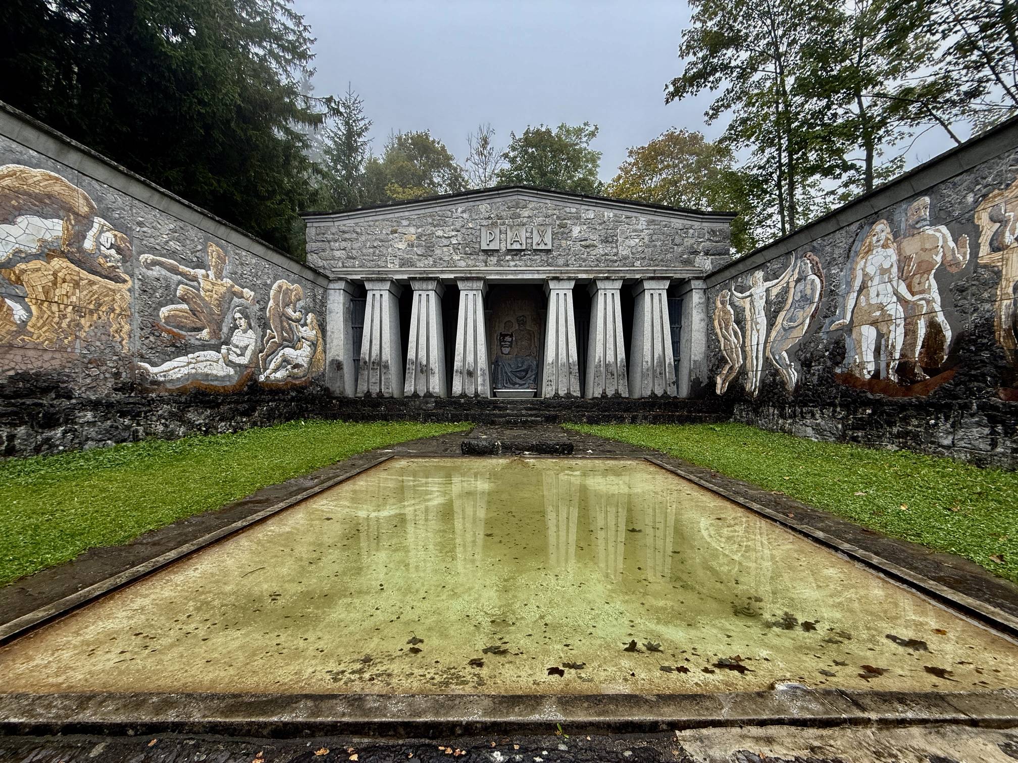
2. Paxmal: Walk to the "Temple of Peace" Overlooking Walensee
Conclude your Swiss adventure with a walk to the Paxmal, a serene and stunning art monument situated high above Walenstadt. This easy, 1 km out-and-back walk leads to a monumental stone structure created by artist Karl Bickel, often called a "Temple of Peace." The Paxmal features vibrant frescoes depicting the development of humanity and offers some of the best, most panoramic views of the Walensee's turquoise waters and the dramatic Glarus Alps. The drive along Ruggstrasse to the trailhead is an adventure itself, but the reward is a beautiful blend of art, philosophy, and a final, unforgettable Swiss Alps vista.
View the Paxmal Trail
Ready to Explore Switzerland?
This guide is just your starting point. Use our detailed, full-length trail guides below to plan the logistics, parking, entry fees, and specific routes for your Swiss adventures.
See All Switzerland Trail Guides
Download the MyHikes® app Today!
Track your hikes, download Trail and Park routes from MyHikes.org to follow offline, or find a new trail to hike on the MyHikes® app!
 Learn More
You may also like
Explore
Plan your Zermatt Matterhorn hiking trip! Discover unforgettable hikes, where to eat, and how to access the car-free village via Matterhorn Gotthard Bahn.
Explore
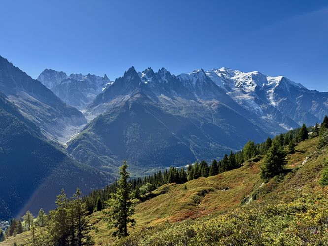
Hike Chamonix’s must-do trails! Find breathtaking Mont Blanc views, reflections on alpine lakes, and secluded waterfalls. Includes where to eat and stay.
Explore
Plan your ultimate European Alps adventure! Discover the best hiking trails, epic scenery, and villages in the Swiss Alps, Dolomites, Chamonix, and Lake Como.
Explore
Discover the Dolomites with our ultimate guide. Explore hikes like Seceda and Alpe di Siusi, turquoise alpine lakes like Lago di Braies, and castle ruins.