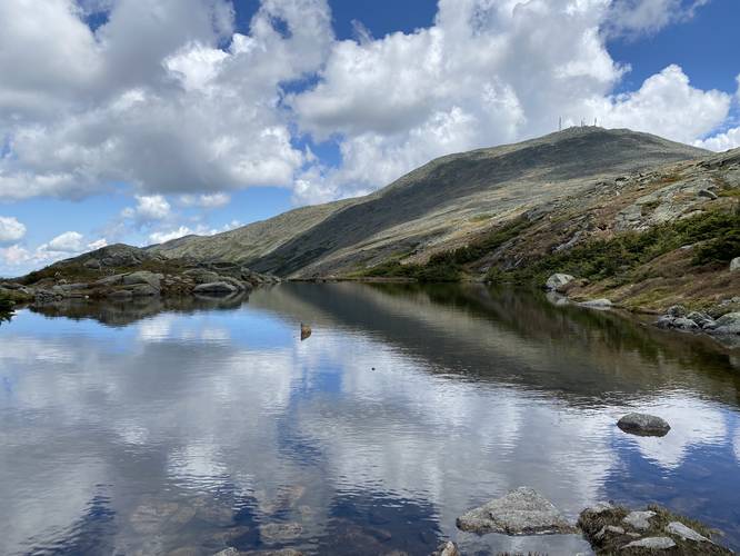
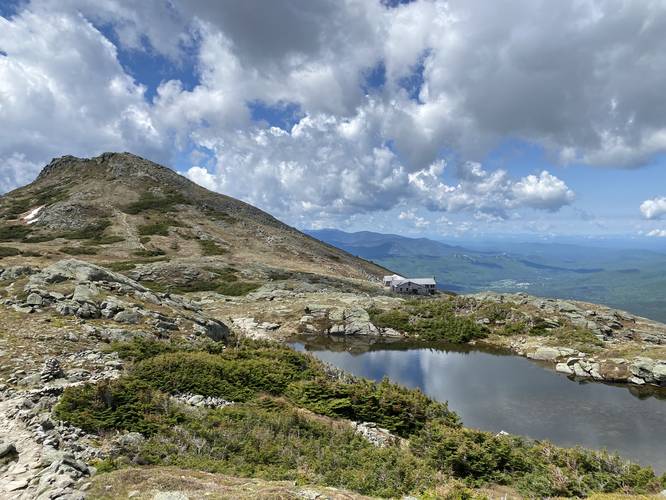
Mt. Washington via the Ammonoosuc Ravine Trail and Jewell Trail in White Mountain National Forest, New Hampshire, is a strenuous 10-mile loop that reaches the summits of Mt. Washington and Mt. Monroe. It also passes by Lakes of the Clouds and the AMC Lakes of the Clouds Hut while providing some of the most scenic alpine views from the top of New England.
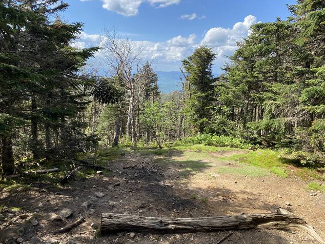
Trails: This hike encompasses the Ammonoosuc Ravine Trail to Lakes of the Clouds hut, continues on to Mt. Monroe before heading up to the Mt. Washington summit from the Lakes of the Clouds hut via Crawford Path. The hike finally heads back from the summit via the Trinity Heights Connector Trail to the Gulfside Trail which leads to the Jewell Trail. Once on the Jewell Trail, hikers will follow that all the way back to parking. The two main trails on this hike are the Ammonoosuc Ravine and Jewell trails, hence the trail name.
Expect a lot of scrambling up rocks, and a decent amount of time climbing through boulder fields. The hike down will be difficult on your joints no matter what route you choose.
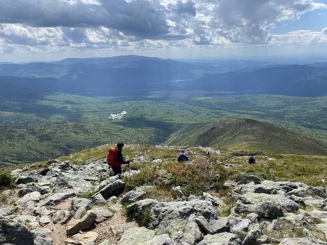
When I went, it was a beautiful day on a holiday weekend, so there were quite a few people both on the trails and at the summit. I only experienced one "traffic jam" while hiking, but if you want to avoid crowds, I would hike this on a weekday if possible. Remember that people can drive or take a shuttle up to the summit, so there will likely be a lot of people at the top. It's not a quiet experience unless you find a spot to sit just below the summit. The good news is that if you wore yourself out too badly on the way up, you can take the train back down and it will drop you off near where you started.
I carried about 1.5L of water on me, but I think 2 would be ideal. You can refill at Lakes of the Clouds hut, and at the summit, and I suggest doing so. You can also buy food and use the restrooms at both locations.
AMC Lakes of the Clouds Hut: Hikers will find restrooms, coffee, snacks, trail maps, patches, socks, and other items to buy at the hut located around mile 2.9 from the parking lot. Hikers can also hang out in their dining room to relax, have a coffee, and get a stunning view.
What to bring: Most of this hike will be spent above treeline, so remember to wear sunscreen, and reapply if needed. Also, anything below treeline is likely to have mosquitoes and other biting bugs, so bug spray is also highly recommended. Bring at least 2-liters of water with you if you can carry it and note that you can refill at the summit and Lakes of the Clouds hut.
Facilities: There are restrooms at the summit of Mt Washington and at the Lakes of the Clouds hut.
Camping: Dispersed camping is allowed beyond 200-feet of the trail along the Ammonoosuc Ravine Trail and the Jewell Trail, but no camping is allowed above the treeline. See this White Mountains PDF for more backcountry camping rules: https://www.fs.usda.gov/Internet/FSE_DOCUMENTS/stelprdb5363715.pdf
Pets: Dogs are allowed if on leash and their waste must be carried out.
Parking & Fees: Hikers will find a very large parking lot at the coordinates provided. As of June 2022, there's a $5 per day per vehicle fee to park.
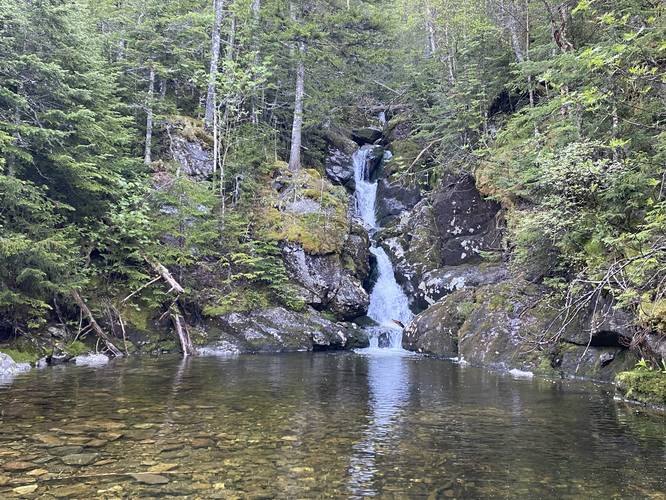
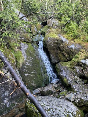
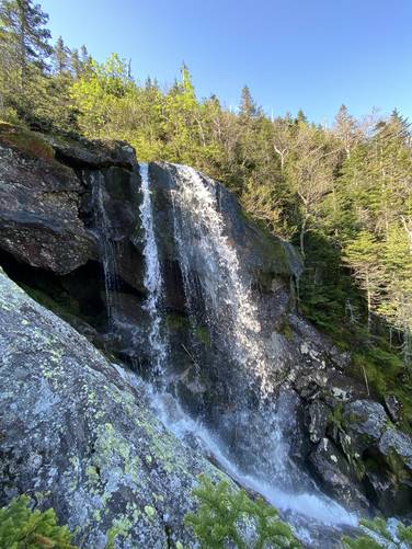
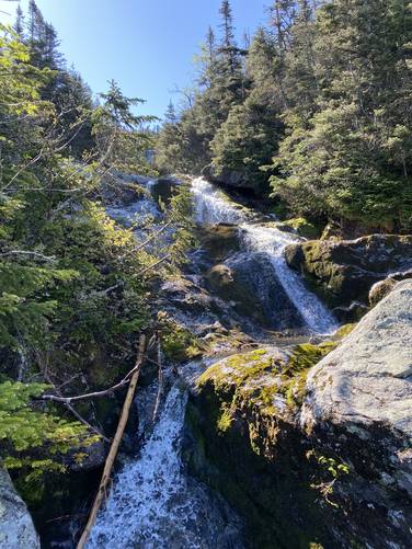
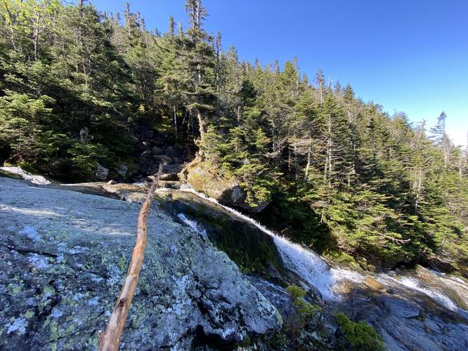
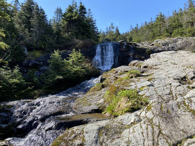
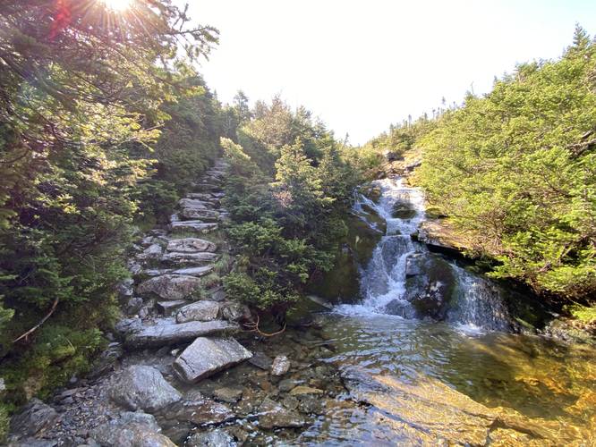
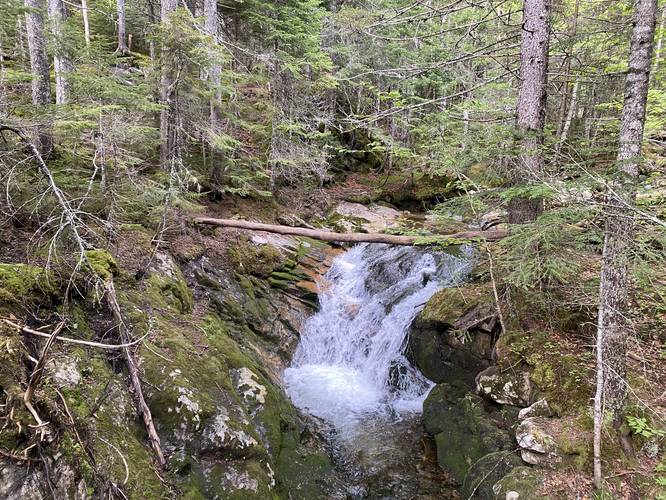
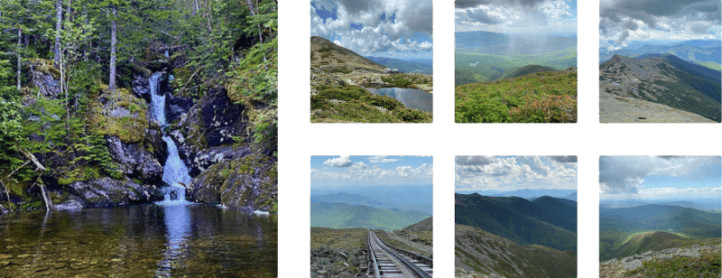
Waterfalls: There are three large waterfalls along this hike and they can be found along the Ammonoosuc Ravine Trail. The first can be found approximately 2-miles in (Gem Pool Falls), the 2nd waterfall located off-trail is located around mile 2.25, a couple of waterfalls located around mile 2.3 (one off-trail), with the last large cascade can be found around mile 2.45 in the route provided. One last waterfall, a 6th cascade, can be found directly on-trail around mile 2.5.
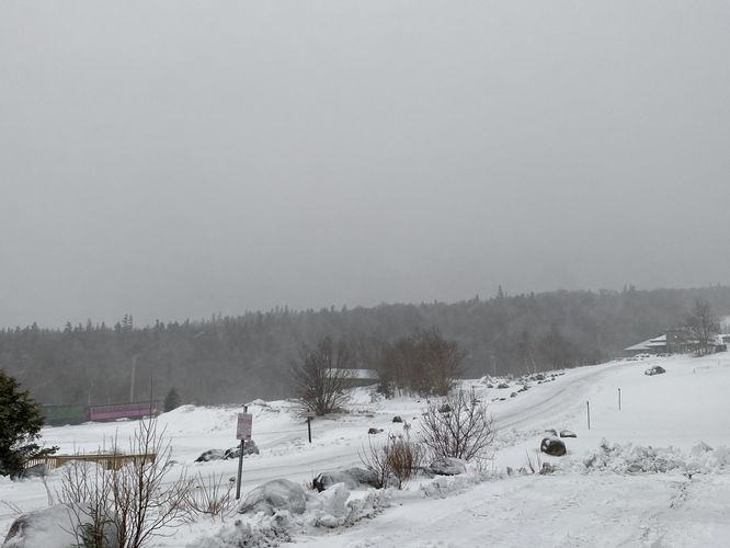
Planning for snow: Mt Washington may have snow on it really any time of the year due to always-changing conditions above the treeline, but it's most common for hikers to encounter snow throughout the entire Spring and into late Spring / early Summer and even late Summer / early Fall. Conditions above the treeline and in the shadowy mountain hollows and ravines can cause snow, ice, and undermining to exist longer than the average hiker expects. Some great resources for checking snow melt, current snow pack, and snow/ice conditions: Mt Washington Avalanche Center, the Mt Washington Observatory IG page, or the Mt Washington Observatory website. If planning to hike in snow/ice conditions, hikers should be equipped with the proper gear based on the exact conditions. For Spring and Fall months, including Summer, it's smart to carry micro-spikes (ice spikes) just in case you encounter snowpack or ice and a hard shell jacket with a hood for windy conditions above the treeline. During the winter, hikers should be fully equipped with winter mountaineering gear like ice spikes, hiking crampons (i.e. Kahtoola K10s) or climbing crampons, ice axe, trekking poles, waterproof clothing and boots, headlamp with backup batteries, skii goggles and face protection from the wind and cold, and emergency winter equipment like backup gloves, a Mylar blanket, and a winter hat to name a few items.
Blaze Colors: This hike follows several blaze colors. The Ammonoosuc Ravine Trail and the Jewell Trail both follow blue blazes. Crawford Path does not have any blazes, but follows stone cairns, and the Gulfside Trail follows both yellow and white blazes - white blazes mark the Appalachian Trail.
Length and Time: Hikers should plan on 10 miles of hiking depending on where they end up hiking to. If hikers skip Mt. Monroe, this hike is closer to nikkiseeseverything's original recording of ~8 miles. If hikers choose to visit Mt. Monroe (following Admin's hike), this trek is 10-miles long. The total time it takes is anywhere between 9 - 11 hours, depending on how many breaks you take.
Warnings
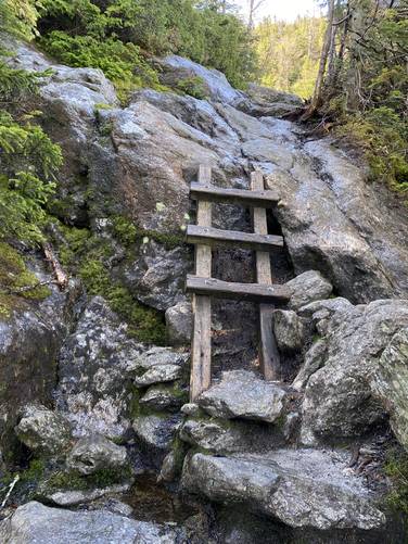
Rock Scrambles: Hikers should be warned that rock scrambles can be found mostly along the Ammonoosuc Ravine Trail around miles 2.3. Most of these rock scrambles are not difficult, but when the rocks are wet it creates even more challenging terrain. Hikers can find small foot holds, hand holds, and cracks in the bedrock to help scurry up the rock faces.
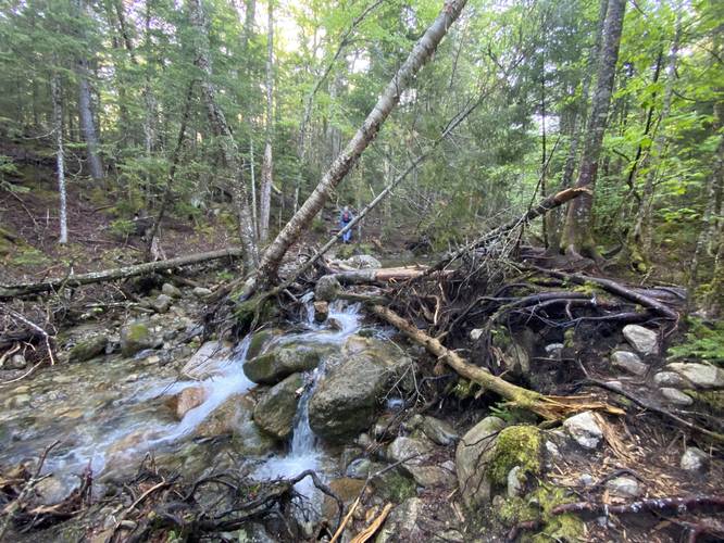
Creek Crossings: Hikers will have to cross at least 4 creek crossings along the Ammonoosuc Ravine Trail. During early June these crossings weren't bad; however, most of the snow had already melted off of the mountain by this time in 2022. That's not always the case though, and sometimes these creeks can be running a lot higher. Plan to get your feet and socks wet.
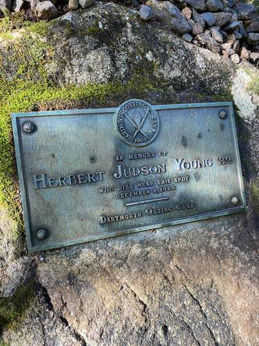
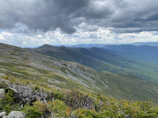
United States' Worst Weather Conditions: According to many many signs along Mt. Washington, above the treeline - in the alpine zone - is where the US' worst weather has been recorded. Many people have died on this mountain due to extreme weather conditions. Plan your trek based on weather reports and do not attempt a summit in blizzard-like, thunderstorm, or extreme wind conditions.
Sun Exposure & Wind: Hikers will be exposed and in the direct elements of wind and sun once above the tree line. It's smart to pack a light jacket or windbreaker along with plenty of sun screen. Remember to reapply sunscreen to any exposed areas to reduce getting burnt.
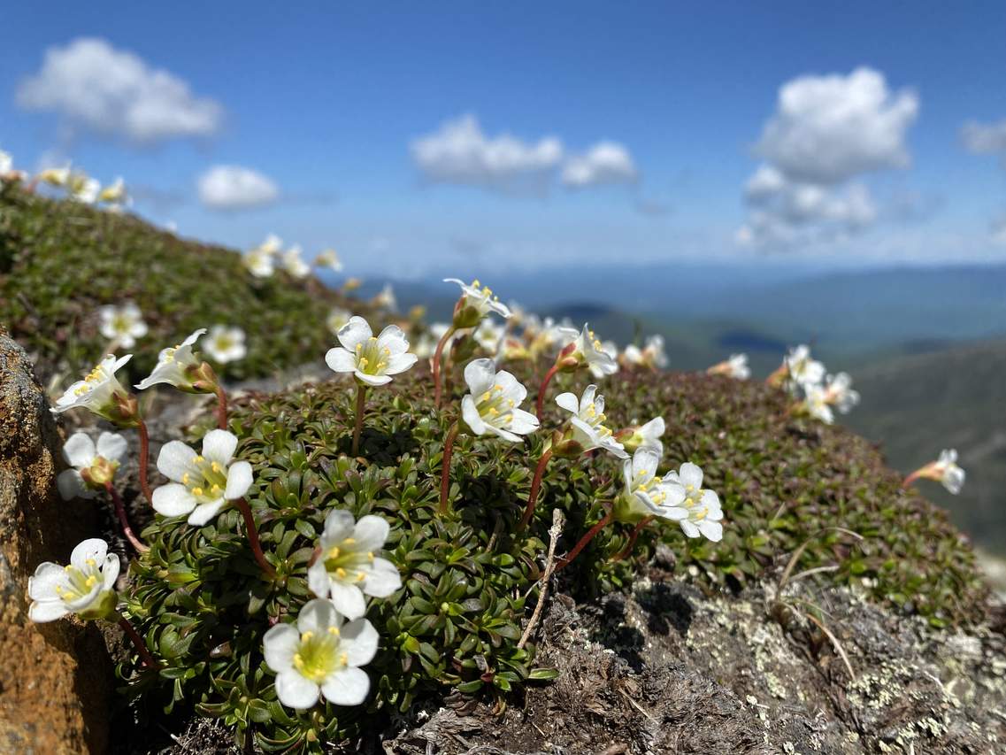
Rare Plants - Watch Your Steps: Mt. Washington's alpine zone is home to several rare plant species. One of these species is the Diapensia, which takes ~100-years to grow the size of an average dinner plate due to the mountain's cold and extreme conditions. Diapensia begins to die after just three footsteps, so please watch your step. Stay on the trail or only step on rocks to reach off-trail destinations to keep the Diapensia happily growing on these mountain ridges. Without the plant, devastating erosion begins to occur.
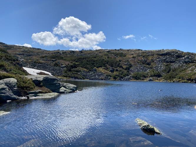
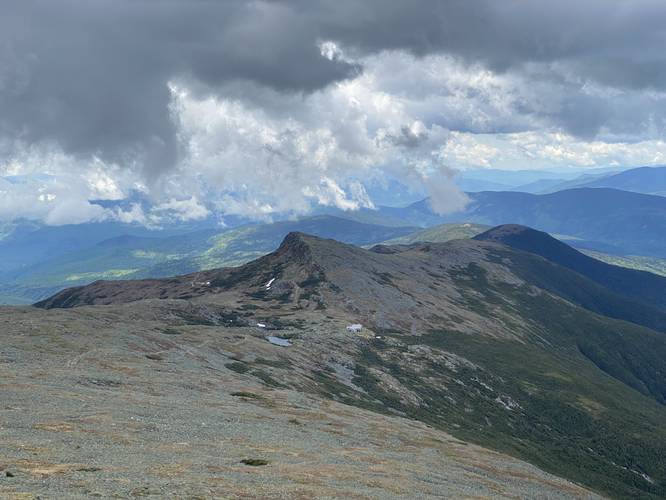
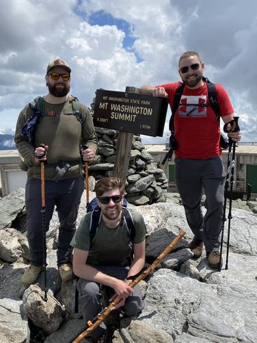
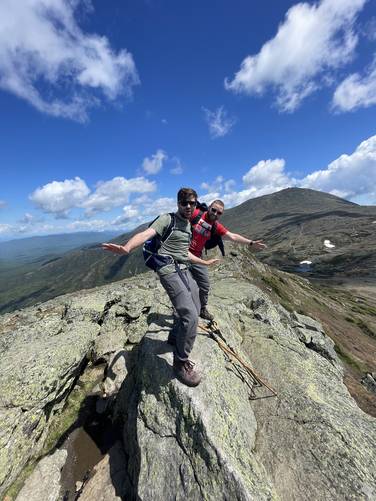
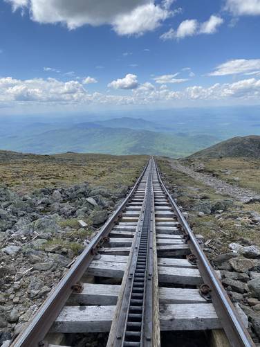
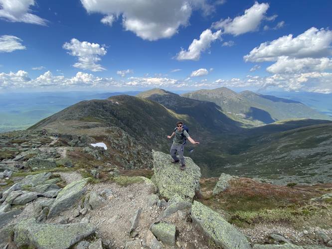
Dave's Edits: After hiking this trail on June 4, 2022 , I (Admin) decided to update these notes to include more information based on my own experience including fixing waterfall mileage locations, adding more POI and warnings, updating the track to include Mt. Monroe, and more. First, I updated the trail map and mileage to include Mt. Monroe's summit. Along my trek here, we decided to sit by the Lakes of the Clouds hut before summitting Monroe, thus there's some extra mileage in the GPS recording. It took us ~11 hours to do the whole loop, including a lot of breaks along the way. The Ammonoosuc Ravine Trail had more creek crossings than anticipated - approximately 4 or 5 in total. During late Spring (early June), these creek crossings were not difficult, but some hikers may have to get their feet wet early into the hike. Luckily, the AMC Hut sells extra socks in case you get wet feet and forgot to bring an extra pair. The Mt. Monroe and Lakes of the Clouds Hut area were my personal favorite spots along this hike since there weren't many people, we got stunning views, and the terrain is engaging and interesting ascending Monroe - not to mention how peaceful and tranquil the Lakes of the Clouds were. Summitting Mt. Washington was fun, but the summit is full of people - especially those who drove up. The Gulfside Trail, as it passes the Cog Railway and the Great Gulf Wilderness was stunning as well. Last, we got lucky and hit good weather with minimal crowds on the trails. Note that most of the crowded trails were along the Presidential Range as many people simply drive to the summit of Mt. Washington for ridge day hikes.
Trails: This hike encompasses the Ammonoosuc Ravine Trail to Lakes of the Clouds hut, continues on to Mt. Monroe before heading up to the Mt. Washington summit from the Lakes of the Clouds hut via Crawford Path. The hike finally heads back from the summit via the Trinity Heights Connector Trail to the Gulfside Trail which leads to the Jewell Trail. Once on the Jewell Trail, hikers will follow that all the way back to parking. The two main trails on this hike are the Ammonoosuc Ravine and Jewell trails, hence the trail name.
Expect a lot of scrambling up rocks, and a decent amount of time climbing through boulder fields. The hike down will be difficult on your joints no matter what route you choose.
When I went, it was a beautiful day on a holiday weekend, so there were quite a few people both on the trails and at the summit. I only experienced one "traffic jam" while hiking, but if you want to avoid crowds, I would hike this on a weekday if possible. Remember that people can drive or take a shuttle up to the summit, so there will likely be a lot of people at the top. It's not a quiet experience unless you find a spot to sit just below the summit. The good news is that if you wore yourself out too badly on the way up, you can take the train back down and it will drop you off near where you started.
I carried about 1.5L of water on me, but I think 2 would be ideal. You can refill at Lakes of the Clouds hut, and at the summit, and I suggest doing so. You can also buy food and use the restrooms at both locations.
AMC Lakes of the Clouds Hut: Hikers will find restrooms, coffee, snacks, trail maps, patches, socks, and other items to buy at the hut located around mile 2.9 from the parking lot. Hikers can also hang out in their dining room to relax, have a coffee, and get a stunning view.
What to bring: Most of this hike will be spent above treeline, so remember to wear sunscreen, and reapply if needed. Also, anything below treeline is likely to have mosquitoes and other biting bugs, so bug spray is also highly recommended. Bring at least 2-liters of water with you if you can carry it and note that you can refill at the summit and Lakes of the Clouds hut.
Facilities: There are restrooms at the summit of Mt Washington and at the Lakes of the Clouds hut.
Camping: Dispersed camping is allowed beyond 200-feet of the trail along the Ammonoosuc Ravine Trail and the Jewell Trail, but no camping is allowed above the treeline. See this White Mountains PDF for more backcountry camping rules: https://www.fs.usda.gov/Internet/FSE_DOCUMENTS/stelprdb5363715.pdf
Pets: Dogs are allowed if on leash and their waste must be carried out.
Parking & Fees: Hikers will find a very large parking lot at the coordinates provided. As of June 2022, there's a $5 per day per vehicle fee to park.
Waterfalls: There are three large waterfalls along this hike and they can be found along the Ammonoosuc Ravine Trail. The first can be found approximately 2-miles in (Gem Pool Falls), the 2nd waterfall located off-trail is located around mile 2.25, a couple of waterfalls located around mile 2.3 (one off-trail), with the last large cascade can be found around mile 2.45 in the route provided. One last waterfall, a 6th cascade, can be found directly on-trail around mile 2.5.
Planning for snow: Mt Washington may have snow on it really any time of the year due to always-changing conditions above the treeline, but it's most common for hikers to encounter snow throughout the entire Spring and into late Spring / early Summer and even late Summer / early Fall. Conditions above the treeline and in the shadowy mountain hollows and ravines can cause snow, ice, and undermining to exist longer than the average hiker expects. Some great resources for checking snow melt, current snow pack, and snow/ice conditions: Mt Washington Avalanche Center, the Mt Washington Observatory IG page, or the Mt Washington Observatory website. If planning to hike in snow/ice conditions, hikers should be equipped with the proper gear based on the exact conditions. For Spring and Fall months, including Summer, it's smart to carry micro-spikes (ice spikes) just in case you encounter snowpack or ice and a hard shell jacket with a hood for windy conditions above the treeline. During the winter, hikers should be fully equipped with winter mountaineering gear like ice spikes, hiking crampons (i.e. Kahtoola K10s) or climbing crampons, ice axe, trekking poles, waterproof clothing and boots, headlamp with backup batteries, skii goggles and face protection from the wind and cold, and emergency winter equipment like backup gloves, a Mylar blanket, and a winter hat to name a few items.
Blaze Colors: This hike follows several blaze colors. The Ammonoosuc Ravine Trail and the Jewell Trail both follow blue blazes. Crawford Path does not have any blazes, but follows stone cairns, and the Gulfside Trail follows both yellow and white blazes - white blazes mark the Appalachian Trail.
Length and Time: Hikers should plan on 10 miles of hiking depending on where they end up hiking to. If hikers skip Mt. Monroe, this hike is closer to nikkiseeseverything's original recording of ~8 miles. If hikers choose to visit Mt. Monroe (following Admin's hike), this trek is 10-miles long. The total time it takes is anywhere between 9 - 11 hours, depending on how many breaks you take.
Warnings
Rock Scrambles: Hikers should be warned that rock scrambles can be found mostly along the Ammonoosuc Ravine Trail around miles 2.3. Most of these rock scrambles are not difficult, but when the rocks are wet it creates even more challenging terrain. Hikers can find small foot holds, hand holds, and cracks in the bedrock to help scurry up the rock faces.
Creek Crossings: Hikers will have to cross at least 4 creek crossings along the Ammonoosuc Ravine Trail. During early June these crossings weren't bad; however, most of the snow had already melted off of the mountain by this time in 2022. That's not always the case though, and sometimes these creeks can be running a lot higher. Plan to get your feet and socks wet.
United States' Worst Weather Conditions: According to many many signs along Mt. Washington, above the treeline - in the alpine zone - is where the US' worst weather has been recorded. Many people have died on this mountain due to extreme weather conditions. Plan your trek based on weather reports and do not attempt a summit in blizzard-like, thunderstorm, or extreme wind conditions.
Sun Exposure & Wind: Hikers will be exposed and in the direct elements of wind and sun once above the tree line. It's smart to pack a light jacket or windbreaker along with plenty of sun screen. Remember to reapply sunscreen to any exposed areas to reduce getting burnt.
Rare Plants - Watch Your Steps: Mt. Washington's alpine zone is home to several rare plant species. One of these species is the Diapensia, which takes ~100-years to grow the size of an average dinner plate due to the mountain's cold and extreme conditions. Diapensia begins to die after just three footsteps, so please watch your step. Stay on the trail or only step on rocks to reach off-trail destinations to keep the Diapensia happily growing on these mountain ridges. Without the plant, devastating erosion begins to occur.
Dave's Edits: After hiking this trail on June 4, 2022 , I (Admin) decided to update these notes to include more information based on my own experience including fixing waterfall mileage locations, adding more POI and warnings, updating the track to include Mt. Monroe, and more. First, I updated the trail map and mileage to include Mt. Monroe's summit. Along my trek here, we decided to sit by the Lakes of the Clouds hut before summitting Monroe, thus there's some extra mileage in the GPS recording. It took us ~11 hours to do the whole loop, including a lot of breaks along the way. The Ammonoosuc Ravine Trail had more creek crossings than anticipated - approximately 4 or 5 in total. During late Spring (early June), these creek crossings were not difficult, but some hikers may have to get their feet wet early into the hike. Luckily, the AMC Hut sells extra socks in case you get wet feet and forgot to bring an extra pair. The Mt. Monroe and Lakes of the Clouds Hut area were my personal favorite spots along this hike since there weren't many people, we got stunning views, and the terrain is engaging and interesting ascending Monroe - not to mention how peaceful and tranquil the Lakes of the Clouds were. Summitting Mt. Washington was fun, but the summit is full of people - especially those who drove up. The Gulfside Trail, as it passes the Cog Railway and the Great Gulf Wilderness was stunning as well. Last, we got lucky and hit good weather with minimal crowds on the trails. Note that most of the crowded trails were along the Presidential Range as many people simply drive to the summit of Mt. Washington for ridge day hikes.


