Discover Castel Grande (Castelgrande), the oldest and most imposing of the three UNESCO World Heritage Castles in Bellinzona, Switzerland. This short, scenic route guides you through millennia of history, from Roman garrisons to modern architectural restoration, culminating in breathtaking views of the Ticino Valley.
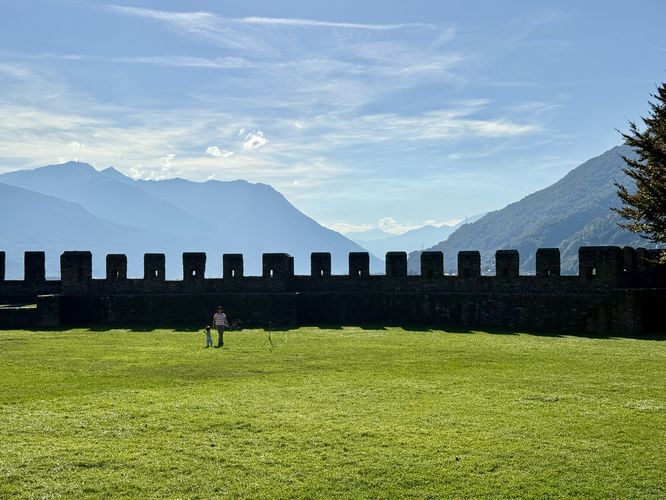
Walk toward the eastern edge of the main courtyard. From here, you have a perfect vantage point to appreciate why this fortress ensemble earned its UNESCO status in 2000. From here, you can look out over the city to see the other two castles on nearby hills — Montebello Castle and Sasso Corbaro Castle.
November – March: From 10:30 to 16:00.
Explore Castel Grande in Bellinzona, Switzerland
This route begins by entering the striking concrete-enclosed elevator carved directly into the bedrock, located conveniently near Piazza del Sole. This is a masterpiece of modern integration by architect Aurelio Galfetti (renovation completed in the late 1980s), transporting you to the castle grounds. The bedrock you are ascending has been fortified for at least two thousand years, with evidence of human presence dating back 6,000 years to the Neolithic era.Castel Grande's Fortified Gateway and Main Courtyard
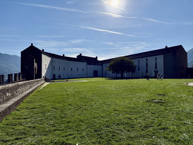
Upon exiting the elevator, you pass directly into the inner life of the fortress. Pass through the castle’s deep, historic inner gateway, walking directly into the sprawling, publically-accessible outdoor area that defines Castel Grande. This site was known for centuries as Castrum Magnum (Great Castle). From the 4th century onward, the Romans and succeeding rulers continuously fortified this hill because it commanded the key passage point into the Alps, controlling trade routes over the St. Gotthard, San Bernardino, and Lukmanier passes.Walk toward the eastern edge of the main courtyard. From here, you have a perfect vantage point to appreciate why this fortress ensemble earned its UNESCO status in 2000. From here, you can look out over the city to see the other two castles on nearby hills — Montebello Castle and Sasso Corbaro Castle.
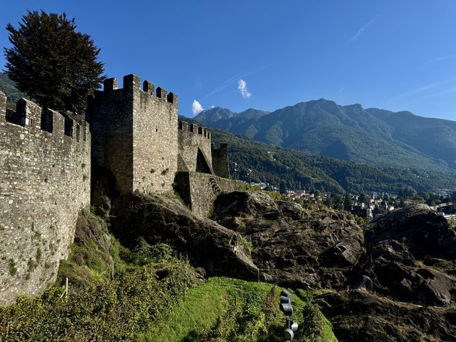
Military Architecture and Defensive Walls
After soaking in the beautiful views of historic Bellinzona and the nearby castles, this walk leads into the Torre Bianca (White Tower). Torre Bianca, the tallest tower at Castel Grande, served as the castle's medieval keep and dates back to the 13th century.The Vineyard & Castle Viewpoint
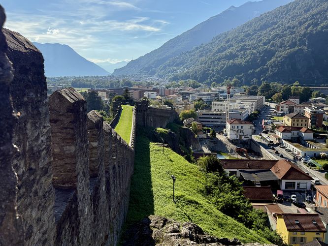
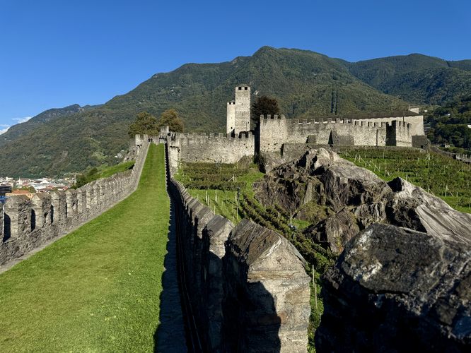
From Torre Bianca, this route leads visitors along the edge of Castel Grande's fortified walls, with more views high above Bellinzona to reach a grass-filled castle murata (rampart) that juts away from the main courtyard. Here, visitors will find the best views of Castel Grande and its surrounding vineyards — a must-see if visiting Bellinzona.Returning to the Castle Courtyard
After exploring the castle's best viewpoint along the murata, this route leads visitors back to the main courtyard but follows the fortified walls along the way. The route ends back at the elevator for an easy 0.7 km out-and-back walk.Entrance Fees & Site Info
For more historical facts, castle entrance fees, and more please see the castle's main website: https://fortezzabellinzona.ch/Parking & Directions: How to Get to Castel Grande
Castel Grande is uniquely accessible for a historic fortress, situated conveniently in the heart of Bellinzona's old town. If traveling by train, the Bellinzona station is only a 15-minute walk from the city center, which leads directly to the castle's base. If arriving by car, the recommended parking is the Autosilo Piazza del Sole garage (Piazza del Sole 7), where visitors can park for an hourly fee. The castle grounds are reached via an elevator built into the rock, with the elevator entrance located directly below the castle hill near Piazza del Sole, offering a quick and fully accessible ascent to begin your walking tour.Hours of Operation
April – October: From 10:00 to 18:00.November – March: From 10:30 to 16:00.