Loading...

🌲 WINTER SALE! 50% OFF on Supporter Accounts — now through December 31st. Unlock a full year of exclusive website & app perks for better hikes. Learn More.

Lake Davos Trail (Seepromenade)

Directions
Map
Pictures
Download Lake Davos Trail (Seepromenade) GPX Data to the MyHikes Mobile App
Distance:
3.9 km / 2.4 Miles
Type:
Loop
Difficulty:
Easy
Time to Hike:
1 hour, ~12 minutes
Features:
Surface Type:
Dirt
Town:
Davos, Switzerland
Get Directions:
46.814381, 9.84661
Added:
September 26, 2025
Updated:
November 24, 2025
Copy Trail Link Hiking this trail? Send a friend or family member a link to this trail guide for your own safety. Hike at your own risk (disclaimer)
Loading...
Loading...
17m

Total Change
32m

Ascent
31m

Descent

Download the GPX Data for Offline Use

Supporters get exclusive access to download trail routes to the MyHikes app for offline use. Stay prepared on your adventure, even without an internet connection! Become a Supporter today to unlock this feature and hike with confidence.

Download Lake Davos Trail (Seepromenade) GPX Data to the MyHikes Mobile App

Key Takeaways

  • Explore the easy, flat 3.9 km (2.4 miles) crushed stone loop trail—the Seepromenade—around Lake Davos, making it the perfect choice for wheelchair users, strollers, and all ability levels seeking accessible outdoor recreation in Davos.
  • Experience photo-worthy turquoise lake views and unobstructed panoramas of the Swiss Alps on this popular Davos walk, complete with chiming Swiss cowbells during warmer months.
  • Find detailed directions and coordinates for the massive, easy-access public parking lot located just off Road 28 (Kantonsstrasse), marking the main trailhead for this central and convenient Lake Davos hike.

Lake Davos Trail (Seepromenade)

The Lake Davos Trail, also known as the Seepromenade, offers a peaceful and universally accessible Swiss experience right in the heart of Davos, Switzerland.

This easy, flat 3.9 km (2.4 miles) loop provides a perfect opportunity for visitors of all abilities to enjoy the stunning natural beauty of the region. Winding around the shimmering turquoise waters of Lake Davos, the crushed stone trail is ideal for gentle strolls, wheelchair users, and families with strollers, featuring breathtaking, unobstructed views of the surrounding Swiss Alps. During warm months, you may even find Swiss cows, with their chiming cowbells, grazing in the nearby meadows. Whether you're seeking a relaxed walk, accessible outdoor recreation, or simply a photo-worthy alpine backdrop, the Lake Davos Seepromenade is a must-visit destination.

Lake Davos Trail (Seepromenade): Accessible Alpine Views in Davos, Switzerland

This easy hike around Lake Davos (Davosersee) begins at the large public parking lot at the parking coordinates provided (46.814381, 9.84661). The flat trail circles the lake with its main trailhead located on the southeast side of the lake, where this hike starts.

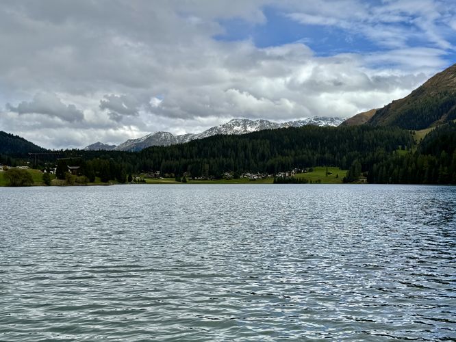
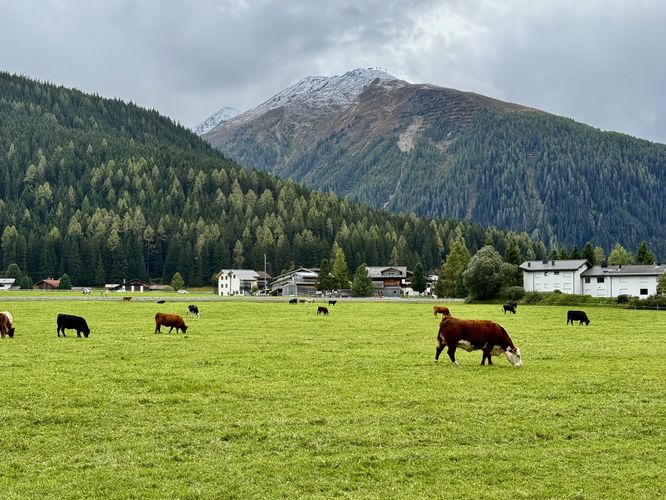
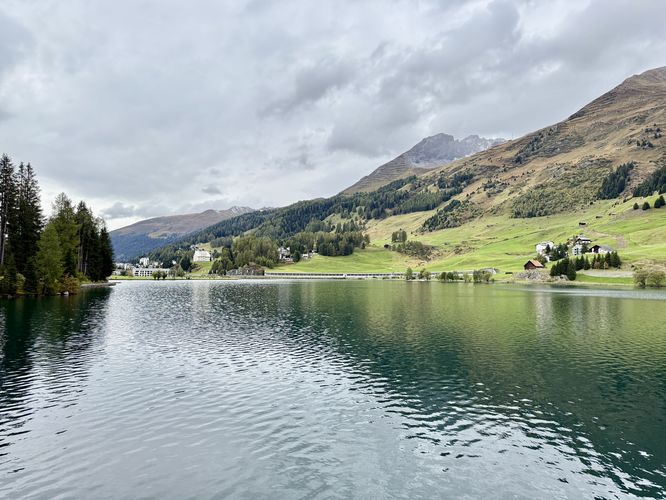
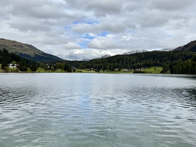
The trail leads north where visitors will find beautiful Alps views above the turquoise-hued waters of Lake Davos. As you follow the trail around the lake, during warmer months, you may even find Swiss cows grazing in the open alpine meadows. The chiming of their cowbells makes for a fun, family-friendly walk in the heart of Davos without having to travel very far.

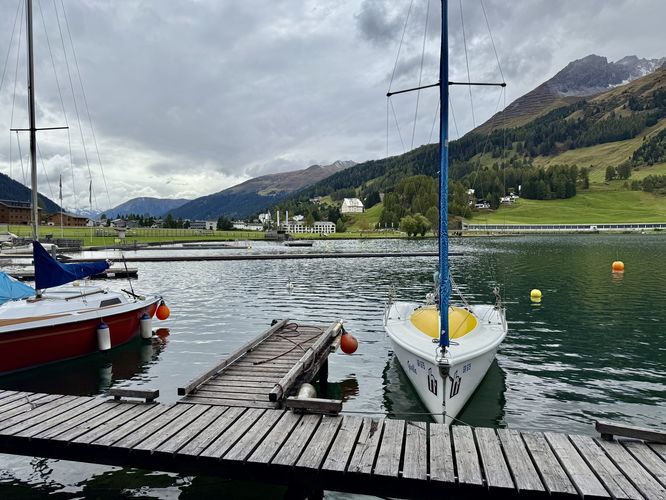
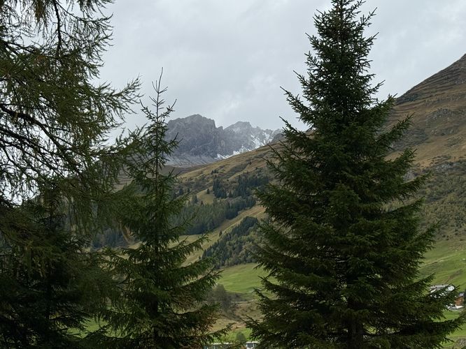
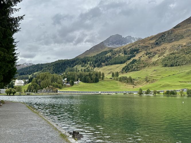
The Lake Davos Trail winds around the eastern side of the lake, passing recreational facilities, and even a boat dock. Eventually, the trail leads to an observation deck that sits above the lake. Here, you'll find Larch trees, views of the Swiss Alps, and more scenic views of the turquoise-hued waters of the lake.

The trail continues north from the observation deck and curves around the north side of the lake where visitors will find two walking paths that diverge, but meet up once again. For the universally-accessible path, continue on the northern path.

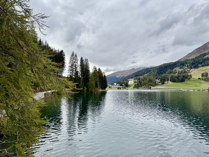
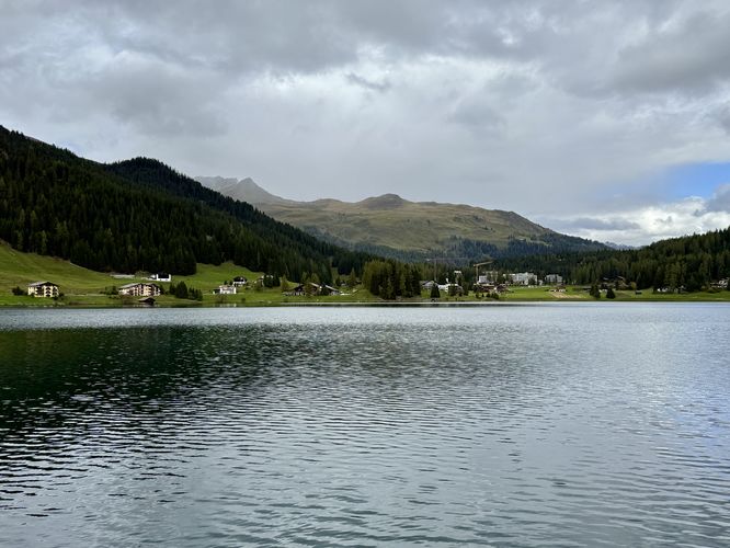
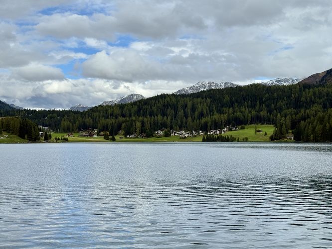
More views of the alpine peaks can be found along the northern shore of Lake Davos (Davosersee) with views back toward the center of Davos, Switzerland. The trail eventually wraps around the western side of the lake where you'll find even more breathtaking Alps views as it leads back toward the parking lot.

Finally, the trail wraps up at the main trailhead, after passing through the very large parking lot to end this easy and accessible 3.9 km (2.4 mile) loop hike.

Parking & Directions: Getting to the Lake Davos Trail

Visitors to Lake Davos will find a massive parking lot at the coordinates provided (46.814381, 9.84661). The parking lot is located just off of Road 28 (Kantonsstrasse) and can accommodate over 100 vehicles as of September 2025. There is only one entrance to the parking lot, located just before the long avalanche tunnel that covers Route 28 - do not miss the turn or you'll have to drive back.

Pets

Dogs are allowed only if leashed and must be cleaned up after. 
Explore 9 trails near Davos, Switzerland
  1. Parking

    46.814381, 9.84661
  2. Main Trailhead

    46.814481, 9.846668
  3. Beautiful view of Lake Davos

    46.815164, 9.847756
    Beautiful view of Lake Davos
  4. View of Swiss cows grazing under alpine peaks in Davos

    46.815178, 9.847936
    View of Swiss cows grazing under alpine peaks in Davos
  5. Boats moored at a dock along Lake Davos

    46.815894, 9.852411
    Boats moored at a dock along Lake Davos
  6. South-facing view of Lake Davos

    46.817681, 9.854814
    South-facing view of Lake Davos
  7. View of turquoise waters in Lake Davos

    46.817669, 9.854811
    View of turquoise waters in Lake Davos
  8. Views of mountains surrounding Lake Davos

    46.817694, 9.85485
    Views of mountains surrounding Lake Davos
  9. View of Swiss Alps between evergreens along the Lake Davos Trail

    46.816894, 9.853831
    View of Swiss Alps between evergreens along the Lake Davos Trail
  10. View of Lake Davos and surrounding alpine peaks

    46.816558, 9.853089
    View of Lake Davos and surrounding alpine peaks
  11. Another sweeping view of Lake Davos

    46.815539, 9.849828
    Another sweeping view of Lake Davos
  12. Beautiful view of Lake Davos

    46.815539, 9.849828
    Beautiful view of Lake Davos
No community routes found. To add your own hike as a Community Route for this Trail guide, leave a Trip Report with an attached GPX file.

Seasons

All

Photo Albums

+ Add Photo Album

Upload your photos from the trail to help others know what to expect.

Preview of the MyHikes mobile app interface

Track, Log, and Explore Hikes with the MyHikes App

Shop Landscape Prints
Shop our Alps landscape prints to support MyHikes!

Trip Reports (Reviews)

Ready to help fellow hikers? Add a trip report to share your experience and provide valuable insights for those planning their next hike. Your review makes the trail better for everyone.

Rated 4.0 out of 5 based on 1 rating.
2.4 miles / 3.9 km
September 26, 2025
This trail is a scenic walk around Lake Davos and is not challenging at all. Very easy walking and nice views of the Swiss Alps. We even found cows grazing alongside the trail, probably my favorite part.
Hiking

Explore Hiking Trails

You May Also Like

Colorado's Million Dollar Highway - Plan a day's drive adventure along the iconic Million Dollar Highway in Colorado. Explore the best short trails, roadside stops, waterfalls, vistas, ghost towns, and hot springs within a ~6 hour road trip.
Explore

Colorado's Million Dollar Highway

Plan a day's drive adventure along the iconic Million Dollar Highway in Colorado. Explore the best short trails, roadside stops, waterfalls, vistas, ghost towns, and hot springs within a ~6 hour road trip.

Read
Glacier's Going-to-the-Sun Road - Discover the breathtaking beauty of Glacier National Park along the iconic Going-to-the-Sun Road. From stunning roadside stops to picturesque waterfalls and vistas, this engineering marvel offers endless opportunities for exploration.
Explore

Glacier's Going-to-the-Sun Road

Discover the breathtaking beauty of Glacier National Park along the iconic Going-to-the-Sun Road. From stunning roadside stops to picturesque waterfalls and vistas, this engineering marvel offers endless opportunities for exploration.

Read
New York's Best Waterfalls - Whether you're planning a day hike, roadside stop, or a leisurely short walk, this guide provides hikers, travelers, and locals alike with 63 different locations to over 100 scenic waterfalls to help plan your next adventure!
Explore

New York's Best Waterfalls

Whether you're planning a day hike, roadside stop, or a leisurely short walk, this guide provides hikers, travelers, and locals alike with 63 different locations to over 100 scenic waterfalls to help plan your next adventure!

Read

Before you boogie...

Find our trail guides useful? Consider becoming a Supporter to unlock perks!

MyHikes is an indie platform that makes exploring public trails easier for everyone. The platform has no investors, no ads, and is owned and operated by one person, Dave Miller. Dave has personally mapped and written over 1,800 trail guides on MyHikes for the public to explore. MyHikes has helped millions outdoor enthusiasts plan their next adventure.

But it takes a lot of time 🕦, money 💰, work, and espresso shots ☕ to run MyHikes, including hiking , mapping , writing , and publishing new trails with high-quality (accurate) information... along with software engineering (coding) the platform like building new features, website and mobile app development (iOS and Android), site maintainance . and much much more.

Supporters unlock website and mobile app perks with an annual one-time payment of $25 (you renew) 😎👍. Or you can simply make a Donation of your choice. Otherwise, you can support us by telling your friends about MyHikes - both quick and free 🎉

Admin avatar

Dave Miller
MyHikes Founder
🍪 We use cookies to learn about site usage, performance, and to serve map tiles. You may block cookies manually in the browser. By continuing to use MyHikes, you agree. Learn more