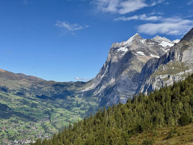
Towering high over Grindelwald, Switzerland stands the 3,967m tall mountain, the Eiger (Ogre in English) where travelers from all around the world flock to view one of Europes highest mountain peaks with its slopes enshrouded by glaciers. Mountaineers from all over the world attempt to tackle the 1,800m tall Eiger North Face every year to test their own skills and strength, but for the average traveler, the Eiger Walk and the Eiger Trail is one of the best hikes in the Alps and for good reason — panoramic views, towering alpine mountains, wild ibex, glaciers, and more await along this breathtaking hike. A personal favorite!
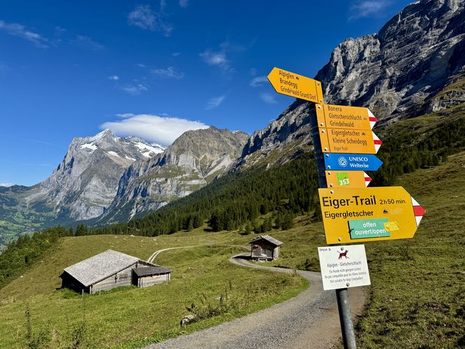
This guide combines the Eiger Walk Trail and the Eiger Trail into one amazing, moderate 8.5km day hike through the Swiss Alps that avid hikers should not skip if visiting Grindelwald, Switzerland. The route leads from Kleine Scheidegg pass down to the village of Alpiglen and Alpiglen station.
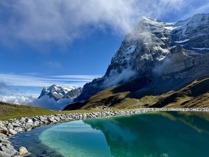
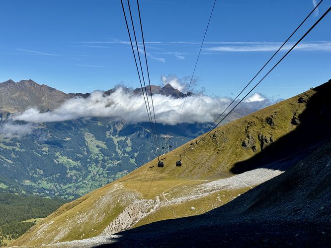
The trail quickly climbs uphill before wrapping around the turquoise-tinted (human-made) lake, Fallbodensee (Fallboden Lake) where you'll find reflective scenery of the Eiger and Wetterhorn in the glassy water. Make your way around Fallbodensee to its northern side to find your first panoramic views of Grindelwald in the valley below. Here, you'll even find distant cable cars of the Eiger Express ascending toward Eigergletscher station.
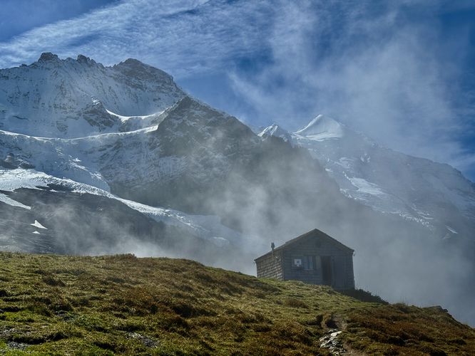
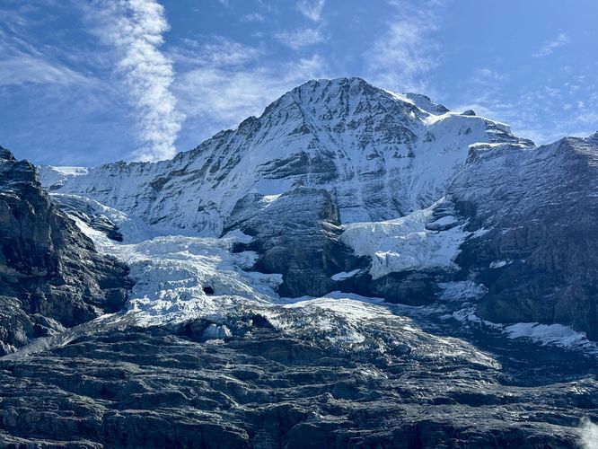
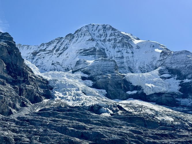
The Eiger Walk continues ascending toward Eigergletscher station as it traverses under, then adjacent to the Jungfrau Railway tunnel. Along the way, you'll have more panoramic views toward the Lauterbrunnen valley. As the trail ascends further, hikers will find breathtaking views of Eigergletscher (Eiger Glacier) and the Jungfrau Peak overhead. These massive alpine mountains provide excellent photo opportunities, so be sure to take as many as you can on the hike up. One neat point-of-interest along the route is the Alte Mittellegihütte (Old Mittellegi Hut) which now sits alongside a cliff with the backdrop of Jungfrau Peak and Eigergletscher. Passing the Alte Mittellegihütte, you'll find more views of Eigergletscher and its towering alpine peaks before the trail curves a bend and leads up to the Eigergletscher station.
After passing the mountaineering exhibit, the Eiger Trail presents its entire route beneath your feet with panoramic, breathtaking, and absolutely stunning views into the Grindelwald valley with the 1,800m tall Eiger North Face towering overhead. As you traverse the Eiger Trail down the mountainside, remember to look back from where you came as the views of Kleine Scheidegg pass are unmatched unless riding the Eiger Express. The trail is not all downhill, so keep this in mind as between 3.6km and 4km, the trail leads back uphill along a moderate grade with steep slopes located off-trail.
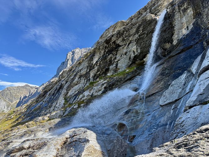
This section of the Eiger Trail provides sweeping views for approximately 2.6km and should not be skipped. Hikers will find plenty of spots to hop off the trail with benches for relaxing and sightseeing. Be sure to take in the views before you reach the end of the trail in Alpiglen to ensure you don't miss anything! Before the trail heads downhill to reach Alpiglen, hikers will find a beautiful ~15m tall waterfall as it plunges over the side of a cliff, located on trail. From this waterfall, you'll have a chance to soak in the cascade's spray from water that flowed down from the Eiger.
From the last large waterfall, the Eiger Trail traverses downhill to reach Alpiglen. The trail passes over a couple of deep gorges, carved out by the flow of the waterfall you just hiked past.
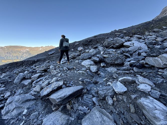
Steep slopes: The Eiger Trail includes sections where the mountain slopes to the side of the trail become very steep. During months where snow is present, it's best to wear ice spikes or traction on your footwear to ensure your own safety.
This guide combines the Eiger Walk Trail and the Eiger Trail into one amazing, moderate 8.5km day hike through the Swiss Alps that avid hikers should not skip if visiting Grindelwald, Switzerland. The route leads from Kleine Scheidegg pass down to the village of Alpiglen and Alpiglen station.
Hiking the Eiger Walk & Eiger Trail
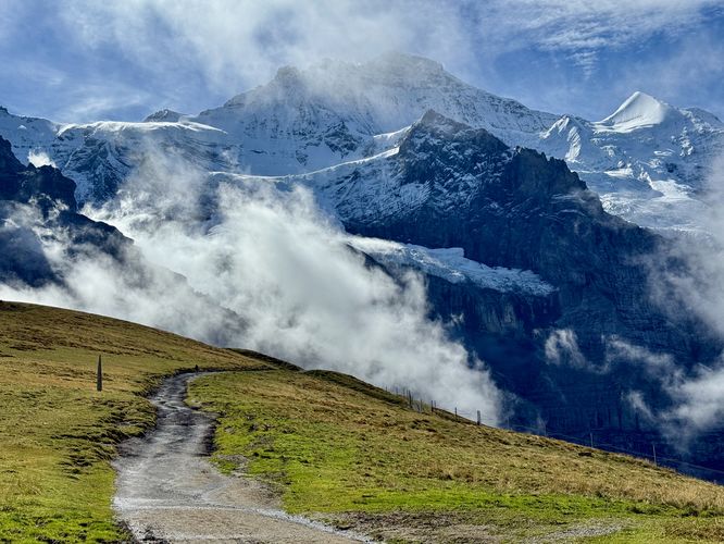
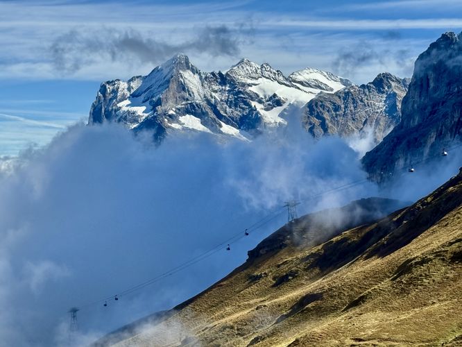
This hike begins at the Kleine Scheidegg station where you'll be dropped off by train at the stunning mountain pass. From the trailhead, located next to the train station, you'll find restaurants, coffee shops, and more that await basic travelers looking to relax. Here, at the Hotel Restaurant Bellevue des Alpes, you'll find the Eiger Walk Trail's trailhead. The Eiger Walk Trail leads from Kleine Scheidegg pass up to the Eigergletscher station where the 330m ascent includes more breathtaking views of the Swiss Alps along the way.Eiger Walk to Eigergletscher Station - 0km to 2.6km
Once you leave Kleine Scheidegg station and pass the Hotel Restaurant Bellevue des Alpes, you'll be following the dirt path of the Eiger Walk. This section of the hike has arguably some of the best and most dynamic views along the entire route. To start, you'll have panoramic views toward the Lauterbrunnen valley with the tiny cliff side town of Mürren in the hanging valley overhead. Views toward Lauterbrunnen include various alpine peaks from Kleine Scheidegg where you'll find the Jungfrau Railway slip down the mountain pass as it makes its way into the valley.The trail quickly climbs uphill before wrapping around the turquoise-tinted (human-made) lake, Fallbodensee (Fallboden Lake) where you'll find reflective scenery of the Eiger and Wetterhorn in the glassy water. Make your way around Fallbodensee to its northern side to find your first panoramic views of Grindelwald in the valley below. Here, you'll even find distant cable cars of the Eiger Express ascending toward Eigergletscher station.
The Eiger Walk continues ascending toward Eigergletscher station as it traverses under, then adjacent to the Jungfrau Railway tunnel. Along the way, you'll have more panoramic views toward the Lauterbrunnen valley. As the trail ascends further, hikers will find breathtaking views of Eigergletscher (Eiger Glacier) and the Jungfrau Peak overhead. These massive alpine mountains provide excellent photo opportunities, so be sure to take as many as you can on the hike up. One neat point-of-interest along the route is the Alte Mittellegihütte (Old Mittellegi Hut) which now sits alongside a cliff with the backdrop of Jungfrau Peak and Eigergletscher. Passing the Alte Mittellegihütte, you'll find more views of Eigergletscher and its towering alpine peaks before the trail curves a bend and leads up to the Eigergletscher station.
Eigerglestcher Station - 2.6km
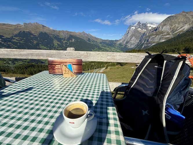
For most hikers, the Eigergletscher station can be skipped, but if you started later in the day or work up an appetite by the time you reach it, there's an opportunity to grab a bite to eat, drink an espresso, or use the restrooms before continuing the hike. For us, we spent a good 30 minutes hanging out in the Eigergletscher station cafe, ate a sandwich, a small pizza, drank espresso, before we started along the Eiger Trail. Note that views from Eigergletscher station are also worth stopping at. During our hike here, we found three wild ibex grazing in the grass below which was a welcomed sight and the only mountain goats we saw in our entire 2-week Alps trip!Hiking the Eiger Trail - 2.85km to 8.6km
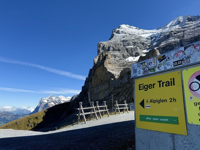
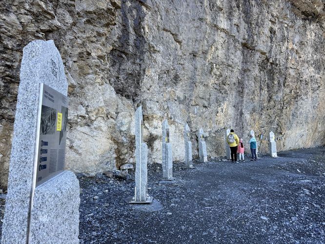
The Eiger Trail starts at the north side of Eigergletscher station where hikers will find signage for the route. The trail immediately starts by heading downhill before it passes directly underneath the Eiger Express. On the other side of the Eiger Express cables sits a mountaineering exhibit for the Eiger and includes historical references, first ascent dates, and plaques from mountaineers that previously conquered the peak including Ueli Steck (RIP) and Dani Arnold's solo ascents.After passing the mountaineering exhibit, the Eiger Trail presents its entire route beneath your feet with panoramic, breathtaking, and absolutely stunning views into the Grindelwald valley with the 1,800m tall Eiger North Face towering overhead. As you traverse the Eiger Trail down the mountainside, remember to look back from where you came as the views of Kleine Scheidegg pass are unmatched unless riding the Eiger Express. The trail is not all downhill, so keep this in mind as between 3.6km and 4km, the trail leads back uphill along a moderate grade with steep slopes located off-trail.
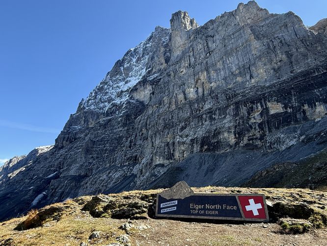
Eiger North Face Sign - 3.95km
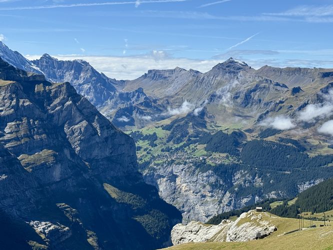
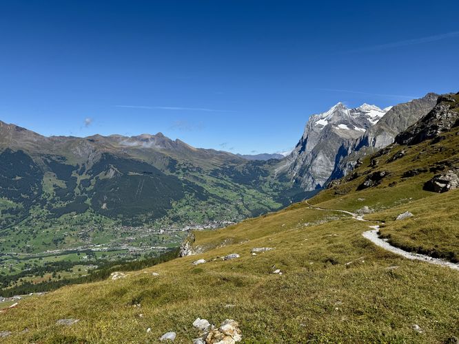
Near the top of the largest uphill ascent along this route sits a trail junction and a bench with a view of Grindelwald and the Wetterhorn's steep alpine slopes, but behind the trail junction sits a photo opportunity — the Eiger North Face sign. Here, you can take some of the best photos of the Eiger North Face from the base of its towering wall (approx. 1,800m tall). Stick around a while and maybe you'll spot skilled mountaineers attempting their own Eiger North Face summit, but due to the sheer scale it may be difficult to spot these climbers!Waterfalls, Vistas, and the Grindelwald Valley - 4km to 8.6km
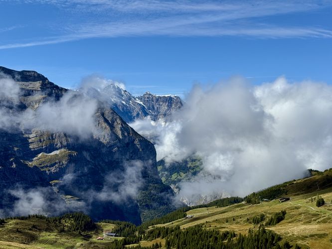
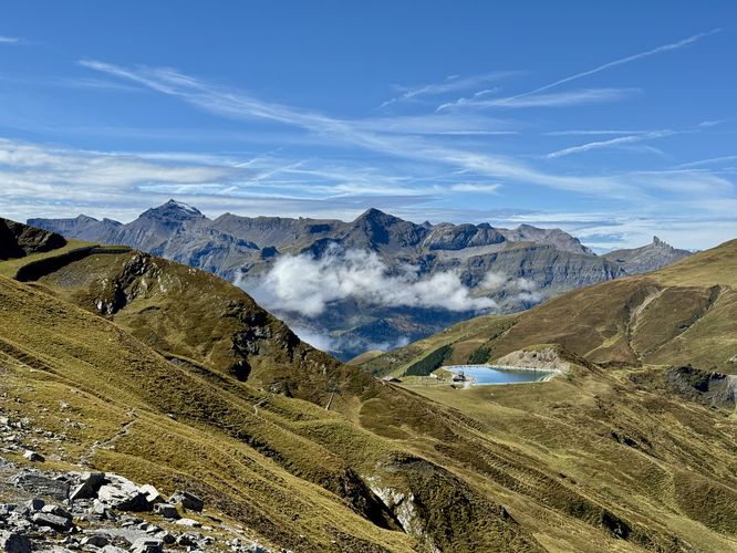
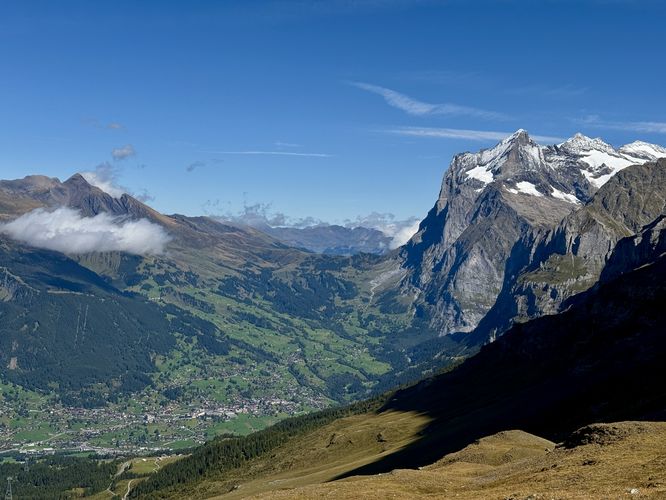
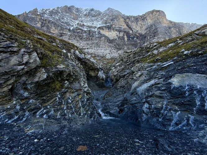
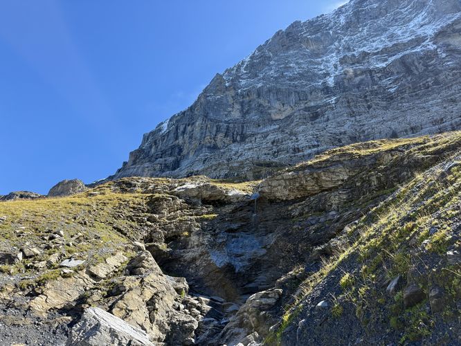
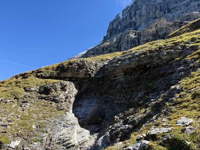
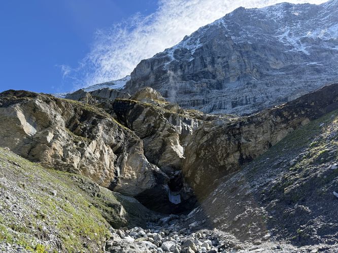
After you pass the Eiger North Face sign and junction, the hike down to Alpiglen is far more scenic than the hike from Eigergletscher station to this point. From here, the Grindelwald valley and the towering alpine slopes of the Wetterhorn are in view for virtually the remainder of the hike. During snow melt season (Spring), hikers will find several waterfalls along the way, all a similar height of approximately 8 - 10m tall. These waterfalls are a great place to filter water if needed. During our hike here in mid-September 2025, the water flow was extremely low except for the very-last waterfall before hiking down to Alpiglen.This section of the Eiger Trail provides sweeping views for approximately 2.6km and should not be skipped. Hikers will find plenty of spots to hop off the trail with benches for relaxing and sightseeing. Be sure to take in the views before you reach the end of the trail in Alpiglen to ensure you don't miss anything! Before the trail heads downhill to reach Alpiglen, hikers will find a beautiful ~15m tall waterfall as it plunges over the side of a cliff, located on trail. From this waterfall, you'll have a chance to soak in the cascade's spray from water that flowed down from the Eiger.
From the last large waterfall, the Eiger Trail traverses downhill to reach Alpiglen. The trail passes over a couple of deep gorges, carved out by the flow of the waterfall you just hiked past.
Alpiglen Station - 8.6km
The end of this hike lies in Alpiglen. Technically, this route ends at the Berghaus Alpiglen where we grabbed another trail-side espresso and enjoyed views of the Grindelwald valley and the surrounding alpine peaks like the Wetterhorn. We also witnessed a massive (1,000m tall) spindrift avalanche spill down from the Wetterhorn after the previous night's weather dumped a ton of snow on the high elevation peak. The scenery was unmatched as we drank espresso and took a short break while contemplating our day's epic adventure. From Berghaus Alpiglen, we walked to the Alpiglen station and took the Jungfrau Railway back to Grindelwald Grund for an amazing day in the Swiss Alps!How to Get to the Eiger Trail
For most visitors, reaching the Eiger Trail is a matter of hopping on the Eiger Express gondola or taking a ride along the Jungfrau Railway. Ticket prices will vary based on your destination, but as of September 2025 a ride from Grindelwald Grund station to the Kleine Scheidegg station cost 37.60 CHF for one adult. There is a return fee along the Jungfrau Railway from Alpiglen station back to Grindelwald Grund which cost about half of the ride up, around 16 CHF per adult. If you wish, you can order your tickets online or pay at the station in person.Parking
If you arrive by car, the parking coordinates provided will bring you to a very large parking garage located on the west side of Grundstrasse, located west of Grindelwald Grund station. Parking rates vary but for us in September 2025, cost less than 15 CHF for the day.Pets
Dogs are allowed only if leashed and must be cleaned up after.Warning
Falling rocks: While the Eiger Trail is situated fairly far away from the mountain's steepest slopes, rockfall can happen at any time and in any location.Steep slopes: The Eiger Trail includes sections where the mountain slopes to the side of the trail become very steep. During months where snow is present, it's best to wear ice spikes or traction on your footwear to ensure your own safety.