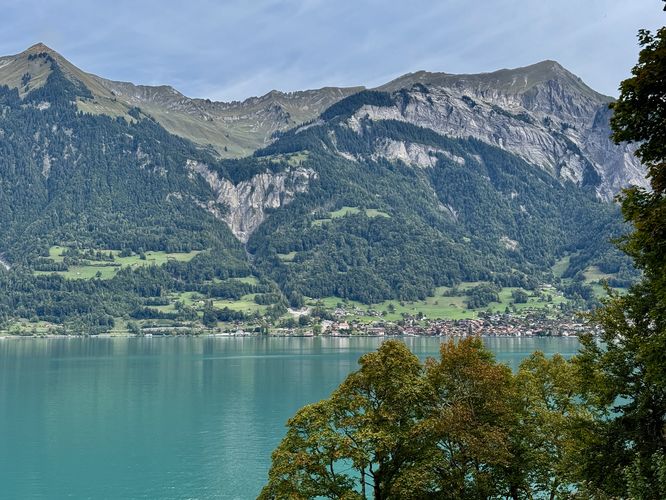
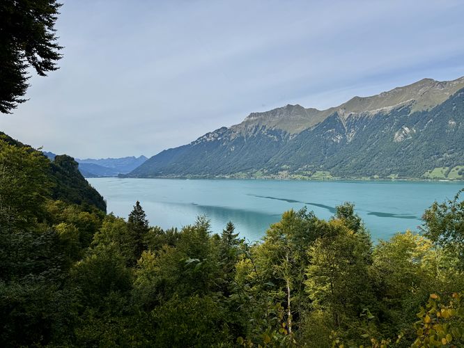
Located near the eastern border of the Bernese Oberland in Brienz, Switzerland, Giessbachfälle (Giessbach Falls) is one of Brienzersee's (Lake Brienz) most-visited waterfalls with its multitude of cascades that comprise the 400m tall waterfall, Giessbach Falls.
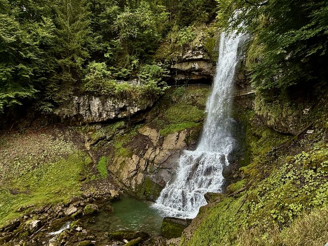
Just after passing behind the waterfall, the trail leads downhill toward Lake Brienz, but along the way are more stunning views, waterfalls, and more. Near 0.35 km from the start, you'll find a breathtaking view of Giessbach Falls main cascade that you just hiked behind. Stick around for a few minutes and you'll find more tourists making their way behind the waterfall too.
After the trail passes the Grandhotel Giessbach, it leads into the forest and crosses the "Napolean Bridge" around 0.9 km. The scenic stone arch bridge has managed to survive flooding since its construction, however, the nature park's guide did not provide a date when it was built.
Hiking the Giessbach Falls Trail
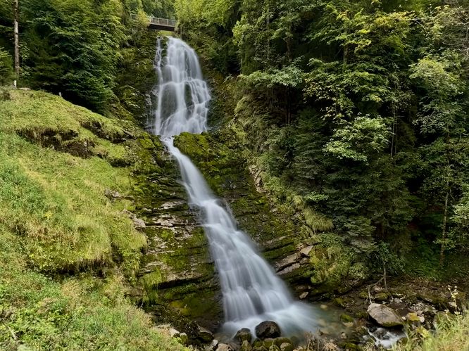
For nearly 200 years, visitors to Giessbachfälle (Giessbach Falls) have been showing up in droves to experience the multi-tiered 400m tall waterfall with views of Brienzersee (Lake Brienz) from behind the main cascade, Giessbach Falls. This short hike is one of the best waterfall hikes in the area and for good reason. The route includes several views of waterfalls, views of Lake Brienz, and even includes a stop at the Grandhotel Giessbach for a quick snack and espresso.Reaching Giessbach Falls - 0.3 km
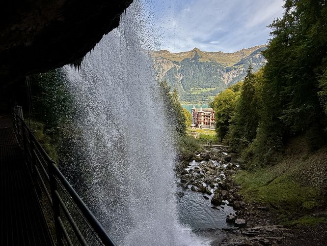
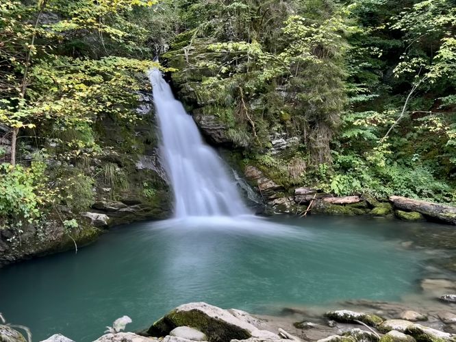
At the western end of the parking lot, hikers will find the trailhead with signage that leads uphill toward Giessbach. The trail leads through the forest before reaching a turn that follows switchbacks downhill before the trail crosses the Giessbach. As the trail crosses the stream, you'll follow a footpath bridge that runs under a cliff directly behind Giessbach Falls. As you walk behind the waterfall, you'll find stunning views of Grandhotel Giessbach, Lake Brienz, and the plunging waterfall of Giessbach Falls — the Giessbach experience!Just after passing behind the waterfall, the trail leads downhill toward Lake Brienz, but along the way are more stunning views, waterfalls, and more. Near 0.35 km from the start, you'll find a breathtaking view of Giessbach Falls main cascade that you just hiked behind. Stick around for a few minutes and you'll find more tourists making their way behind the waterfall too.
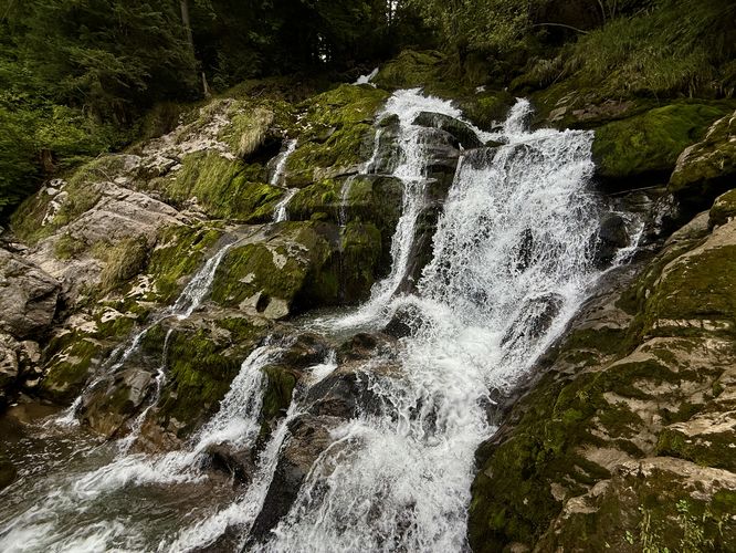
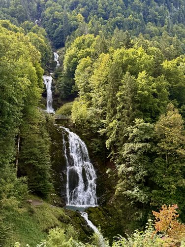
Giessbach Falls VII, VIII, VIIII - 0.55 to 0.78 km
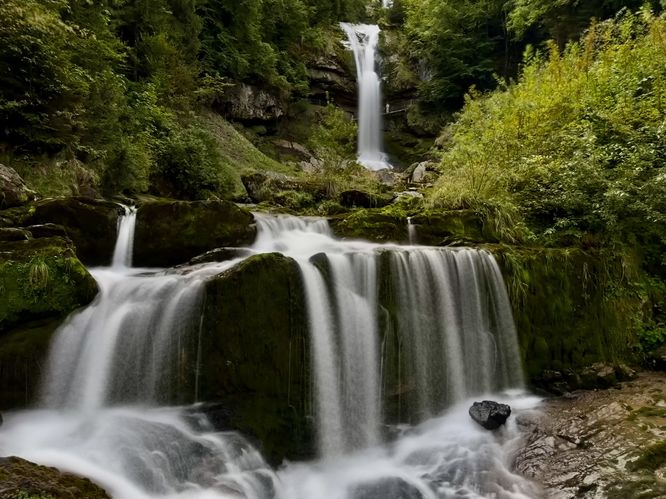
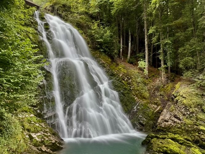
As you make your way downhill, the trail will quickly split into two directions. Keep right at the intersection to continue along the path to reach views of Giessbach Falls VII (7), VIII (8), and VIIII (9). Around 0.55 km from the start, you'll find a beautiful view of Giessbach Falls VII with a glimpse of a cascade located high above the waterfall you just hiked behind. The view from this bridge is impressive and the bridge itself dates back to the 15th century. Here, you'll also find more views of Grandhotel Giessbach and Lake Brienz. As you continue to follow the path downhill, you'll find two more views of Giessbach Falls, this time Giessbach Falls VIII (8) and Giessbach Falls (9). The trail provides a couple of great viewing points for both waterfalls, located around 0.7 km and 0.78 km from the start.After the trail passes the Grandhotel Giessbach, it leads into the forest and crosses the "Napolean Bridge" around 0.9 km. The scenic stone arch bridge has managed to survive flooding since its construction, however, the nature park's guide did not provide a date when it was built.