Located in the heart of Lauterbrunnen Valley, Trümmelbach Falls (Trümmelbachfälle) is one of Switzerland’s most unique series of waterfalls where visitors will find 10 different cascades that plummet through a gorge nestled in the Alps.
This trail guide brings tourists and visitors through the entire Trümmelbachfälle experience including the mountain tunnel lift, passing every waterfall and viewpoint along this moderate 1.3 km trail.
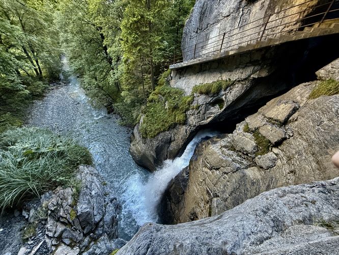
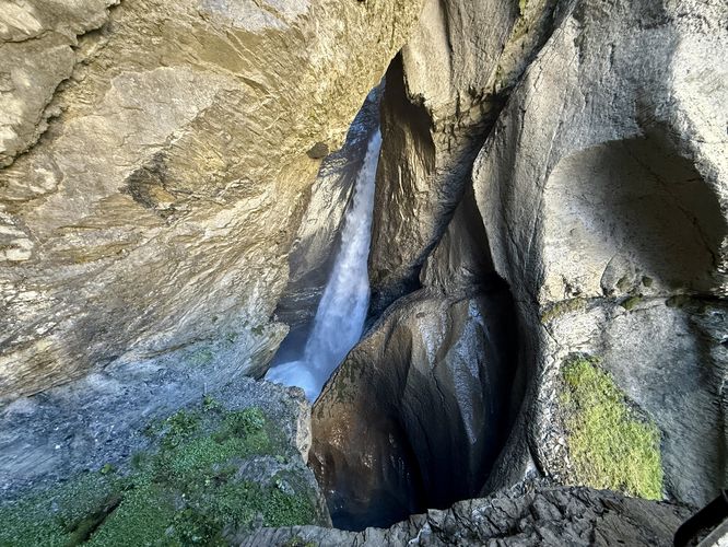
After paying the entrance fee, the trail leads to the gorge where you’ll find several paths ahead of you to explore. Before hopping on the lift, this guide leads tourists to the base of Trümmelbach Falls — take a right-hand turn at the first trail junction and follow the path as it leads into the gorge where you’ll find a thundering waterfall as it plummets down the bedrock. Rounding the path’s bend, you’ll find a view of the lowest waterfall where the Trümmelbach leaves the gorge and enters the Lauterbrunnen Valley.
Once you reach the very end of the trail, you’ll find one last waterfall that plummets through the dimly-lit gorge. Here, you’ll start your walk back toward the Trümmelbach lift where you’ll find two new paths to explore. First, you can take a left-hand turn at the lift to hike down a series of stairs to reach a view of more waterfalls before backtracking toward the lift one last time. Once you reach the Trümmelbach lift, there’s one last trail to explore. Follow the path that leads north before it descends a series of stairs, passing several stunning views of the Lauterbrunnen Valley along the way. On your way down this path, you’ll find more views of waterfalls before the trail curves around to reach the first trail junction you passed on the way in.
When you reach the base of the trail, back at the first Trümmelbach lift junction, you will have wrapped up exploring the gorge. Simply follow the trail back to parking to wrap up this moderate, but short hike at Trümmelbachfälle.
Falling rock / steep drop-offs: Be aware that this trail follows a gorge that leads directly into the mountain and leads along steep drop-offs and through tunnels. While the path is safe, rock fall could happen at any time. If worried about dropping your cell phone into the gorge (losing it forever), you may want to consider bringing a phone tether.
Stairs: This hike follows many stairs along the way. Prepare for lots of staircases and potentially wet and slippery stairs from the waterfall's spray.
This trail guide brings tourists and visitors through the entire Trümmelbachfälle experience including the mountain tunnel lift, passing every waterfall and viewpoint along this moderate 1.3 km trail.
Exploring Trümmelbach Falls
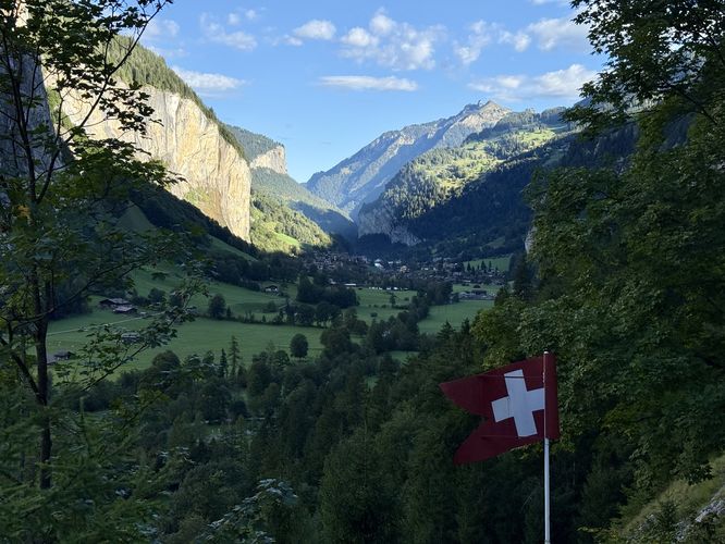
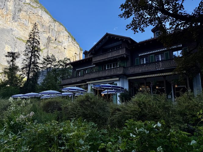
The adventure at Trümmelbach Falls begins at the parking lot where you’ll first pass the quaint Trümmelbachfälle Cafe to find the main path on the south side of the building. Following the path leads visitors through Lauterbrunnen Valley with distant, glacier-capped alpine peaks and massive 400m tall cliffs that surround the valley. Along the way are several information kiosks that include historical information about the gorge, waterfalls, and tourist info. Visitors will even find a small diorama of the mechanical lift, located inside of the mountain, that swiftly brings tourists up the gorge to reach the main cascades.After paying the entrance fee, the trail leads to the gorge where you’ll find several paths ahead of you to explore. Before hopping on the lift, this guide leads tourists to the base of Trümmelbach Falls — take a right-hand turn at the first trail junction and follow the path as it leads into the gorge where you’ll find a thundering waterfall as it plummets down the bedrock. Rounding the path’s bend, you’ll find a view of the lowest waterfall where the Trümmelbach leaves the gorge and enters the Lauterbrunnen Valley.
Trümmelbach Tunnel Lift
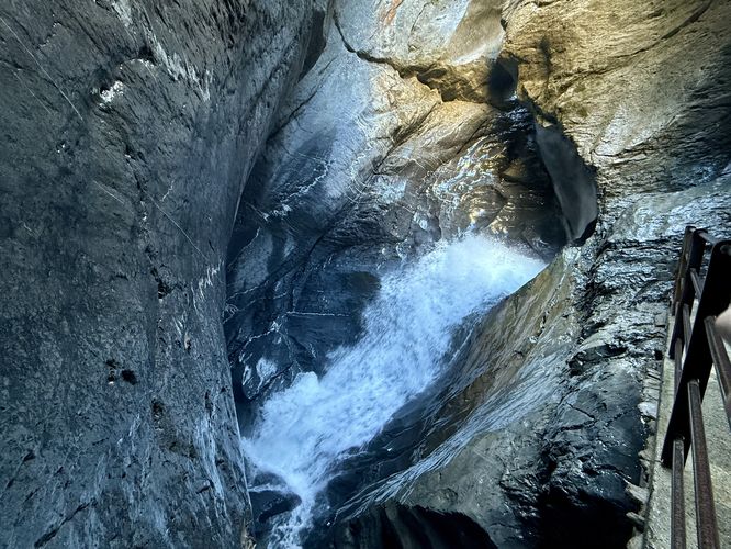
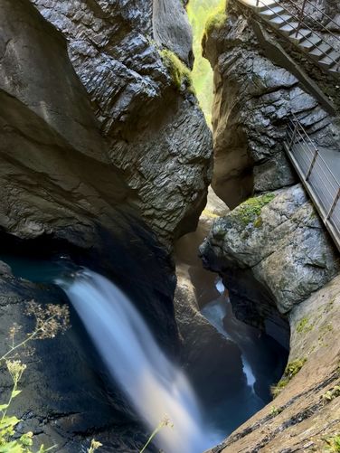
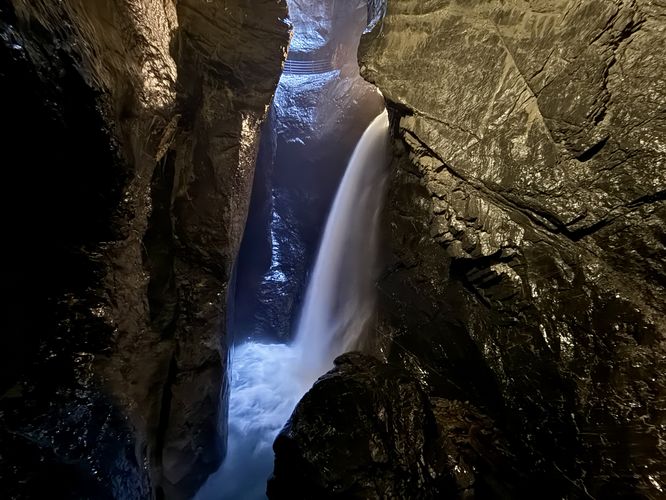
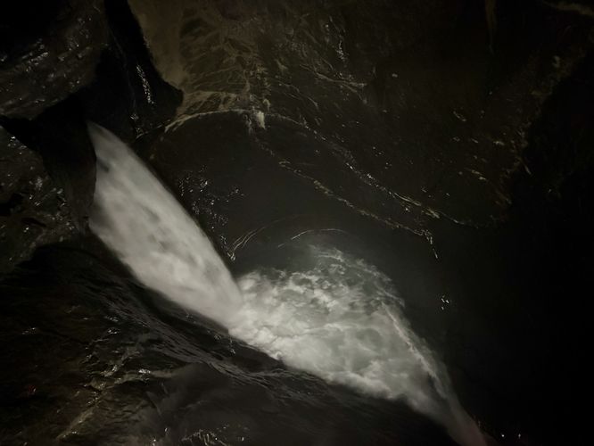
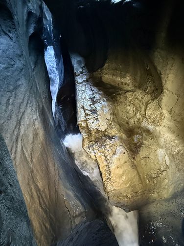
Backtracking to the mechanical lift, this route heads onto the lift where you’ll ride a funicular through the mountain to reach a path that passes through the Trümmelbach gorge. As you follow the path through the gorge, you’ll pass a multitude of thundering waterfalls. Here, you’ll see the sheer force of the Trümmelbach and can imagine how it carved out the gorge over the course of millennia with the strength of melting glacier water.Trümmelbach Falls Chamber
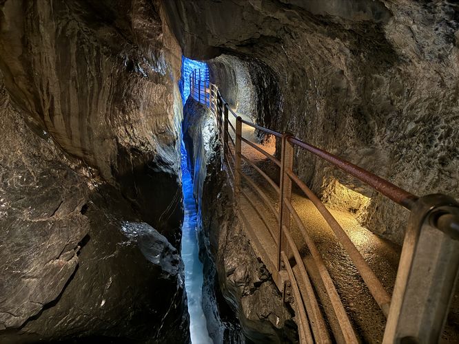
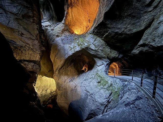
The Trümmelbach Falls trail cuts through the mountain, passing steep drop-offs alongside the gorge where you’ll find a dimly-lit gorge, thundering cascades, and paths that tunnel through the mountain’s bedrock. As you follow the path, you’ll eventually reach a large staircase that ascends to the final chamber of the Trümmelbach where visitors will find two large plummeting waterfalls inside of a massive room that was once carved out by the melting glacier flow. For fans of the Lord of the Rings movies or book series, you may feel like you're in the middle of the Mines of Moria, deep in the mountain.Once you reach the very end of the trail, you’ll find one last waterfall that plummets through the dimly-lit gorge. Here, you’ll start your walk back toward the Trümmelbach lift where you’ll find two new paths to explore. First, you can take a left-hand turn at the lift to hike down a series of stairs to reach a view of more waterfalls before backtracking toward the lift one last time. Once you reach the Trümmelbach lift, there’s one last trail to explore. Follow the path that leads north before it descends a series of stairs, passing several stunning views of the Lauterbrunnen Valley along the way. On your way down this path, you’ll find more views of waterfalls before the trail curves around to reach the first trail junction you passed on the way in.
When you reach the base of the trail, back at the first Trümmelbach lift junction, you will have wrapped up exploring the gorge. Simply follow the trail back to parking to wrap up this moderate, but short hike at Trümmelbachfälle.
Explore the Lauterbrunnen Valley
For more adventures in the Lauterbrunnen Valley, consider exploring the Lauterbrunnen Valley Loop, Mürrenbach Falls, and Staubbach Falls.Seasonal Hours
The Trümmelbach Falls are open daily from 9 a.m. to 5 p.m., depending on weather conditions, from the beginning of April to the beginning of November, and from 8:30 a.m. to 6 p.m.Pets
Dogs are not allowed.Fees
As of September 2025, the entrance fee for Trümmelbach gorge is 16 CHF per adult and 7 CHF per child between 6 and 15 years old. For the latest information, please see the official website (browser translation required for non-Swiss German readers).Parking
Visitors will find a large parking lot at the coordinates provided at the Trümmelbach Cafe.Warning
No children under 4: Trümmelbach Falls is not suitable for babies and very small children. As of September 2025, children must be over the age of 4 to enter.Falling rock / steep drop-offs: Be aware that this trail follows a gorge that leads directly into the mountain and leads along steep drop-offs and through tunnels. While the path is safe, rock fall could happen at any time. If worried about dropping your cell phone into the gorge (losing it forever), you may want to consider bringing a phone tether.
Stairs: This hike follows many stairs along the way. Prepare for lots of staircases and potentially wet and slippery stairs from the waterfall's spray.