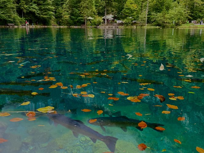
Blausee, translated to Blue Lake in English, is one of Switzerland's most scenic lakes with its crystal-clear turquoise waters full of schools of trout. For road trippers and vacationers to the Bernese Oberland, Blausee is a must-see on your trip.
This short 2.6km (1.6 mile) walk leads visitors around the vibrant waters of Blausee, makes a stop at the coffee shop, visits the trout farm, crosses the Kander River to visit two large waterfalls, and passes through a llama park before cruising through the lush moss-covered forest of the nature park.
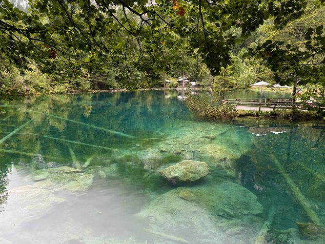
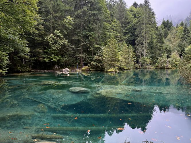
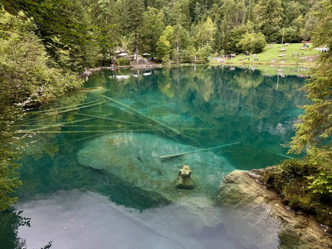
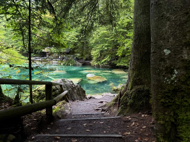
At Blausee, you'll likely find large schools of trout swimming and fallen trees scattered in the deep water. There's a small boat dock where you can take a glass-bottom boat tour through the lake while getting a short guided tour if you wish. You may even find Nikoli, the massive sturgeon fish swimming around the lake's waters. The route provided continues along Hauptweg (Main Path) as it runs along the northern shore before following the Seeweg (Lake Path) as it encompasses Blausee. Seeweg (Lake Path) leads along the western and southern shores of Blausee, dipping in and out of the forest before crossing a small footbridge where visitors will find the maid of Blausee - a stone statue submerged in the lake's waters. The maid represents the Blausee saga, a tale once told about how the lake's vibrant colors came to be, which can be read on their nature park's main website.
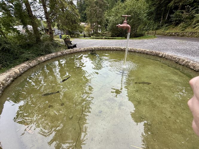
Eventually the Seeweg (Lake Path) meets up with the Hauptweg (Main Path) once more. During our visit, we stepped into the coffee shop for an espresso before exploring more. The route then leads along Hauptweg once more before heading north to reach the trout farm. At the trout farm, visitors will find several large pools where hundreds of trout swim around and in between the pools via small channels that connect each.
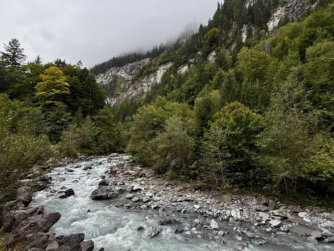
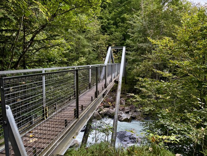
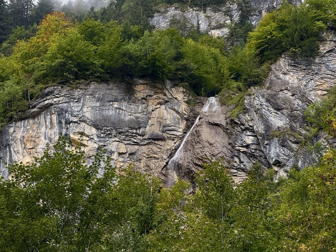
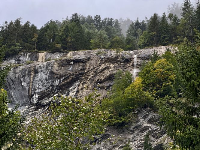
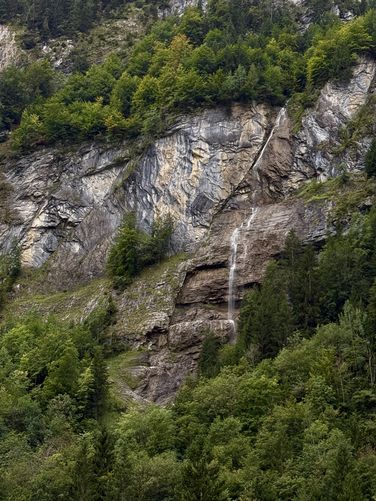
After exploring the trout farm's pools, this route leads visitors to the banks of the Kander River where you'll find beautiful views of the rushing water and towering alpine mountains overhead. It then exits the boundaries of the Blausee Nature Park, crossing a footbridge over the Kander River, to reach a footpath. Following the footpath south, you'll find two large waterfalls cascading down the mountainside. Backtracking from the waterfalls, you'll cross the Kander River footbridge once more before following the Sommerauweg (Sommerau Path) which leads directly to the llama park. Note that dogs are not allowed in the llama park!
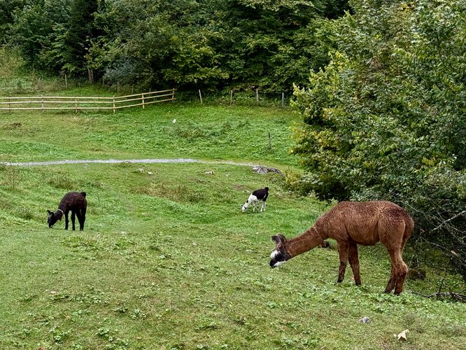
In the llama park, following the Sommerauweg, be on the lookout for llamas grazing in the grass. For us, we had to leave the trail to explore the grassy area where the llamas hang out. We then hiked around Sommerauweg before it connected to the Waldweg (Forest Path) and followed the Waldweg (Forest Path) through the lush moss-covered, boulder-filled forest which led us directly back to the entrance to wrap up the short and easy hike at Blausee Nature Park.
For more information, please visit the Blausee website: https://www.blausee.ch/en/nature-park/
This short 2.6km (1.6 mile) walk leads visitors around the vibrant waters of Blausee, makes a stop at the coffee shop, visits the trout farm, crosses the Kander River to visit two large waterfalls, and passes through a llama park before cruising through the lush moss-covered forest of the nature park.
Exploring Blausee Nature Park
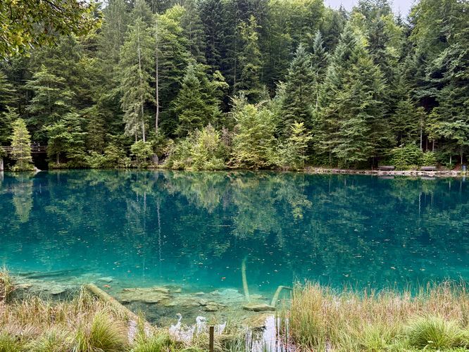
This short walk begins at the main trailhead where visitors will find several paths that lead to Blausee (Blue Lake). The route first follows the Hauptweg (Main Path) along the paved, universally-accessible trail as it leads through the forest directly to Blausee. Along the way are massive boulder, glacial erratics, that are left over from when the valley was once carved out by ancient glaciers. Eventually, the Hauptweg (Main Path) reaches Blausee, where visitors will find the vibrant, crystal-clear turquoise waters.At Blausee, you'll likely find large schools of trout swimming and fallen trees scattered in the deep water. There's a small boat dock where you can take a glass-bottom boat tour through the lake while getting a short guided tour if you wish. You may even find Nikoli, the massive sturgeon fish swimming around the lake's waters. The route provided continues along Hauptweg (Main Path) as it runs along the northern shore before following the Seeweg (Lake Path) as it encompasses Blausee. Seeweg (Lake Path) leads along the western and southern shores of Blausee, dipping in and out of the forest before crossing a small footbridge where visitors will find the maid of Blausee - a stone statue submerged in the lake's waters. The maid represents the Blausee saga, a tale once told about how the lake's vibrant colors came to be, which can be read on their nature park's main website.
Eventually the Seeweg (Lake Path) meets up with the Hauptweg (Main Path) once more. During our visit, we stepped into the coffee shop for an espresso before exploring more. The route then leads along Hauptweg once more before heading north to reach the trout farm. At the trout farm, visitors will find several large pools where hundreds of trout swim around and in between the pools via small channels that connect each.
After exploring the trout farm's pools, this route leads visitors to the banks of the Kander River where you'll find beautiful views of the rushing water and towering alpine mountains overhead. It then exits the boundaries of the Blausee Nature Park, crossing a footbridge over the Kander River, to reach a footpath. Following the footpath south, you'll find two large waterfalls cascading down the mountainside. Backtracking from the waterfalls, you'll cross the Kander River footbridge once more before following the Sommerauweg (Sommerau Path) which leads directly to the llama park. Note that dogs are not allowed in the llama park!
In the llama park, following the Sommerauweg, be on the lookout for llamas grazing in the grass. For us, we had to leave the trail to explore the grassy area where the llamas hang out. We then hiked around Sommerauweg before it connected to the Waldweg (Forest Path) and followed the Waldweg (Forest Path) through the lush moss-covered, boulder-filled forest which led us directly back to the entrance to wrap up the short and easy hike at Blausee Nature Park.
For more information, please visit the Blausee website: https://www.blausee.ch/en/nature-park/