Looking for the best Matterhorn views? The moderate Schwarzsee to Furi hike in Zermatt, Switzerland offers up-close views of the Matterhorn, glaciers, Gornergrat, and iconic Swiss Alps scenery.
This guide leads hikers up the Matterhorn Express gondola to Schwarzee, makes a stop at the Instagram-worthy "Zermatt" sign, passes breathtaking views of Gornergrat, the Riffelhorn, Monte Rosa massif and Grenzgletscher, before it dips into a larch forest before ending in Furi with a return gondola to Zermatt.
Similar the Gornergrat hike, this route offers panoramic views for a large portion of the walk down to Furi, but instead of constant Matterhorn views, hikers will find abundant Gornergrat and Monte Rosa massif views. As you traverse the foothills down toward Furi, there will be plenty of Matterhorn views behind you, but eventually the Matterhorn becomes blocked by the foothills just downhill from 1km in this route.
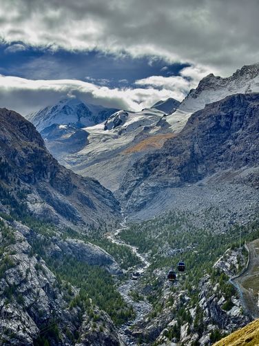
As you continue the descent past 1km, the Matterhorn might be out of view for the rest of the hike, but the views of Gornergrat, the Monte Rosa massif, and Grenzgletscher are unmatched elsewhere around Zermatt, so be sure to enjoy the sprawling Alps views on your way down. Note that between 1.1km and 1.45km are a set of switchbacks that should be followed to avoid eroding steep alpine terrain and ecosystems.
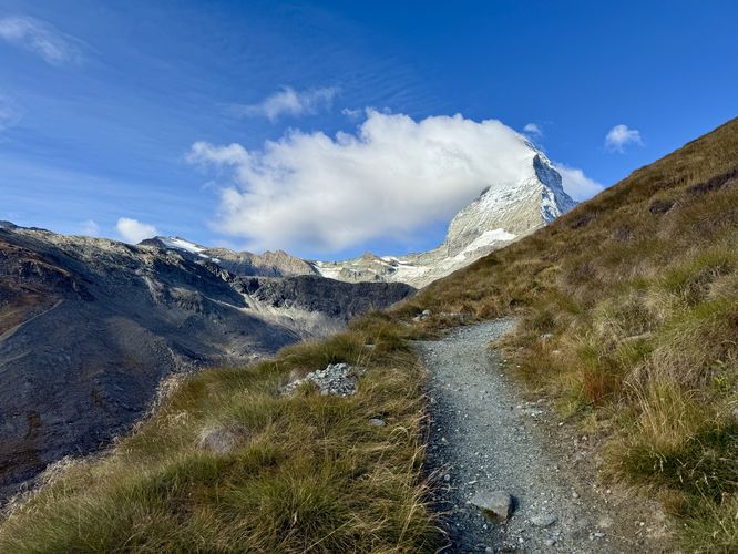
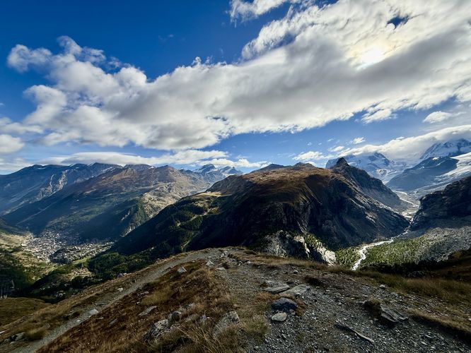
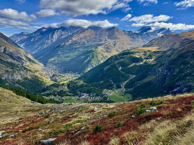
The trail will pass under the Matterhorn Express around 1.75km, which is a fun place to stop and wave to gondola riders as they pass overhead. Past the Matterhorn Express is one last panoramic viewpoint that sits high above the Zermatt Valley with more Alps views near 2.15km. These Alps views last for just a short while before you start following switchbacks that lead into a larch forest. As you traverse the switchbacks you'll find more stunning Alps views, especially of Gornergrat, as the trail descends closer to Furi.
This guide leads hikers up the Matterhorn Express gondola to Schwarzee, makes a stop at the Instagram-worthy "Zermatt" sign, passes breathtaking views of Gornergrat, the Riffelhorn, Monte Rosa massif and Grenzgletscher, before it dips into a larch forest before ending in Furi with a return gondola to Zermatt.
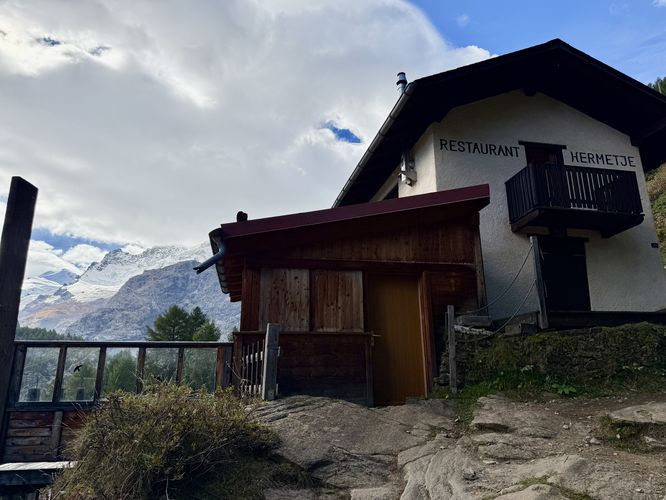
Hiking Schwarzsee to Furi
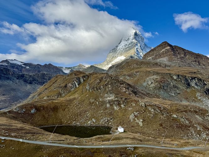
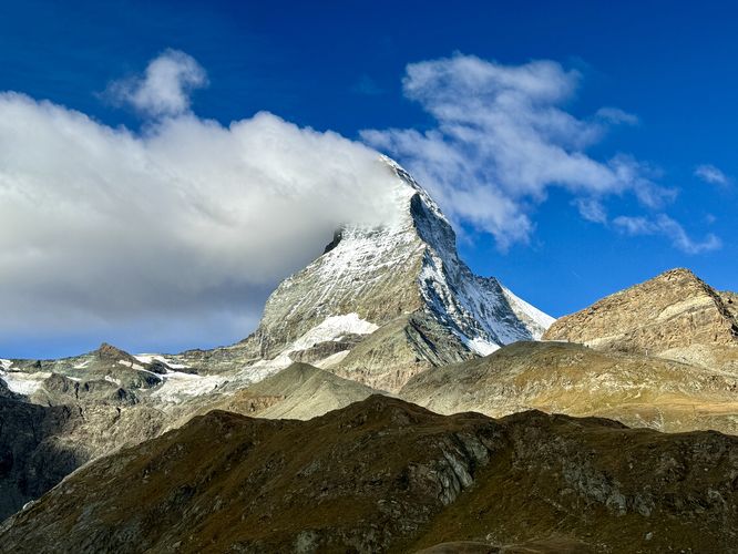
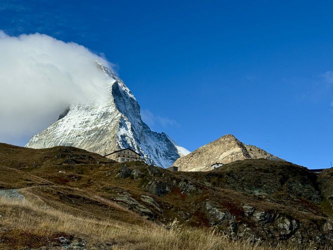
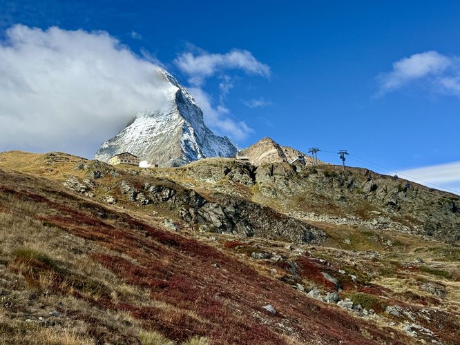
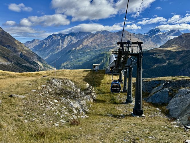
This hike begins at the Schwarzsee gondola station after taking a quick 10 minute ride up from Zermatt via the Matterhorn Express. From the start, hikers will find stunning Matterhorn views with the mountain towering overhead. The Matterhorn cannot be missed unless you arrive on a very cloudy day.Zermatt Sign - 0.25km
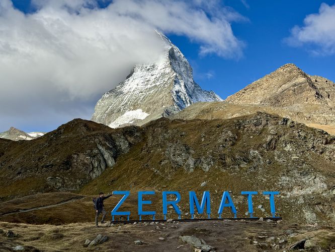
The first stop along this hike is the ultra-popular photo spot, the "Zermatt" sign. For Instagrammers, the Zermatt sign should not be skipped. The hike down to the Zermatt sign is a quick hit from the gondola station. If you're lucky, like we were, you'll show up and have the sign all to yourself. At the Zermatt sign, you'll find Matterhorn views with the mountain towering overhead.Gornergrat, Glacier, & Matterhorn Views - 0.4km to 2.7km
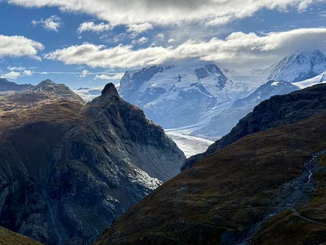
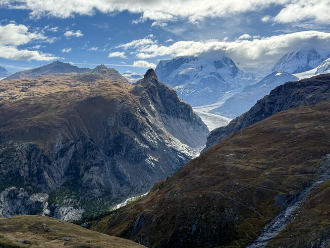
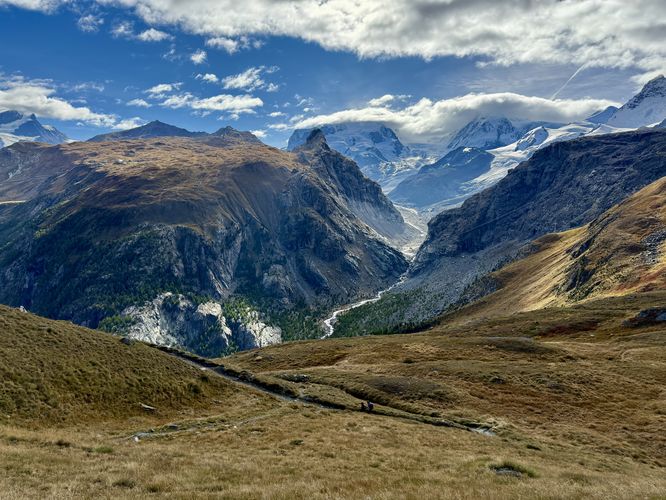
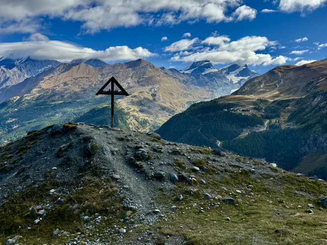
After passing the Zermatt sign, the trail leads back uphill toward the gondola station and keeps right at the trail junction where it leads southwest toward stunning vistas of Gornergrat (Gorner Ridge), the Riffelhorn - jagged peak on its slopes, the Monte Rosa massif, and the sprawling glacier, Grenzgletscher.Similar the Gornergrat hike, this route offers panoramic views for a large portion of the walk down to Furi, but instead of constant Matterhorn views, hikers will find abundant Gornergrat and Monte Rosa massif views. As you traverse the foothills down toward Furi, there will be plenty of Matterhorn views behind you, but eventually the Matterhorn becomes blocked by the foothills just downhill from 1km in this route.
As you continue the descent past 1km, the Matterhorn might be out of view for the rest of the hike, but the views of Gornergrat, the Monte Rosa massif, and Grenzgletscher are unmatched elsewhere around Zermatt, so be sure to enjoy the sprawling Alps views on your way down. Note that between 1.1km and 1.45km are a set of switchbacks that should be followed to avoid eroding steep alpine terrain and ecosystems.
The trail will pass under the Matterhorn Express around 1.75km, which is a fun place to stop and wave to gondola riders as they pass overhead. Past the Matterhorn Express is one last panoramic viewpoint that sits high above the Zermatt Valley with more Alps views near 2.15km. These Alps views last for just a short while before you start following switchbacks that lead into a larch forest. As you traverse the switchbacks you'll find more stunning Alps views, especially of Gornergrat, as the trail descends closer to Furi.