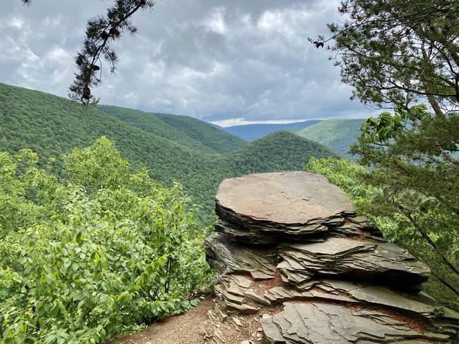
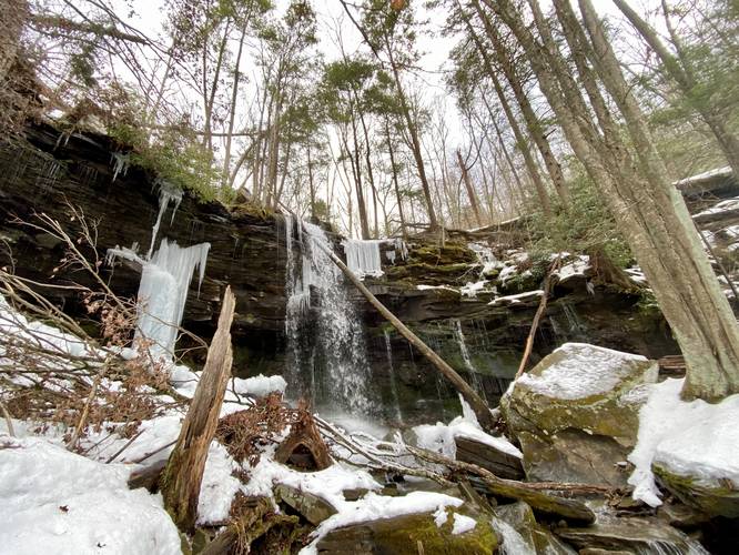
Loading...

🎆 50% off 4th of July sale on Supporter Accounts — now through July 6! Learn More.

Hiking Trails in the PA Wilds

Browse 391 hiking trails across 980.9 miles (1,579 km) in the PA Wilds.
PA Wilds logo

Hiking the PA Wilds

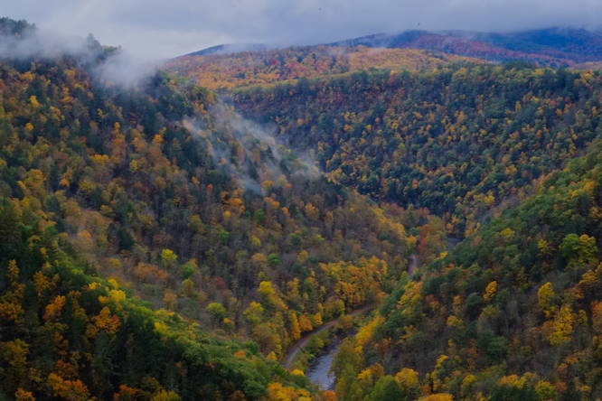
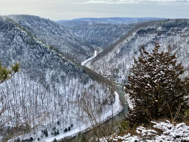
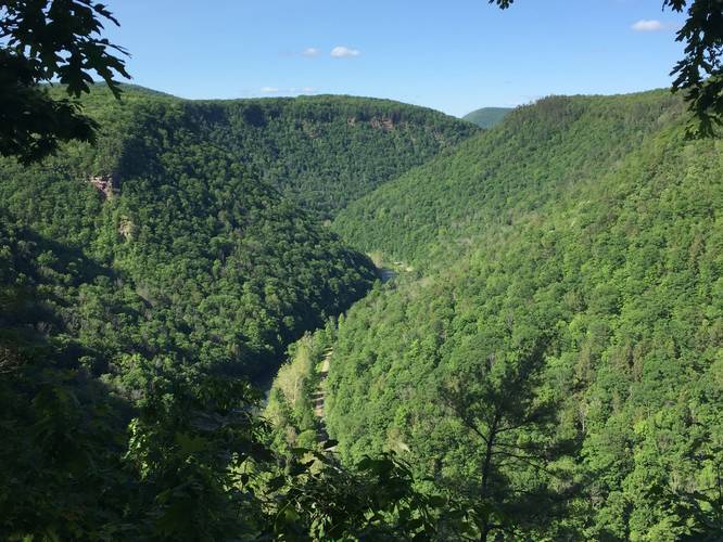
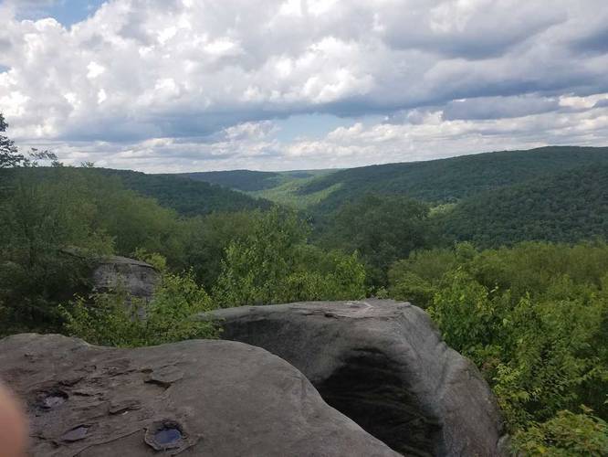
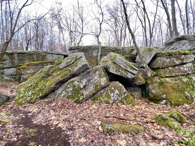
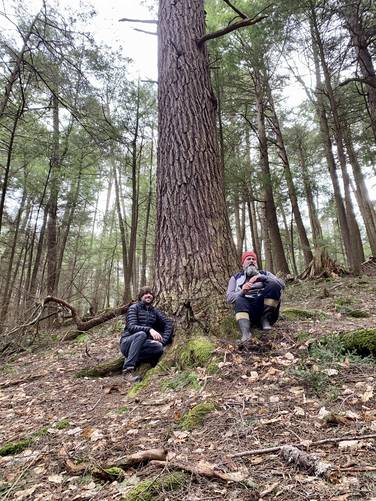
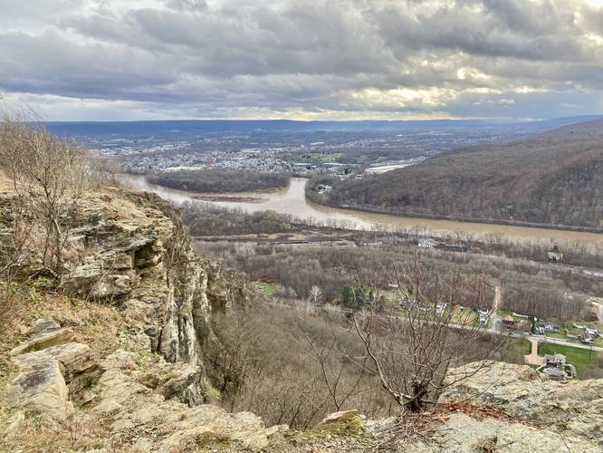
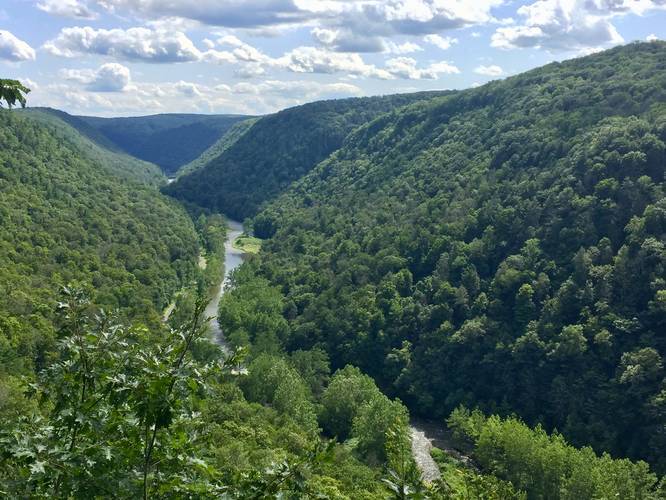
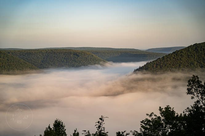
Located in north central Pennsylvania, the PA Wilds covers about 25% of Pennsylvania's total land acreage and features more than 2 million acres of public land with hundreds of miles of hiking and backpacking trails. From the popular Pennsylvania Grand Canyon (officially named Pine Creek Gorge) to the Kinzua Bridge, Austin Dam Memorial Park, and Allegheny National Forest, the PA Wilds has endless natural beauty and unique sights to explore among its vast wilderness.

Plan your next adventure to the PA Wilds by exploring our hiking trails - all curated by locals!
Default image for Barbour Rock Accessible Trail, a 1.3-mile trail in Wellsboro, PA (US)
1.3 Miles
2.1 km
Easy Out-and-Back
Default image for Golden Eagle Trail, a 9.9-mile trail in Cammal, PA (US)
9.9 Miles
15.9 km
Strenuous Loop
Default image for Minister Creek Trail, a 6.0-mile trail in Sheffield, PA (US)
6 Miles
9.7 km
Moderate Loop
Default image for Hessel Gessel Trail, a 2.9-mile trail in Wellsboro, PA (US)
2.9 Miles
4.7 km
Easy Out-and-Back
Default image for Chimney Rock Vista Hike, a 5.0-mile trail in Cedar Run, PA (US)
5 Miles
8 km
Strenuous Out-and-Back
Default image for Rim Trail, a 1.5-mile trail in Wellsboro, PA (US)
1.5 Miles
2.4 km
Easy Loop
Default image for Bent Run Waterfall Trail, a 0.2-mile trail in Warren, PA (US)
0.2 Miles
0.3 km
Moderate Out-and-Back
Default image for F. H. Dutlinger Old Growth Forest Hike, a 5.9-mile trail in Cross Fork, PA (US)
5.9 Miles
9.5 km
Moderate Out-and-Back
Default image for Morrison Loop Trail, a 5.5-mile trail in Bradford, PA (US)
5.5 Miles
8.9 km
Moderate Loop
Default image for Campbell's Ledge, a 3.0-mile trail in Duryea, PA (US)
3 Miles
4.8 km
Moderate Out-and-Back
Default image for Sand Run Falls Trail, a 6.9-mile trail in Wellsboro, PA (US)
6.9 Miles
11.1 km
Moderate Loop
Default image for Kinzua Creek Trail, a 1.2-mile trail in Kane, PA (US)
1.2 Miles
1.9 km
Hard Out-and-Back
Loading...
Showing 25 to 36 of 391 Hiking Trails

Trails by Category

You May Also Like

Colorado's Million Dollar Highway - Plan a day's drive adventure along the iconic Million Dollar Highway in Colorado. Explore the best short trails, roadside stops, waterfalls, vistas, ghost towns, and hot springs within a ~6 hour road trip.
Explore

Colorado's Million Dollar Highway

Plan a day's drive adventure along the iconic Million Dollar Highway in Colorado. Explore the best short trails, roadside stops, waterfalls, vistas, ghost towns, and hot springs within a ~6 hour road trip.

Read
Glacier's Going-to-the-Sun Road - Discover the breathtaking beauty of Glacier National Park along the iconic Going-to-the-Sun Road. From stunning roadside stops to picturesque waterfalls and vistas, this engineering marvel offers endless opportunities for exploration.
Explore

Glacier's Going-to-the-Sun Road

Discover the breathtaking beauty of Glacier National Park along the iconic Going-to-the-Sun Road. From stunning roadside stops to picturesque waterfalls and vistas, this engineering marvel offers endless opportunities for exploration.

Read
New York's Best Waterfalls - Whether you're planning a day hike, roadside stop, or a leisurely short walk, this guide provides hikers, travelers, and locals alike with 63 different locations to over 100 scenic waterfalls to help plan your next adventure!
Explore

New York's Best Waterfalls

Whether you're planning a day hike, roadside stop, or a leisurely short walk, this guide provides hikers, travelers, and locals alike with 63 different locations to over 100 scenic waterfalls to help plan your next adventure!

Read

Before you boogie...

Find our trail guides useful? Consider becoming a Supporter to unlock perks!

MyHikes is an indie platform that makes exploring public trails easier for everyone. The platform has no investors, no ads, and is owned and operated by one person, Dave Miller. Dave has personally mapped and written over 1,800 trail guides on MyHikes for the public to explore. MyHikes has helped millions outdoor enthusiasts plan their next adventure.

But it takes a lot of time 🕦, money 💰, work, and espresso shots ☕ to run MyHikes, including hiking , mapping , writing , and publishing new trails with high-quality (accurate) information... along with software engineering (coding) the platform like building new features, website and mobile app development (iOS and Android), site maintainance . and much much more.

Supporters unlock website and mobile app perks with an annual one-time payment of $25 (you renew) 😎👍. Or you can simply make a Donation of your choice. Otherwise, you can support us by telling your friends about MyHikes - both quick and free 🎉

Admin user profile picture

Dave Miller
MyHikes Founder