The Rim Trail at Colton Point State Park in Wellsboro, Pennsylvania is an easy 1.5-mile loop trail that encompasses the park and also features five amazing lookout points that sit high above the Grand Canyon of Pennsylvania.
This recording starts at the very top of the loop at the first parking lot near the trailhead. We hiked the loop clockwise which allowed us to get views first, since there are no views on the west side of the trail.
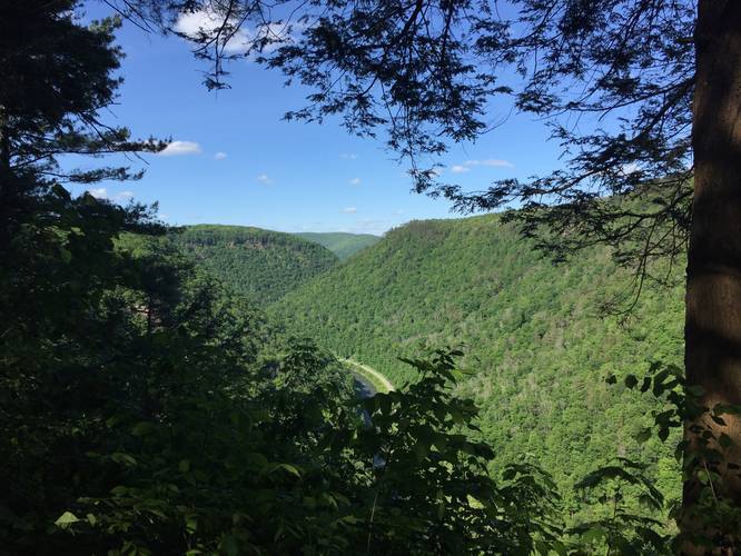
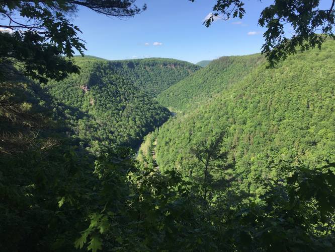
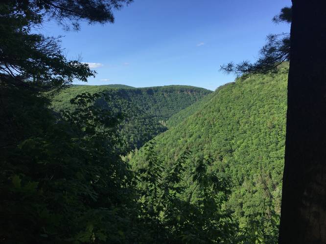
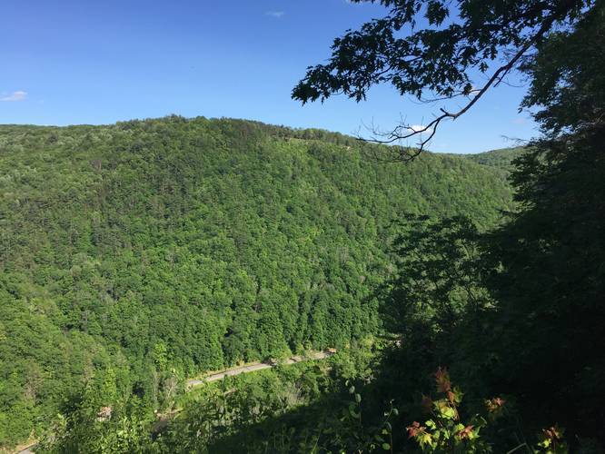
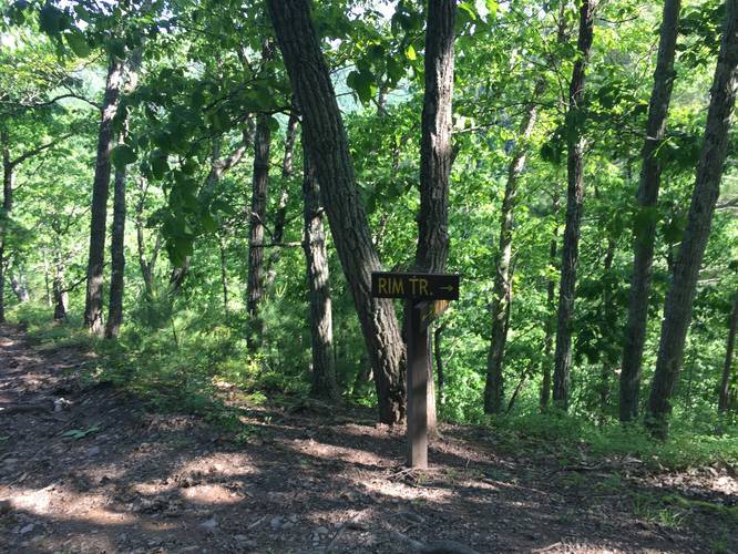
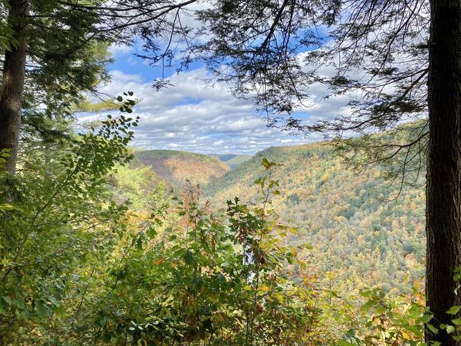
Follow the yellow blazes from the parking lot south as you hit multiple lookout points high above the Grand Canyon of Pennsylvania with Pine Creek below. When you reach the southern tip of the trail, there will be two signs labeled "Rim Trail" you can follow; however, there's an additional spur trail that leads downhill to another lookout point with views of the Main Lookout Trail at Leonard Harrison State Park.
Continuing west and north from the southern lookout spur trail, you'll follow yellow blazes as the trail skirts the rim of yet another little canyon area to the west. Here you'll get some views through the trees of the surrounding area before heading into coniferous forests back to parking.
Before you reach parking, the trail will run through large coniferous trees and along the Rexford Branch Creek. Here the trail can be muddy as water tries to cross the trail to reach the creek. Despite the area being muddy, it's a really interesting section of the hike despite not having any views.
Finally, you'll reach the parking lot once again to complete the hike for 1.5-miles.
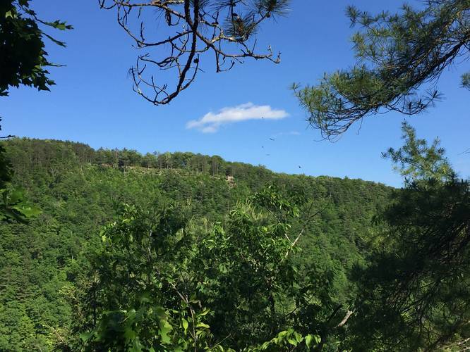
Lookout Points: Four lookout points can be found along the eastern side of this trail. Most of them are very easy to get to since the trail is so flat in this section and for the most part, the lookout points aren't too far apart. Some of these lookout points have views of Leonard Harrison State Park and the Main Lookout Trail located at that park, which is really neat if you've visited Leonard Harrison State Park previously.
Blazes: Follow the yellow blazes. In the southwest section of the trail, the trail technically splits and runs parallel to itself. Both parallel trails have yellow blazes, but they both go to the same place and thus end up meeting up once again before heading back north.
Parking: Parking can be found at the coordinates provided; however, if you park anywhere south of the coordinates here, you can pick up the trail from various points in the park.
Pets: Leashed dogs are allowed and their waste must be carried out.
Restrooms: This trail has restrooms available due to the picnic and camping areas at the park. They can be found randomly along the trail near the middle of the park.
This recording starts at the very top of the loop at the first parking lot near the trailhead. We hiked the loop clockwise which allowed us to get views first, since there are no views on the west side of the trail.
Follow the yellow blazes from the parking lot south as you hit multiple lookout points high above the Grand Canyon of Pennsylvania with Pine Creek below. When you reach the southern tip of the trail, there will be two signs labeled "Rim Trail" you can follow; however, there's an additional spur trail that leads downhill to another lookout point with views of the Main Lookout Trail at Leonard Harrison State Park.
Continuing west and north from the southern lookout spur trail, you'll follow yellow blazes as the trail skirts the rim of yet another little canyon area to the west. Here you'll get some views through the trees of the surrounding area before heading into coniferous forests back to parking.
Before you reach parking, the trail will run through large coniferous trees and along the Rexford Branch Creek. Here the trail can be muddy as water tries to cross the trail to reach the creek. Despite the area being muddy, it's a really interesting section of the hike despite not having any views.
Finally, you'll reach the parking lot once again to complete the hike for 1.5-miles.
Lookout Points: Four lookout points can be found along the eastern side of this trail. Most of them are very easy to get to since the trail is so flat in this section and for the most part, the lookout points aren't too far apart. Some of these lookout points have views of Leonard Harrison State Park and the Main Lookout Trail located at that park, which is really neat if you've visited Leonard Harrison State Park previously.
Blazes: Follow the yellow blazes. In the southwest section of the trail, the trail technically splits and runs parallel to itself. Both parallel trails have yellow blazes, but they both go to the same place and thus end up meeting up once again before heading back north.
Parking: Parking can be found at the coordinates provided; however, if you park anywhere south of the coordinates here, you can pick up the trail from various points in the park.
Pets: Leashed dogs are allowed and their waste must be carried out.
Restrooms: This trail has restrooms available due to the picnic and camping areas at the park. They can be found randomly along the trail near the middle of the park.