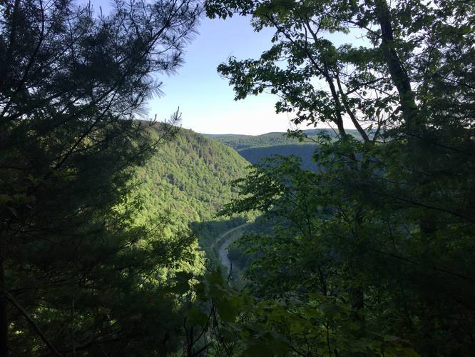
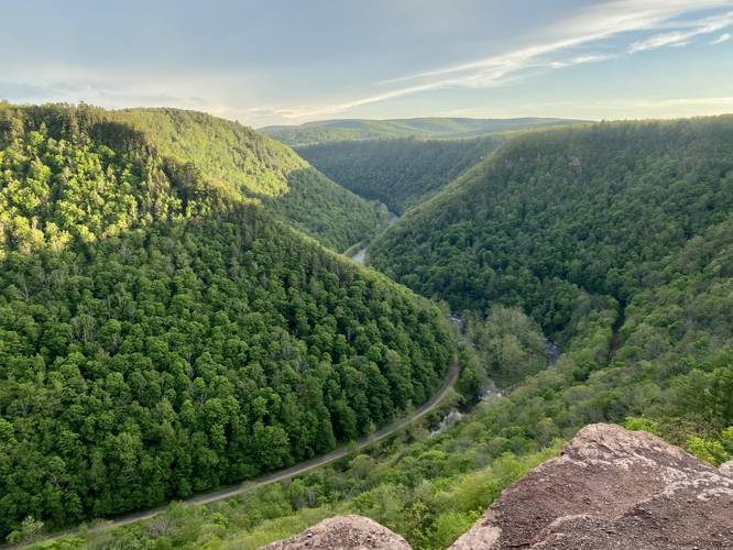
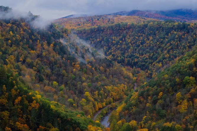
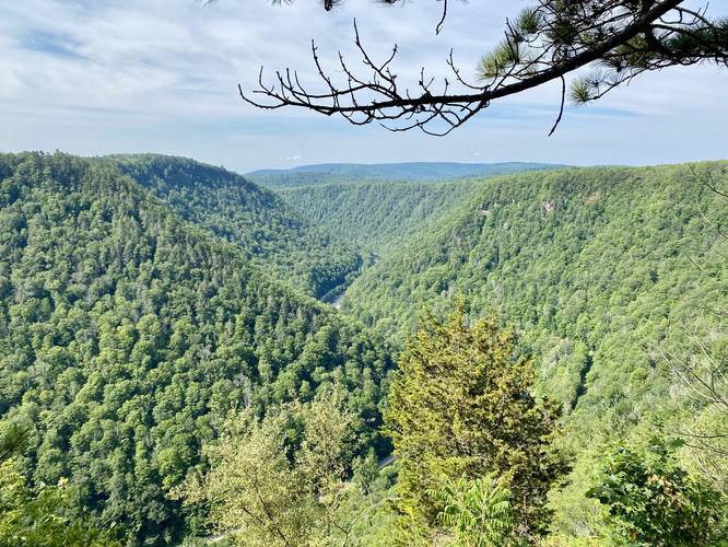
The Barbour Rock Handicap Trail at Tioga State Forest in Wellsboro, Pennsylvania is an easy 1.3-mile out-and-back accessible trail that leads out to two amazing lookout points high above the Grand Canyon of Pennsylvania (officially known as Pine Creek Gorge).
The trail is a gradual-grade stone-crushed path that meanders through the woods of Tioga State Forest within the Pine Creek Gorge Natural Area. The hike itself is easy since the elevation gain is very gradual throughout the entire trail.
Hikers can alternatively take the Barbour Rock Trail (yellow blaze loop) which is a slightly more moderate and rugged trail that leads to the same place.
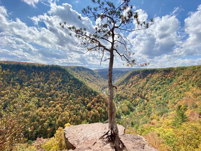
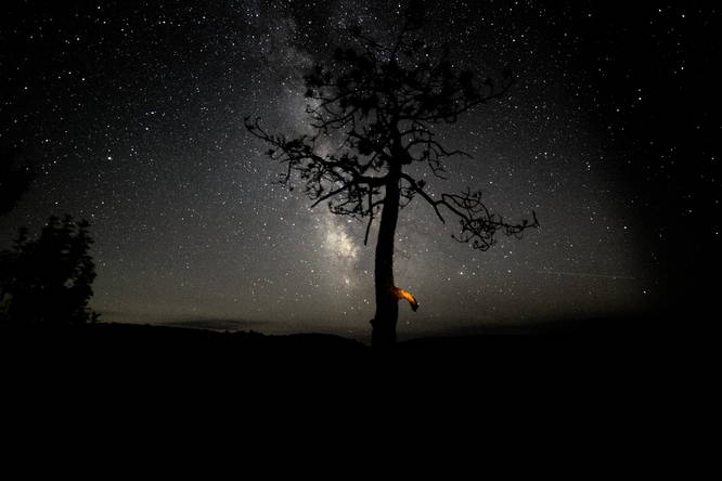
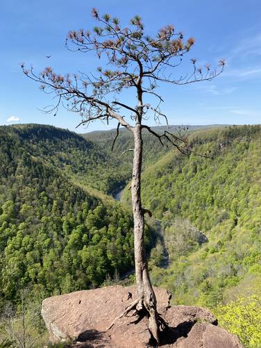
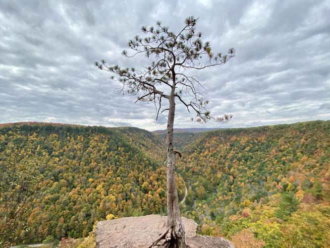
RIP Lone Pine - Spring 2022
As of Spring 2022, the Lone Pine (which died 1 year earlier) has fallen off of Barbour Rock. For folks looking for this iconic tree, it's no longer here.
Universal Accessibility
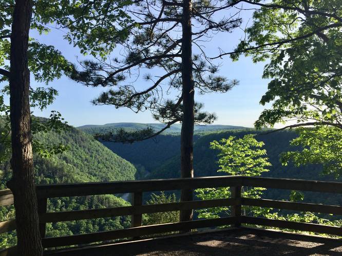
Please note that this trail is fully accessible and leads to one accessible overlook with a wooden fence. The view at the accessible overlook is nice, but the main view is just nextdoor to the east, approximately 50-feet away; however, that area is not universally accessible.
Parking
Parking can be found at the trailhead or across the street in either lot.
Pets
Leashed dogs are allowed and their waste must be carried out.
Warning
Some lookout points along Pine Creek Gorge have very steep cliffs and no fencing. Hike at your own risk.
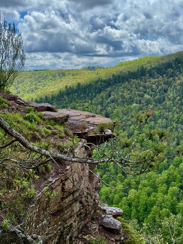
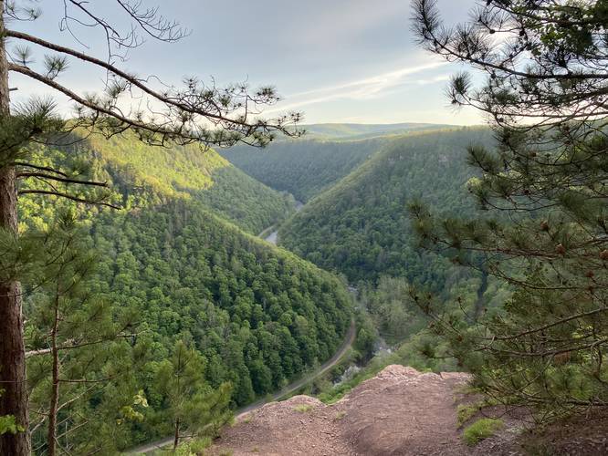
Lookout Point
The destination of this hike is the lookout points along the rim of Pine Creek Gorge (Grand Canyon of Pennsylvania). The first lookout point is an accessible lookout with a bench; however, just 20 feet further from the 1st lookout is a non-accessible stunning vista with a cliff that's a must-see.
History
This trail was constructed in 1978 by the Youth Conservation Corps and named after Samuel Barbour who died in a log jam on Owassee Rapids in the 1890's. Owassee Rapids is also known as Barbour's Bend.
Camping
Camping is technically allowed off of this trail, but no designated campsites can be seen from the trail. Backpackers must be aware of the state forest's primitive camping rules before heading out. More information can be found on the park's site. As a rule of thumb, it's best to not camp near the trail unless there is a designated campsite just off of the trail, never camp directly on the trail, and leave no trace.
Winter Road Conditions
Tioga State Forest does not maintain this road during the winter. Do not attempt driving on this road without proper equipment including snow tires and/or chains unless the road is clear. High wind storms may also cause trees to fall across the road, making the road impassible. If you plan to visit during the winter, plan accordingly.
The trail is a gradual-grade stone-crushed path that meanders through the woods of Tioga State Forest within the Pine Creek Gorge Natural Area. The hike itself is easy since the elevation gain is very gradual throughout the entire trail.
Hikers can alternatively take the Barbour Rock Trail (yellow blaze loop) which is a slightly more moderate and rugged trail that leads to the same place.
RIP Lone Pine - Spring 2022
As of Spring 2022, the Lone Pine (which died 1 year earlier) has fallen off of Barbour Rock. For folks looking for this iconic tree, it's no longer here.
Universal Accessibility
Please note that this trail is fully accessible and leads to one accessible overlook with a wooden fence. The view at the accessible overlook is nice, but the main view is just nextdoor to the east, approximately 50-feet away; however, that area is not universally accessible.
Parking
Parking can be found at the trailhead or across the street in either lot.
Pets
Leashed dogs are allowed and their waste must be carried out.
Warning
Some lookout points along Pine Creek Gorge have very steep cliffs and no fencing. Hike at your own risk.
Lookout Point
The destination of this hike is the lookout points along the rim of Pine Creek Gorge (Grand Canyon of Pennsylvania). The first lookout point is an accessible lookout with a bench; however, just 20 feet further from the 1st lookout is a non-accessible stunning vista with a cliff that's a must-see.
History
This trail was constructed in 1978 by the Youth Conservation Corps and named after Samuel Barbour who died in a log jam on Owassee Rapids in the 1890's. Owassee Rapids is also known as Barbour's Bend.
Camping
Camping is technically allowed off of this trail, but no designated campsites can be seen from the trail. Backpackers must be aware of the state forest's primitive camping rules before heading out. More information can be found on the park's site. As a rule of thumb, it's best to not camp near the trail unless there is a designated campsite just off of the trail, never camp directly on the trail, and leave no trace.
Winter Road Conditions
Tioga State Forest does not maintain this road during the winter. Do not attempt driving on this road without proper equipment including snow tires and/or chains unless the road is clear. High wind storms may also cause trees to fall across the road, making the road impassible. If you plan to visit during the winter, plan accordingly.