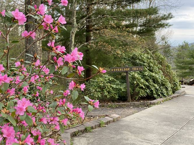
The Overlook Trail at Leonard Harrison State Park in Wellsboro, Pennsylvania is a moderate to difficult 0.8-mile loop trail that leads to Otter View, a scenic overlook above Pine Creek Gorge / Grand Canyon of Pennsylvania, and two seasonal waterfalls.
Hike Description
This trail is rated as moderate due to the steep sections of trail hikers face closer to Otter View; however, if you're an inexperienced hiker, this may be more of a difficult hike for you.
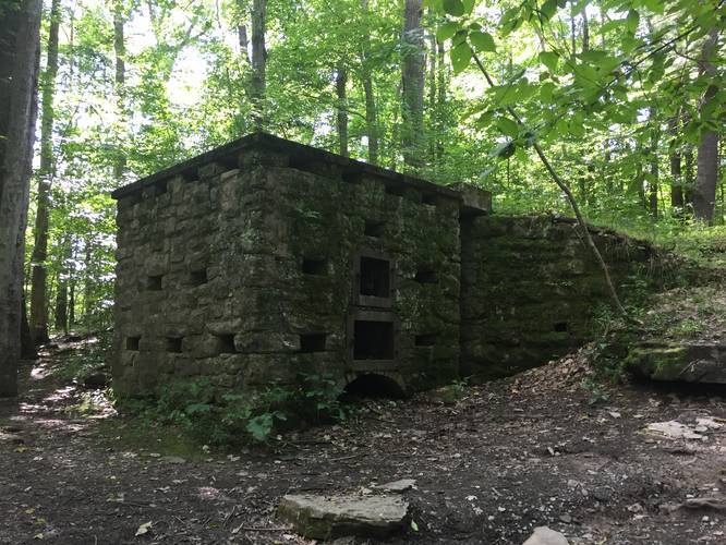
This recording starts on the Leonard Harrison Main Lookout Trail and follows the short spur trail to the main loop which leads downhill toward Otter View and the seasonal waterfalls. At the first trail junction, you'll find an old incinerator built by the CCC (Civilian Conservation Corps) in the 1930's - here you can go right or left, but this recording heads right at the loop junction to follow the eastern rim of Pine Creek Gorge.
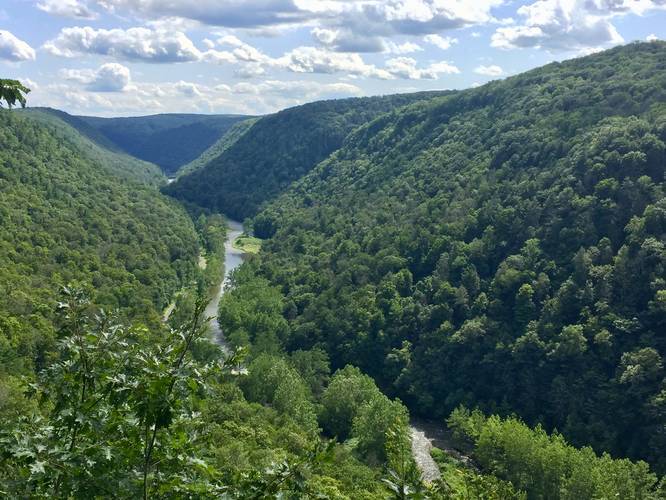
After hiking beyond the trail junction, heading right, you'll find a couple of small lookout points with small peaks through the trees of the western side of Pine Creek Gorge. Hiking further downhill, you'll reach a fairly steep-graded section with loose rocks and wooden planks to help with the hike down (or up). At the end of this steep downhill section is Otter View - a stunning south-facing overlook that sits high above Pine Creek Gorge. Otter View is the main reason to hike this trail, but due to the difficulty of the downhill hike, many people will skip out and just stay along the Main Lookout Trail instead.
Views: Otter View is the main lookout point along this trail, which is located roughly half-way down the loop; however, there are other, less scenic overlooks along the way. Most of these extra overlooks sit on rocks that jut out from the steep hillside that slopes down the canyon - these views aren't great, but if you choose to explore them, hike at your own risk.
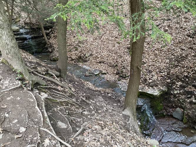
Waterfalls: If you wish to visit the seasonal waterfalls (Spring, Winter, and after heavy rains), located on a small spur trail on the east side of the loop, the hike becomes even more complex and a bit dangerous due to the loose footing and the width of the trail. There are two waterfalls visible from this short spur trail - one closer to the main loop, which cascades about 5-feet down the creek. The other waterfall is located further down the trail and cascades about 8-feet into the creek. These waterfalls have no name and no maps appear to have a name for the creek either, so Otter Falls may suit their name. Please note that the trail that leads to these waterfalls is dangerous due to the narrow width and footing available on the trail.
Parking: Parking can be found at the main parking lot at the coordinates provided.
Pets: Dogs are allowed if leashed and their waste must be carried out by the hiker.
Warnings: The spur trail to the waterfalls is dangerous due to loose footing placement and the narrow width of the trail. Additionally, the small lookout points on the west side of the trail, above Pine Creek Gorge (Grand Canyon of Pennsylvania), are narrow with steep drops down into the gorge.
Hike Description
This trail is rated as moderate due to the steep sections of trail hikers face closer to Otter View; however, if you're an inexperienced hiker, this may be more of a difficult hike for you.
This recording starts on the Leonard Harrison Main Lookout Trail and follows the short spur trail to the main loop which leads downhill toward Otter View and the seasonal waterfalls. At the first trail junction, you'll find an old incinerator built by the CCC (Civilian Conservation Corps) in the 1930's - here you can go right or left, but this recording heads right at the loop junction to follow the eastern rim of Pine Creek Gorge.
After hiking beyond the trail junction, heading right, you'll find a couple of small lookout points with small peaks through the trees of the western side of Pine Creek Gorge. Hiking further downhill, you'll reach a fairly steep-graded section with loose rocks and wooden planks to help with the hike down (or up). At the end of this steep downhill section is Otter View - a stunning south-facing overlook that sits high above Pine Creek Gorge. Otter View is the main reason to hike this trail, but due to the difficulty of the downhill hike, many people will skip out and just stay along the Main Lookout Trail instead.
Views: Otter View is the main lookout point along this trail, which is located roughly half-way down the loop; however, there are other, less scenic overlooks along the way. Most of these extra overlooks sit on rocks that jut out from the steep hillside that slopes down the canyon - these views aren't great, but if you choose to explore them, hike at your own risk.
Waterfalls: If you wish to visit the seasonal waterfalls (Spring, Winter, and after heavy rains), located on a small spur trail on the east side of the loop, the hike becomes even more complex and a bit dangerous due to the loose footing and the width of the trail. There are two waterfalls visible from this short spur trail - one closer to the main loop, which cascades about 5-feet down the creek. The other waterfall is located further down the trail and cascades about 8-feet into the creek. These waterfalls have no name and no maps appear to have a name for the creek either, so Otter Falls may suit their name. Please note that the trail that leads to these waterfalls is dangerous due to the narrow width and footing available on the trail.
Parking: Parking can be found at the main parking lot at the coordinates provided.
Pets: Dogs are allowed if leashed and their waste must be carried out by the hiker.
Warnings: The spur trail to the waterfalls is dangerous due to loose footing placement and the narrow width of the trail. Additionally, the small lookout points on the west side of the trail, above Pine Creek Gorge (Grand Canyon of Pennsylvania), are narrow with steep drops down into the gorge.