This section of the Hessel Gessel Trail at Tioga State Forest near Wellsboro, Pennsylvania is an easy 2.9-mile out-and-back trail that includes a historical millstone, an old quarry rock outcropping, a swamp that boasts colorful views during Autumn, and a seasonal obstructed-vista area at the top of the mountain with a view of the Asaph Wild Area plateau.
Hike Description
This hike begins at the yellow service road gate along Hessel Gessel Road - where the Hessel Gessel Trail turns onto the road. Hikers, looking for the points-of-interest along this trail, will want to skip the longer logging road hike and stick to the short GPS track provided that heads west along the Hessel Gessel Trail.
Millstone Site
Heading west first, hikers will reach an old Millstone with a forest sign that provides some additional history. This millstone was cut by James Hesselgessel in 1836. Stones from this quarry were used at the Beach Mill at Little Marsh, PA, the Billings Mill at Knoxville, PA, and the Ainsley Mill at Galeton, PA.
Old Quarry Outcropping
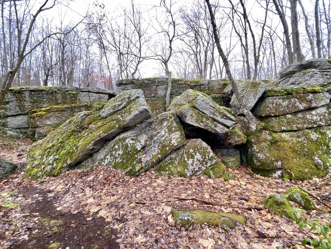
Just beyond the millstone, hikers will enter the old stone quarry - or what's left of it. There are large slabs of rock, with some 5-foot deep cracks, that hikers can meander over and around. The trail heads down these rocks - sometimes a scramble in places - to continue onward.
Just beyond the rock outcropping lies another area of large boulders - likely left-over from quarry work. After these large boulders, the trail becomes more manageable as it follows a well-beaten forest floor. Around mile 0.35, hikers will reach a swamp off-trail to the right-hand side (heading west) which usually boasts colors during Autumn.
Forest Road Hike to Obstructed Vista
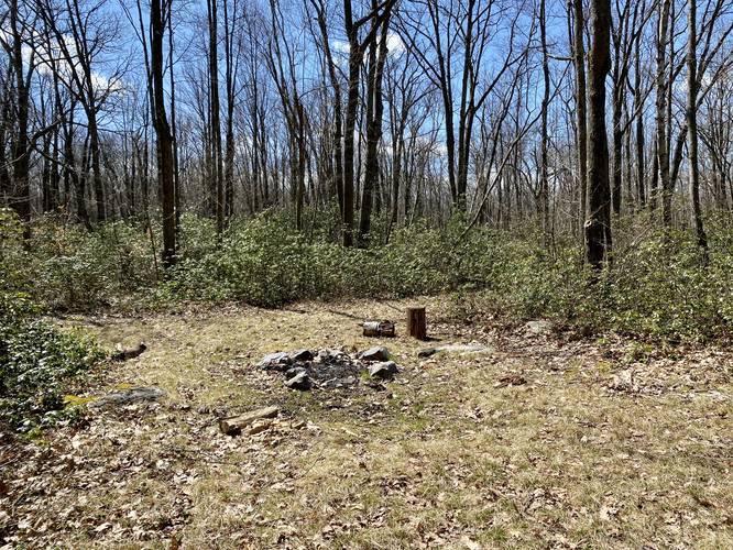
After visiting the old quarry section of the trail, hikers may want to take a longer walk down to the edge of the mountain, which has an unexciting obstructed seasonal vista area. This section of trail follows a beautiful coniferous-lined road for a short way before the trail opens up to a field.
At the large field, hikers should stay right to continue along this trail. Heading left at this trail junction will lead hikers down the Scotch Pine Hollow Trail instead.
Right after the Hessel Gessel Trail forks from the Scotch Pine Hollow Trail, the trail will begin heading downhill at a gradual grade. Eventually, the trail will essentially end as it reaches another larger cutout of forest; however, the trail does continue just slightly further for about 0.1-miles to where the loggers actually stopped cutting trees down along the side of the mountain.
By the time you reach the obvious obstructed vista point, the hike is over and the hike back to the parking area begins. The uphill climb is not difficult at all since it's a gradual climb back up this section of the mountain. Eventually the trail evens out again and the hike back is easy and flat.
Obstructed Seasonal Vista
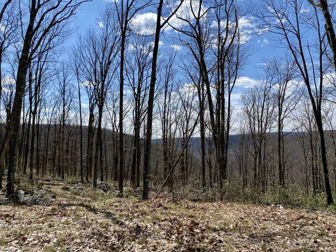
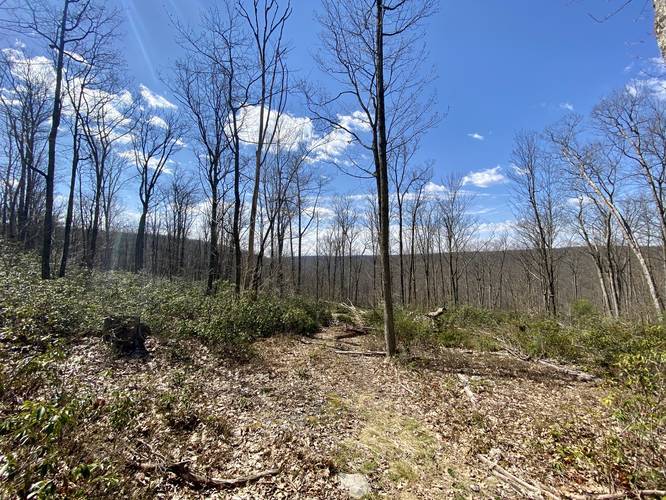
At the end of this trail is an area along the side of the mountain that has views of neighboring mountains - including the Asaph Wild Area plateau; however, none of these mountain tops are visible when the leaves are on the trees. So the "vista" here is only during the seasons when there are no leaves on the trees. Even then, the obstructed views from this trail may not be worth the effort and drive, unless to just explore this area of Tioga State Forest.
Trail Length
This is just one section of the Hessel Gessel Trail. The remaining trail can be found heading down the mountain next to the parking area (see the yellow blazes) and eventually runs into the Asaph Wild Area.
Parking
Hikers can find parking at the coordinates provided. The lot is large enough to fit about 4 vehicles.
Camping and Backpacking Backpackers will find a nice campsite next to the parking lot. The campsite is large enough to fit a few tents. Backpackers and campers must follow the Tioga State Forest primitive/dispersed/backcountry camping rules.
Pets
Dogs are allowed if leashed.
Winter Road Conditions
Tioga State Forest does not maintain this road during the winter. Do not attempt driving on this road without proper equipment including snow tires and/or chains unless the road is clear. High wind storms may also cause trees to fall across the road, making the road impassible. If you plan to visit during the winter, plan accordingly.
Hike Description
This hike begins at the yellow service road gate along Hessel Gessel Road - where the Hessel Gessel Trail turns onto the road. Hikers, looking for the points-of-interest along this trail, will want to skip the longer logging road hike and stick to the short GPS track provided that heads west along the Hessel Gessel Trail.
Millstone Site
Heading west first, hikers will reach an old Millstone with a forest sign that provides some additional history. This millstone was cut by James Hesselgessel in 1836. Stones from this quarry were used at the Beach Mill at Little Marsh, PA, the Billings Mill at Knoxville, PA, and the Ainsley Mill at Galeton, PA.
Old Quarry Outcropping
Just beyond the millstone, hikers will enter the old stone quarry - or what's left of it. There are large slabs of rock, with some 5-foot deep cracks, that hikers can meander over and around. The trail heads down these rocks - sometimes a scramble in places - to continue onward.
Just beyond the rock outcropping lies another area of large boulders - likely left-over from quarry work. After these large boulders, the trail becomes more manageable as it follows a well-beaten forest floor. Around mile 0.35, hikers will reach a swamp off-trail to the right-hand side (heading west) which usually boasts colors during Autumn.
Forest Road Hike to Obstructed Vista
After visiting the old quarry section of the trail, hikers may want to take a longer walk down to the edge of the mountain, which has an unexciting obstructed seasonal vista area. This section of trail follows a beautiful coniferous-lined road for a short way before the trail opens up to a field.
At the large field, hikers should stay right to continue along this trail. Heading left at this trail junction will lead hikers down the Scotch Pine Hollow Trail instead.
Right after the Hessel Gessel Trail forks from the Scotch Pine Hollow Trail, the trail will begin heading downhill at a gradual grade. Eventually, the trail will essentially end as it reaches another larger cutout of forest; however, the trail does continue just slightly further for about 0.1-miles to where the loggers actually stopped cutting trees down along the side of the mountain.
By the time you reach the obvious obstructed vista point, the hike is over and the hike back to the parking area begins. The uphill climb is not difficult at all since it's a gradual climb back up this section of the mountain. Eventually the trail evens out again and the hike back is easy and flat.
Obstructed Seasonal Vista
At the end of this trail is an area along the side of the mountain that has views of neighboring mountains - including the Asaph Wild Area plateau; however, none of these mountain tops are visible when the leaves are on the trees. So the "vista" here is only during the seasons when there are no leaves on the trees. Even then, the obstructed views from this trail may not be worth the effort and drive, unless to just explore this area of Tioga State Forest.
Trail Length
This is just one section of the Hessel Gessel Trail. The remaining trail can be found heading down the mountain next to the parking area (see the yellow blazes) and eventually runs into the Asaph Wild Area.
Parking
Hikers can find parking at the coordinates provided. The lot is large enough to fit about 4 vehicles.
Camping and Backpacking Backpackers will find a nice campsite next to the parking lot. The campsite is large enough to fit a few tents. Backpackers and campers must follow the Tioga State Forest primitive/dispersed/backcountry camping rules.
Pets
Dogs are allowed if leashed.
Winter Road Conditions
Tioga State Forest does not maintain this road during the winter. Do not attempt driving on this road without proper equipment including snow tires and/or chains unless the road is clear. High wind storms may also cause trees to fall across the road, making the road impassible. If you plan to visit during the winter, plan accordingly.