The Barbour Rock Trail at Tioga State Forest in Wellsboro, Pennsylvania is a moderate 1-mile loop hike that leads out to a stunning vista point high above the Grand Canyon of Pennsylvania.
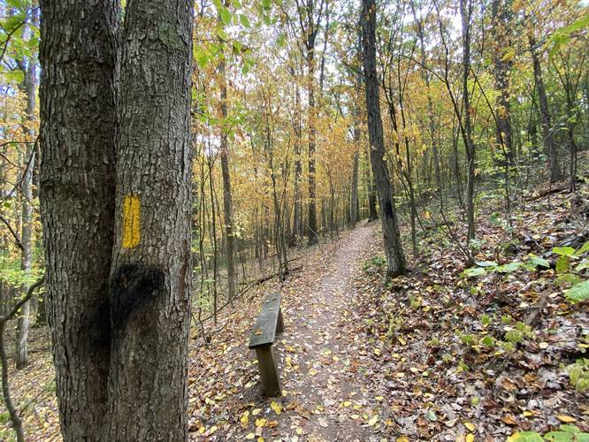
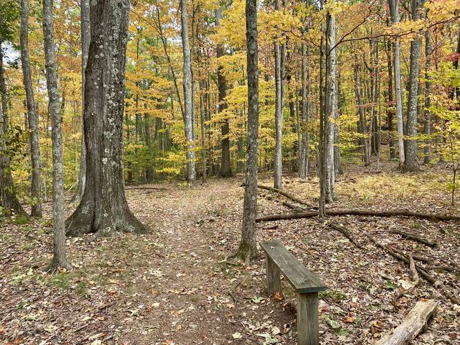
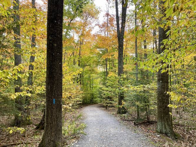
The trail starts off by following a flat crushed-stone trail that eventually starts to curve, after 0.2-miles. After 0.2-miles you'll find a trail that skirts off to the left-hand side of the Barbour Rock Accessible Trail - this is where the Barbour Rock Trail continues onto a skinnier dirt path and heads uphill toward Barbour Rock.
Following the yellow blazes, you'll eventually reach another fork in the trail - here, you can stay right to follow the trail uphill towards Barbour Rock (the top of the hill).
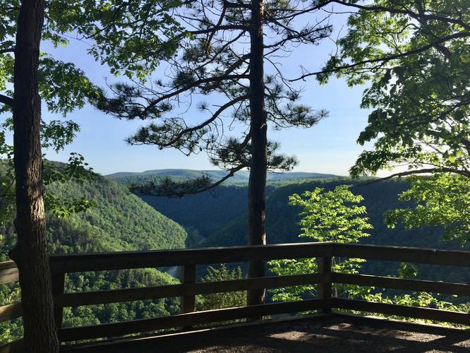
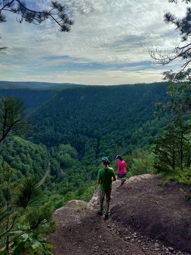
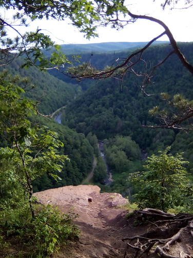
After just 0.45-miles, you'll reach the West Rim Trail and the accessible lookout point above Pine Creek Gorge / PA Grand Canyon. Take a left-hand turn at the first lookout point to head to an even better lookout with a rock ledge. After the rock ledge lookout, there's one final lookout point with a fence before the yellow blazes head back into the woods - follow these blazes to complete the loop.
RIP Lone Pine - Spring 2022
As of Spring 2022, the Lone Pine (which died 1 year earlier) has fallen off of Barbour Rock. For folks looking for this iconic tree, it's no longer here.
Warning
Some lookout points along Pine Creek Gorge have very steep cliffs and no fencing. Hike at your own risk.
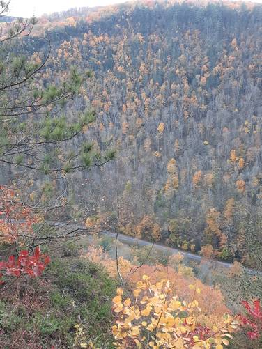
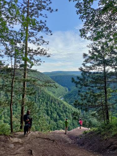
Lookout Points
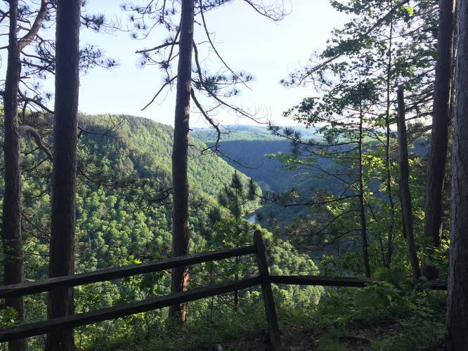
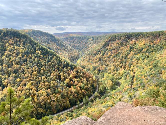
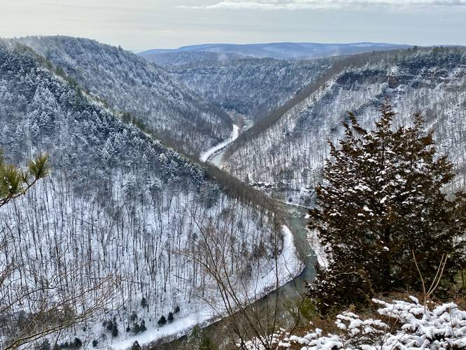
The destination of this hike is the lookout points along the rim of Pine Creek Gorge (Grand Canyon of Pennsylvania). In total there are about 3 overlooks - one fenced and obstructed overlook to the east, the unobstructed Barbour Rock overlook in the middle, and the accessible overlook along the Barbour Rock Accessible Trail. Hikers can visit a 4th vista if they take a 100-foot walk west along the West Rim Trail to the Lone Pine vista as well.
Pets
Leashed dogs are allowed and their waste must be carried out.
Parking
Parking can be found at the trailhead and parking coordinates provided. You can also park across the street.
History
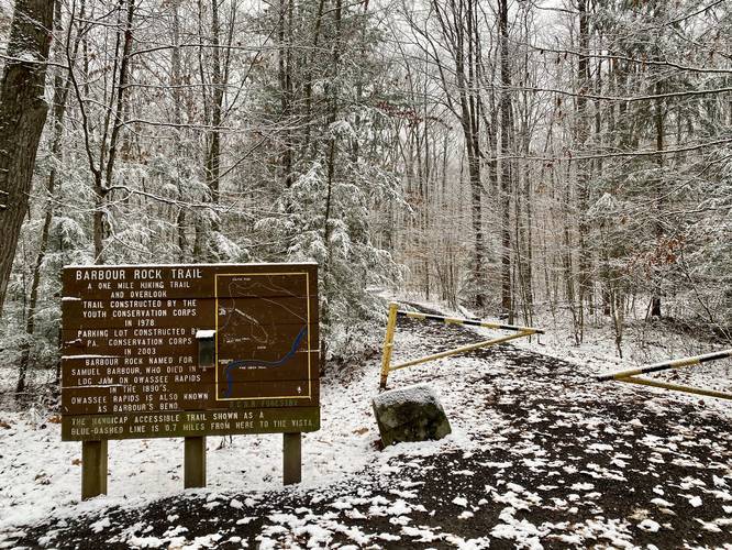
This trail was constructed in 1978 by the Youth Conservation Corps and named after Samuel Barbour who died in a log jam on Owassee Rapids in the 1890's. Owassee Rapids is also known as Barbour's Bend.
Camping
Camping is technically allowed off of this trail, but no designated campsites can be seen from the trail. Backpackers must be aware of the state forest's primitive camping rules before heading out. More information can be found on the park's site.
Winter Road Conditions
Tioga State Forest does not maintain this road during the winter. Do not attempt driving on this road without proper equipment including snow tires and/or chains unless the road is clear. High wind storms may also cause trees to fall across the road, making the road impassible. If you plan to visit during the winter, plan accordingly.
Pine Creek Pinnacles (PCP20)
This hike is part of the Pine Creek Pinnacles hiking challenge. For more information, details, and FAQs, please visit our Pine Creek Pinnacles (PCP20) page.
The trail starts off by following a flat crushed-stone trail that eventually starts to curve, after 0.2-miles. After 0.2-miles you'll find a trail that skirts off to the left-hand side of the Barbour Rock Accessible Trail - this is where the Barbour Rock Trail continues onto a skinnier dirt path and heads uphill toward Barbour Rock.
Following the yellow blazes, you'll eventually reach another fork in the trail - here, you can stay right to follow the trail uphill towards Barbour Rock (the top of the hill).
After just 0.45-miles, you'll reach the West Rim Trail and the accessible lookout point above Pine Creek Gorge / PA Grand Canyon. Take a left-hand turn at the first lookout point to head to an even better lookout with a rock ledge. After the rock ledge lookout, there's one final lookout point with a fence before the yellow blazes head back into the woods - follow these blazes to complete the loop.
RIP Lone Pine - Spring 2022
As of Spring 2022, the Lone Pine (which died 1 year earlier) has fallen off of Barbour Rock. For folks looking for this iconic tree, it's no longer here.
Warning
Some lookout points along Pine Creek Gorge have very steep cliffs and no fencing. Hike at your own risk.
Lookout Points
The destination of this hike is the lookout points along the rim of Pine Creek Gorge (Grand Canyon of Pennsylvania). In total there are about 3 overlooks - one fenced and obstructed overlook to the east, the unobstructed Barbour Rock overlook in the middle, and the accessible overlook along the Barbour Rock Accessible Trail. Hikers can visit a 4th vista if they take a 100-foot walk west along the West Rim Trail to the Lone Pine vista as well.
Pets
Leashed dogs are allowed and their waste must be carried out.
Parking
Parking can be found at the trailhead and parking coordinates provided. You can also park across the street.
History
This trail was constructed in 1978 by the Youth Conservation Corps and named after Samuel Barbour who died in a log jam on Owassee Rapids in the 1890's. Owassee Rapids is also known as Barbour's Bend.
Camping
Camping is technically allowed off of this trail, but no designated campsites can be seen from the trail. Backpackers must be aware of the state forest's primitive camping rules before heading out. More information can be found on the park's site.
Winter Road Conditions
Tioga State Forest does not maintain this road during the winter. Do not attempt driving on this road without proper equipment including snow tires and/or chains unless the road is clear. High wind storms may also cause trees to fall across the road, making the road impassible. If you plan to visit during the winter, plan accordingly.
Pine Creek Pinnacles (PCP20)
This hike is part of the Pine Creek Pinnacles hiking challenge. For more information, details, and FAQs, please visit our Pine Creek Pinnacles (PCP20) page.