Loading...

🍂 Prep for Fall! Unlock exclusive features to plan your perfect late-summer and autumn hikes — become a Supporter today. Learn more.

Uinta-Wasatch-Cache National Forest

Map
Park Website
Park Map PDF
Send to App
Explore 13 Trails with 26.3 Miles (42.3 km) at Uinta-Wasatch-Cache National Forest, Utah to plan your next hike or adventure!
Added:
October 02, 2023
Updated:
October 02, 2023
Default image for Silver Lake Trail, a 4.6-mile trail in Alpine, UT (US)
4.6 mi
7.4 km
Hard Out-and-Back
Default image for Mt. Timpanogos Trail to Emerald Lake, a 10.7-mile trail in Provo, UT (US)
10.7 mi
17.2 km
Hard Out-and-Back
Default image for Battle Creek Falls Trail, a 1.2-mile trail in Pleasant Grove, UT (US)
1.2 mi
1.9 km
Moderate Out-and-Back
Default image for Springdell Cascade Trail, a 2.3-mile trail in Provo, UT (US)
2.3 mi
3.7 km
Moderate Out-and-Back
Default image for Silver Lake Flat Reservoir Trail, a 1.0-mile trail in Alpine, UT (US)
1 mi
1.6 km
Easy Out-and-Back
Default image for The Y Trail, a 2.2-mile trail in Provo, UT (US)
2.2 mi
3.5 km
Hard Out-and-Back
Default image for G Monument Trail, a 1.9-mile trail in Pleasant Grove, UT (US)
1.9 mi
3.1 km
Hard Out-and-Back
Default image for Hidden Falls Trail, a 0.2-mile trail in Salt Lake City, UT (US)
0.2 mi
0.3 km
Easy Out-and-Back
Default image for Silver Creek Trail Overlooks, a 0.2-mile trail in Alpine, UT (US)
0.2 mi
0.3 km
Easy Out-and-Back
Default image for Tibble Fork Reservoir Loop, a 1.5-mile trail in Alpine, UT (US)
1.5 mi
2.4 km
Hard Loop
Default image for Hogum Fork Falls Lookout, a 0.0-mile trail in Alta, UT (US)
Easy Out-and-Back
Default image for Moss Ledge Falls Trail, a 0.2-mile trail in Salt Lake City, UT (US)
0.2 mi
0.3 km
Easy Out-and-Back
Loading...
Showing 1 to 12 of 13 Trails at Uinta-Wasatch-Cache National Forest, UT

Key Takeaways

  • Offers diverse recreational opportunities like hiking, camping, fishing, skiing, and scenic drives across a vast mountain landscape.
  • Spans a large area with varying elevations and terrain, so visitors should check specific trail conditions, weather forecasts, and consider altitude sickness.
  • Permits and reservations may be required for certain activities and locations, especially during peak seasons, so plan ahead.

About Uinta-Wasatch-Cache National Forest

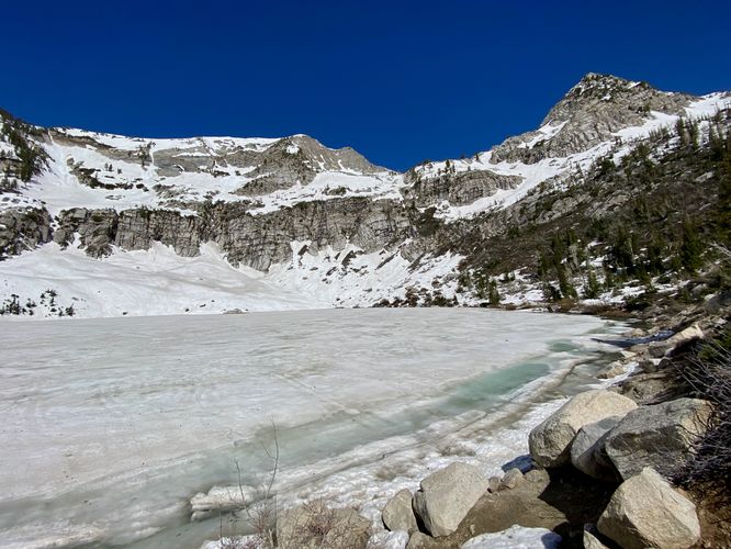
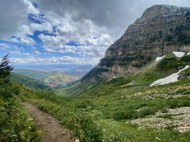
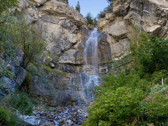
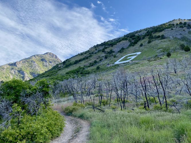
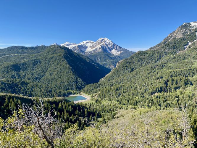
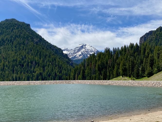
Explore the diverse hiking trails of the Uinta-Wasatch-Cache National Forest in South Jordan, Utah, and discover breathtaking scenery for all skill levels. From the easily accessible Lisa Falls Trail with its stunning waterfall in Granite, UT, to the challenging Mt. Timpanogos Trail leading to Emerald Lake near Provo, UT, adventures await. Keep in mind that some trails, like Lisa Falls, prohibit dogs and require some scrambling, while others, such as Hogum Fork Falls Lookout in Alta, Utah, a roadside stop, welcomes leashed canine companions. Always be mindful of potential hazards like rockfalls, flash flooding, and snowfields, and ensure you're prepared for rapidly changing alpine weather conditions, especially at higher elevations.

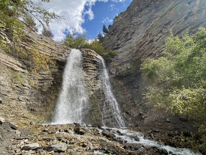
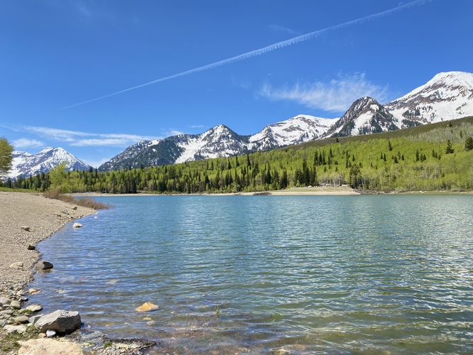
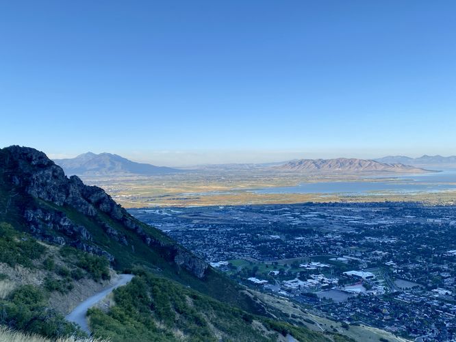
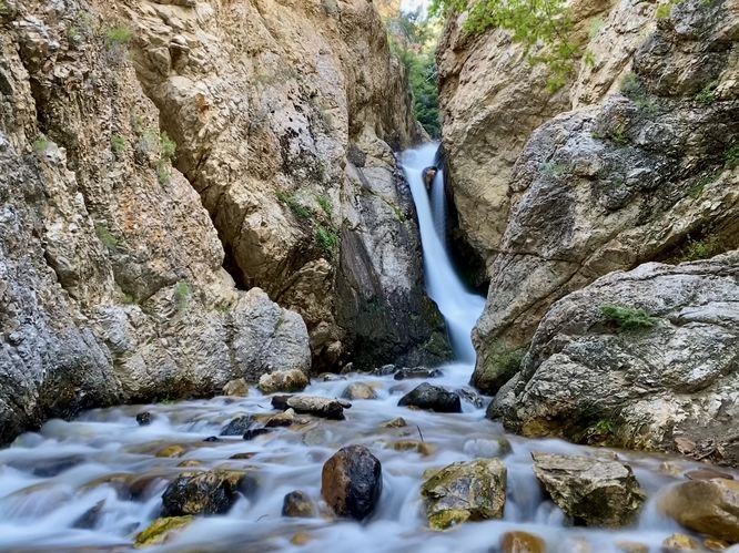
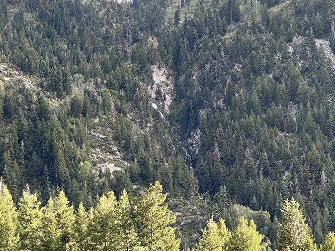
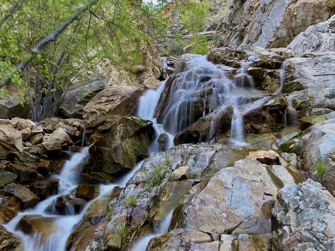
Delve deeper into the Uinta-Wasatch-Cache National Forest with trails like Battle Creek Falls Trail near Pleasant Grove, UT, known for its 60-foot waterfall and moderate difficulty, and the moderate Springdell Cascade Trail with its impressive 120-foot waterfall in Provo, UT. For a leg-burning challenge with rewarding views, conquer the steep slopes of the Y Trail, also in Provo, or enjoy immediate scenic vistas on the short Silver Creek Trail Overlooks near Alpine, UT. Remember to check for seasonal road closures and parking limitations, particularly for trails accessing via Silver Lake Flat Road. Whether you choose the short and easy Hidden Falls Trail in Big Cottonwood Canyon, UT, or the more strenuous Silver Lake Trail, be aware of potential creek crossings, elevation changes, and wildlife, and always prioritize safety and environmental stewardship by packing out everything you pack in.

Explore Hiking Trails

You May Also Like

Colorado's Million Dollar Highway - Plan a day's drive adventure along the iconic Million Dollar Highway in Colorado. Explore the best short trails, roadside stops, waterfalls, vistas, ghost towns, and hot springs within a ~6 hour road trip.
Explore

Colorado's Million Dollar Highway

Plan a day's drive adventure along the iconic Million Dollar Highway in Colorado. Explore the best short trails, roadside stops, waterfalls, vistas, ghost towns, and hot springs within a ~6 hour road trip.

Read
Glacier's Going-to-the-Sun Road - Discover the breathtaking beauty of Glacier National Park along the iconic Going-to-the-Sun Road. From stunning roadside stops to picturesque waterfalls and vistas, this engineering marvel offers endless opportunities for exploration.
Explore

Glacier's Going-to-the-Sun Road

Discover the breathtaking beauty of Glacier National Park along the iconic Going-to-the-Sun Road. From stunning roadside stops to picturesque waterfalls and vistas, this engineering marvel offers endless opportunities for exploration.

Read
New York's Best Waterfalls - Whether you're planning a day hike, roadside stop, or a leisurely short walk, this guide provides hikers, travelers, and locals alike with 63 different locations to over 100 scenic waterfalls to help plan your next adventure!
Explore

New York's Best Waterfalls

Whether you're planning a day hike, roadside stop, or a leisurely short walk, this guide provides hikers, travelers, and locals alike with 63 different locations to over 100 scenic waterfalls to help plan your next adventure!

Read