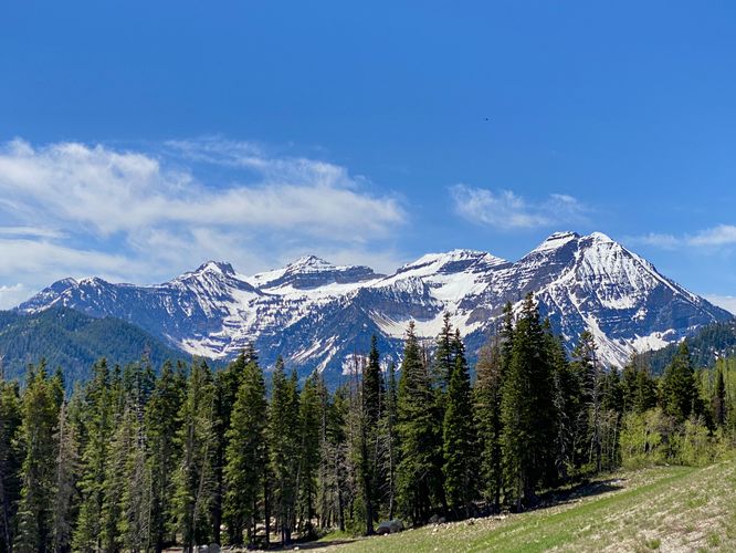
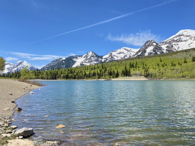
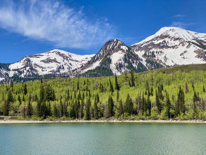
The Silver Lake Flat Reservoir Trail at Uinta National Forest near Alpine, Utah is an easy 1-mile out-and-back hike that features stunning views of Mt. Timpanogos and White Baldy Mountain.
Hike
This trail can be started along Silver Lake Flat Road at the coordinates provided, located just south of the reservoir. Hikers will follow the steep rocky trail as it ascends to the reservoir. Despite the easy difficulty of this hike, the first steep section should be considered at least moderate. The hike then leads north along the reservoir where you'll find stunning views of the water and the surrounding mountains like Box Elder Peak, White Baldy mountain, and Mt. Timpanogos behind you. If you ever hiked the Silver Lake Trail, you can spot where Silver Lake sits on the slopes of White Baldy mountain above you. The service-road portion of the reservoir's trail ends where you'll begin to follow a dirt path that runs along Silver Lake Flat Reservoir up to the campsite parking lot located at the end of Silver Lake Flat Road. Along the hike up to the far parking lot are more breathtaking views -- especially when the mountains are snow-capped like when I hiked this in late May 2024. Hikers will reach the far parking lot where the hike leads back to where you started. Along the way back, you'll find more views of Mt. Timpanogos and mountain reflections off of the reservoir's water. Complete the 1-mile out-and-back hike by taking the steep trail from the reservoir back to parking.
Nearby Hikes
If you plan to check out this trail, you might want to consider exploring other nearby hikes while in the area like the Silver Lake Trail which leads to an alpine lake, the Tibble Fork Reservoir Loop which provides views of the reservoir and surrounding mountains, and the Silver Creek Trail Overlooks which features views of Mt. Timpanogos and the Tibble Fork Reservoir.
Parking
Hikers will find a tiny parking turnout at the coordinates provided, located south of the reservoir. The turnout is large enough to fit one vehicle as of May 2024. Note that this road is closed for a very large portion of the year once too much snow and ice have built-up during the Fall. The road is generally open for travel after it's been cleared during late Spring. For more information about seasonal road closures, contact Uinta National Forest. The turnout is large enough to fit less than 5 vehicles as of May 2024. Note that the road to reach this trailhead is a dirt road with ruts and potholes. The road follows some insanely-steep mountain slopes with just barely enough space for two vehicles to pass each other. Just reaching this trailhead might not be for everyone.
Pets
Dogs are allowed only if leashed and must be cleaned up after.
Warning
Elevation sickness: This trail leads hikers up to about 7,500 feet above sea level. Around the 7,000-foot mark above sea level, hikers may start to experience symptoms of elevation sickness including headache, muscle aches, shortness of breath, among other warning signs. In order to avoid elevation sickness it's recommended to ascend to higher elevations and take short walks to acclimate over the course of several days before taking a long or physically-demanding hike. At any time you feel elevation sickness kicking in, that's the time to turn back and head for lower altitude or the parking lot.