The Silver Creek Trail Overlooks at Uinta National Forest near Alpine, Utah is an easy 0.2-mile hike that features views of Mt. Timpanogos and the Tibble Fork Reservoir.
Hike
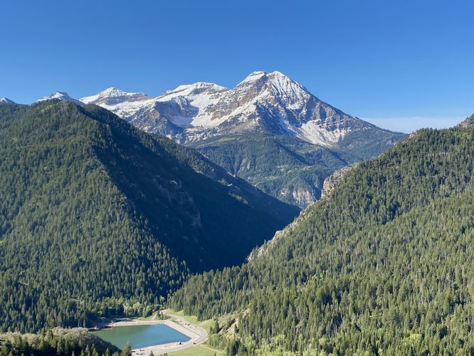
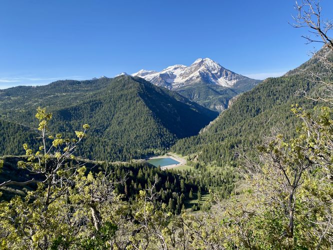
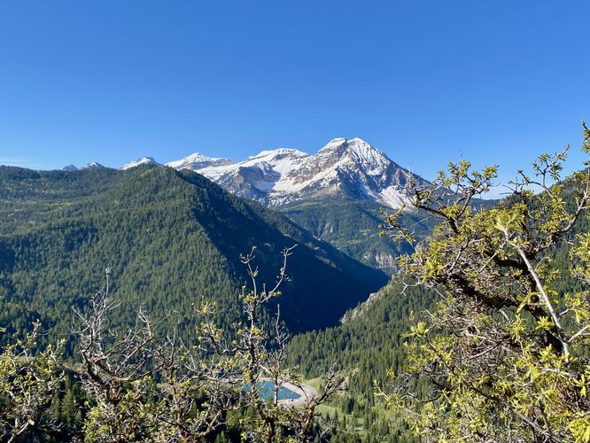
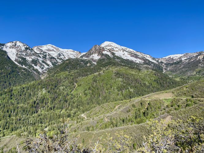
This short hike begins along the rugged Silver Lake Flat Road in a small parking turnout for the Silver Creek Trail. Hikers will head-in from here where you'll be struck with almost-immediate views of the surrounding mountains, mainly to the west. Just down the trail from the parking turnout sit several views of Mt. Timpanogos and the Tibble Fork Reservoir. Here you can choose to hike the trail which leads down the mountain toward the northeast or simply take a short walk along this route. If you hike a bit further down the trail, you'll find similar views from between the overgrowth. During late Spring, you might find lupine wildflowers along the trail which add to the scenery. On the hike in and on the way out, if you look to the west or northwest you'll find Box Elder Peak and White Baldy Mountain -- during my hike here in late May 2024 the mountains were still shrouded with snow-capped slopes that were slowly melting into the valleys below.
Nearby Hikes
If you plan to check out this trail, you might want to consider exploring other nearby hikes while in the area like the Silver Lake Trail which leads to an alpine lake, the Tibble Fork Reservoir Loop which provides views of the reservoir and surrounding mountains, and the Silver Lake Flat Reservoir Trail which features mountain views of Mt. Timpanogos and others.
Parking
Hikers will find a small parking turnout located at the coordinates provided, along Silver Lake Flat Road. Note that this road is closed for a very large portion of the year once too much snow and ice have built-up during the Fall. The road is generally open for travel after it's been cleared during late Spring. For more information about seasonal road closures, contact Uinta National Forest. The turnout is large enough to fit less than 5 vehicles as of May 2024. Note that the road to reach this trailhead is a dirt road with ruts and potholes. The road follows some insanely-steep mountain slopes with just barely enough space for two vehicles to pass each other. Just reaching this trailhead might not be for everyone.
Pets
Dogs are allowed only if leashed and should be cleaned up after.
Warning
Steep terrain: This trail leads to mountain slope overlooks that sit along very-steep slopes.
Rattlesnakes: During warm months, while rare, you could encounter rattlesnakes basking or sunbathing on-trail. If you find any rattlers, give them plenty of space.
Hike
This short hike begins along the rugged Silver Lake Flat Road in a small parking turnout for the Silver Creek Trail. Hikers will head-in from here where you'll be struck with almost-immediate views of the surrounding mountains, mainly to the west. Just down the trail from the parking turnout sit several views of Mt. Timpanogos and the Tibble Fork Reservoir. Here you can choose to hike the trail which leads down the mountain toward the northeast or simply take a short walk along this route. If you hike a bit further down the trail, you'll find similar views from between the overgrowth. During late Spring, you might find lupine wildflowers along the trail which add to the scenery. On the hike in and on the way out, if you look to the west or northwest you'll find Box Elder Peak and White Baldy Mountain -- during my hike here in late May 2024 the mountains were still shrouded with snow-capped slopes that were slowly melting into the valleys below.
Nearby Hikes
If you plan to check out this trail, you might want to consider exploring other nearby hikes while in the area like the Silver Lake Trail which leads to an alpine lake, the Tibble Fork Reservoir Loop which provides views of the reservoir and surrounding mountains, and the Silver Lake Flat Reservoir Trail which features mountain views of Mt. Timpanogos and others.
Parking
Hikers will find a small parking turnout located at the coordinates provided, along Silver Lake Flat Road. Note that this road is closed for a very large portion of the year once too much snow and ice have built-up during the Fall. The road is generally open for travel after it's been cleared during late Spring. For more information about seasonal road closures, contact Uinta National Forest. The turnout is large enough to fit less than 5 vehicles as of May 2024. Note that the road to reach this trailhead is a dirt road with ruts and potholes. The road follows some insanely-steep mountain slopes with just barely enough space for two vehicles to pass each other. Just reaching this trailhead might not be for everyone.
Pets
Dogs are allowed only if leashed and should be cleaned up after.
Warning
Steep terrain: This trail leads to mountain slope overlooks that sit along very-steep slopes.
Rattlesnakes: During warm months, while rare, you could encounter rattlesnakes basking or sunbathing on-trail. If you find any rattlers, give them plenty of space.