The Moss Ledge Falls Trail at Wasatch National Forest near Salt Lake City, Utah is an easy 0.2-mile out-and-back hike that leads to the multi-tier waterfall known as Mess Ledge Falls.
Hike
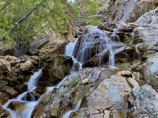
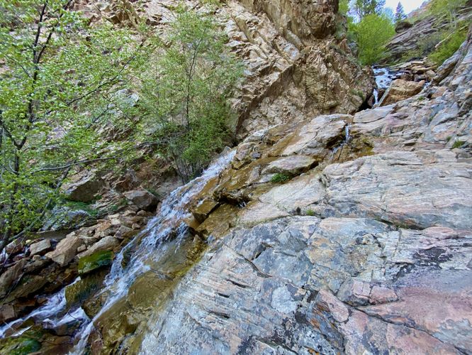
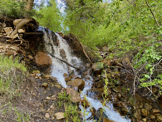
This hike begins at a discrete trailhead at the coordinates provided located on the north side of a large parking turnout along UT-190 within Big Cottonwood Canyon. The dirt trail leads up a moderate grade for just one-tenth of a mile to reach the multi-tiered waterfall, Moss Ledge Falls. The trail itself runs alongside Elbow Fork Creek and provides hikers with the opportunity to rock hop to the west side if they wish. During the Spring, when snow is still melting from the high elevation peaks, the creek may flood the trail slightly, so you may have to get your feet wet or rock hop to keep them dry. At mile 0.1, hikers will reach the base of Moss Ledge Falls. During our hike here in late May 2024, the snow melt and recent rain water filled the bedrock enough to form the waterfall, but it wasn't rushing like other waterfalls in the area, like Hidden Falls. Due to the lack of water, I was able to scramble up the lower tier of the cascade to get a better view of the upper tier of Moss Ledge Falls, you can check out the attached photos for a wide-angle shot of the waterfall if you're curious. The hike back is easy, just follow the same trail out. Before you leave, you might notice a ~8-foot tall waterfall tucked away that sits just off-trail -- technically, you pass this cascade on the hike in and out. I've added that as POI to the map and you can choose to explore the cascade before you leave.
Parking
Hikers will find a large parking turnout at the coordinates provided. The turnout is large enough to fit a dozen vehicles as of May 2024.
Pets
Dogs are not allowed within Big Cottonwood Canyon.
Hike
This hike begins at a discrete trailhead at the coordinates provided located on the north side of a large parking turnout along UT-190 within Big Cottonwood Canyon. The dirt trail leads up a moderate grade for just one-tenth of a mile to reach the multi-tiered waterfall, Moss Ledge Falls. The trail itself runs alongside Elbow Fork Creek and provides hikers with the opportunity to rock hop to the west side if they wish. During the Spring, when snow is still melting from the high elevation peaks, the creek may flood the trail slightly, so you may have to get your feet wet or rock hop to keep them dry. At mile 0.1, hikers will reach the base of Moss Ledge Falls. During our hike here in late May 2024, the snow melt and recent rain water filled the bedrock enough to form the waterfall, but it wasn't rushing like other waterfalls in the area, like Hidden Falls. Due to the lack of water, I was able to scramble up the lower tier of the cascade to get a better view of the upper tier of Moss Ledge Falls, you can check out the attached photos for a wide-angle shot of the waterfall if you're curious. The hike back is easy, just follow the same trail out. Before you leave, you might notice a ~8-foot tall waterfall tucked away that sits just off-trail -- technically, you pass this cascade on the hike in and out. I've added that as POI to the map and you can choose to explore the cascade before you leave.
Parking
Hikers will find a large parking turnout at the coordinates provided. The turnout is large enough to fit a dozen vehicles as of May 2024.
Pets
Dogs are not allowed within Big Cottonwood Canyon.