Hogum Fork Falls Lookout
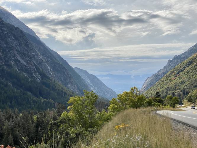
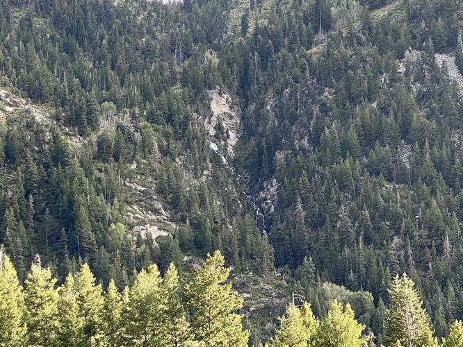
Note that this is not a hike, but rather a short walk outside of your car to enjoy the views of Hogum Fork Falls from a roadside parking turnout. Visitors will find views of Hogum Fork Falls along with views westward facing down the Little Cottonwood Canyon toward Salt Lake City.
Parking
Visitors will find a parking turnout at the coordinates provided.
Pets
Dogs are allowed if leashed and should be cleaned up after.
Know Before You Go
Interactive topographic map for Hogum Fork Falls Lookout located in Alta, UT. Click the "View Map" button to load GPS coordinates and trail markers.
View map
Get directions
- Distance
- N/A
- Difficulty
- Easy
- Type
- Out-and-Back
- Est. Time
- 5 min
- Elev. Gain
- 2'
- Rating
- 0.0
- Added
- September 21, 2023
- Updated
- October 02, 2023
Weather Forecast
Don't let Google decide who you trust.


Loading...
<strong>Trail map and elevation chart not rendering in print mode?</strong> Simply scroll to the trail map section, then try printing again!
Features
- Vista / Lookout Point
- Dogs
- Waterfalls
Points of interest
-
Parking
40.571312, -111.716911 -
Main Trailhead
40.571308, -111.717011 -
View of Little Cottonwood Canyon
40.571408, -111.717231 -
View of Hogum Fork Falls
40.5714, -111.717164
Safety information
For your own safety: plan ahead, let someone know where you'll be, and hike at your own risk.
Availability
All seasons
Surface type
Dirt
Trip Reports (Reviews)
Ready to help fellow hikers? Add a trip report to share your experience!
No community routes found. To add your own hike as a Community Route for this Trail guide, leave a Trip Report with an attached GPX file.


You may also like

Explore
Best of the Alps: Hiking, Adventure & Scenery
Plan your ultimate European Alps adventure! Discover the best hiking trails, epic scenery, and villages in the Swiss Alps, Dolomites, Chamonix, and Lake Como.

Explore
Colorado's Million Dollar Highway
Plan a day's drive adventure along the iconic Million Dollar Highway in Colorado. Explore the best short trails, roadside stops, waterfalls, vistas, ghost towns, and hot springs within a ~6 hour road trip.

Explore
Glacier's Going-to-the-Sun Road
Discover the breathtaking beauty of Glacier National Park along the iconic Going-to-the-Sun Road. From stunning roadside stops to picturesque waterfalls and vistas, this engineering marvel offers endless opportunities for exploration.

Explore
Hike Washington's National Parks & Forests
Find the best day hikes in Washington's National Parks and Forests. Explore panoramic alpine vistas, turquoise lakes, and stunning waterfalls.
uinta-wasatch-cache national forest

