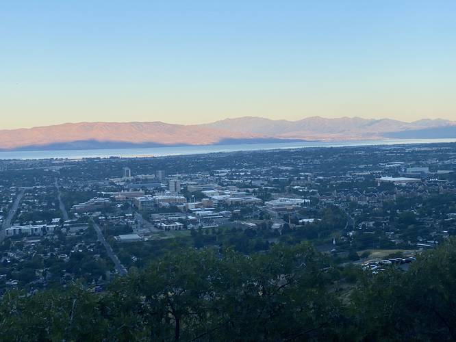
The Y Trail in Provo, Utah is a difficult and popular 2.25-mile out-and-back hike that features stunning views of Provo, Mt. Timpanogos, West Mountain, Dry Mountain, and of course, the massive "Y" on the side of Y Mountain.
Location
Note that the trail itself sits on Y Mountain which is a part of the Uinta-Wasatch-Cache National Forest; however, the trailhead and part of the trail appear to be owned and maintained by Brigham Young University.
Hike Description
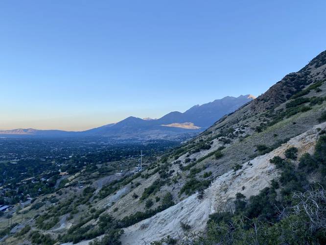
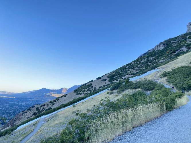
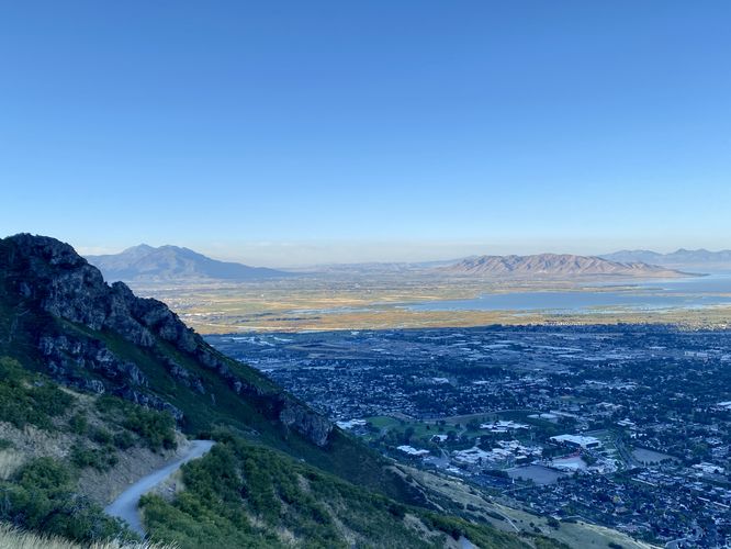
This hike begins at the main trailhead for the Y, located at the parking coordinates provided. The trail itself follows a similar elevation grade throughout the entire hike - which is pretty steep. The hike starts off difficult and does not let up until you reach the top of the Y. Along the way, hikers will get views along the entire trail, but for a lot of folks, the switchbacks in the trail will provide places to rest and take in the views as you slowly ascend the western slopes of Y Mountain.
Bottom of the "Y" - Mile 1.05
Around mile 1.05, hikers will reach a spur trail that leads to the bottom of the "Y". Here, the trail continues onward to reach the top.
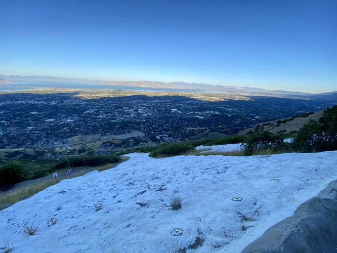
Top of the "Y" - Mile 1.15
Around mile 1.15 hikers will reach the very-top of the "Y" where you'll find benches to sit, relax, and take in the views of Provo and beyond.
After visiting the top of the Y, hikers will head out, but on the way down you get to enjoy all of the views along the way without having to work for them.
Popularity
This is a very popular trail. Even during weekdays, the trailhead parking lot can fill up very early, around Sunrise. There are additional parking spaces along the road on the drive in, used for overflow parking.
Pets
Dogs are allowed only if leashed and must be cleaned up after.
Parking
Hikers will find a large parking lot at the coordinates provided. The lot is large enough to fit several dozen vehicles as of September, 2023.
Location
Note that the trail itself sits on Y Mountain which is a part of the Uinta-Wasatch-Cache National Forest; however, the trailhead and part of the trail appear to be owned and maintained by Brigham Young University.
Hike Description
This hike begins at the main trailhead for the Y, located at the parking coordinates provided. The trail itself follows a similar elevation grade throughout the entire hike - which is pretty steep. The hike starts off difficult and does not let up until you reach the top of the Y. Along the way, hikers will get views along the entire trail, but for a lot of folks, the switchbacks in the trail will provide places to rest and take in the views as you slowly ascend the western slopes of Y Mountain.
Bottom of the "Y" - Mile 1.05
Around mile 1.05, hikers will reach a spur trail that leads to the bottom of the "Y". Here, the trail continues onward to reach the top.
Top of the "Y" - Mile 1.15
Around mile 1.15 hikers will reach the very-top of the "Y" where you'll find benches to sit, relax, and take in the views of Provo and beyond.
After visiting the top of the Y, hikers will head out, but on the way down you get to enjoy all of the views along the way without having to work for them.
Popularity
This is a very popular trail. Even during weekdays, the trailhead parking lot can fill up very early, around Sunrise. There are additional parking spaces along the road on the drive in, used for overflow parking.
Pets
Dogs are allowed only if leashed and must be cleaned up after.
Parking
Hikers will find a large parking lot at the coordinates provided. The lot is large enough to fit several dozen vehicles as of September, 2023.