Explore Article
Best of the Alps: Hiking, Adventure & Scenery
Plan your ultimate European Alps adventure! Discover the best hiking trails, epic scenery, and villages in the Swiss Alps, Dolomites, Chamonix, and Lake Como.
Plan your ultimate European Alps adventure! Discover the best hiking trails, epic scenery, and villages in the Swiss Alps, Dolomites, Chamonix, and Lake Como.

Plan a day's drive adventure along the iconic Million Dollar Highway in Colorado. Explore the best short trails, roadside stops, waterfalls, vistas, ghost towns, and hot springs within a ~6 hour road trip.

Discover the breathtaking beauty of Glacier National Park along the iconic Going-to-the-Sun Road. From stunning roadside stops to picturesque waterfalls and vistas, this engineering marvel offers endless opportunities for exploration.


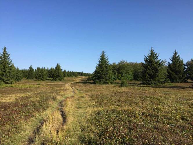
_20180801021119UTC_small.JPG "Bear Rocks Trail")

Explore 2 Trails with 1.6 Miles (2.6 km) to plan your next hike or adventure!

Explore 3 Trails with 0.6 Miles (1.0 km) to plan your next hike or adventure!

Explore 2 Trails with 2.0 Miles (3.2 km) to plan your next hike or adventure!
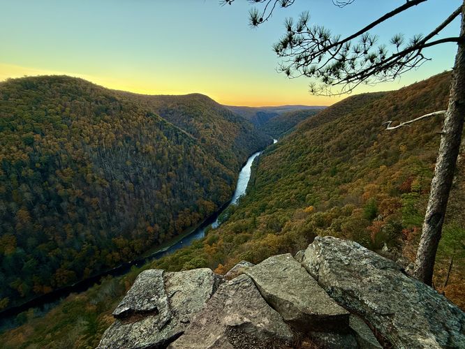
Uncover Pennsylvania's "Grand Canyon", Pine Creek Gorge. Located in the remote north-central PA Wilds, this trailmix includes hundreds of miles of hiking with waterfalls, views, and more.
Take on the Pine Creek Pinnacles Challenge—Created by MyHikes Founder Dave Miller, the PCP20 includes 20 hikes, 81 miles, and 23,000 feet of elevation in Pennsylvania’s Grand Canyon. Are you up for the adventure?
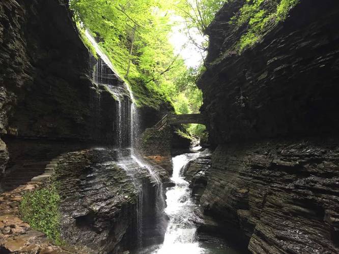
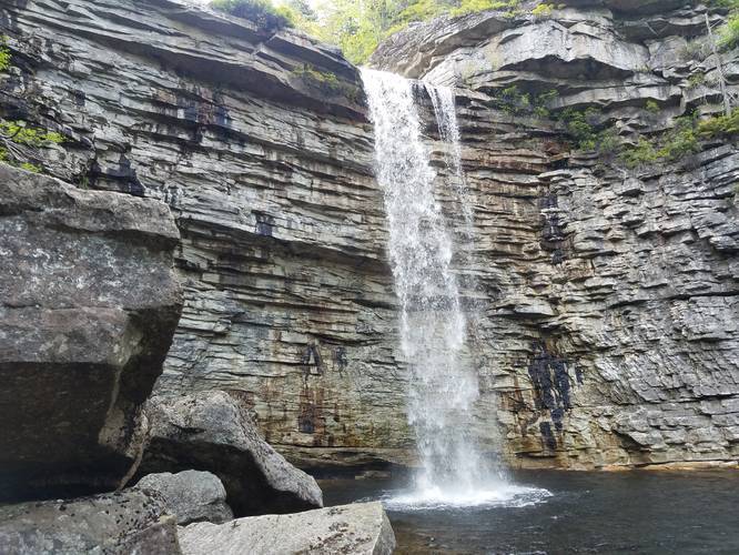
Discover the breathtaking beauty of New York's top waterfalls, including the majestic Taughannock Falls, the enchanting cascades of Watkins Glen State Park, and the towering Kaaterskill Falls. Create your New York waterfall bucket list with this extensive trailmix!

Plan your Zermatt Matterhorn hiking trip! Discover unforgettable hikes, where to eat, and how to access the car-free village via Matterhorn Gotthard Bahn.

Explore the best Swiss Alps hikes and adventures! From the Bernese Oberland and Lauterbrunnen to Zermatt, Davos, and Walensee. Find trails, views, and more.

Discover the Dolomites with our ultimate guide. Explore hikes like Seceda and Alpe di Siusi, turquoise alpine lakes like Lago di Braies, and castle ruins.
Plan your ultimate European Alps adventure! Discover the best hiking trails, epic scenery, and villages in the Swiss Alps, Dolomites, Chamonix, and Lake Como.


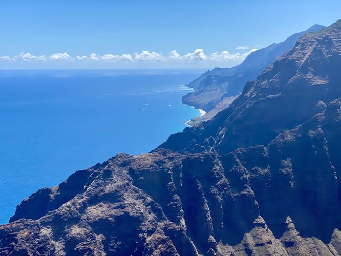
Explore Kauai, from the rugged Napali Coast to lush Waimea Canyon. Trek to hidden waterfalls, stunning ocean views, and vibrant tropical rainforests. Whether easy or challenging, adventure awaits on the Garden Isle with this trailmix!
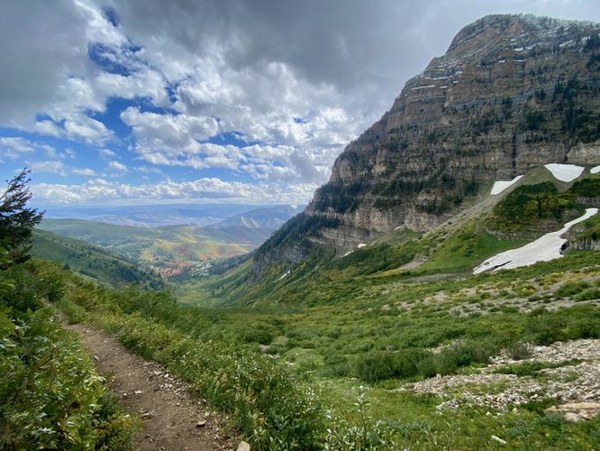
Discover amazing day hikes near Salt Lake City, Utah—a perfect trailmix for adventure lovers! Featuring scenic waterfalls, breathtaking views, and alpine trails, it's the ideal fuel for your next outdoor escape near Salt Lake City.
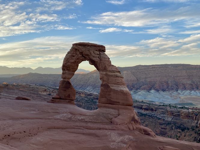
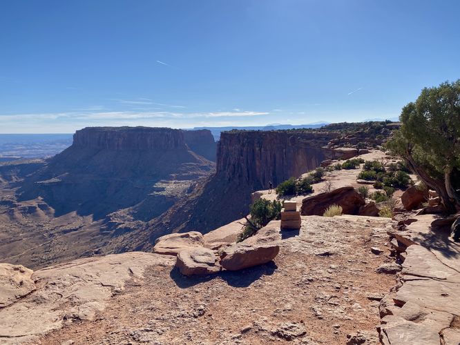
Explore the best hikes, short walks, views, and roadside stops in Utah’s Mighty 5, from Zion’s cliffs to Bryce’s hoodoos, Capitol Reef’s rugged beauty, and Moab’s iconic arches. This trailmix guides you on an epic road trip through breathtaking landscapes and must-see trails!
Explore the real-life ORTBO scenes from Severance at Minnewaska State Park Preserve, NY. The show’s dramatic cliffs and Awosting Falls appear here, letting fans step into Lumon’s world. Follow trails to cliff ledges like the ORTBO overlook, then add the Beacon Hill Loop for another stunning view.
Spend less time scrolling and more time on the trail. By logging in, we can surface the top-rated spots in your area and trending destinations tailored specifically to you.


08/04/2025 • LeelaRay
So Helpful!
I stumbled across this app when looking for a new hike as a relatively inexperienced hiker. The directions were so descriptive and clear that it made finding parking, navigating the trail, and knowing what to expect so much easier! There was even a little bonus info about a great view just off the trail that was well worth it. Highly recommend!
10/15/2025 • Chris
Perfect for my needs
I usually don't leave reviews but this app is perfect I dig a lot of ginseng and this keeps up with track for track where I'm at on the map how the elevation ideal for what I need thanks for making a great app
08/30/2025 • THEYRE
Amazing hiking app!!!
Perfect hiking app for finding and exploring trails wherever you are. I’ve discovered lots of new places and trails - me and my dog have really had a great time.
08/21/2025 • Wolf Pearle
Works perfectly
Does what it should, perfectly, very impressed.
06/06/2024 • Neeners1515
Tracking works great!
Used this app with no cell service in Rocky Mountain National Park while in the backcountry and tracked accurately for over 6 hours. I downloaded an offline map region before the hike and then got a bit lost along the way as the trails had minimal signage and multiple routes to take. The app displayed all possible routes and I chose the right one each time I got confused - without the app I would’ve been lost.
07/21/2024 • JPneus
Good Alternative/Backup Hiking App
I have now used this app a few times. It seems very good and does all the basic things I would want from a hiking app! I think it tends to overstate mileage and altitude gain (and although one can edit a track, I don’t wish to feel the need to edit). So with that one caveat, this app will be my second hiking app (to be used simultaneously with a more high profile and long establish hiking app).
09/10/2023 • Sam Monks
Love MyHikes
MyHikes is the best!
Plan your ultimate European Alps adventure! Discover the best hiking trails, epic scenery, and villages in the Swiss Alps, Dolomites, Chamonix, and Lake Como.
Plan a day's drive adventure along the iconic Million Dollar Highway in Colorado. Explore the best short trails, roadside stops, waterfalls, vistas, ghost towns, and hot springs within a ~6 hour road trip.
Discover the breathtaking beauty of Glacier National Park along the iconic Going-to-the-Sun Road. From stunning roadside stops to picturesque waterfalls and vistas, this engineering marvel offers endless opportunities for exploration.

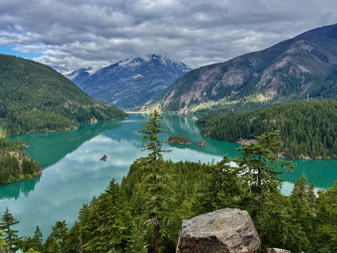
Find the best day hikes in Washington's National Parks and Forests. Explore panoramic alpine vistas, turquoise lakes, and stunning waterfalls.

MyHikes® was built by Dave Miller (Founder & Admin) in 2015 for himself and his friends as a personal hiking journal. Since opening the site to the public, MyHikes® has helped over 3,000,000 hikers plan and explore!