Trail name(s)
Day Mountain TrailLocation
Acadia National Park, Champlain Road, Route 3,Mount Desert Isle, MainePermitted uses
Hiking, bird watching, nature studyProhibited uses
No biking, No motorcycles, No trapping, No camping, No overnight parking, No fires, No horses, No collecting of plants, rocks or animals. No feeding of wildlife. Do not build or add to any cairns along the trail. No use of drones.Hours
Parts of Acadia National Park are open year round and are open 24 hours a day. However, not all areas are accessible or staffed year round. It's best to check the park’s website and plan ahead for your visit. Follow the link below to find out if the area you want to visit is open during the time you want to visit. https://www.nps.gov/acad/planyourvisit/hours.htmFees and Parking
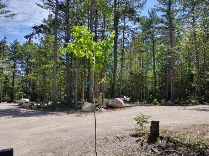
There is a fee to enter Acadia National Park. The fee schedule can be found at the park’s website or by following this link: https://www.nps.gov/acad/planyourvisit/fees.htmThere are a great deal of parking spaces at this trailhead parking area. The parking area used to access this trailhead is the same parking area used for the Hunters Beach and Cliffs Trail. The Day Mountain trailhead entrance is across the street from the parking area and a short section of the trail is on the Hunters Cliff Natural Lands Preserve.
Pets
Dogs are allowed on the trail and must be kept on a leash that is not longer than 6 feet. Pets waste must be properly disposed of by the owner.Accessibility
This hike is not wheelchair accessible.Hiker amenities
There is an information kiosk at the trailhead parking area with a posted map of the trails. There are no restrooms or trash bins. Please carry out all waste you create or find.Length and Trail information
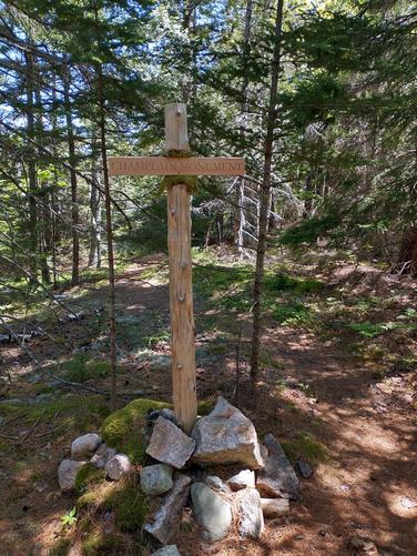
This hike was done as a 2.7-mile out-and-back that should be considered easy to moderate for most hikers. The trail is blazed by blue trail markers. Our goal for this hike was to reach the 583 foot summit of Day Mountain and enjoy the views along the hike and from atop the summit.The trail is pine needle cushioned and narrow as it winds its way through the dense mixed forest. A short distance down the trail we find an engraved wooden post inviting us to explore a side trail to see the Champlain Monument. The small granite monument and mounted plaques were erected in 1904 to commemorate the 300th anniversary of French navigator Samuel De Champlain's Voyage and naming of the island “Isle des Monts Deserts” (Mount Desert Island). After our brief visit to the monument, we headed back to the Day Mountain trail.
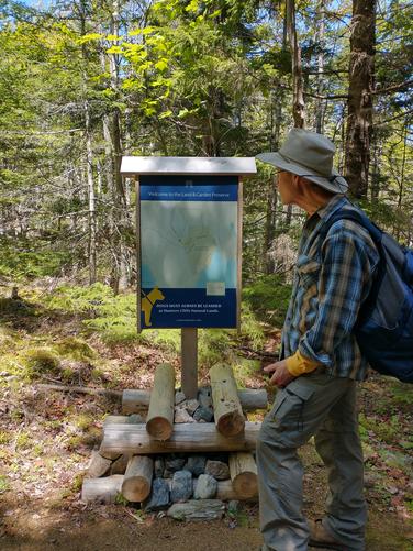
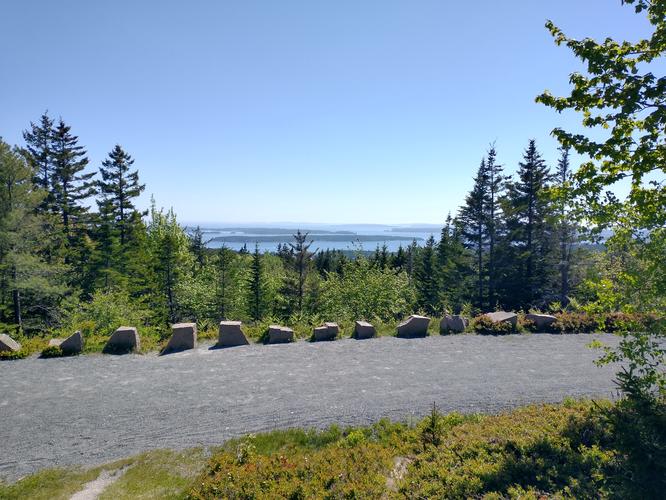
We hiked along the natural path to a sturdy double plank boardwalk, then onto a ledge pathway that led us to a small kiosk where a trail map was installed. A short distance from the kiosk hikers will intersect with a Carriage Road that also leads to the summit of Day Mountain. The Carriage Road is longer, but also has no trip hazards, so if hiking on a graded gravel compacted substrate is preferred over the rougher natural substrate found on the Day Mountain Trail, this would be the time to access the Carriage Road. The Carriage Road also offers visitors different views than would be experienced while hiking the Day Mountain Trail.
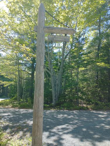
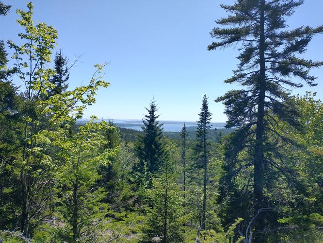
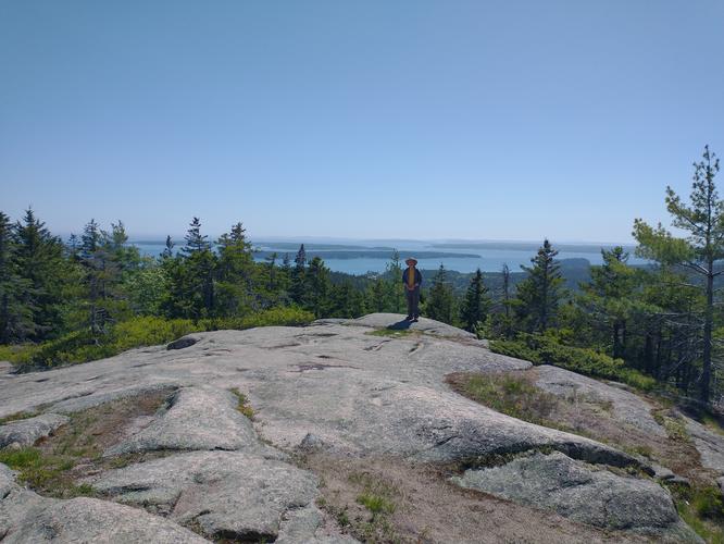
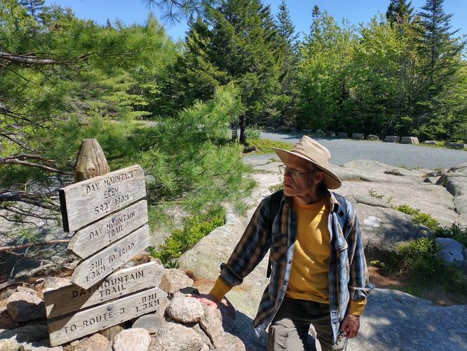
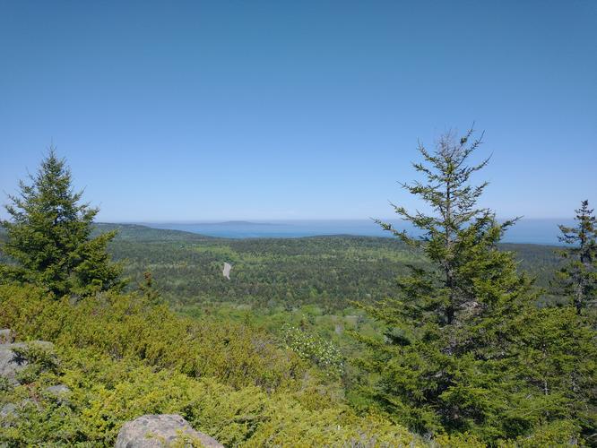
The Day Mountain Trail is not completely wooded or devoid of beautiful views. There were spots where we hiked across open ledge plaza and were able to enjoy expansive views out to the ocean. The trail exits the woods and after a very small climb up we intersected with the Carriage Road. Across the Carriage Road we found the engraved wooden sign marking the summit of Day Mountain. The view from the summit was not spectacular, but it was still lovely. The trees are growing taller and it's conceivable that the view might be obscured in the not too distant future. We spent some time at the summit and walked a bit down the Carriage Road to see if we could enjoy better views.
We decided that we would retrace our steps and head back down the Day Mountain Trail instead of following the Carriage Road down. Day Mountain is a lovely hike and not difficult to do along with the Hunters Beach and Hunters Cliffs trails on the same day. We enjoyed the difference between the two areas and would encourage hikers to explore this trail.