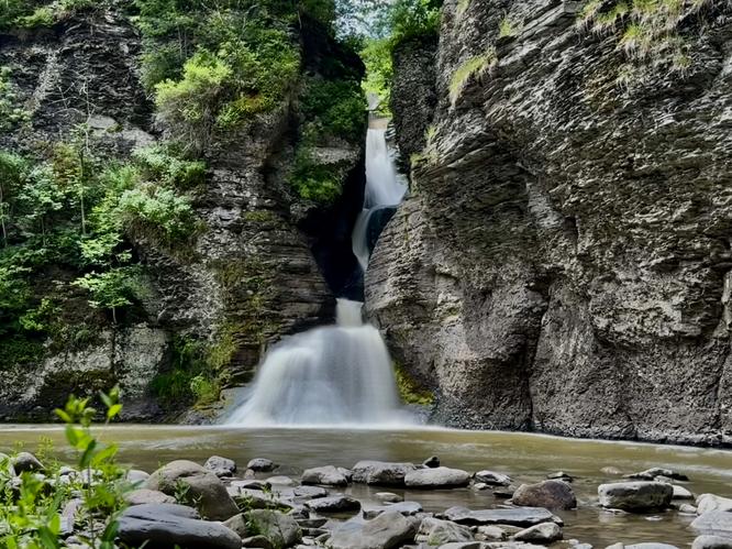
Nestled within the western side of New York's Catskills near Gilboa, New York sits the 80-foot tall, multi-tier waterfall known as Mine Kill Falls within Mine Kill State Park.
This short, but moderate 0.9-mile out-and-back hike leads visitors to a viewing platform where you'll find Upper and Middle Mine Kill Falls as they swoop through the gorge before following a trail to the base of the 80-foot tall Mine Kill Falls. A great hike for the whole family!
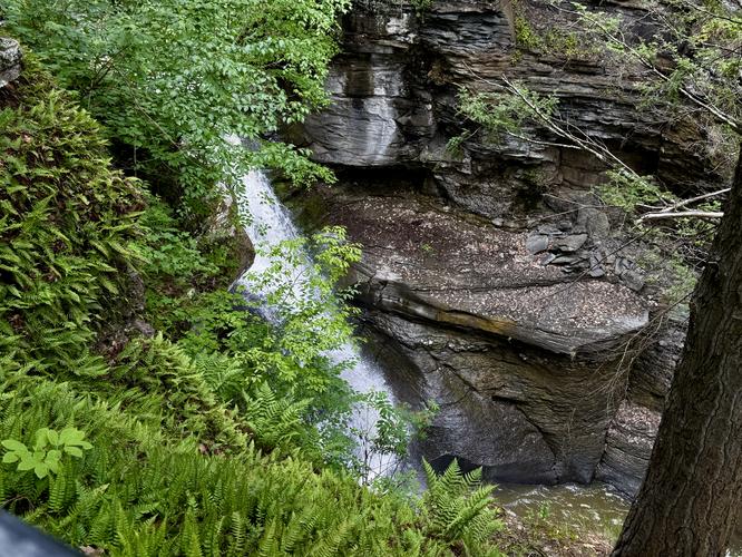
Just below your feet, however, sits Middle Mine Kill Falls, another waterfall that plummets its way through the Mine Kill Gorge. Both waterfalls here are difficult to view and photograph, but are still worth a few extra minutes of your time to explore. While you appreciate the tumbling waters, you might even notice nearby shale ledges with carpet-like moss clinging to its slopes.
This short, but moderate 0.9-mile out-and-back hike leads visitors to a viewing platform where you'll find Upper and Middle Mine Kill Falls as they swoop through the gorge before following a trail to the base of the 80-foot tall Mine Kill Falls. A great hike for the whole family!
Exploring Mine Kill Falls
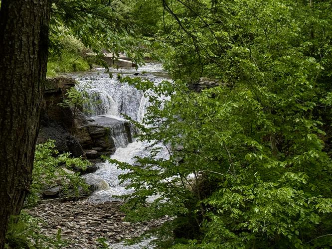
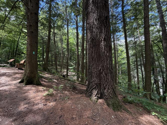
This hike begins at the main parking lot located just off of NY-30 where visitors will find a trailhead with an information kiosk on the far side of the parking lot. The hike starts here. Follow the gravel pathway as it heads toward Mine Kill Gorge where you'll come across a fork in the trail just a stone's throw from the parking lot. Keep left here to head toward a viewing platform for Upper and Middle Mine Kill Falls.Upper & Middle Falls - Mile 0.12
As you follow the trail out to reach an overlook above the gorge, hikers will find an enclosed series of stairs that reaches the edge of the gorge near mile 0.12. Here, you'll find an upstream view of Mine Kill Creek with Upper Mine Kill Falls cascading down the bedrock, located under the NY-30 bridge.Just below your feet, however, sits Middle Mine Kill Falls, another waterfall that plummets its way through the Mine Kill Gorge. Both waterfalls here are difficult to view and photograph, but are still worth a few extra minutes of your time to explore. While you appreciate the tumbling waters, you might even notice nearby shale ledges with carpet-like moss clinging to its slopes.