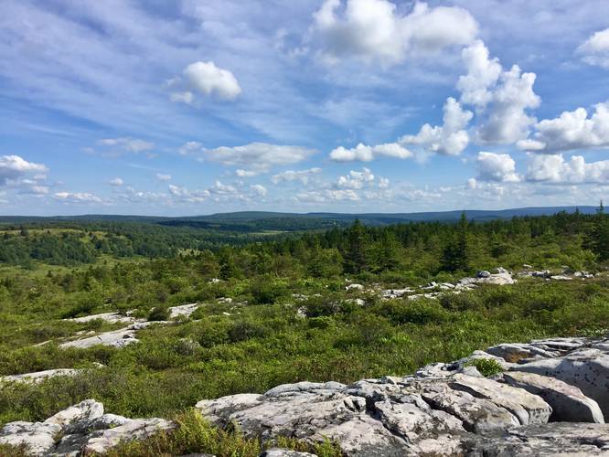
The Rocky Ridge Trail at the Dolly Sods Wilderness in Tucker County, West Virginia is a moderate 3 mile one-way trail that runs along the northwest corner of the wilderness. This trail is one of the most scenic trails within the entirety of Dolly Sods, but is often less trafficked due to how far it is from the main parking near the Bear Rocks Trail.
The trail connects a few different trails within Dolly Sods and outside of Dolly Sods including the Dobbin Grade Trail, Harman Trail, Blackbird Knob Trail, Raven Ridge Trail, and even the Valley View Trail - which lies just outside of the wilderness.
This recording starts at the southern terminus and quickly climbs a hill up to Harman Knob, where you get views of Canaan Valley below. You can also connect to the Harman Trail (at mile 0.5) and the Valley View Trail (at mile 0.4) just before hitting Harman Knob. You'll know you're at the top of Harman Knob when you're hiking across rocks and you have views of Canaan Valley to your left. I personally prefer hiking along the Valley View Trail in this section as you get better views and it's the same distance to connect back to the Rocky Ridge Trail.
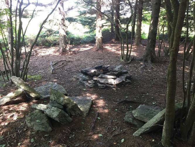
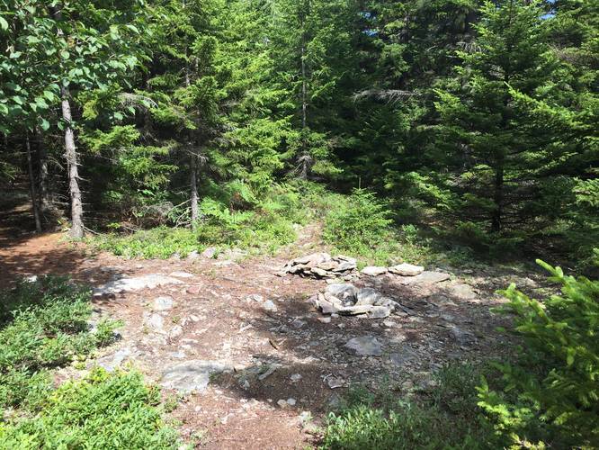
Continuing on from the northern terminus of the Valley View Trail and you'll end up hiking downhill towards the Dobbin Grade Trail at mile 1.3. Just before hitting the Dobbin Grade Trail, you'll pass a nice campsite tucked away in a conifer grove. There are two campsites just beyond the Dobbin Grade junction as well.
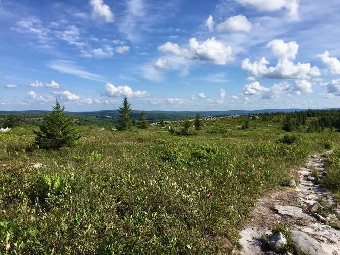
After passing the Dobbin Grade Trail, the Rocky Ridge Trail will head back uphill to yet another plateau with views of Canaan Valley and eventually the northern section of Dolly Sods. The hike uphill is a moderate hike, but a bit rocky. Once you reach the top of the plateau the trail turns to sand in places and the hiking is a bit easier. There are certain places where you need to hike up and over the granite rocks, but those sections aren't very long.
Trailheads: The southern trailhead can be found 0.3 miles in on the Blackbird Knob Trail starting in the west from the Dolly Sods FR-80 Trail. The northern trailhead can be found at the end of the Raven Ridge Trail in the northwest corner of the Sods.
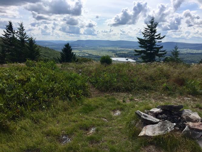
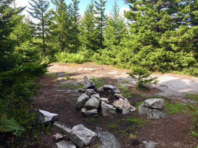
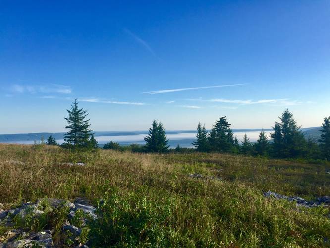
Northern Lookouts: At mile 2.6 you'll find a small trail that leads east to a large granite rock outcropping with amazing views into Dolly Sods. If you hike further north from this lookout point, you'll reach the highest point along the Rocky Ridge Trail with more views of Canaan Valley and Dolly Sods. There's also a nice campsite setup with a large rock windbreaker and a fire pit, so backpackers can enjoy an amazing view of Canaan Valley from their tent.
Parking: Parking can be found either along FR-75 and near the Bear Rocks Trail or you can get an overnight parking permit from the Canaan Valley National Wildlife Refuge to park along FR-80. More info on how to get an overnight parking permit can be found here. Please note, if you park along FR-80, you also need to hike in on the Wilderness Way Trail and the Dolly Sods FR-80 Trail, then 0.3 miles along the Blackbird Knob Trail to reach the trailhead for the Rocky Ridge Trail.
Water access: Unfortunately this trail does not have any streams that cross it and finding water along this trail is virtually impossible. If you need water, there's a creek along the western side of the Dobbin Grade Trail. If you plan to camp along the Rocky Ridge Trail, bring plenty of water.
Blueberry bushes: The trail is lined with blueberry bushes for almost its entirey, so during the Summer you can usually find a snack along your hike.
Warning: Dolly Sods was used for military bombing training during WWII and there are still unexploded ordinances in the ground out in the wilderness. Most of these trails and the areas around them have been combed and searched, but not everything has been found. If you find any strange metal objects, especially bomb-shaped, do not tamper with them. Make a note of where you found it and alert the proper authorities. More information can be found at the wilderness trailheads.
Dolly Sods trail map PDF
The trail connects a few different trails within Dolly Sods and outside of Dolly Sods including the Dobbin Grade Trail, Harman Trail, Blackbird Knob Trail, Raven Ridge Trail, and even the Valley View Trail - which lies just outside of the wilderness.
This recording starts at the southern terminus and quickly climbs a hill up to Harman Knob, where you get views of Canaan Valley below. You can also connect to the Harman Trail (at mile 0.5) and the Valley View Trail (at mile 0.4) just before hitting Harman Knob. You'll know you're at the top of Harman Knob when you're hiking across rocks and you have views of Canaan Valley to your left. I personally prefer hiking along the Valley View Trail in this section as you get better views and it's the same distance to connect back to the Rocky Ridge Trail.
Continuing on from the northern terminus of the Valley View Trail and you'll end up hiking downhill towards the Dobbin Grade Trail at mile 1.3. Just before hitting the Dobbin Grade Trail, you'll pass a nice campsite tucked away in a conifer grove. There are two campsites just beyond the Dobbin Grade junction as well.
After passing the Dobbin Grade Trail, the Rocky Ridge Trail will head back uphill to yet another plateau with views of Canaan Valley and eventually the northern section of Dolly Sods. The hike uphill is a moderate hike, but a bit rocky. Once you reach the top of the plateau the trail turns to sand in places and the hiking is a bit easier. There are certain places where you need to hike up and over the granite rocks, but those sections aren't very long.
Trailheads: The southern trailhead can be found 0.3 miles in on the Blackbird Knob Trail starting in the west from the Dolly Sods FR-80 Trail. The northern trailhead can be found at the end of the Raven Ridge Trail in the northwest corner of the Sods.
Northern Lookouts: At mile 2.6 you'll find a small trail that leads east to a large granite rock outcropping with amazing views into Dolly Sods. If you hike further north from this lookout point, you'll reach the highest point along the Rocky Ridge Trail with more views of Canaan Valley and Dolly Sods. There's also a nice campsite setup with a large rock windbreaker and a fire pit, so backpackers can enjoy an amazing view of Canaan Valley from their tent.
Parking: Parking can be found either along FR-75 and near the Bear Rocks Trail or you can get an overnight parking permit from the Canaan Valley National Wildlife Refuge to park along FR-80. More info on how to get an overnight parking permit can be found here. Please note, if you park along FR-80, you also need to hike in on the Wilderness Way Trail and the Dolly Sods FR-80 Trail, then 0.3 miles along the Blackbird Knob Trail to reach the trailhead for the Rocky Ridge Trail.
Water access: Unfortunately this trail does not have any streams that cross it and finding water along this trail is virtually impossible. If you need water, there's a creek along the western side of the Dobbin Grade Trail. If you plan to camp along the Rocky Ridge Trail, bring plenty of water.
Blueberry bushes: The trail is lined with blueberry bushes for almost its entirey, so during the Summer you can usually find a snack along your hike.
Warning: Dolly Sods was used for military bombing training during WWII and there are still unexploded ordinances in the ground out in the wilderness. Most of these trails and the areas around them have been combed and searched, but not everything has been found. If you find any strange metal objects, especially bomb-shaped, do not tamper with them. Make a note of where you found it and alert the proper authorities. More information can be found at the wilderness trailheads.
Dolly Sods trail map PDF