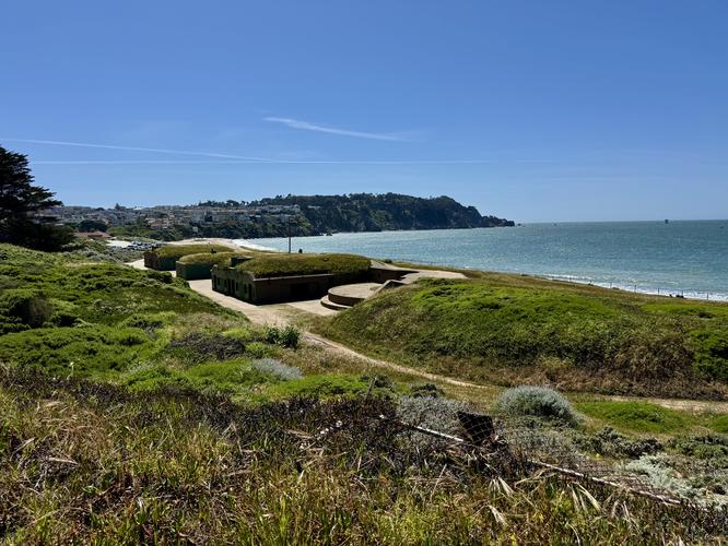
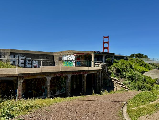
Located on the south side of the Golden Gate Bridge sits the Presidio of San Francisco, an abandoned military base—turned public park—that features beautiful views of the Pacific Ocean, Baker Beach, Golden Gate Bridge, Marin Headlands, Alcatraz, and the Palace of Fine Arts within the Golden Gate National Recreation Area.
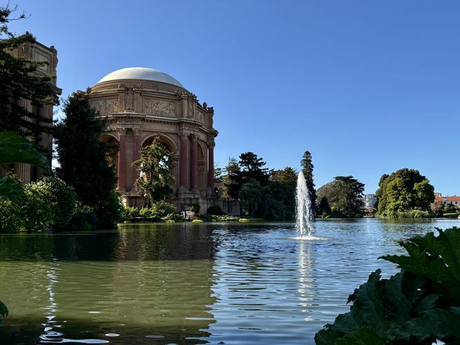
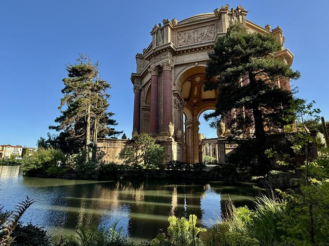
This moderate 7.4-mile one-way hike leads through the entire park starting in the southwest corner and wraps up at the Palace of Fine Arts with countless views along the way.
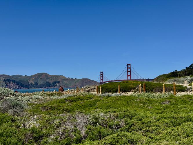
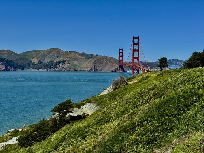
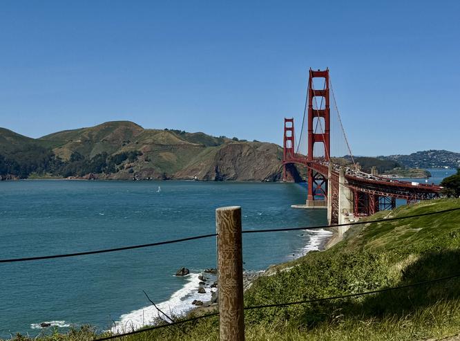
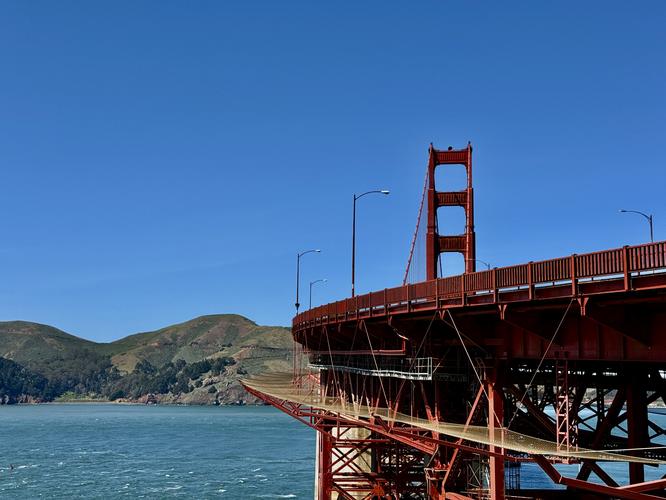
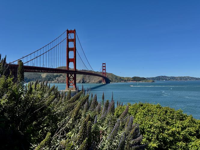
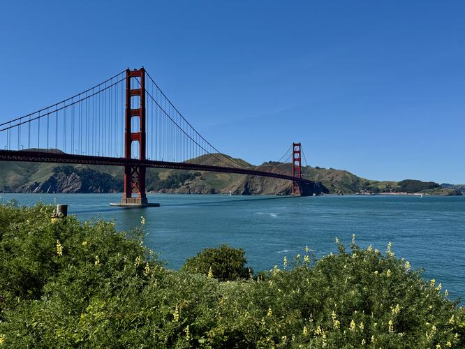
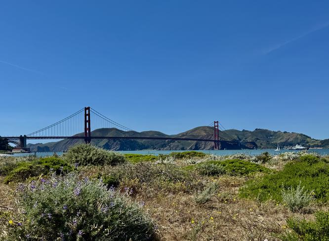
The Coastal Trail includes plenty of beach access and views along the way with some of the best views located around miles 1.25, 1.5, and 1.6 — mostly of the Golden Gate Bridge. At mile 2, the trail passes directly underneath the famous Golden Gate Bridge as the hike leads toward Fort Point.
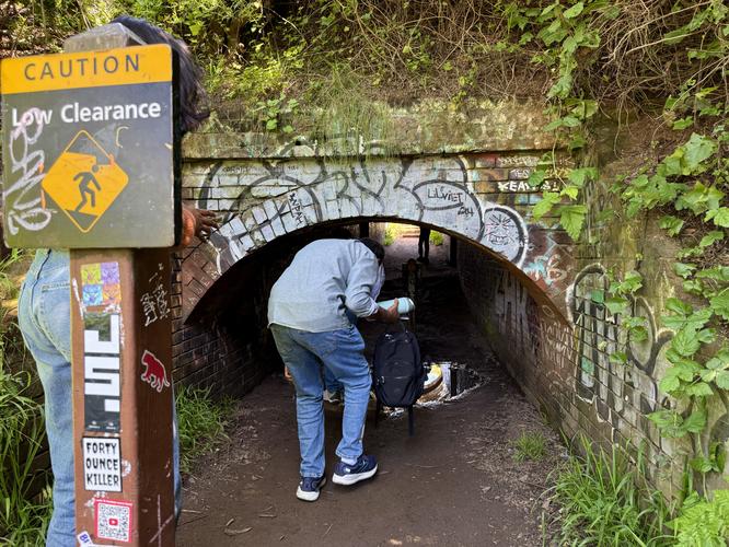
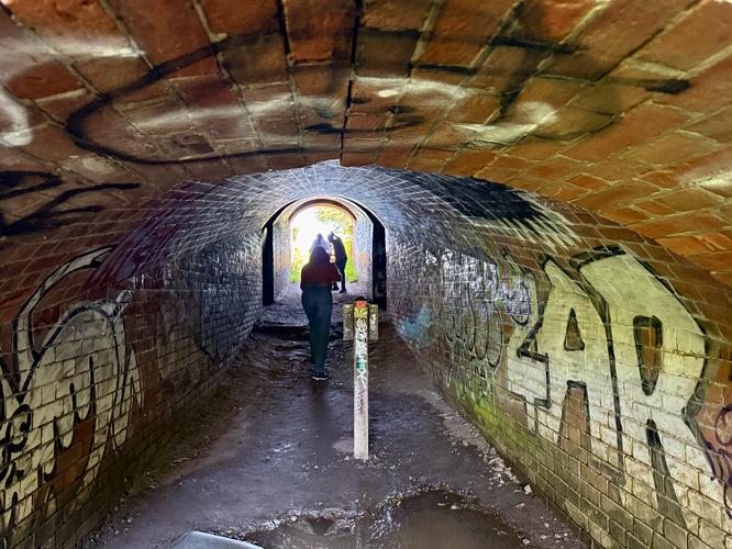
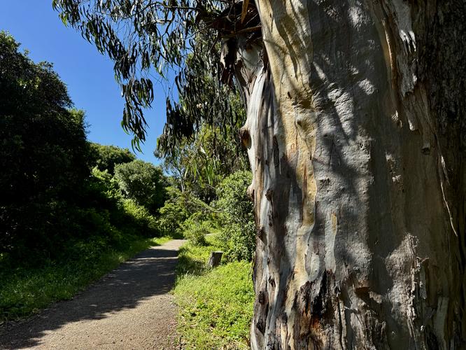
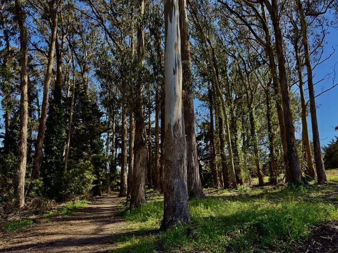
This track continues east, passing more views of the bridge and bay, before it reaches a short tunnel, located at mile 2.15, where hikers will have to crouch to pass through. On the east side of the tunnel, you'll find more views of the bridge before the tourists fade out and the trail becomes more secluded. Just a bit further down the path sits a fragrant Eucalyptus grove near mile 2.5. Eventually, the trail reaches an official "Fort Point" sign with a beautiful view of the city and the bay.
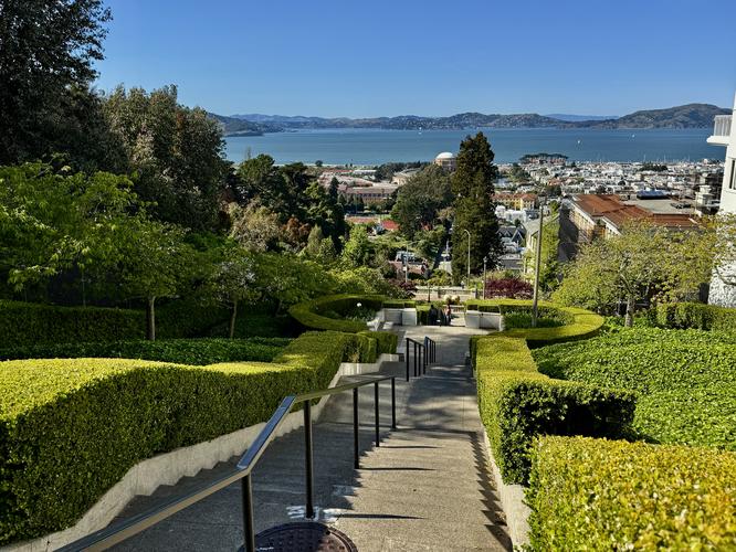
From the base of the Lyon Steps, the hike technically exists the Presidio to follow Lyon Street, Francisco Street, and Baker Street to reach the Palace of Fine Arts, which is the last stop along the route.
This moderate 7.4-mile one-way hike leads through the entire park starting in the southwest corner and wraps up at the Palace of Fine Arts with countless views along the way.
Hiking the Presidio
This hike begins at nondescript trailhead located across the street from the large parking lot, El Camino Del Mar Parking, on Lincoln Blvd. Follow the trail as it leads along Lobos Creek, passing springtime wildflowers, before the trail reaches Baker Beach.Coastal Trail / Baker Beach / Golden Gate Views - Mile 0.2 to 2
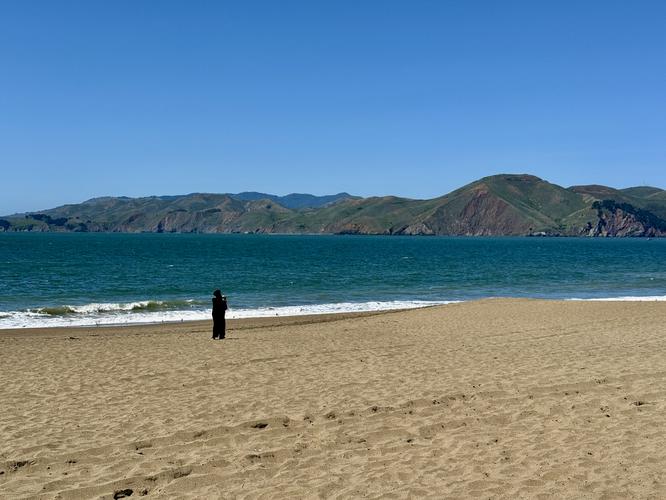
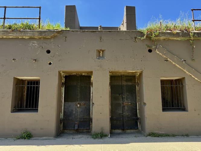
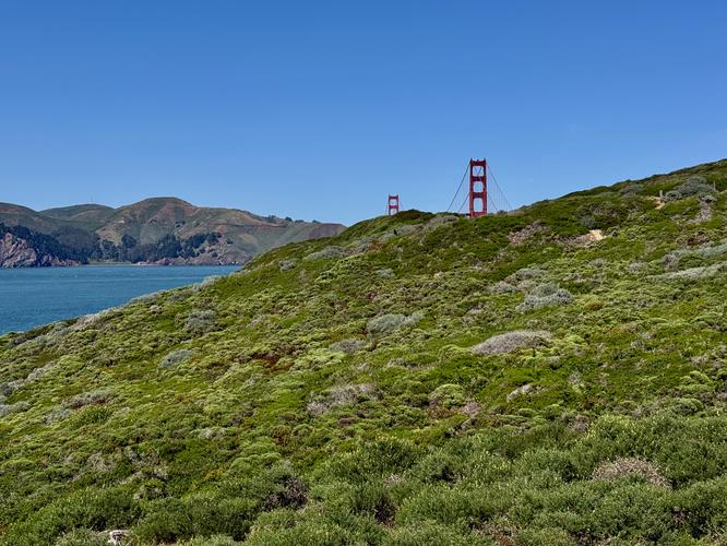
After hiking along the skinny, sandy trail through the forest alongside Lobos Creek, hikers will find themselves on the shore of the Pacific Ocean on Baker Beach. Here, the Coastal Trail runs north along the beach where you'll find breathtaking views of the ocean, the Marin Headlands to the north, the Golden Gate Bridge, and abandoned military battery installations.The Coastal Trail includes plenty of beach access and views along the way with some of the best views located around miles 1.25, 1.5, and 1.6 — mostly of the Golden Gate Bridge. At mile 2, the trail passes directly underneath the famous Golden Gate Bridge as the hike leads toward Fort Point.
Fort Point Views / Tunnel / Eucalyptus Grove - Mile 2 to 2.6
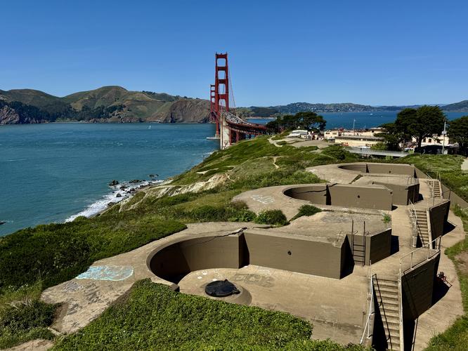
After passing under the Golden Gate Bridge to reach Fort Point, hikers will find some of the best views of the bridge and the bay. The views from Fort Point are likely the most popular, with the area crawling with tourists snapping photos of the bridge and nearby wildflowers. The trail switches from sand and dirt to universal-access pathways that wind around various viewpoints.This track continues east, passing more views of the bridge and bay, before it reaches a short tunnel, located at mile 2.15, where hikers will have to crouch to pass through. On the east side of the tunnel, you'll find more views of the bridge before the tourists fade out and the trail becomes more secluded. Just a bit further down the path sits a fragrant Eucalyptus grove near mile 2.5. Eventually, the trail reaches an official "Fort Point" sign with a beautiful view of the city and the bay.
Golden Gate Promenade to Tunnel Tops - Mile 3.25 to 4
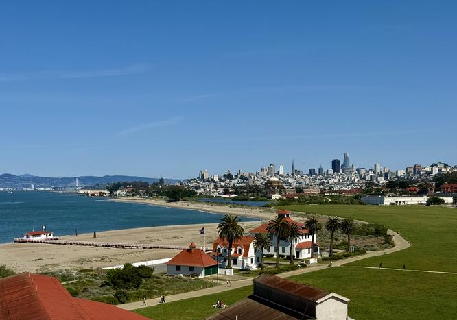
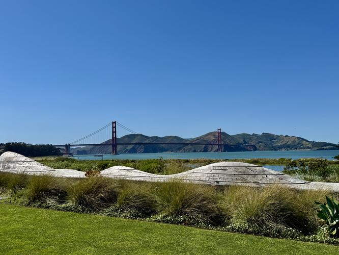
Once you reach the Fort Point sign, located above Cissy Field, the hike then leads down the road to reach Cissy Field. Cross Cissy Field to reach the Golden Gate Promenade with views of the bay and the bridge along the way. Follow the flat and easy Golden Gate Promenade as it runs alongside the East Beach Lagoon with views of the city and the Palace of Fine Arts in the near distance. This route skips the Palace of Fine Arts, to save it for last, and instead crosses the East Beach Lagoon via a raised boardwalk path to reach the Presidio Tunnel Tops — a small park that sits above highway tunnels that pass below your feet. Surrounding the Presidio Tunnel Tops area are beautiful, fragrant wildflowers that fill the landscaping.Hike to Inspiration Point - Mile 4 to 5.2
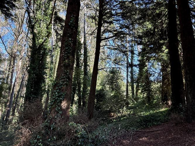
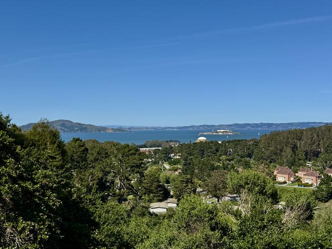
Once you leave the Presidio Tunnel Tops park, the hike passes through neighborhoods following Lincoln Blvd and Mesa Street to reach the Ecology Trail. The Ecology Trail can be picked up behind the Inn at the Presidio and leads uphill, passing Redwood groves along the way to reach Inspiration Point. Hikers will reach the top of the hill, with the official Inspiration Point overlook located at mile 5.2. From Inspiration Point, you'll find views of the San Francisco Bay, Alcatraz, and hillside neighborhoods.Hike to the Lyon Steps - Mile 5.2 to 6.1
Once you leave Inspiration Point, the hike passes one more Eucalyptus grove before following the Mountain Lake Trail which runs parallel to Pacific Ave. Cross Presidio Ave around mile 6, then follow the trail east to reach the top of the Lyon Steps. The Lyon Steps include beautiful views of the bay from Italian-inspired viewing platforms, or terraces, with hedges that line the steep steps.From the base of the Lyon Steps, the hike technically exists the Presidio to follow Lyon Street, Francisco Street, and Baker Street to reach the Palace of Fine Arts, which is the last stop along the route.