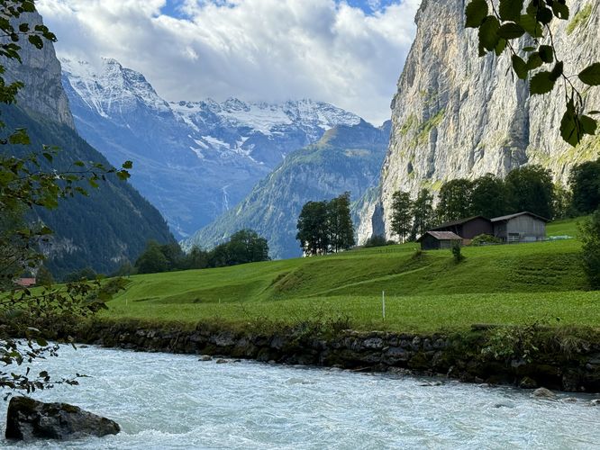
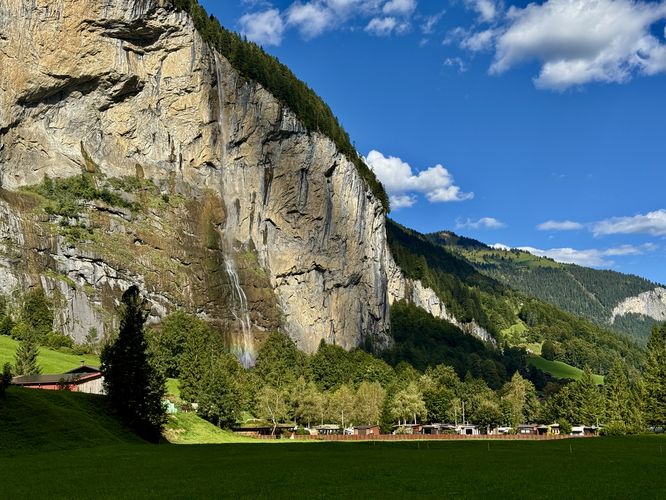
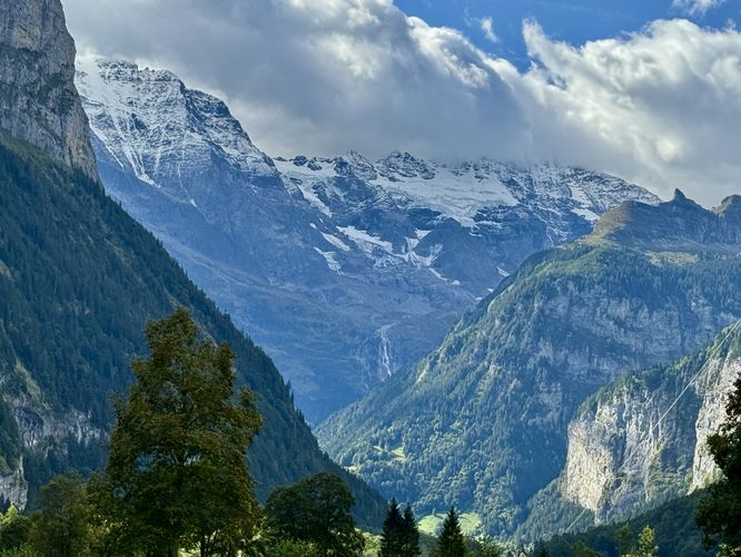
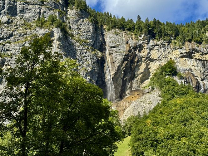
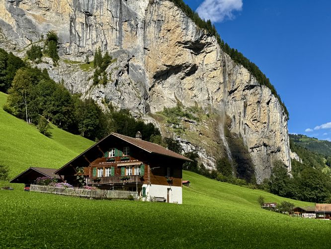
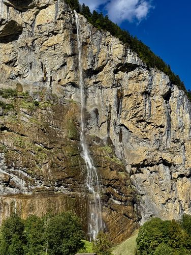
Lauterbrunnen Valley is one of Switzerland's most impressive and scenic landscapes — carved out by glaciers and glacial melt, the valley includes breathtaking views of the Alps, towering cliffs, massive waterfalls like Staubbach Falls and Spissbach Falls, and quaint Swiss chalet-styled houses that dot the valley floor.
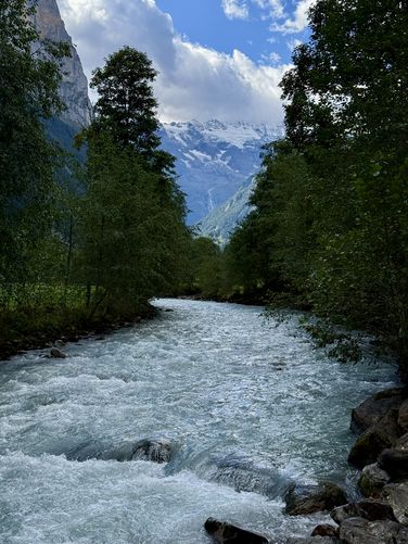
Starting in the village of Lauterbrunnen, you'll find a trail that runs along the Weisse Lütschine river (White Lütschine) and finally cuts through the center of the valley for an easy 2.6km walk.
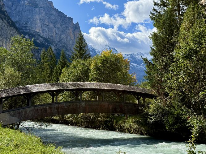
From the footbridge, the trail leads south as it runs alongside the Weisse Lütschine river. Along the way, you'll find various viewpoints with similar valley views that offer visitors a different perspective of the Lauterbrunnen Valley. Another scenic covered bridge can be found along the path near 0.55km from the trailhead and is yet another great place to take a photo.
Starting in the village of Lauterbrunnen, you'll find a trail that runs along the Weisse Lütschine river (White Lütschine) and finally cuts through the center of the valley for an easy 2.6km walk.
Explore the Lauterbrunnen Valley Loop
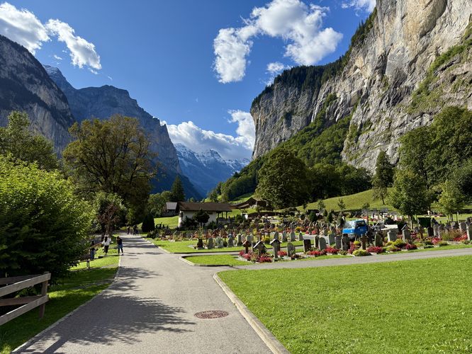
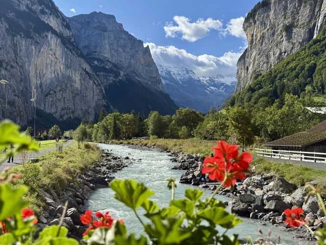
This easy, but ultra-scenic trail begins at the main parking area for Staubbach Falls where visitors will find a trailhead located on the south side of the parking lot. Walking south from the parking area, you'll first pass through the Lauterbrunnen Cemetery with views of towering alpine peaks in the distance and Staubbach Falls to the west. The trail makes a sharp left-hand turn as it heads toward Weisse Lütschine (White Lütschine river) where you'll find a quaint and scenic covered bridge that spans the rushing glacial melt water. If visiting during the summer or warmer months, you'll find flower boxes that line the bridge with a scenic backdrop of alpine peaks, towering cliffs, and Staubbach Falls with Weisse Lütschine rushing below your feet — a great place to take photos. If you look close enough at Staubbach Falls, you'll notice the large tunnels that were cut-out of the cliff which is the Staubbach Falls Trail.From the footbridge, the trail leads south as it runs alongside the Weisse Lütschine river. Along the way, you'll find various viewpoints with similar valley views that offer visitors a different perspective of the Lauterbrunnen Valley. Another scenic covered bridge can be found along the path near 0.55km from the trailhead and is yet another great place to take a photo.