Looking for the best hikes in Chamonix that deliver maximum reward for a moderate effort? Look no further than the iconic Grand Balcon Nord! This classic Alpine trail is a must-do for any visitor to the Mont Blanc massif, offering one of the most accessible high-altitude trekking experiences in the valley. Traversing the mountainside between Montenvers and Plan de l'Aiguille, this stunning panoramic hike treats you to continuous, jaw-dropping vistas of the colossal Mont Blanc, the famous Aiguille de Midi, and the impressive Mer de Glace, France's largest glacier. Whether you're an experienced hiker or a family looking for an easy to moderate day hike, the Grand Balcon Nord is your ticket to experiencing the sprawling beauty of the French Alps.
This detailed guide will take you step-by-step along one of the most scenic hiking trails in Chamonix for a moderate 7.7km (4.8 mile) hike. We'll cover everything from Montenvers to Plan de l'Aiguille to maximizing your day by combining the trail with a visit to the restaurant Refuge du Plan de l'Aiguille, the Alpine lake Lac Bleu (Blue Lake), before wrapping up at the the Aiguille du Midi cable car station to ride back down the mountain to Chamonix. Get ready to lace up your boots and discover why the Grand Balcon Nord is consistently ranked among the top Chamonix outdoor adventures—an exhilarating Alpine trek where breathtaking Mont Blanc views are around every corner.
Once you leave the Mer de Glace overlook, the hike begins by heading north toward the Glacorium and along the way are more stunning Alpine views like the towering Aiguille Verte peak overhead and waterfalls that flow down from its slopes, stretching hundreds of meters from the mountain to the Mer de Glace valley below. Near the Refuge du Montenvers is the official trailhead for the Grand Balcon Nord with signage. Follow this trail to make your way toward Plan de l'Aiguille.
Finally, when you arrive back at Plan de l'Aiguille, the Grand Balcon Nord hike is over. Time to ride the Aiguille du Midi cable car back down to the Chamonix Valley to wrap up your day on the scenic slopes of the Mont Blanc Massif! For hikers who parked a vehicle near the Montenvers train station, you can follow public roads in combination with the Passage du Montenvers to reach the parking lot.
Visitors to the Chamonix Valley should consider purchasing day passes or multi-day passes ahead of time from the Mont Blanc Natural Resort, which are used for train, cable car (gondola) access in the area. A (2) day summer pass for one adult, as of September 2025, cost us 103,20 €. So for both adults plus taxes, the total cost was 225,62 €. After purchase, simply follow the instructions to find where to pick up your day pass smart cards.
Parking coordinates: The parking / get directions coordinates for this hike will lead you to a very large parking lot located near the Montenvers train station. Parking is not free and has an hourly rate.
Elevation sickness: This hike leads up to ~7,600-feet or 2,300 meters above sea level. Around this range is where people can start to feel minute elevation sickness. During this hike, one of us was feeling the elevation and made for the last section to Lac Bleu (Blue Lake) a bit more challenging.
Exposure: The southern half of this hike leads through exposed mountain slopes where there's very-little shade. Be prepared with sunscreen and a hat to help combat the sun exposure.
This detailed guide will take you step-by-step along one of the most scenic hiking trails in Chamonix for a moderate 7.7km (4.8 mile) hike. We'll cover everything from Montenvers to Plan de l'Aiguille to maximizing your day by combining the trail with a visit to the restaurant Refuge du Plan de l'Aiguille, the Alpine lake Lac Bleu (Blue Lake), before wrapping up at the the Aiguille du Midi cable car station to ride back down the mountain to Chamonix. Get ready to lace up your boots and discover why the Grand Balcon Nord is consistently ranked among the top Chamonix outdoor adventures—an exhilarating Alpine trek where breathtaking Mont Blanc views are around every corner.
Hiking Grand Balcon Nord
Hikers can start this Mont Blanc trek in two different locations, either at Montenvers or Plan de I'Aiguille. The easiest way to hike the Grand Balcon Nord is downhill from Plan de l'Aiguille to Montenvers, but this route leads hikers up the mountain from Montenvers with views of Mer de Glace to Plan de l'Aiguille for a slightly-more challenging but rewarding hike on the Mont Blanc massif.Montenvers - Mer de Glace
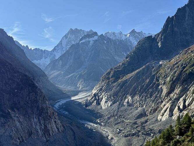
The start of the hike begins at Mer de Glace after riding the train up from the Chamonix Valley up to Montenvers. After exiting the train, you'll be standing at an overlook of France's largest glacier, Mer de Glace (Sea of Ice). On the far end of the Mer de Glace valley stands the 4,208m tall Grandes Jorasses - one of three great north faces of the Alps (alongside the Eiger and the Matterhorn). If you do not plan to enter the Mer de Glace Ice Cave (which this route skips), consider grabbing an espresso and pastry at the nearby store before you start the hike.Once you leave the Mer de Glace overlook, the hike begins by heading north toward the Glacorium and along the way are more stunning Alpine views like the towering Aiguille Verte peak overhead and waterfalls that flow down from its slopes, stretching hundreds of meters from the mountain to the Mer de Glace valley below. Near the Refuge du Montenvers is the official trailhead for the Grand Balcon Nord with signage. Follow this trail to make your way toward Plan de l'Aiguille.
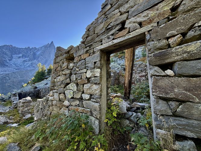
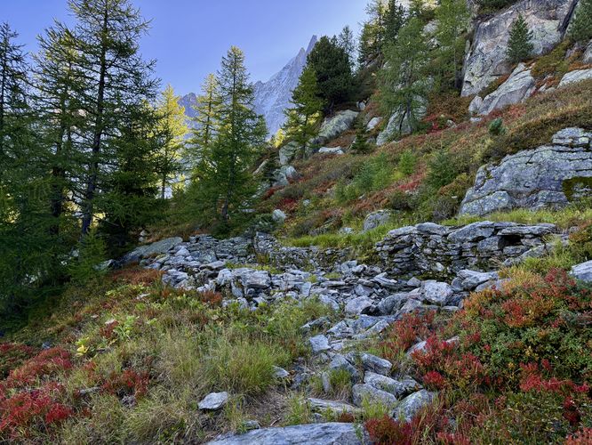
Abandoned Mountain Huts - 0.6 km & 0.7 km
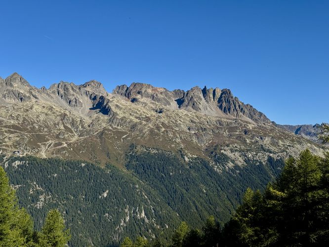
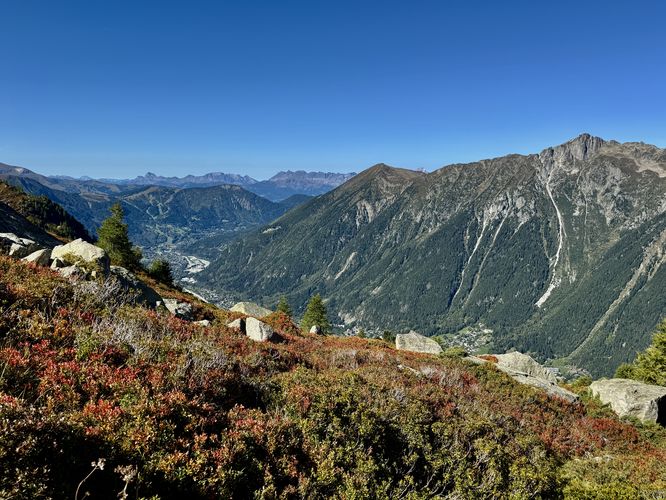
Once you're on the official Grand Balcon Nord trail, you'll find stunning views of the mountain range located across the Chamonix Valley, the Aiguilles Rouges (Red Needles) massif. The Aiguilles Rouges will be visible throughout the entire hike, but having views of the Red Needles massif to start adds to the Alpine scenery with Chamonix sitting 2,000 meters below! As you traverse the trail, you'll quickly come across the remnants of two mountain huts that were abandoned long ago. These mountain huts were possibly used by herders, however, that's speculation. What remains today are the stone foundations with one hut that includes a wooden door frame. One can be found near 0.6km and the other near 0.7km in the route provided.Grand Balcon Nord Forest - 0.7km to 1.9km
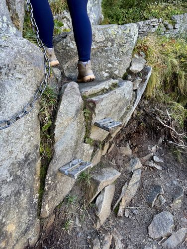
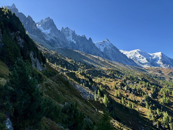
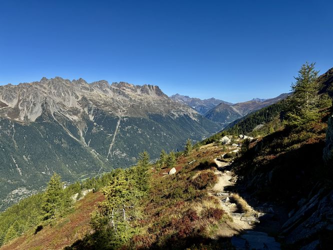
Once you pass the second abandoned mountain hut, the Grand Balcon Nord trail leads through an evergreen forest as it slowly ascends the Mont Blanc massif. Along the way are several viewpoints of the Chamonix Valley, Aiguilles Rouges (Red Needles) massif, and the towering but fading peaks that surround Mer de Glace. Near 0.8km sits a cliff and ledge where hikers must traverse an easy scramble to continue. This easy scramble includes a metal steps and a chain that you can hold onto for safety.Chamonix & Mont Blanc Massif Views - 1.9km to 5.5km
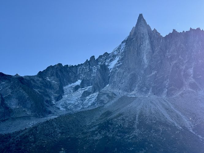
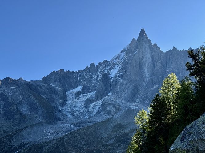
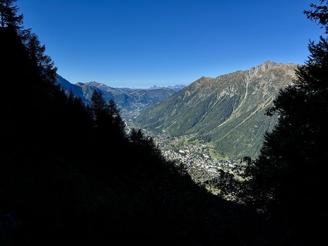
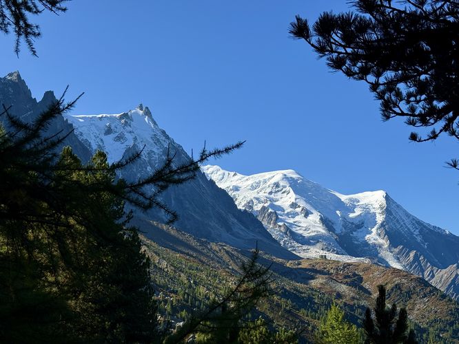
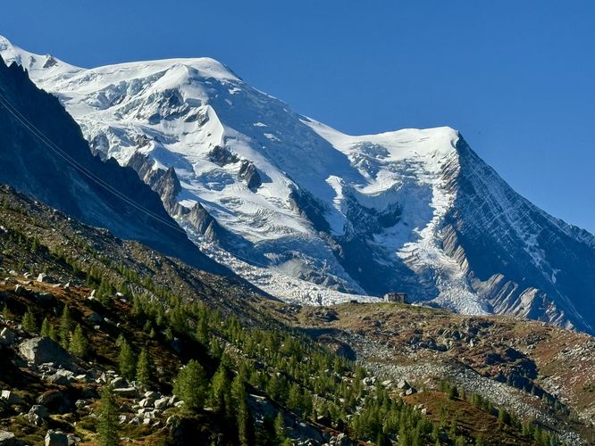
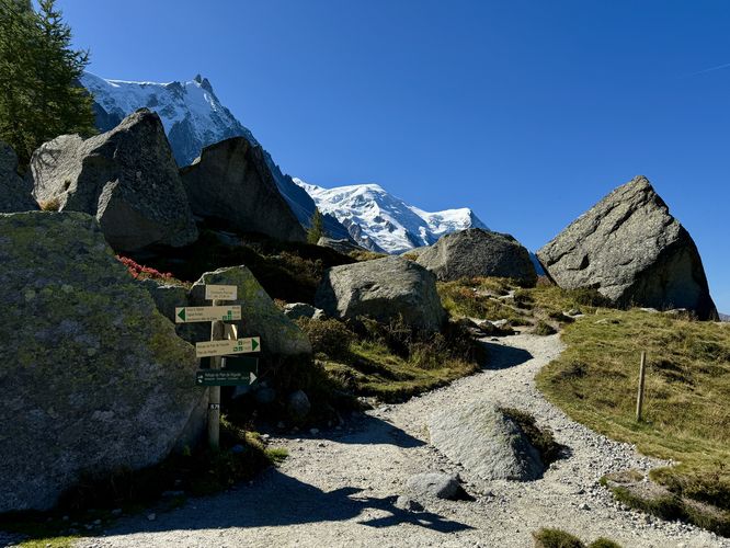
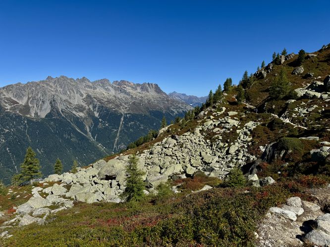
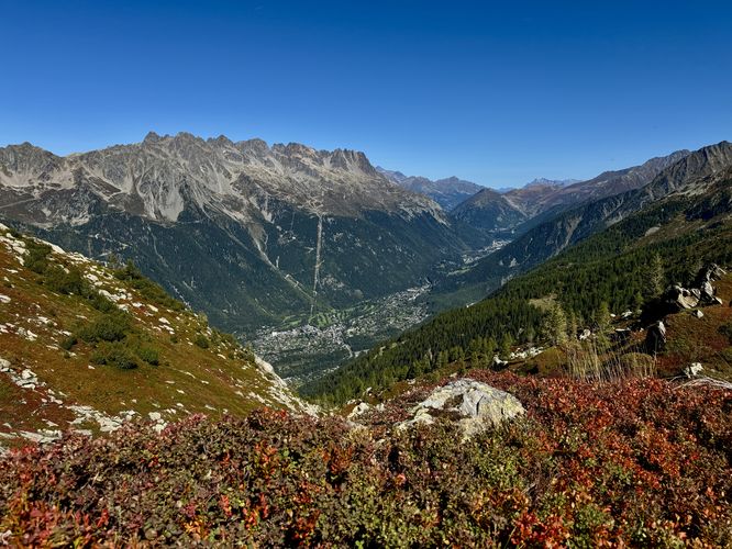
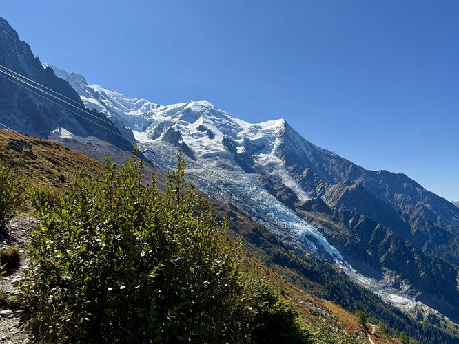
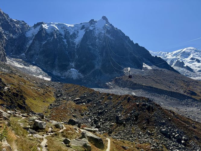
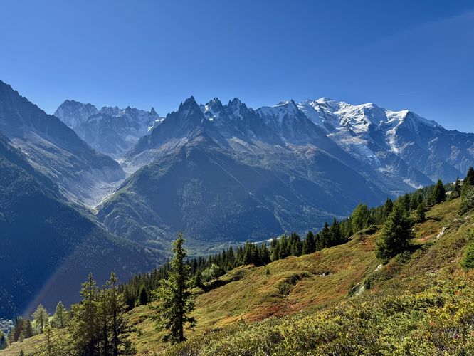
Around 1.9km into the hike is when the views of the Mont Blanc massif, including Bossons Glacier, Aiguille du Midi, and the jagged peaks of the mountain range come into full view. From here, until approximately 5.5km, the hike features breathtaking views of the Mont Blanc massif and the entire Chamonix Valley below. Additionally, you'll find more panoramic views of the Aiguilles Rouges (Red Needles) massif located across the Chamonix Valley. Along this part of the hike, the trail is very easy to follow where it passes just a couple of trail junctions. Between 3.4km and 5.3km are where the landscape and ecosystem along the Grand Balcon Nord change where hikers will pass large boulders, blueberry bushes, and rock fields. During early Autumn, the blueberry and low-growing bushes turn a fiery-red, simply adding to the stunning scenery high above Chamonix. As the trail curves the bend, near 5.3km, hikers will approach a really great place to grab lunch, the restaurant, Refuge du Plan de l'Aiguille. During our hike, we spent about 1 hour at Refuge du Plan de l'Aiguille and had an amazing mountainside lunch, espresso, and some wine. After that, we kept hiking for just a short while.Lac Bleu (Blue Lake) & Plan de l'Aiguille - 5.5km to 7.7km
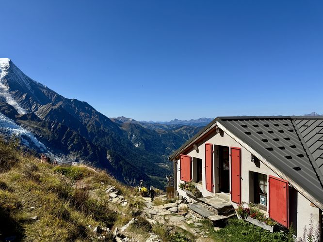
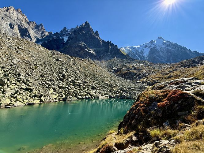
The final section of this hike leads to the alpine lake, Lac Bleu (Blue Lake), which is a neat addition to exploring the Grand Balcon Nord. From Refuge du Plan de l'Aiguille, the trail leads further up the mountain to reach Plan de l'Aiguille where you'll find the Aiguille du Midi cable car station, a small restaurant, and views of the Bossons Glacier. The hike to reach Plan de l'Aiguille from Refuge du Plan de l'Aiguille is not difficult but follows a moderate grade, so if you just ate lunch this might slow you down. At Plan de l'Aiguille, this route leads northeast as it follows a trail out to reach the alpine lake, Lac Blue (Blue Lake) nestled below the towering peaks overhead. The hike out to Lac Bleu is short and easy. Once you reach Lac Bleu, you'll find turquoise-hued waters sitting below towering alpine peaks - a great place to sit and relax. Once you've explored the views of Lac Bleu, the hike back to Plan de l'Aiguille is an easy 0.8km walk.Finally, when you arrive back at Plan de l'Aiguille, the Grand Balcon Nord hike is over. Time to ride the Aiguille du Midi cable car back down to the Chamonix Valley to wrap up your day on the scenic slopes of the Mont Blanc Massif! For hikers who parked a vehicle near the Montenvers train station, you can follow public roads in combination with the Passage du Montenvers to reach the parking lot.
How to Get to Grand Balcon Nord
To reach the Grand Balcon Nord, hikers will need to take the Montenvers train from Chamonix up to Mer de Glace where this route starts. Alternatively, many hikers follows this trail downhill from Plan de l'Aiguille to Mer de Glace, where you start at Plan de l'Aiguille, accessed via the Aiguille du Midi cable car.Visitors to the Chamonix Valley should consider purchasing day passes or multi-day passes ahead of time from the Mont Blanc Natural Resort, which are used for train, cable car (gondola) access in the area. A (2) day summer pass for one adult, as of September 2025, cost us 103,20 €. So for both adults plus taxes, the total cost was 225,62 €. After purchase, simply follow the instructions to find where to pick up your day pass smart cards.
Parking coordinates: The parking / get directions coordinates for this hike will lead you to a very large parking lot located near the Montenvers train station. Parking is not free and has an hourly rate.
Pets
Dogs are allowed on this hike, however, dogs may or may not be allowed on the Montenvers train. Please double-check where you can bring your dog before planning your day hike.Explore Hikes near Chamonix
Looking for more breathtaking view hikes in Chamonix? Consider hiking the Grand Balcon Sud, located across the Chamonix Valley as it runs along the slopes of the Aiguilles Rouges (Red Needles) massif. The views from Grand Balcon Sud are unmatched and provide hikers with breathtaking panoramic views of the entire Mont Blanc massif, including Mer de Glace, the Grandes Jorasses, glaciers near Le Tour, Aiguille du Midi, and Mont Blanc's summit. Alternatively, for a fun family-friendly, short hike to a waterfall near Chamonix, consider exploring Cascade du Dard. The Cascade du Dard (Dart Waterfall) is an easy out-and-back walk that requires very little effort and offers a bit more seclusion on the Mont Blanc massif.Warning
Steep slopes: This trail follows sections of steep mountain slopes. During colder months, especially when the trail is still covered in snow, the trail can pose slipping hazards. It's best to bring a pair of ice spikes per hiker just in case you come across snow. During our hike in mid-September, however, we did not encounter any snow.Elevation sickness: This hike leads up to ~7,600-feet or 2,300 meters above sea level. Around this range is where people can start to feel minute elevation sickness. During this hike, one of us was feeling the elevation and made for the last section to Lac Bleu (Blue Lake) a bit more challenging.
Exposure: The southern half of this hike leads through exposed mountain slopes where there's very-little shade. Be prepared with sunscreen and a hat to help combat the sun exposure.