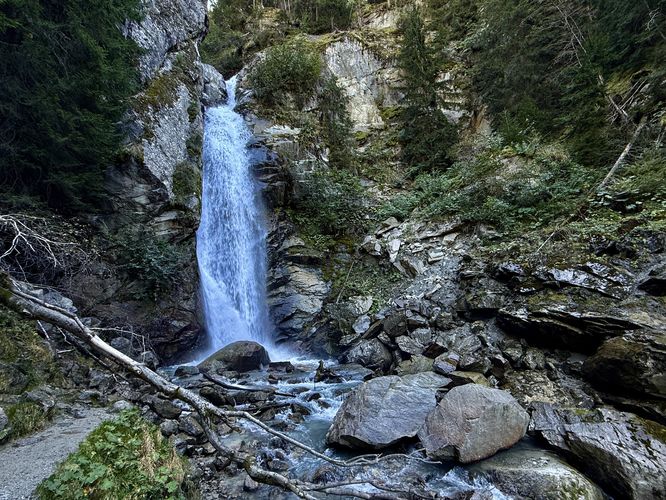
The Cascade du Dard (Dart Waterfall) in Chamonix Mont Blanc is one of the best family-friendly and easy-to-access waterfalls in the valley. Located just minutes from downtown Chamonix on the spectacular Mont Blanc massif, this short, fun walk leads directly to the stunning 21m (68-foot) glacial cascade. This easy hike is perfect for visitors who want a beautiful and rewarding outdoor experience without the commitment of a full-day trek.
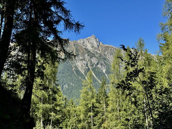
Next, you'll pass through the outdoor seating area of Restaurant La Cascade du Dard where, if you're hungry, you can grab a bite to eat or an espresso to refuel. Just beyond the restaurant is a view of La Brévent, the highest peak on the Aiguilles Rouges (Red Needles) massif.
Finally, as you follow a bend in the trail, it leads to a beautiful viewpoint of Cascade du Dard from a wooden footbridge. Here, you'll find some of the best views of the 21m (68 feet) tall waterfall. Following the trail upstream, hikers can reach a viewpoint near the base of the waterfall where you can take in the scenery of this glacial melt cascade as it spills over a cliff along the Mont Blanc massif. If you wish, you can even hike up a short hillside nearby to find a different perspective of Cascade du Dard.
When you're done exploring the waterfall, you can choose to jaunt around the trail systems nearby or head back to the parking lot. This route leads hikers straight back to parking for a short and easy 0.5km (0.3 mile) walk.
Exploring Cascade du Dard
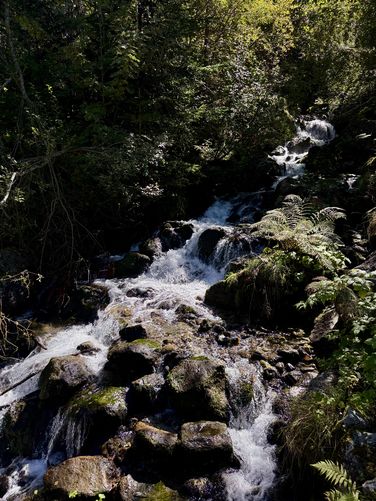
Visitors to Cascade du Dard will find a trailhead just off of N205 near Restaurant La Cascade du Dard where the trail leads hikers through the woods and out to the waterfall. While the trail out to Cascade du Dard is short, there are some sights along the way that hikers may not expect. First, you'll cross a footbridge over Torrents des Favrands dit des Tissourds (Torrents of the Favrands, also known as des Tissourds) where short, tumbling waterfalls spill down the mountainside.Next, you'll pass through the outdoor seating area of Restaurant La Cascade du Dard where, if you're hungry, you can grab a bite to eat or an espresso to refuel. Just beyond the restaurant is a view of La Brévent, the highest peak on the Aiguilles Rouges (Red Needles) massif.
Finally, as you follow a bend in the trail, it leads to a beautiful viewpoint of Cascade du Dard from a wooden footbridge. Here, you'll find some of the best views of the 21m (68 feet) tall waterfall. Following the trail upstream, hikers can reach a viewpoint near the base of the waterfall where you can take in the scenery of this glacial melt cascade as it spills over a cliff along the Mont Blanc massif. If you wish, you can even hike up a short hillside nearby to find a different perspective of Cascade du Dard.
When you're done exploring the waterfall, you can choose to jaunt around the trail systems nearby or head back to the parking lot. This route leads hikers straight back to parking for a short and easy 0.5km (0.3 mile) walk.