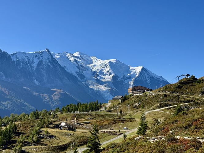
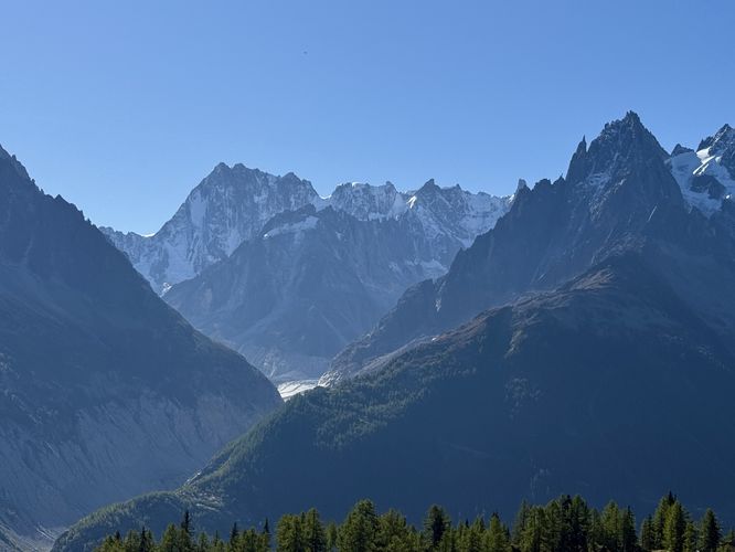
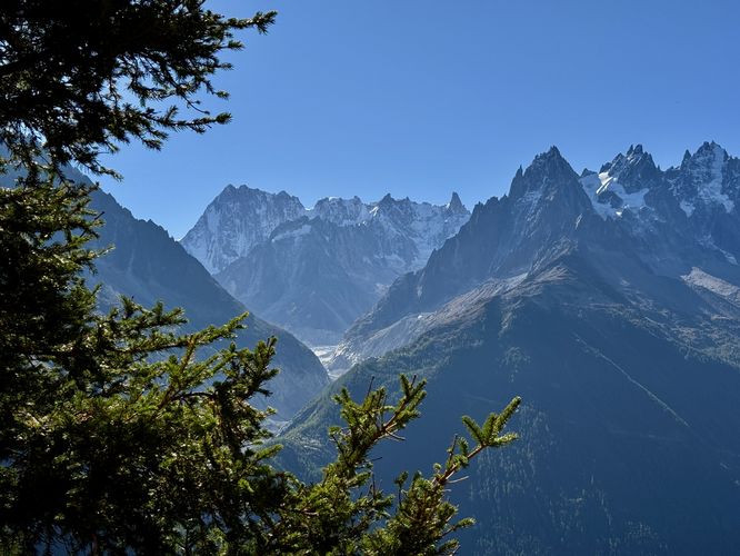
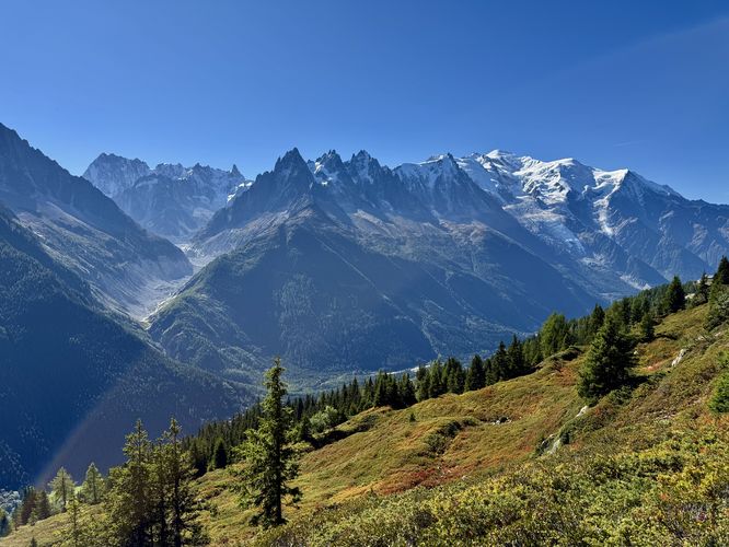
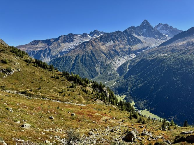
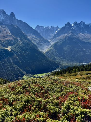
This short, but spectacular Grand Balcon Sud hike offers one of the most comprehensive views of the majestic Mont Blanc Massif in the Chamonix Valley. As you traverse this renowned high-altitude trail, you'll be constantly rewarded with an unobstructed, panoramic view of Western Europe's highest peak, the glistening summit of Mont Blanc (on clear days), and its sprawling glacier-covered slopes. Keep your camera ready for the massive Bossons Glacier snaking down the mountainside and the impressive, rugged expanse of the Mer de Glace, showcasing the raw beauty of the French Alps.
Perfect for hikers seeking a breathtaking Alpine experience near Chamonix without a full-day commitment, this section of the Grand Balcon Sud in Réserves Naturelles Aiguilles Rouges (Natural Reserve of the Red Needles) provides panoramic Alps views along a moderate 4km (2.5 mile) out-and-back hike.
Parking coordinates: The parking / get directions coordinates for this hike will lead you to a very large parking lot located at the Téléphérique Flégère (Flégère cable car) station. As of September 2025, parking is free and may be subject to change.
Exposure: The entire hike leads through exposed mountain slopes where there's very-little shade. Be prepared with sunscreen and a hat to help combat the sun exposure.
Perfect for hikers seeking a breathtaking Alpine experience near Chamonix without a full-day commitment, this section of the Grand Balcon Sud in Réserves Naturelles Aiguilles Rouges (Natural Reserve of the Red Needles) provides panoramic Alps views along a moderate 4km (2.5 mile) out-and-back hike.
Hiking the Grand Balcon Sud
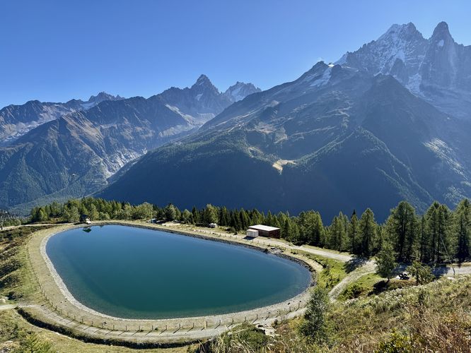
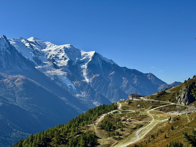
This hike begins in La Flégère, high above the Chamonix Valley, where the Téléphérique Flégère drops you off. When you leave the cable car station, hikers will find a couple of mountainside restaurants and the main trailhead at La Flégère that leads directly into the nature reserve. Right at the trailhead sits a beautiful Alps view of the northern end of the Mont Blanc massif toward Le Tour. Directly below the Téléphérique Flégère station sits a human-made lake that adds to the Alpine scenery from the slopes of Aiguilles Rouges.Mont Blanc's Best Viewpoints
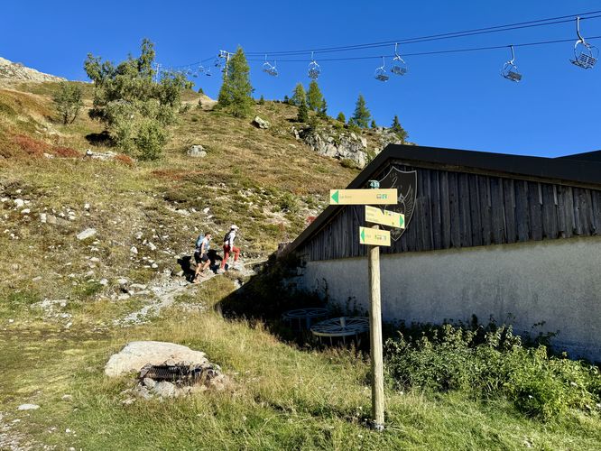
This route begins by heading straight downhill from the trailhead before it follows a right-hand turn and heads toward Restaurant les Deux Aigles. Hikers will leave the best views of Mont Blanc behind for just a short while as the trail leads past the restaurant, near 0.5km. On the north side of the restaurant, near 0.6km the stunning panoramic views begin as you follow the Grand Balcon Sud northeast. Not only do the breathtaking, panoramic Alpine views open up here, the trail also begins to ascend along a moderate grade through an exposed Alpine landscape. Note that the exposure is very high here and the trail provides very little shade.Mont Blanc & the Massif: What You're Seeing
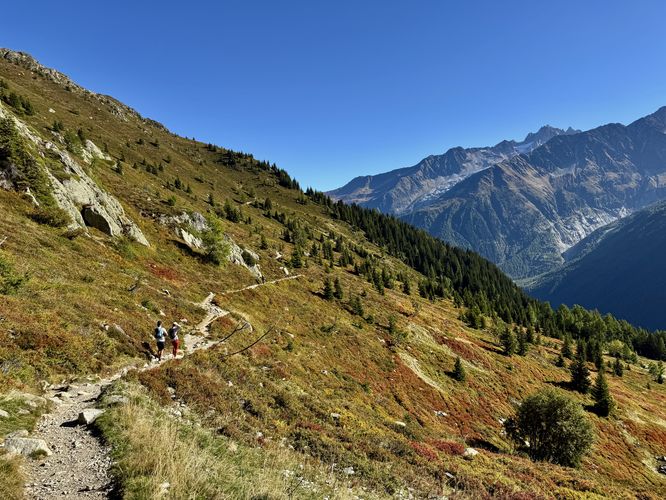
As you make your way further along the trail, more views of famous peaks and glaciers come into view. We got lucky on this hike and despite the unexpected high heat in mid-September, there were no clouds on the Mont Blanc massif so we had views of Western Europe's highest summit along with the entire massif. The trail continues to ascend and more breathtaking, panoramic views can be found along the way. Near 0.8km, the views of Mer de Glace and the Grandes Jorasses come into sight and the views of these magnificent Alps landscapes follow you as you traverse the Grand Balcon Sud trail. A steeper section of the trail presents itself to hikers, between 1km and 1.5km with a couple of shaded spots along the way, likely some of the only reliable shade on this part of the Aiguilles Rouges mountain slopes. Near the top of the first steep incline is where we turned around, due to the excessive heat and over-exposed terrain that day; however, near 2km from the trailhead are even more impressive views of the Alps and glaciers that surround the Chamonix Valley like the mountains near Le Tour and two glaciers - Glacier du Tour (northern) and Argentière Glacier (southern).The Return: Heading Back Down
After reaching the 2km point from Téléphérique Flégère, this route ends, however the Grand Balcon Sud continues onward for hikers that wish to continue. As previously stated, the heat and high exposure for us the day that we hiked the route was far too extreme to continue, so we turned back near 2km. With that said, the best views of the Mont Blanc massif were not going to get much better, so luckily we explored everything we meant to that day. The return hike from 2km back to Téléphérique Flégère is straight forward - simply follow the Grand Balcon Sud trail back toward the cable car station, passing the restaurant along the way. The last section of the hike is a moderate, but short uphill climb to reach the cable car to wrap up this 4km (2.5 mile) hike.Pets
Dogs are not allowed on this hike.How to Get to Grand Balcon Sud
To reach the Grand Balcon Sud, hikers will need to take the Téléphérique Flégère (Flégère cable car) from Chamonix up to La Flégère. Visitors to the Chamonix Valley should consider purchasing day passes or multi-day passes ahead of time from the Mont Blanc Natural Resort, which are used for train, cable car (gondola) access in the area. A (2) day summer pass for one adult, as of September 2025, cost us 103,20 €. So for both adults plus taxes, the total cost was 225,62 €. After purchase, simply follow the instructions to find where to pick up your day pass smart cards.Parking coordinates: The parking / get directions coordinates for this hike will lead you to a very large parking lot located at the Téléphérique Flégère (Flégère cable car) station. As of September 2025, parking is free and may be subject to change.
Explore Hikes near Chamonix
Looking for more breathtaking view hikes in Chamonix? Consider hiking the Grand Balcon Nord located across the Chamonix Valley as it runs along the Mont Blanc massif. The views from Grand Balcon Nord are unmatched and provide hikers with panoramic vistas of the entire Aiguilles Rouges (Red Needles) Massif, the Chamonix Valley, the Bossons Glacier, and the towering peaks of the Mont Blanc massif. Alternatively, for a fun family-friendly, short hike to a waterfall near Chamonix, consider exploring Cascade du Dard. The Cascade du Dard (Dart Waterfall) is an easy out-and-back walk that requires very little effort and offers a bit more seclusion on the Mont Blanc massif.Warning
Elevation sickness: This hike leads up to ~7,600-feet or 2,300 meters above sea level. Around this range is where people can start to feel minute elevation sickness. During this hike, one of us was feeling the elevation and made for the last section to Lac Bleu (Blue Lake) a bit more challenging.Exposure: The entire hike leads through exposed mountain slopes where there's very-little shade. Be prepared with sunscreen and a hat to help combat the sun exposure.