The Ansonia Knob Hike at Tioga State Forest in Ansonia, Pennsylvania is a moderate 1.9-mile out-and-back hike that leads to views of Mt. Tom, the Wellsboro Airport, and the mountains around Herrington Hollow.
Trails
This hike follows the Bee Tree Hollow Trail (red blazes) and the officially-unnamed but popular horse trail, known as the Ansonia Ridge Trail (red blazes).
Bushwhacking (Pre-2025)
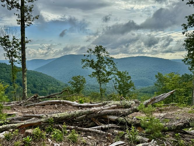
Note prior to the new log-cut in July 2025, the Ansonia Ridge Trail is often very overgrown during warm months and is never maintained outside of the very-seldom horse rider, backpacker, or crazy day hiker passing through. As of July 2025, bushwhacking up to the Ansonia Knob and Ansonia Ridge is less of a bushwhack due to the excessive logging truck activity that's keeping the trail free of overgrowth.
Hike Description
This hike begins at the southern trailhead for the Bee Tree Hollow Trail, which does not have a trailhead sign like the Bee Tree Ski Trail, so don't get confused. The hike heads up the mountain at a steady and moderate grade following the service road portion of the Bee Tree Hollow Trail.
Ansonia Ridge Trail / Left-Hand Turn - Mile 0.6
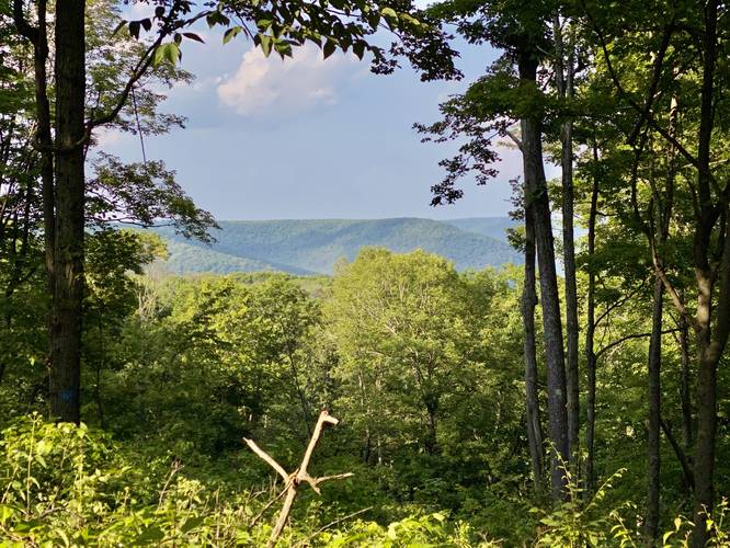
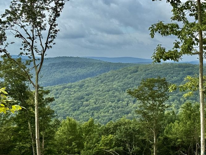
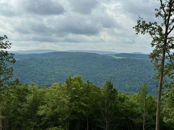
At mile 0.6, hikers will reach an easy-to-miss left-hand turn with red blazes on the trees. This sign-less trail is the continuation of the Ansonia Ridge Trail (note that the eastern terminus is located at the junction of Colton Point Rd and Owassee Rd). Once on the unmaintained, likely very overgrown Ansonia Ridge Trail, the hike is a steady uphill climb that gets a bit steeper along the way. These steep sections of elevation are not too difficult since they don't last very long and level out for a bit, but the very-last push up to the top of the first knob along the ridge is a bit of work - some may consider it a "Hard" hike instead of "Moderate". Note that along the way, the forest changes from closed-in to more open, with a thicket of blackberry, dew berry, and bramble to bushwhack through. Off to the side of the trail, in several spots, are additional "window" views between the trees of the surrounding mountains above PA-6, but to have the best view or photo one must be carrying a telephoto lens.
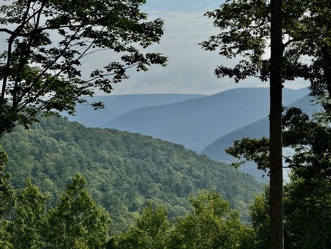
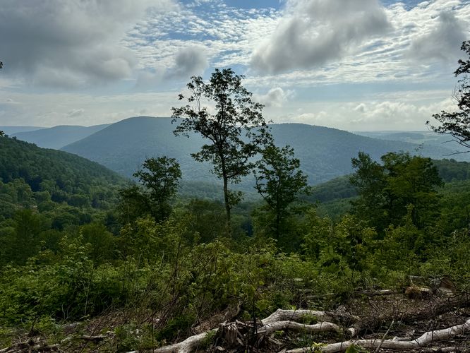
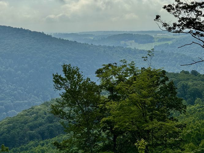
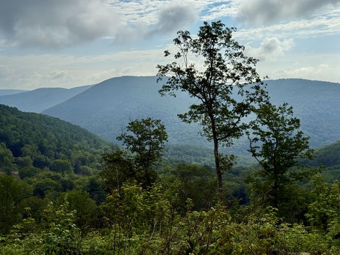
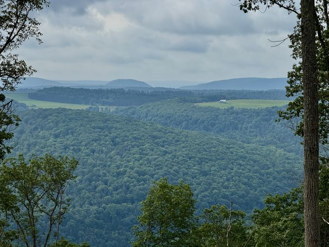
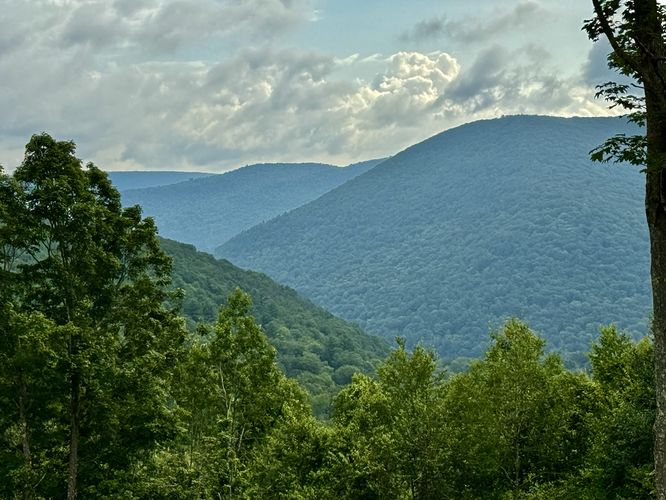
Ansonia Ridge Views - Mile 0.95
Prior to July 2025, the view atop Ansonia Ridge on the eastern Ansonia Knob included one north-facing view of the mountainous plateau, but that changed in July 2025. Thanks to the logging efforts in July 2025, the new views start around mile 0.7 and last until mile 0.96 at the top of the knob. The views along the way up include Mt. Tom, the Wellsboro Airport, and the rolling mountains that sit above the Pine Creek Valley. At mile 0.95, you'll reach the crest in the mountain ridge's eastern knob (mountain top). Just off to the side, to the north, sits a nice window between the trees of the mountains that makeup Herrington Hollow.
Hiking Out
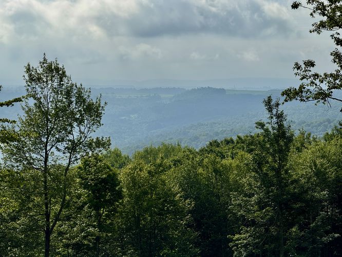
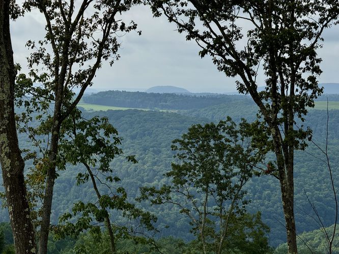
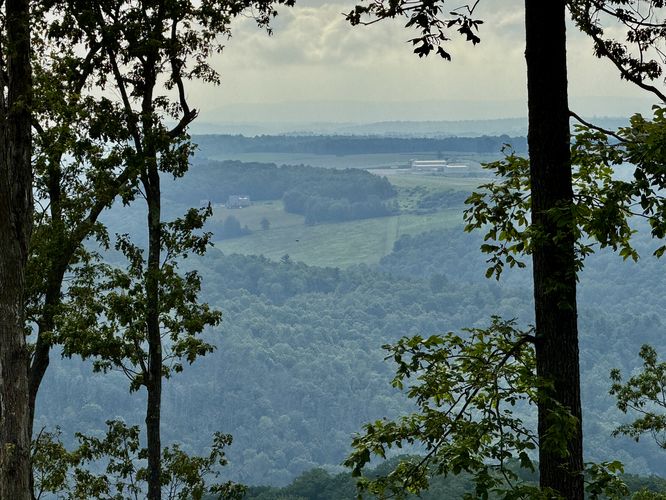
Not much to note, but you can add some additional mileage by hiking up the Bee Tree Hollow Trail a bit more to reach some more views of the area. Most of the views, again are windows, but some include views of Mount Tom, the Wellsboro Airport, and Tannery Hill in the distance.
Parking
Hikers will find very few parking spaces for this trail, located off of the road near the coordinates provided. Or park near the service road gate, but do not block it.
Pets
Dogs are allowed if leashed and should be cleaned up after.
Camping & Backpacking
While there were no defined campsites along this hike, camping and backpacking are permitted. Please follow all state forest rules and regulations when camping.
Warning
Timber Rattlesnake: This area is home to the Timber Rattlesnake and while there may not be any nearby dens, rattlesnakes may be out roaming the forest between the end of April and mid-October each year. Be on the lookout or keep an ear out for their rattle and give any you find plenty of space.
Lack of water: This hike has no water sources along it - all water must be packed in.
Bushwhack: The Ansonia Ridge Trail (popular horse trail) is often extremely overgrown with bramble, blackberry, and dew berry bushes. Great bear territory, but also requires a bit of bushwhacking.
Seasonal (Road Closed in Winter)
Note that this road is not maintained during the Winter, so if a hiker would like to hike up here they'd have to snowshoe quite a way from the northern West Rim Trail parking lot.
Trails
This hike follows the Bee Tree Hollow Trail (red blazes) and the officially-unnamed but popular horse trail, known as the Ansonia Ridge Trail (red blazes).
Bushwhacking (Pre-2025)
Note prior to the new log-cut in July 2025, the Ansonia Ridge Trail is often very overgrown during warm months and is never maintained outside of the very-seldom horse rider, backpacker, or crazy day hiker passing through. As of July 2025, bushwhacking up to the Ansonia Knob and Ansonia Ridge is less of a bushwhack due to the excessive logging truck activity that's keeping the trail free of overgrowth.
Hike Description
This hike begins at the southern trailhead for the Bee Tree Hollow Trail, which does not have a trailhead sign like the Bee Tree Ski Trail, so don't get confused. The hike heads up the mountain at a steady and moderate grade following the service road portion of the Bee Tree Hollow Trail.
Ansonia Ridge Trail / Left-Hand Turn - Mile 0.6
At mile 0.6, hikers will reach an easy-to-miss left-hand turn with red blazes on the trees. This sign-less trail is the continuation of the Ansonia Ridge Trail (note that the eastern terminus is located at the junction of Colton Point Rd and Owassee Rd). Once on the unmaintained, likely very overgrown Ansonia Ridge Trail, the hike is a steady uphill climb that gets a bit steeper along the way. These steep sections of elevation are not too difficult since they don't last very long and level out for a bit, but the very-last push up to the top of the first knob along the ridge is a bit of work - some may consider it a "Hard" hike instead of "Moderate". Note that along the way, the forest changes from closed-in to more open, with a thicket of blackberry, dew berry, and bramble to bushwhack through. Off to the side of the trail, in several spots, are additional "window" views between the trees of the surrounding mountains above PA-6, but to have the best view or photo one must be carrying a telephoto lens.
Ansonia Ridge Views - Mile 0.95
Prior to July 2025, the view atop Ansonia Ridge on the eastern Ansonia Knob included one north-facing view of the mountainous plateau, but that changed in July 2025. Thanks to the logging efforts in July 2025, the new views start around mile 0.7 and last until mile 0.96 at the top of the knob. The views along the way up include Mt. Tom, the Wellsboro Airport, and the rolling mountains that sit above the Pine Creek Valley. At mile 0.95, you'll reach the crest in the mountain ridge's eastern knob (mountain top). Just off to the side, to the north, sits a nice window between the trees of the mountains that makeup Herrington Hollow.
Hiking Out
Not much to note, but you can add some additional mileage by hiking up the Bee Tree Hollow Trail a bit more to reach some more views of the area. Most of the views, again are windows, but some include views of Mount Tom, the Wellsboro Airport, and Tannery Hill in the distance.
Parking
Hikers will find very few parking spaces for this trail, located off of the road near the coordinates provided. Or park near the service road gate, but do not block it.
Pets
Dogs are allowed if leashed and should be cleaned up after.
Camping & Backpacking
While there were no defined campsites along this hike, camping and backpacking are permitted. Please follow all state forest rules and regulations when camping.
Warning
Timber Rattlesnake: This area is home to the Timber Rattlesnake and while there may not be any nearby dens, rattlesnakes may be out roaming the forest between the end of April and mid-October each year. Be on the lookout or keep an ear out for their rattle and give any you find plenty of space.
Lack of water: This hike has no water sources along it - all water must be packed in.
Bushwhack: The Ansonia Ridge Trail (popular horse trail) is often extremely overgrown with bramble, blackberry, and dew berry bushes. Great bear territory, but also requires a bit of bushwhacking.
Seasonal (Road Closed in Winter)
Note that this road is not maintained during the Winter, so if a hiker would like to hike up here they'd have to snowshoe quite a way from the northern West Rim Trail parking lot.