The West Rim Trail at Tioga State Forest near Wellsboro, Pennsylvania is a strenuous 31+ mile one-way trail that runs along the western side of Pine Creek Gorge, also known as the Grand Canyon of Pennsylvania.
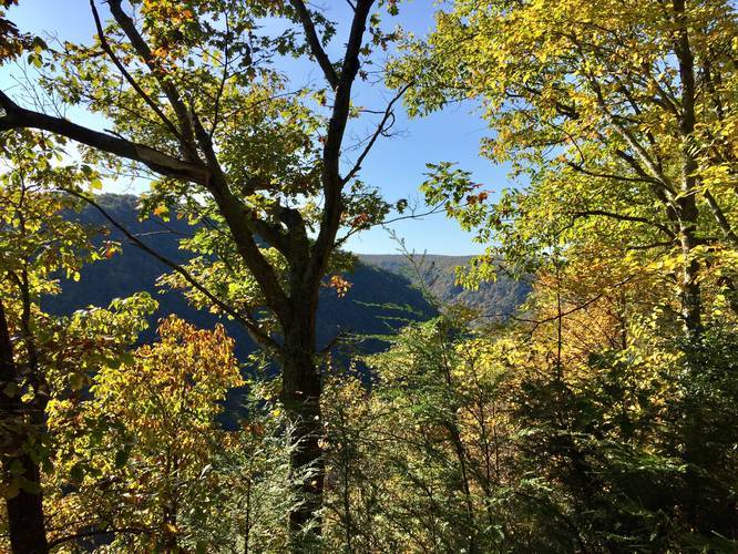
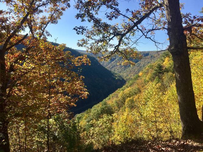
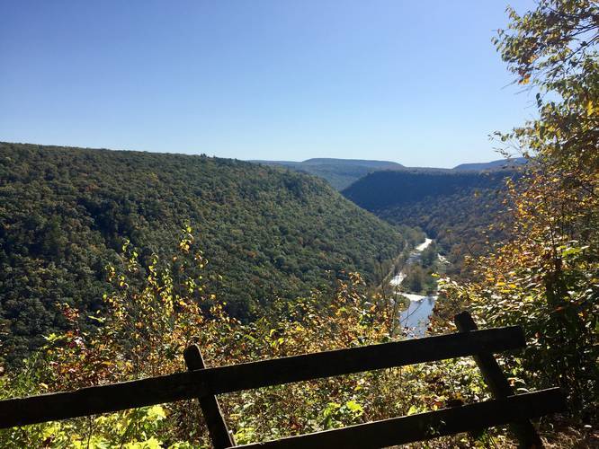
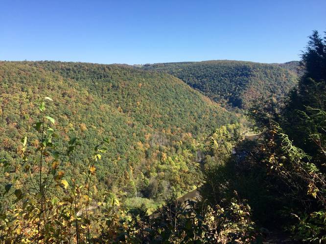
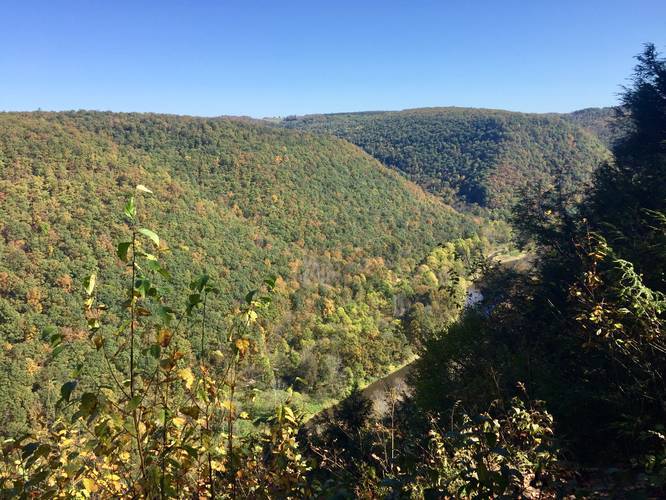
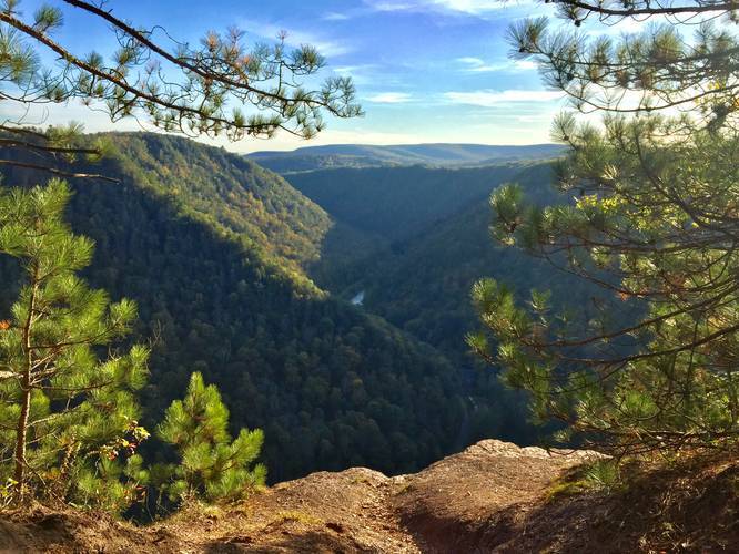
The West Rim Trail (W.R.T / WRT) is one of Pennsylvania's most popular backpacking destinations, especially during Autumn when Pine Creek Gorge is lit up with vibrant colors of foliage. The trail features numerous lookout points, including several south-facing views from the popular Barbour Rock.
Hikers and backpackers will find a beautiful trail that leads through, what feels like, a wilderness area in the middle of the PA Wilds, as it cuts through the Pine Creek Gorge Natural Area for 31+ miles. While Tioga State Forest is not a wilderness area (it does contain the Asaph Wild Area), it's a landmass covering 161,890 acres of land across two counties. The Pine Creek Gorge Natural Area has only a couple of private plots of land, down along Pine Creek, but for the most-part is an untouched section of Tioga State Forest that consists of just trails and a dirt road the follows the west rim of the gorge.
Trail Notes (North to South)
This recording begins at the northern terminus and thus the parking coordinates lead to the northern trailhead (see Parking below for the southern terminus coordinates) so the trail description and mileage follows from north to south.
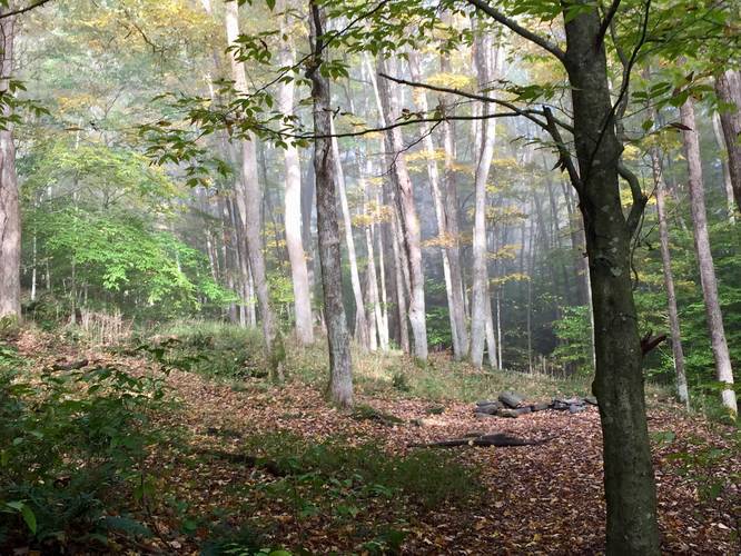
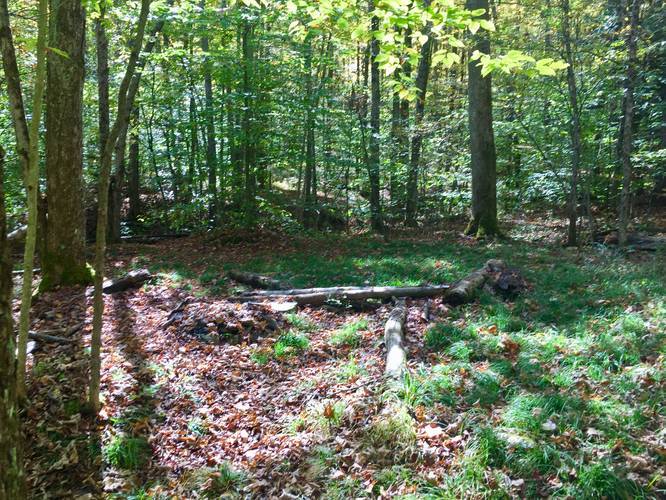
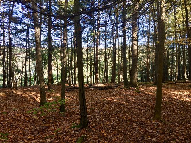
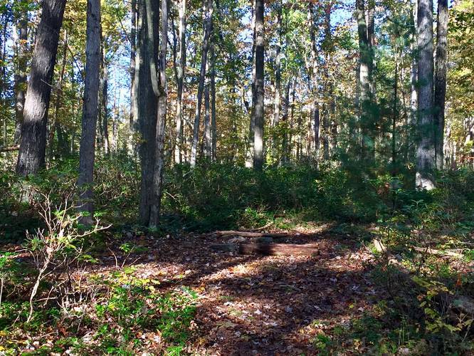
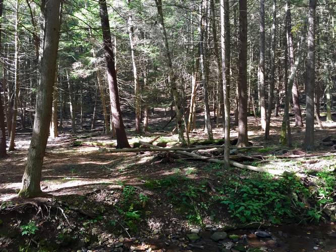
Hikers will enter the trail (northern terminus) to find a trail registry box located about 100-feet from the parking lot. It's smart to sign-in here since cell service along the trail is very hard to acquire. Hikers will then pass through a mixed forest of conifers and deciduous trees before officially entering the Pine Creek Gorge Natural Area around mile 0.6. The trek from here to Barbour Rock is mostly uphill with not much to see as it follows the mountain side adjacent to Pine Creek up to the first series of lookout points along Barbour Rock.
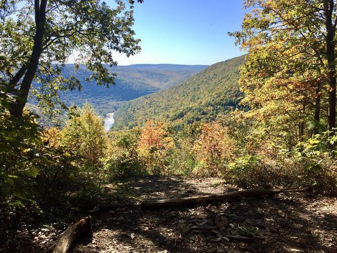
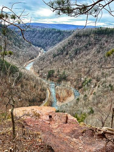
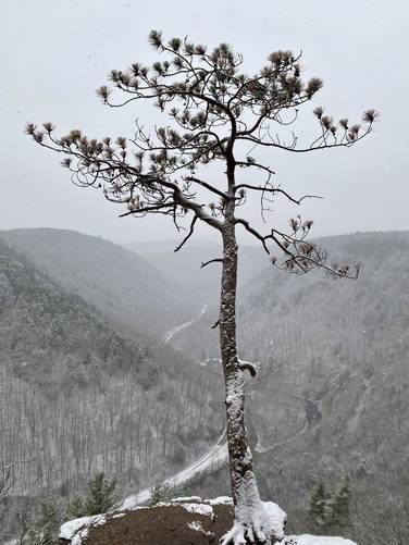
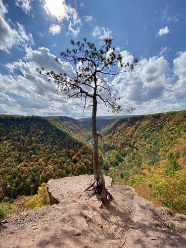
Barbour Rock Vistas (RIP Lone Pine, 2022) - Mile 2.7
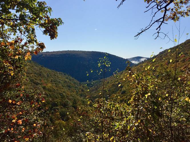
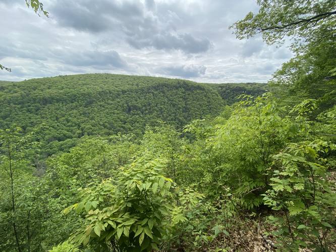
Hikers and backpackers will reach Barbour Rock around mile 2.7 and should take a break to take in the breath-taking views of Pine Creek Gorge before continuing onward, since this section of the trail has some of the best views of the canyon. Additionally, after Barbour Rock, hikers will not have many views for several more miles. Here, hikers will also find both the Barbour Rock Trail and the Barbour Rock Accessible Trail. As of Spring 2022, the Lone Pine - the iconic tree which used to sit on the western section of Barbour Rock on the WRT - has fallen and is no longer there.
Just after the trail passes Barbour Rock, the West Rim Trail follows a close edge of the gorge before turning into the woods for approximately the next 6-miles. So between mile 3.5 and mile 9.2, hikers will be ascending and descending hills to the west before heading back to the edge of the gorge.
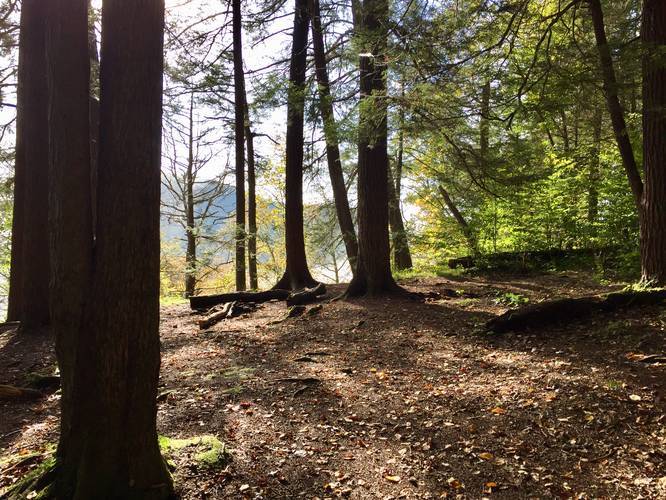
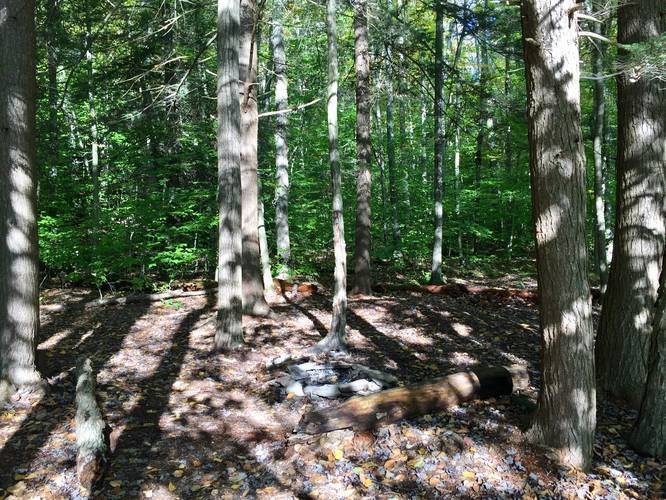
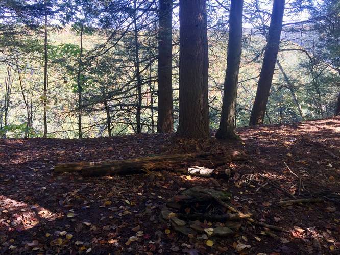
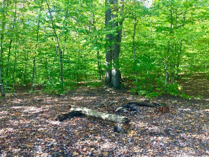
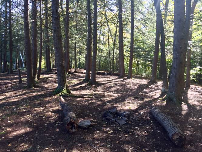
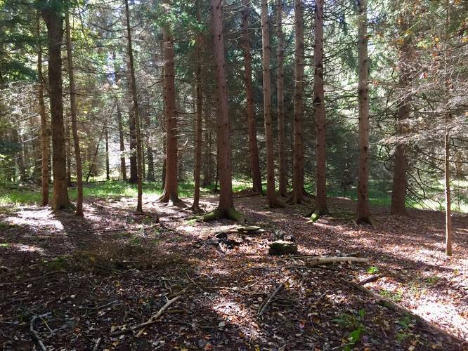
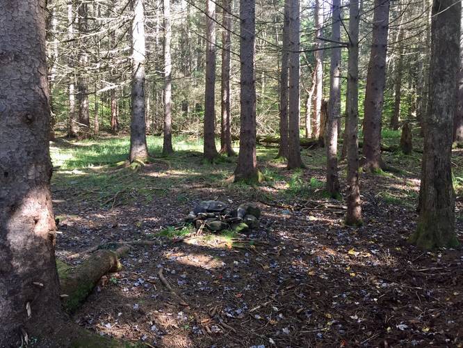
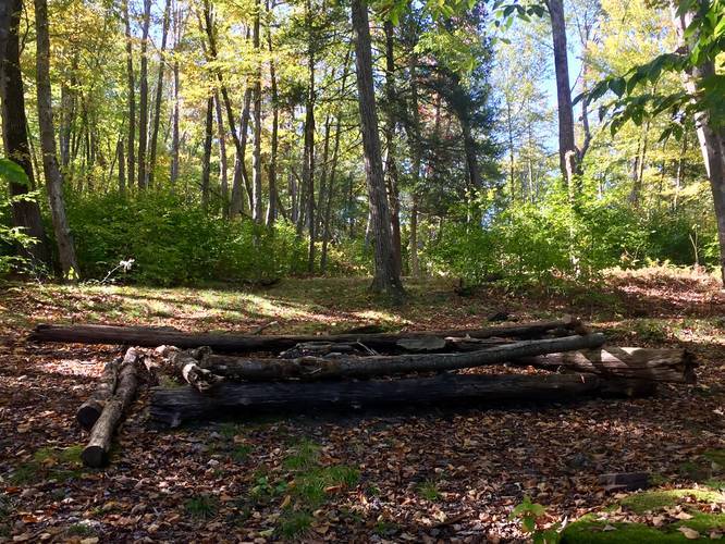
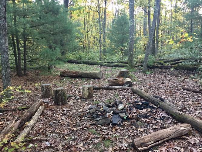
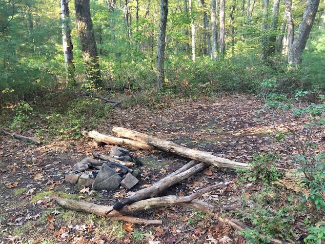
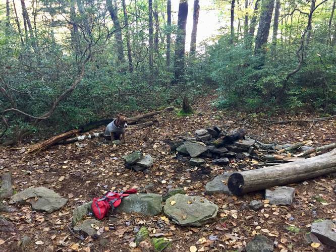
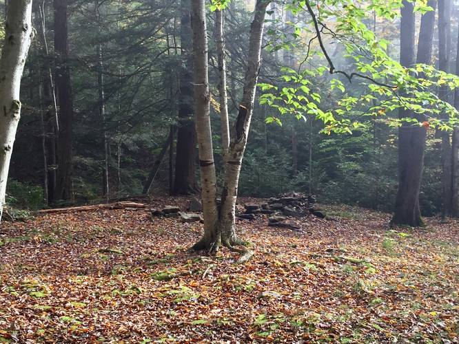
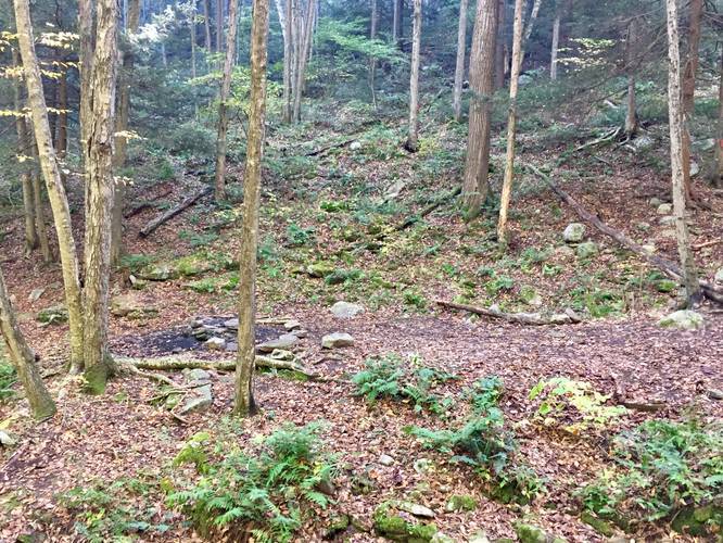
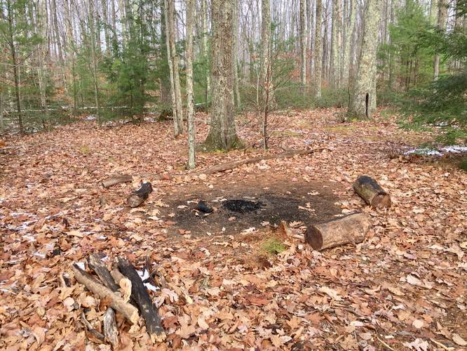
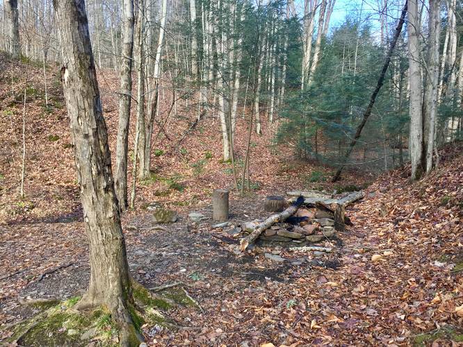
Once hikers reach mile ~9.2 (starting from the north), the trail will follow the rim of the gorge more closely, giving views along the way; however, this is where the constant undulating ravines begin and feel like they'll never end. For thru-hiking backpackers, this section of the trail is preferable to camp at due to the amazing campsites that sit directly behind vista points - please see the map for campsite locations.
Old-Growth Hemlock Grove (off-trail) - Mile 11.5
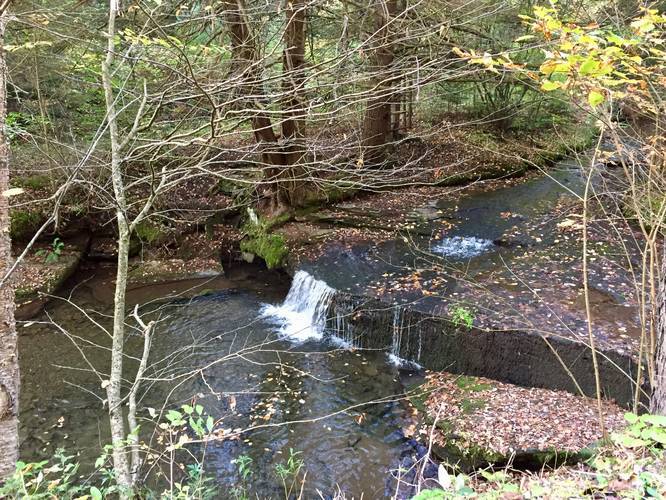
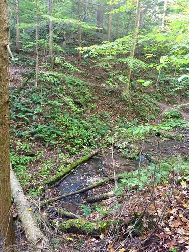
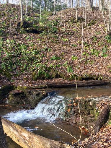
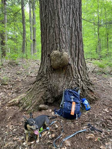
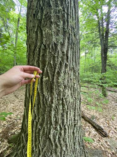
Around mile 11.5, hikers will encounter a creek crossing at Horse Run. Just upstream from Horse Run is an old-growth Eastern Hemlock grove located ~250-feet off-trail that was spared during the logging era (circa late 1800s to early 1900s) due to a land boundary dispute. Here, if hikers will find a "Mother Tree" Eastern Hemlock which in late May, 2022, I (Admin) measured to be ~121.5 inches in diameter. This measurement translates to ~98.2336 cm D.b.h (diameter at breast height), which is equivalent to ~240 to 250-years old. If this tree grew in a dark dense forest (very likely), then it's age could be even older than estimated, since the dark forest would have slowed its growth. Hikers may also notice some very large old-growth Eastern Hemlocks and Red Oak trees along the trail between miles 11 and Horse Run. I took measurements of ~5 more Eastern Hemlocks directly on the WRT - the largest measured to ~109.5 inches in circumference which is ~220-years old. One of the largest Red Oaks measured to be ~103.5 inch circumference, which translates to ~190-years old for that species. For hikers looking to day hike to this old-growth grove, check out our Horse Run Old-Growth Hemlocks guide.
Bradley Wales Picnic Area Potable Water - Mile 16.5
Once hikers reach the Bradley Wales picnic area (approx. mile 16.5), they can refill their water bottles with potable water available. Depending on the time of year will determine if the water fountain is working - check with the state forest first to see when they shut this off for the year.
After the Bradley Wales picnic area, the trail heads back west and around some hills, while avoiding the rim of the gorge altogether. This is the last section of the trail that skirts away from the rim, but the entire length of this section of the West Rim Trail is about 4-miles long. During this portion, the trail will cross a road around mile 18 and then follow the West Rim Road for a short while before it heads back into the woods around mile 18.5.
After hiking out of the final western section of the trail (with no views), the trail continues to undulate its way south along the rim of the gorge, while following a multitude of ravines. Again, campsites and lookout points can be found scattered throughout this section of the trail (see the trail map).
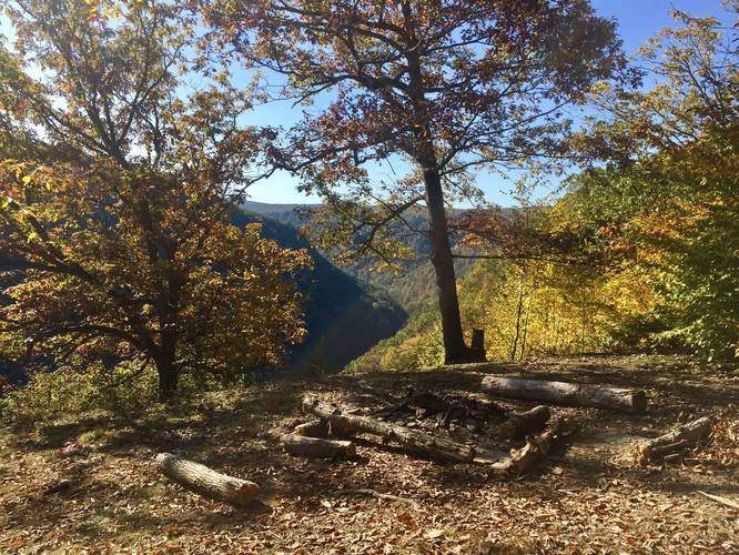
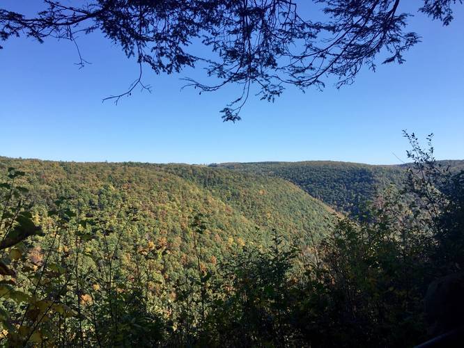
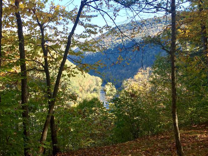
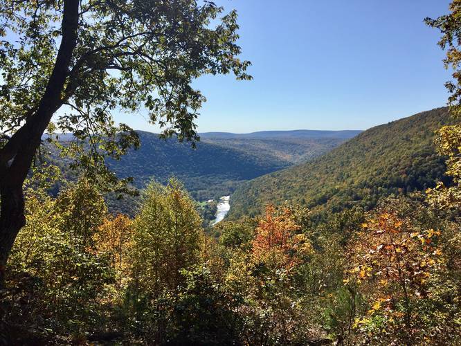
South-facing Vista - Mile 23.4
The last notable section of the trail is the last ravine climb within the last 5-miles of the trail. This climb is difficult, but the vista point (and campsite) at the top is well worth the payout. The vista offers views of Pine Creek, the southern section of the gorge, and a bridge that you might drive over after the hike.
From here, the hike is mostly all downhill, but this section is by far one of the worst on the entire West Rim Trail. Near the top of the mountain, the trail is littered with fist-sized rocks (sometimes larger) and it makes it really difficult to hike down - especially with a backpack of 25lbs or more. Take your time down this last section of trail as it's not easy descending the 1,000-feet to the southern parking lot.
Finally, the trail ends across the street at the "Rattlesnake Rock" parking area along the Pine Creek Rail Trail.
Length & Difficulty
This recording is 31.6-miles one-way; however, the state forest's signs claim the trail is 30 miles one-way. It's likely the trail is between 30 and 31 miles long, but the GPS device likely added some additional distance due to lookout points and such. If you plan to backpack this entire trail, plan for a 31-mile hike instead of 30 miles. This is especially important if you've never done a long-distance trip before.
Regarding difficulty, this trail is not easy at all and as an experienced hiker (Admin), I've rated it on MyHikes as strenuous. The name of the trail is deceiving, making hikers think they get to easily hike the rim of the gorge. This is somewhat true, hikers do follow the rim of the gorge for most of the trek; however, the trail winds in and out of at least 10 ravines, which means hikers dip down at least 100 - 300 feet and back up for each one. These dips in the trail happen almost continuously and thus makes this trail very difficult overall. In addition to the smaller ravine climbs, there are larger hill/mountain climbs in between the hike as well. One of the most strenuous portions of the trail can be found at the last 2 miles (or first 2 miles if you hike in from the southern terminus). This 2 mile descent (or ascent) is just over 1,000-feet and is brutal - the terrain here switches from a smooth surface to large rock tramples, which are a pain to walk on.
For experienced backpackers who have done long-distance treks before, this trail may be 'hard' or even 'moderate', but for the average experienced hiker, this trail is certainly 'hard' to 'strenuous'.
For day-hikers, this trail is rated anywhere from 'easy' to 'strenuous' depending on which section you plan to hike.
Parking
Hikers and backpackers can find parking at two main locations. The coordinates provided will bring you to the northerm terminus. If you wish to park at the southern terminus, the coordinates are: 41.540631, -77.405291.
Pets
Dogs are allowed and must be kept on a leash. During this trek, I actually found a lost dog (reunited with its owned that same night), who chased a porcupine and was covered in quills. The dog was out on the trail with no food, water, or shelter for almost half a week waiting at a campsite for its owner. If your dog is on-leash at all times, chances of something like this happening are significantly lower.
Warnings
First, hikers and backpackers should be aware that the Timber Rattlersnake lives in these woods and are active between April and October. Stay on the trail and you shouldn't run into many; however, sometimes they can be found on the trail or just off-trail in the brush. Timber Rattlesnakes are also notorious for sunning at rocky outcroppings, so vista points and overlooks could have some.
Second, cliffs and rock ledges along the trail are extremely dangerous, especially near and around Barbour Rock. One false slip and you could fall hundreds of feet down into Pine Creek Gorge. Hike and backpack at your own risk.
Last, the trail also gets very narrow and skinny as it winds along a large ravine, just before the last vista point (if heading south). Take your time along this section and watch your footing as these hillsides can be dangerous.
Water Sources
Bradley Wales picnic area (approx. mile 16.5 heading south) has a potable water fountain that hikers can use to refill. The state forest discourages hikers from filtering water from the streams, likely due to nearby natural gas extraction and waterborne bacteria, but if you run out of water and are in need, you can filter water from creeks along the trail. The creeks are usually dried up or are just a trickle by mid-Summer. Autumn usually brings water back to the creeks, but it can be hit or miss.
Thru-hiking Shuttle
The fine folks at Pine Creek Outfitters near the northern trailhead offer shuttle services for thu-hikers and backpackers. If you live in the area and have two cars, you can get this done without having to pay a service.
Cell Service Availability
Hikers and backpackers using Verizon for their cell service can find scraps of service on the tops of the hills and sometimes near the edge of Pine Creek Gorge - just enough to send a text or make a phone call if needed. However, this service is immediately lost once hiking at elevations just below the tops of the hills or near the edge of the canyon. For the most-part, cell service here is non-existent, so plan your trek accordingly.
Map Markers
To disable camping, lookout, and waterfall makers on the trail map, use the map tile button and uncheck the "Pictures" box to view the trail without markers.
The West Rim Trail (W.R.T / WRT) is one of Pennsylvania's most popular backpacking destinations, especially during Autumn when Pine Creek Gorge is lit up with vibrant colors of foliage. The trail features numerous lookout points, including several south-facing views from the popular Barbour Rock.
Hikers and backpackers will find a beautiful trail that leads through, what feels like, a wilderness area in the middle of the PA Wilds, as it cuts through the Pine Creek Gorge Natural Area for 31+ miles. While Tioga State Forest is not a wilderness area (it does contain the Asaph Wild Area), it's a landmass covering 161,890 acres of land across two counties. The Pine Creek Gorge Natural Area has only a couple of private plots of land, down along Pine Creek, but for the most-part is an untouched section of Tioga State Forest that consists of just trails and a dirt road the follows the west rim of the gorge.
Trail Notes (North to South)
This recording begins at the northern terminus and thus the parking coordinates lead to the northern trailhead (see Parking below for the southern terminus coordinates) so the trail description and mileage follows from north to south.
Hikers will enter the trail (northern terminus) to find a trail registry box located about 100-feet from the parking lot. It's smart to sign-in here since cell service along the trail is very hard to acquire. Hikers will then pass through a mixed forest of conifers and deciduous trees before officially entering the Pine Creek Gorge Natural Area around mile 0.6. The trek from here to Barbour Rock is mostly uphill with not much to see as it follows the mountain side adjacent to Pine Creek up to the first series of lookout points along Barbour Rock.
Barbour Rock Vistas (RIP Lone Pine, 2022) - Mile 2.7
Hikers and backpackers will reach Barbour Rock around mile 2.7 and should take a break to take in the breath-taking views of Pine Creek Gorge before continuing onward, since this section of the trail has some of the best views of the canyon. Additionally, after Barbour Rock, hikers will not have many views for several more miles. Here, hikers will also find both the Barbour Rock Trail and the Barbour Rock Accessible Trail. As of Spring 2022, the Lone Pine - the iconic tree which used to sit on the western section of Barbour Rock on the WRT - has fallen and is no longer there.
Just after the trail passes Barbour Rock, the West Rim Trail follows a close edge of the gorge before turning into the woods for approximately the next 6-miles. So between mile 3.5 and mile 9.2, hikers will be ascending and descending hills to the west before heading back to the edge of the gorge.
Once hikers reach mile ~9.2 (starting from the north), the trail will follow the rim of the gorge more closely, giving views along the way; however, this is where the constant undulating ravines begin and feel like they'll never end. For thru-hiking backpackers, this section of the trail is preferable to camp at due to the amazing campsites that sit directly behind vista points - please see the map for campsite locations.
Old-Growth Hemlock Grove (off-trail) - Mile 11.5
Around mile 11.5, hikers will encounter a creek crossing at Horse Run. Just upstream from Horse Run is an old-growth Eastern Hemlock grove located ~250-feet off-trail that was spared during the logging era (circa late 1800s to early 1900s) due to a land boundary dispute. Here, if hikers will find a "Mother Tree" Eastern Hemlock which in late May, 2022, I (Admin) measured to be ~121.5 inches in diameter. This measurement translates to ~98.2336 cm D.b.h (diameter at breast height), which is equivalent to ~240 to 250-years old. If this tree grew in a dark dense forest (very likely), then it's age could be even older than estimated, since the dark forest would have slowed its growth. Hikers may also notice some very large old-growth Eastern Hemlocks and Red Oak trees along the trail between miles 11 and Horse Run. I took measurements of ~5 more Eastern Hemlocks directly on the WRT - the largest measured to ~109.5 inches in circumference which is ~220-years old. One of the largest Red Oaks measured to be ~103.5 inch circumference, which translates to ~190-years old for that species. For hikers looking to day hike to this old-growth grove, check out our Horse Run Old-Growth Hemlocks guide.
Bradley Wales Picnic Area Potable Water - Mile 16.5
Once hikers reach the Bradley Wales picnic area (approx. mile 16.5), they can refill their water bottles with potable water available. Depending on the time of year will determine if the water fountain is working - check with the state forest first to see when they shut this off for the year.
After the Bradley Wales picnic area, the trail heads back west and around some hills, while avoiding the rim of the gorge altogether. This is the last section of the trail that skirts away from the rim, but the entire length of this section of the West Rim Trail is about 4-miles long. During this portion, the trail will cross a road around mile 18 and then follow the West Rim Road for a short while before it heads back into the woods around mile 18.5.
After hiking out of the final western section of the trail (with no views), the trail continues to undulate its way south along the rim of the gorge, while following a multitude of ravines. Again, campsites and lookout points can be found scattered throughout this section of the trail (see the trail map).
South-facing Vista - Mile 23.4
The last notable section of the trail is the last ravine climb within the last 5-miles of the trail. This climb is difficult, but the vista point (and campsite) at the top is well worth the payout. The vista offers views of Pine Creek, the southern section of the gorge, and a bridge that you might drive over after the hike.
From here, the hike is mostly all downhill, but this section is by far one of the worst on the entire West Rim Trail. Near the top of the mountain, the trail is littered with fist-sized rocks (sometimes larger) and it makes it really difficult to hike down - especially with a backpack of 25lbs or more. Take your time down this last section of trail as it's not easy descending the 1,000-feet to the southern parking lot.
Finally, the trail ends across the street at the "Rattlesnake Rock" parking area along the Pine Creek Rail Trail.
Length & Difficulty
This recording is 31.6-miles one-way; however, the state forest's signs claim the trail is 30 miles one-way. It's likely the trail is between 30 and 31 miles long, but the GPS device likely added some additional distance due to lookout points and such. If you plan to backpack this entire trail, plan for a 31-mile hike instead of 30 miles. This is especially important if you've never done a long-distance trip before.
Regarding difficulty, this trail is not easy at all and as an experienced hiker (Admin), I've rated it on MyHikes as strenuous. The name of the trail is deceiving, making hikers think they get to easily hike the rim of the gorge. This is somewhat true, hikers do follow the rim of the gorge for most of the trek; however, the trail winds in and out of at least 10 ravines, which means hikers dip down at least 100 - 300 feet and back up for each one. These dips in the trail happen almost continuously and thus makes this trail very difficult overall. In addition to the smaller ravine climbs, there are larger hill/mountain climbs in between the hike as well. One of the most strenuous portions of the trail can be found at the last 2 miles (or first 2 miles if you hike in from the southern terminus). This 2 mile descent (or ascent) is just over 1,000-feet and is brutal - the terrain here switches from a smooth surface to large rock tramples, which are a pain to walk on.
For experienced backpackers who have done long-distance treks before, this trail may be 'hard' or even 'moderate', but for the average experienced hiker, this trail is certainly 'hard' to 'strenuous'.
For day-hikers, this trail is rated anywhere from 'easy' to 'strenuous' depending on which section you plan to hike.
Parking
Hikers and backpackers can find parking at two main locations. The coordinates provided will bring you to the northerm terminus. If you wish to park at the southern terminus, the coordinates are: 41.540631, -77.405291.
Pets
Dogs are allowed and must be kept on a leash. During this trek, I actually found a lost dog (reunited with its owned that same night), who chased a porcupine and was covered in quills. The dog was out on the trail with no food, water, or shelter for almost half a week waiting at a campsite for its owner. If your dog is on-leash at all times, chances of something like this happening are significantly lower.
Warnings
First, hikers and backpackers should be aware that the Timber Rattlersnake lives in these woods and are active between April and October. Stay on the trail and you shouldn't run into many; however, sometimes they can be found on the trail or just off-trail in the brush. Timber Rattlesnakes are also notorious for sunning at rocky outcroppings, so vista points and overlooks could have some.
Second, cliffs and rock ledges along the trail are extremely dangerous, especially near and around Barbour Rock. One false slip and you could fall hundreds of feet down into Pine Creek Gorge. Hike and backpack at your own risk.
Last, the trail also gets very narrow and skinny as it winds along a large ravine, just before the last vista point (if heading south). Take your time along this section and watch your footing as these hillsides can be dangerous.
Water Sources
Bradley Wales picnic area (approx. mile 16.5 heading south) has a potable water fountain that hikers can use to refill. The state forest discourages hikers from filtering water from the streams, likely due to nearby natural gas extraction and waterborne bacteria, but if you run out of water and are in need, you can filter water from creeks along the trail. The creeks are usually dried up or are just a trickle by mid-Summer. Autumn usually brings water back to the creeks, but it can be hit or miss.
Thru-hiking Shuttle
The fine folks at Pine Creek Outfitters near the northern trailhead offer shuttle services for thu-hikers and backpackers. If you live in the area and have two cars, you can get this done without having to pay a service.
Cell Service Availability
Hikers and backpackers using Verizon for their cell service can find scraps of service on the tops of the hills and sometimes near the edge of Pine Creek Gorge - just enough to send a text or make a phone call if needed. However, this service is immediately lost once hiking at elevations just below the tops of the hills or near the edge of the canyon. For the most-part, cell service here is non-existent, so plan your trek accordingly.
Map Markers
To disable camping, lookout, and waterfall makers on the trail map, use the map tile button and uncheck the "Pictures" box to view the trail without markers.