The Bee Tree Hollow Trail at Tioga State Forest near Wellsboro, Pennsylvania is a moderate 5-mile out-and-back trail that connects Colton Point Road to the Bee Tree Ski Trail. Hikers should note that this trail has not been maintained from the Bee Tree Ski Trail and does not connect anymore. This also means there are prickers, bushes, downed trees, and overgrowth even during the cold months along the last portion of the trail along the north side of the mountain.
This trail follows a service road for the majority of the hike. The trailhead is a yellow and black gate located near the parking space. This gate is sometimes opened during hunting season or when official-use vehicles need to use the road.
The trail winds up the mountain as it passes several offshoots for other logging roads; however, if you stay on the wide service road, you will follow the Bee Tree Hollow Trail the whole way.
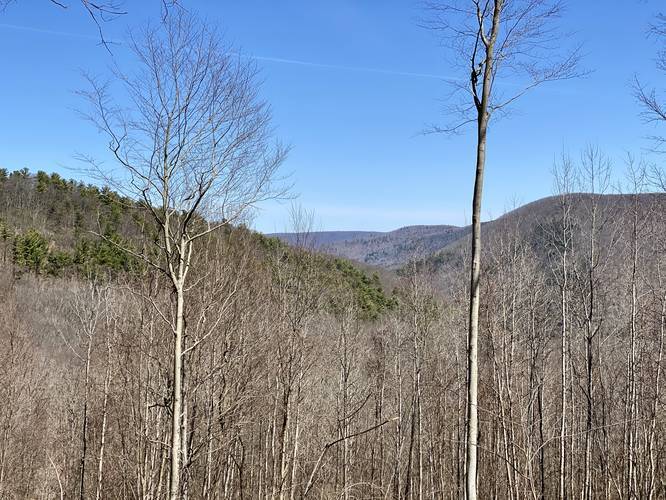
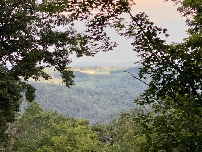
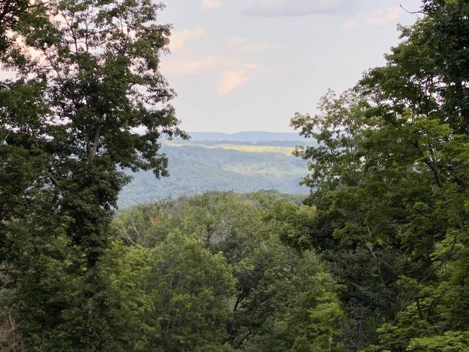
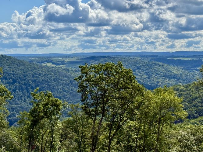
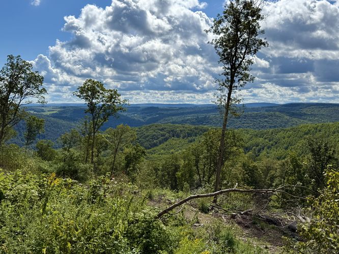
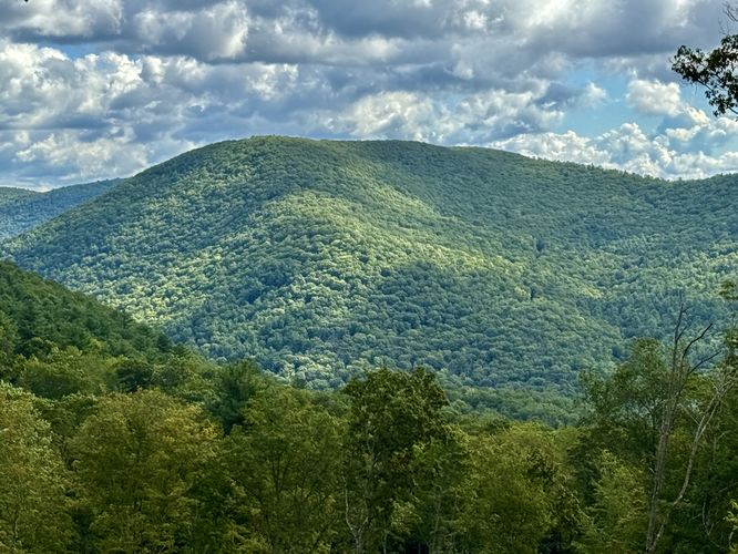
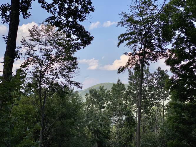
Once at the top of the mountain, hikers will find that the trees were cleared out around Winter 2020 and thus there's somewhat of an obstructed view of the Grand Canyon of Pennsylvania through the trees.
From the top of the mountain, the trail heads north and then west, running downhill along the mountainside. Eventually, the trail will reach a fork where this trail continues down and to the right - keep right at every junction after the mountain top and you'll follow the Bee Tree Hollow Trail.
Not long after the first turn, the trail becomes very overgrown since there has been almost no trail maintanance here in a very long time. The trail will head downhill, heading slightly northeast, before it's supposed to head due-north to hit the Bee Tree Ski Trail; however, the trail abruptly ends about 0.5-miles, or less, from the Bee Tree Ski Trail.
The hike back to parking is the same way you came in.
Parking
Hikers can find a small parking turnout at the coordinates provided.
Camping and Backpacking
Backpackers will find there are no designated campsites along this trail; however, off-trail/dispersed/backcountry/primitive camping is allowed at the state forest. Please follow all rules and regulations before planning to camp off of this trail.
Pets
Dogs are allowed if leashed.
Warning
This trail has been overgrown and not maintained near the Bee Tree Ski Trail and thus this trail no longer connects with that trail.
Obstructed Vista Point
Hikers will find obstructed views of the Grand Canyon of Pennsylvania around mile 0.75 where logging has occurred around the Winter of 2020.
Winter Road Conditions
Tioga State Forest does not maintain this road during the winter. Do not attempt driving on this road without proper equipment including snow tires and/or chains unless the road is clear. High wind storms may also cause trees to fall across the road, making the road impassible. If you plan to visit during the winter, plan accordingly.
This trail follows a service road for the majority of the hike. The trailhead is a yellow and black gate located near the parking space. This gate is sometimes opened during hunting season or when official-use vehicles need to use the road.
The trail winds up the mountain as it passes several offshoots for other logging roads; however, if you stay on the wide service road, you will follow the Bee Tree Hollow Trail the whole way.
Once at the top of the mountain, hikers will find that the trees were cleared out around Winter 2020 and thus there's somewhat of an obstructed view of the Grand Canyon of Pennsylvania through the trees.
From the top of the mountain, the trail heads north and then west, running downhill along the mountainside. Eventually, the trail will reach a fork where this trail continues down and to the right - keep right at every junction after the mountain top and you'll follow the Bee Tree Hollow Trail.
Not long after the first turn, the trail becomes very overgrown since there has been almost no trail maintanance here in a very long time. The trail will head downhill, heading slightly northeast, before it's supposed to head due-north to hit the Bee Tree Ski Trail; however, the trail abruptly ends about 0.5-miles, or less, from the Bee Tree Ski Trail.
The hike back to parking is the same way you came in.
Parking
Hikers can find a small parking turnout at the coordinates provided.
Camping and Backpacking
Backpackers will find there are no designated campsites along this trail; however, off-trail/dispersed/backcountry/primitive camping is allowed at the state forest. Please follow all rules and regulations before planning to camp off of this trail.
Pets
Dogs are allowed if leashed.
Warning
This trail has been overgrown and not maintained near the Bee Tree Ski Trail and thus this trail no longer connects with that trail.
Obstructed Vista Point
Hikers will find obstructed views of the Grand Canyon of Pennsylvania around mile 0.75 where logging has occurred around the Winter of 2020.
Winter Road Conditions
Tioga State Forest does not maintain this road during the winter. Do not attempt driving on this road without proper equipment including snow tires and/or chains unless the road is clear. High wind storms may also cause trees to fall across the road, making the road impassible. If you plan to visit during the winter, plan accordingly.