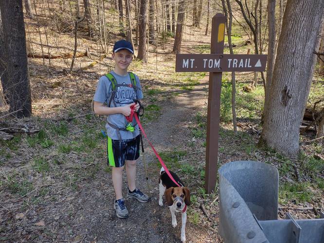
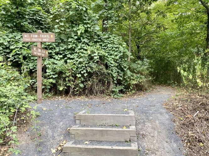
The Mt Tom Loop at Tioga State Forest near Wellsboro, Pennsylvania is a strenuous 3.6-mile loop trail that leads straight up a steep ridge to a stunning vista point near the summit of Mount Tom.
This hike is not meant for a beginner hiker as the easier route up to the top of Mount Tom (the Mt Tom Service Road) is a difficult hike at best. However, for experienced hikers, this mountain is a great climb with an additional very-steep trail that makes the hike strenuous, if that's what you're looking for.
Trails
This hike follows the Mt Tom Trail and the Mt Tom Service Road.
Trail Description (Sept. 2020 Reroute Update)
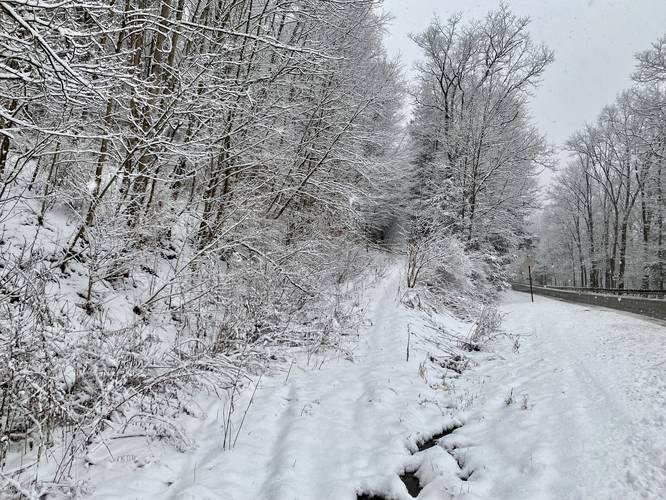
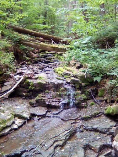
The hike starts out at the main parking lot at the Darling Run Access Area for the Pine Creek Trail - at the coordinates provided. The trailhead can be found at the backside of the upper parking lot. The trail heads up a small hill before crossing PA Route 362, following the signs and yellow blazes. The trail first leads into a ravine hollow before heading up a fairly steep hillside of Mt Tom that leads up to the service road. Within this ravine, before the rail meanders off, is a small 3-foot tall waterfall that cascades off of a large slate rock; however, since the trail was rerouted in 2020, hikers no longer pass this view-point of the waterfall anymore. Please use our Mt. Tom Falls guide for more information on how to reach this waterfall.
After 0.3-miles, the trail will reach the old Mt Tom Trail route, which as of September 2020 had sticks laid across the trail indicating to hikers that they should no longer venture in that direction. Hikers should stay left at this junction, following the yellow blazes until you reach a junction with the service road that leads up Mount Tom.
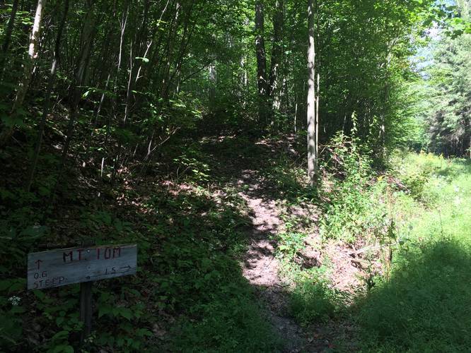
At the service road junction, the trail heads uphill and then hits another junction, after hiking uphill for approximately 100 to 200-feet. This junction has a sign showing the way to Mt Tom and the left-hand turn takes the steep route up -- this recording follows that steep trail to the top of Mount Tom, hence the rest of this trail description will be based on that route.
Upon reaching the junction where hikers can either take the steep route or the gradual route, this trail takes a left-hand turn and heads up the steep route for the grueling 0.6-mile climb. The climb to the top is terrible and includes multiple false summits. The only reference markers hikers have are two large shale rock formations off to the side of the trail. The first shale rock formation can be roughly used to gauge that you're half-way to the top. Once you hike to the second shale rock formation, you're nearly at the top of the hill. Take your time, take breaks, and do not rush to the top as this climb is extremely difficult.
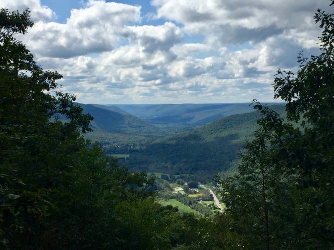
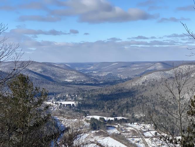
Once you reach the top of the mountain, hikers will take a left-hand turn to find a stunning vista point. The vista point faces due-west and gives hikers views of Pine Creek, Ansonia Valley and Gaines, Pennsylvania. While this view is not technically the main gorge section of the Grand Canyon of Pennsylvania, hikers will be able to see Pine Creek and the northern mountains that it carves through.
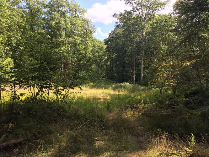
After visiting the vista point, hikers will now follow red blazes along the top of Mount Tom. This recording heads all the way east to the actual summit of Mount Tom and then reaches Mount Tom Lane before heading back. There's nothing to see at the actual summit for Mt Tom, so most hikers choose to skip out on visiting the summit or reaching Mount Tom Lane. To cut out 0.75-miles of this hike, hikers can look for the Mt Tom service road to head back down the mountain. Finding the service road is not straight forward due to a lack of signage; however, it's easy to find because it's the only section at the top of the mountain with a field -- go into the field and look for the service road that head down the mountain, you cannot miss it.
After making your way back down the service road, take a left-hand turn at the first trail junction and hike back down to the Darling Run parking area.
Difficulty, Mileage, and Elevation
This trail is not easy at all. Experienced hikers may find the steep trail very strenuous, so if you want an enjoyable hike, take the service road out-and-back and skip the steep section. Lastly, the mileage is closer to 3-miles total if you skip the Mt Tom summit and the Mount Tom Lane connector trail which runs west to east at the top of the mountain. The total elevation gain for this hike is over 1,100-feet so trekking poles are recommended.
Finding the Trailhead (Old route, pre-2020)
The trailhead can be found across the street from the Darling Run Parking Area for the Pine Creek Rail Trail -- at the coordinates provided on the map. Finding the trailhead is a bit difficult since there are no trailhead signs. Hikers must cross PA Route-362 and walk uphill along the street for about 100-feet until you reach yellow blazes marked on trees to your left-hand side -- this is the trailhead.
Vista Point
The one vista point along this hike is well worth the work to get to the top. From the lookout, hikers get a view of PA Route 6, the Ansonia Valley, Pine Creek, Gaines PA, and a glimpse into the mountains surrounding Galeton, PA. The view from the top is extra-rewarding if you head up the mountain along the steep trail.
Parking
Hikers can find parking at the Darling Run parking area for the Pine Creek Rail Trail -- at the coordinates provided. This parking lot can be fairly full on a weekend, but on a weekday is mostly empty. The parking lots have enough room to fit a few dozen vehicles.
Pets
Dogs are allowed if leashed and their waste must be carried out by the hiker.
Waterfall (Old route pre-2020)
There's a small 3-foot waterfall located in the ravine that leads up to Mount Tom. Hikers used to be able to find this waterfall within the first 0.3-miles of the trail before the new route was built in 2020. If you want to hike to this waterfall, please use our Mt. Tom Falls guide.
Camping
Camping is technically allowed off of this trail, but no designated campsites can be seen from the trail. Backpackers must be aware of the state forest's primitive camping rules before heading out. More information can be found on the park's site.
Foot Traffic Only
This trail is for foot-traffic only. If you wish to bike up Mt Tom, you can do so along the Mt Tom Service Road Trail.
Pine Creek Pinnacles (PCP20)
This hike is part of the Pine Creek Pinnacles hiking challenge. For more information, details, and FAQs, please visit our Pine Creek Pinnacles (PCP20) page.
This hike is not meant for a beginner hiker as the easier route up to the top of Mount Tom (the Mt Tom Service Road) is a difficult hike at best. However, for experienced hikers, this mountain is a great climb with an additional very-steep trail that makes the hike strenuous, if that's what you're looking for.
Trails
This hike follows the Mt Tom Trail and the Mt Tom Service Road.
Trail Description (Sept. 2020 Reroute Update)
The hike starts out at the main parking lot at the Darling Run Access Area for the Pine Creek Trail - at the coordinates provided. The trailhead can be found at the backside of the upper parking lot. The trail heads up a small hill before crossing PA Route 362, following the signs and yellow blazes. The trail first leads into a ravine hollow before heading up a fairly steep hillside of Mt Tom that leads up to the service road. Within this ravine, before the rail meanders off, is a small 3-foot tall waterfall that cascades off of a large slate rock; however, since the trail was rerouted in 2020, hikers no longer pass this view-point of the waterfall anymore. Please use our Mt. Tom Falls guide for more information on how to reach this waterfall.
After 0.3-miles, the trail will reach the old Mt Tom Trail route, which as of September 2020 had sticks laid across the trail indicating to hikers that they should no longer venture in that direction. Hikers should stay left at this junction, following the yellow blazes until you reach a junction with the service road that leads up Mount Tom.
At the service road junction, the trail heads uphill and then hits another junction, after hiking uphill for approximately 100 to 200-feet. This junction has a sign showing the way to Mt Tom and the left-hand turn takes the steep route up -- this recording follows that steep trail to the top of Mount Tom, hence the rest of this trail description will be based on that route.
Upon reaching the junction where hikers can either take the steep route or the gradual route, this trail takes a left-hand turn and heads up the steep route for the grueling 0.6-mile climb. The climb to the top is terrible and includes multiple false summits. The only reference markers hikers have are two large shale rock formations off to the side of the trail. The first shale rock formation can be roughly used to gauge that you're half-way to the top. Once you hike to the second shale rock formation, you're nearly at the top of the hill. Take your time, take breaks, and do not rush to the top as this climb is extremely difficult.
Once you reach the top of the mountain, hikers will take a left-hand turn to find a stunning vista point. The vista point faces due-west and gives hikers views of Pine Creek, Ansonia Valley and Gaines, Pennsylvania. While this view is not technically the main gorge section of the Grand Canyon of Pennsylvania, hikers will be able to see Pine Creek and the northern mountains that it carves through.
After visiting the vista point, hikers will now follow red blazes along the top of Mount Tom. This recording heads all the way east to the actual summit of Mount Tom and then reaches Mount Tom Lane before heading back. There's nothing to see at the actual summit for Mt Tom, so most hikers choose to skip out on visiting the summit or reaching Mount Tom Lane. To cut out 0.75-miles of this hike, hikers can look for the Mt Tom service road to head back down the mountain. Finding the service road is not straight forward due to a lack of signage; however, it's easy to find because it's the only section at the top of the mountain with a field -- go into the field and look for the service road that head down the mountain, you cannot miss it.
After making your way back down the service road, take a left-hand turn at the first trail junction and hike back down to the Darling Run parking area.
Difficulty, Mileage, and Elevation
This trail is not easy at all. Experienced hikers may find the steep trail very strenuous, so if you want an enjoyable hike, take the service road out-and-back and skip the steep section. Lastly, the mileage is closer to 3-miles total if you skip the Mt Tom summit and the Mount Tom Lane connector trail which runs west to east at the top of the mountain. The total elevation gain for this hike is over 1,100-feet so trekking poles are recommended.
Finding the Trailhead (Old route, pre-2020)
The trailhead can be found across the street from the Darling Run Parking Area for the Pine Creek Rail Trail -- at the coordinates provided on the map. Finding the trailhead is a bit difficult since there are no trailhead signs. Hikers must cross PA Route-362 and walk uphill along the street for about 100-feet until you reach yellow blazes marked on trees to your left-hand side -- this is the trailhead.
Vista Point
The one vista point along this hike is well worth the work to get to the top. From the lookout, hikers get a view of PA Route 6, the Ansonia Valley, Pine Creek, Gaines PA, and a glimpse into the mountains surrounding Galeton, PA. The view from the top is extra-rewarding if you head up the mountain along the steep trail.
Parking
Hikers can find parking at the Darling Run parking area for the Pine Creek Rail Trail -- at the coordinates provided. This parking lot can be fairly full on a weekend, but on a weekday is mostly empty. The parking lots have enough room to fit a few dozen vehicles.
Pets
Dogs are allowed if leashed and their waste must be carried out by the hiker.
Waterfall (Old route pre-2020)
There's a small 3-foot waterfall located in the ravine that leads up to Mount Tom. Hikers used to be able to find this waterfall within the first 0.3-miles of the trail before the new route was built in 2020. If you want to hike to this waterfall, please use our Mt. Tom Falls guide.
Camping
Camping is technically allowed off of this trail, but no designated campsites can be seen from the trail. Backpackers must be aware of the state forest's primitive camping rules before heading out. More information can be found on the park's site.
Foot Traffic Only
This trail is for foot-traffic only. If you wish to bike up Mt Tom, you can do so along the Mt Tom Service Road Trail.
Pine Creek Pinnacles (PCP20)
This hike is part of the Pine Creek Pinnacles hiking challenge. For more information, details, and FAQs, please visit our Pine Creek Pinnacles (PCP20) page.