Tully Mountain is located in Orange, Massachusetts on Mountain Rd and is a moderate 1.1-mile out-and-back hike that features beautiful vistas from Tully Mountain.
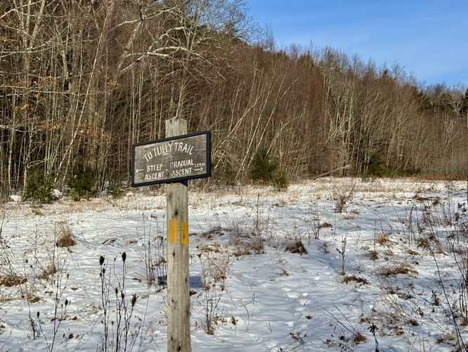
This track follows the Mountain Road Route Trail. The Mountain Road Route Trail's length is approximately 1.6 miles as a loop and should be considered moderate-to-difficult. The loop offers both a steep ascent (0.5-miles) and a gradual ascent (1.25-miles). The trailhead sign is located roughly 0.1-miles from the parking lot. The trail starts by the blue blazed tree, just beyond the northwest corner of the parking lot.
Steep Ascent
The steep ascent up Tully Mountain be considered moderate-to-difficult depending on skill level and the time of year. The trail is as steep, as many of its Western Mass counterparts like Mt Tom or Mt Norwottuck. During autumn, the leaves cover much of the already slick rock leading up the summit. Rain does not help during this time of year, so take your time and be cautious of the risks. Long and wide granite faces dominate much of the trail. The steepest portion of this trail is an elevation gain of about 200-feet over 0.25-miles.
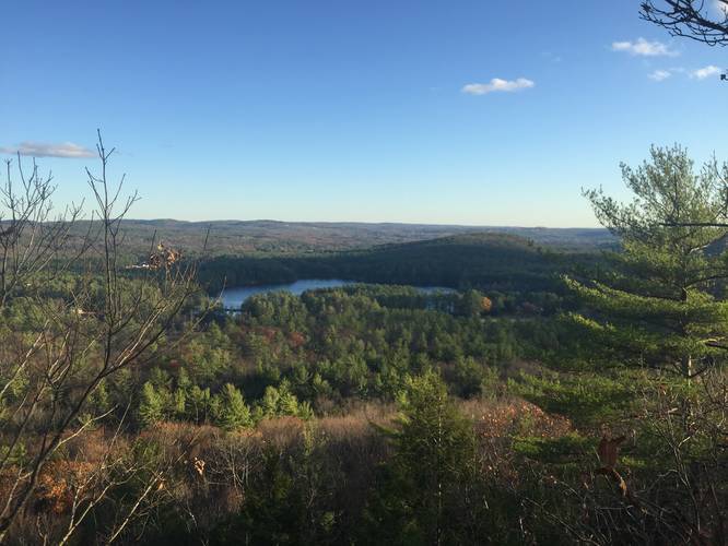
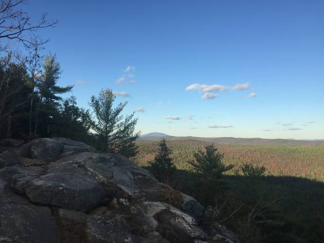
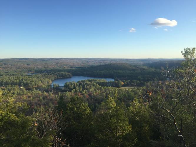
Summit
The summit is a beautiful eastern facing rocky outcrop. From here you can get a breathtaking view of Mt Monadnock, 16 miles north, and to the southeast, 22 miles away, lies Mt Wachusett. Below you are able to see the parking lot and easily hear voices as if they were much closer. Due east lies Tully Lake and Jacobs Hill.
Parking
Parking is available at the end of Mountain Road at the coordinates provided. Parking is free.
This track follows the Mountain Road Route Trail. The Mountain Road Route Trail's length is approximately 1.6 miles as a loop and should be considered moderate-to-difficult. The loop offers both a steep ascent (0.5-miles) and a gradual ascent (1.25-miles). The trailhead sign is located roughly 0.1-miles from the parking lot. The trail starts by the blue blazed tree, just beyond the northwest corner of the parking lot.
Steep Ascent
The steep ascent up Tully Mountain be considered moderate-to-difficult depending on skill level and the time of year. The trail is as steep, as many of its Western Mass counterparts like Mt Tom or Mt Norwottuck. During autumn, the leaves cover much of the already slick rock leading up the summit. Rain does not help during this time of year, so take your time and be cautious of the risks. Long and wide granite faces dominate much of the trail. The steepest portion of this trail is an elevation gain of about 200-feet over 0.25-miles.
Summit
The summit is a beautiful eastern facing rocky outcrop. From here you can get a breathtaking view of Mt Monadnock, 16 miles north, and to the southeast, 22 miles away, lies Mt Wachusett. Below you are able to see the parking lot and easily hear voices as if they were much closer. Due east lies Tully Lake and Jacobs Hill.
Parking
Parking is available at the end of Mountain Road at the coordinates provided. Parking is free.