The Jacobs Hill & Spirit Falls hike in Royalston, Massachusetts is a moderate 1.8 mile overlook and waterfall loop trail.
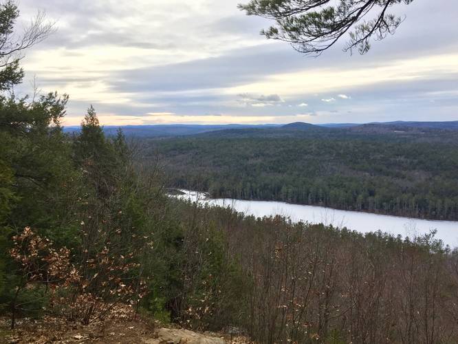
Jacobs Hill Overlook: The hike starts off along a white dot blazed trail which leads out to the yellow-blazed Tully Trail. When you reach the Tully Trail, head north (right-hand turn) and uphill towards the overlook. There's a small sign with an arrow towards the overlook - follow this about 50 feet to the overlook before heading back. At the overlook, you'll get views of Tully Mountain, Mount Grace, and the Berkshires in the distance. Just below Jacobs Hill overlook lies Long Pond and the east branch of the Tully River, which leads to Tully Lake.
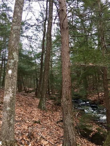
Spirit Falls: Spirit Falls can be found in the southwest corner of this recording along the slopes of this mountain ridge. After hitting Jacobs Hill Overlook, hike south along the yellow-blazed Tully Trail until you reach a large creek crossing. Don't cross the creek - look for red blazes that head downhill to the right-hand side of the creek. Follow the red blazes downhill to the multi-tiered Spirit Falls waterfall which spans about 150 feet down this hill. If you plan to hike to Spirit Falls by skipping the overlook, you can hike there easier by taking the white dot blazed trail out-and-back instead.
Hiking back from Spirit Falls is fairly simple. After hiking back uphill from Spirit Falls along the red blazes, head directly across the yellow-blazed Tully Trail and up a small hill along a trail with white dot blazes. Follow this white dot trail all the way back to parking - stay right at each trail junction.
Pets
Dogs are allowed on this trail if leashed and their waste must be carried out by the hiker.
Jacobs Hill Overlook: The hike starts off along a white dot blazed trail which leads out to the yellow-blazed Tully Trail. When you reach the Tully Trail, head north (right-hand turn) and uphill towards the overlook. There's a small sign with an arrow towards the overlook - follow this about 50 feet to the overlook before heading back. At the overlook, you'll get views of Tully Mountain, Mount Grace, and the Berkshires in the distance. Just below Jacobs Hill overlook lies Long Pond and the east branch of the Tully River, which leads to Tully Lake.
Spirit Falls: Spirit Falls can be found in the southwest corner of this recording along the slopes of this mountain ridge. After hitting Jacobs Hill Overlook, hike south along the yellow-blazed Tully Trail until you reach a large creek crossing. Don't cross the creek - look for red blazes that head downhill to the right-hand side of the creek. Follow the red blazes downhill to the multi-tiered Spirit Falls waterfall which spans about 150 feet down this hill. If you plan to hike to Spirit Falls by skipping the overlook, you can hike there easier by taking the white dot blazed trail out-and-back instead.
Hiking back from Spirit Falls is fairly simple. After hiking back uphill from Spirit Falls along the red blazes, head directly across the yellow-blazed Tully Trail and up a small hill along a trail with white dot blazes. Follow this white dot trail all the way back to parking - stay right at each trail junction.
Pets
Dogs are allowed on this trail if leashed and their waste must be carried out by the hiker.