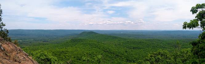
The Mount Norwottuck & Horse Caves Trail is a 4 mile loop that starts and ends at The Notch nature center in Amherst, Massachusetts. Mount Norwottuck is the tallest mountain along the Holyoke range and features stunning views of Amherst and Sunderland to the north, along with views of Belchertown and Granby to the east and south.
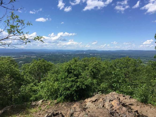
This hike starts along the trail with blue/red/white blazes until it splits off to just follow the white blazes along the M&M trail. Following this route along the white blazes will first bring you to the top of Mount Norwottuck. You'll know you're at the top when you see the sweeping views of Amherst and Sunderland - there's also a plaque embedded on the summit.
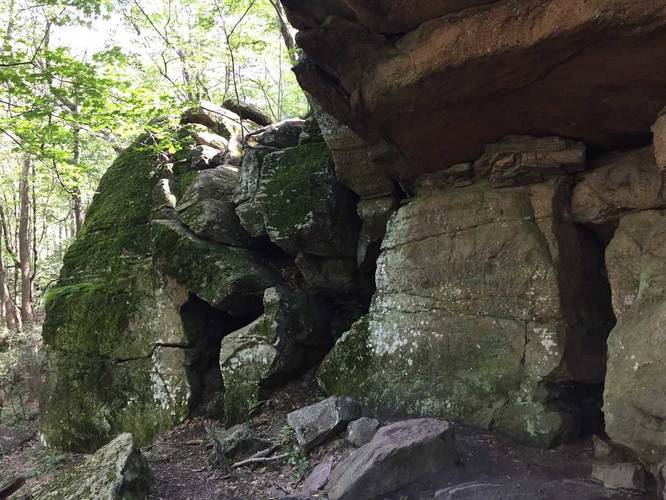
Continue on from the summit by heading south along the trail. Just before heading down from the summit, there's another overlook point on the eastern side of the summit with views of Long Mountain, Belchertown, and parts of Granby, Massachusetts. After stopping at this 2nd overlook, head down the eastern side of the mountain for about 0.4 miles to the Horse Caves. The Horse Caves is a massive ledge that runs along the eastern base of Mount Norwottuck.
After visiting the Horse Caves, continue following the white blazes, but stay left at the next trail junction to follow the red blazes. Once you see red blazes, follow those all the way back to the initial junction where the white blazes (M&M Trail) turned off from the red/white. From there, turn right onto the white blaze trail to head directly back to parking.
This trail is moderate-to-hard and is easily completed in about 2 hours. If you're looking to just see the Horse Caves and don't want the elevation gain of Mount Norwottuck, head along the red blaze trail on the north portion of this loop for an easier hike.
This hike starts along the trail with blue/red/white blazes until it splits off to just follow the white blazes along the M&M trail. Following this route along the white blazes will first bring you to the top of Mount Norwottuck. You'll know you're at the top when you see the sweeping views of Amherst and Sunderland - there's also a plaque embedded on the summit.
Continue on from the summit by heading south along the trail. Just before heading down from the summit, there's another overlook point on the eastern side of the summit with views of Long Mountain, Belchertown, and parts of Granby, Massachusetts. After stopping at this 2nd overlook, head down the eastern side of the mountain for about 0.4 miles to the Horse Caves. The Horse Caves is a massive ledge that runs along the eastern base of Mount Norwottuck.
After visiting the Horse Caves, continue following the white blazes, but stay left at the next trail junction to follow the red blazes. Once you see red blazes, follow those all the way back to the initial junction where the white blazes (M&M Trail) turned off from the red/white. From there, turn right onto the white blaze trail to head directly back to parking.
This trail is moderate-to-hard and is easily completed in about 2 hours. If you're looking to just see the Horse Caves and don't want the elevation gain of Mount Norwottuck, head along the red blaze trail on the north portion of this loop for an easier hike.