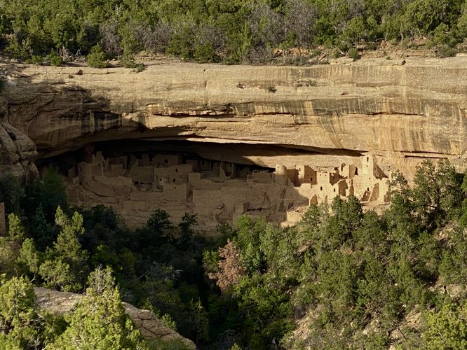
The Sun Temple & Cliff Palace View at Mesa Verde National Park, Colorado is an easy 0.1-mile loop trail that features an ancient Puebloan temple and leads to an overlook that peers into the Cliff Palace alcove dwelling from across Cliff Canyon.
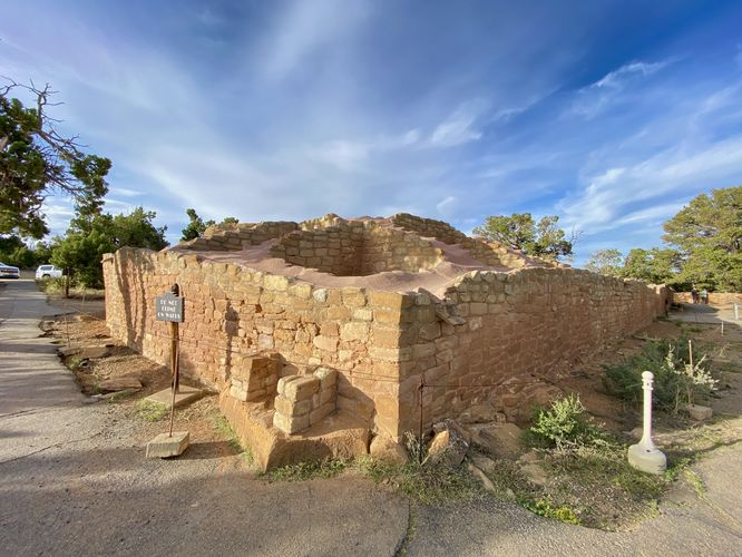
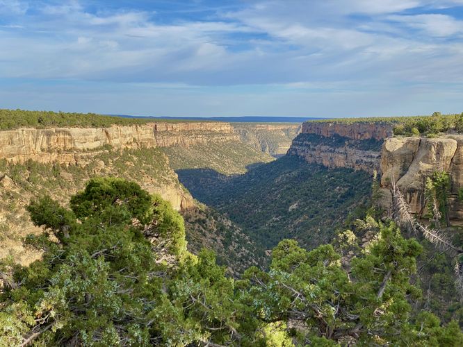
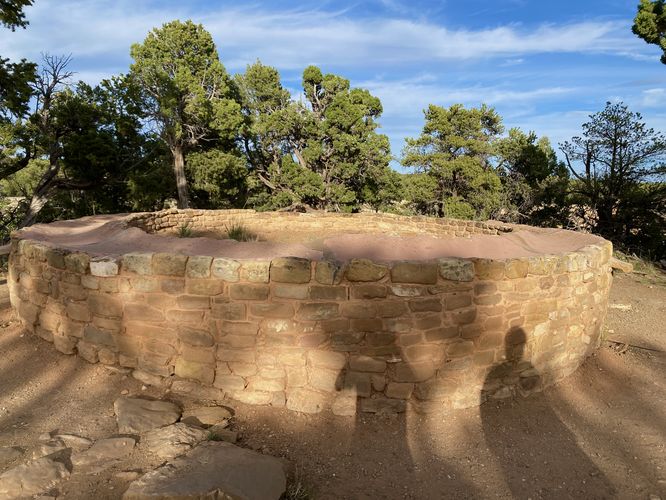
This is not a hike but rather a very short walk that leads around the Sun Temple complex. Visitors will find the large ancient rectangular stone structure that was built sometime in 1200 CE. When walking along the southern end of the trail, it will run along a cliff edge high above Cliff Canyon, which provides views south-facing down the canyon. On the eastern side of the complex is a circular structure that was somehow related to the main building -- both buildings have had much speculation, but have not been fully determined what purposed they served. The trail than leads north to reach an overlook of the Cliff Palace which sits across Cliff Canyon. The trail then leads back to the parking area to complete this very short 0.1-mile loop.
Universal Access
This is a paved and universally-accessible pathway as of June 2024.
What was the Sun Temple's Purpose?
From the park's interpretive sign: Sun Temple is a never-ending source of speculation for scholars and visitors alike. It was built sometime in the 1200s, and was part of the community of cliff dwellings that surrounded it. Its D-shaped outline; no evidence of roofing; few doors or household artifacts: and massive architecture is unlike any other structure in the park. Of the few similar D-shaped buildings found in the region, it is the only one not built within a pueblo. Could it have had social, ritual, or even symbolic functions? Some studies suggest it had a role in celestial observations.
Parking
Visitors will find a parking lot at the coordinates provided along Mesa Top Loop Road in the park. As of June 2024, the lot is large enough to fit approximately a dozen vehicles.
Pets
Dogs are allowed on this trail and must be cleaned and cleaned up after. Dogs are allowed on paved trails including the Park Point Trail and the Mesa Top Loop Sites including: The Navajo Canyon Overlook, Square Tower House Overlook Trail, Pithouses & Pueblos Loop, Mesa Top Sites Trail, Sun Point Pueblo, Sun Point View, Oak Tree House View, Fire Temple & New Fire House View, and the Sun Temple & Cliff Palace View.
Warning
Steep cliffs: This trail leads out to tall and steep cliffs.