The Park Point Trail at Mesa Verde National Park near Mancos, Colorado is a moderate 0.4-mile out-and-back hike that features two overlooks with views of the mesa, Ute Mountain, and the Montezuma Valley from the park's highest point at ~8,572-feet.
Hike
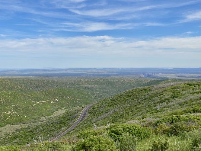
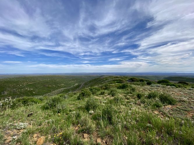
This short hike begins at the main trailhead for Park Point and the Park Point Trail. The trail heads uphill right off the bat and follows a fairly steep grade for a paved and universally-accessible pathway. If you haven't fully acclimatized to Colorado's high elevation, hiking this trail may slow you down as breathing is certainly harder at 8,500-feet. The trail eventually levels out once you reach the top of the hill near the fire tower before descending back downhill to reach the overlooks. This route heads toward the norther viewpoint first, which I found to be the better of the two lookouts.
North Overlook - Mile 0.15
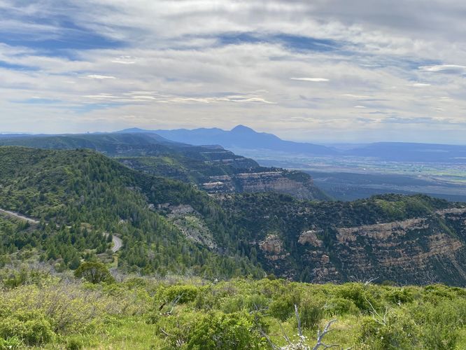
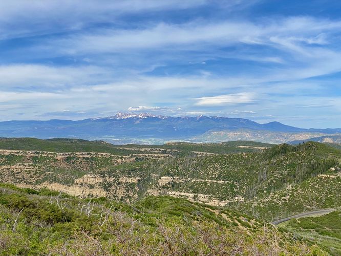
Around mile 0.15, hikers will reach the northern-most overlook at Park Point. This view features the northern slopes of Mesa Verde as it stretches down into the Mancos Valley, views of Ute Mountain in the distance, and snow-capped mountains far to the north and northeast.
Fire Lookout - Mile 0.2
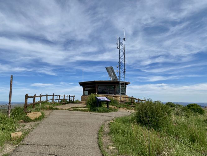
After taking in the views at the northern lookout, hikers will head back the way they came in, passing the Fire Lookout around mile 0.2 to reach the southern overlook. You can read more about the fire lookout from interpretive signs on-trail.
South Overlook - Mile 0.25
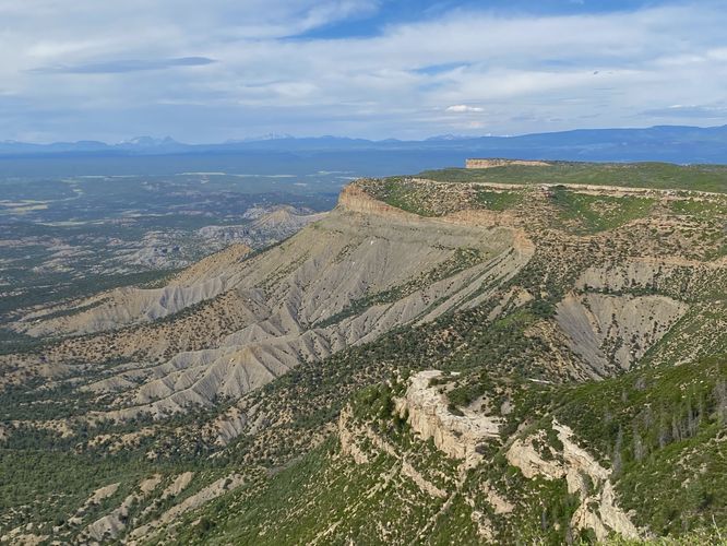
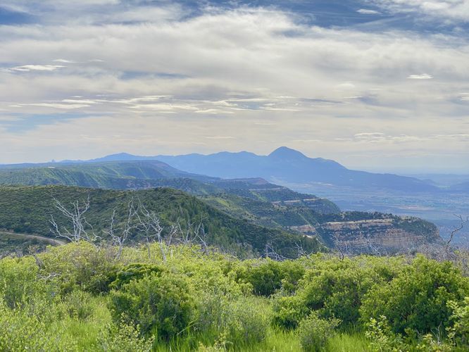
Around mile 0.25, hikers will reach the southern-most overlook at Park Point. This overlook provides similar views as the northern overlook, but this one includes views south into the mesa's lush landscape. These expansive views are difficult to capture in photos, but in-person it's significantly more impressive as you can see for hundreds of miles into southern Colorado, New Mexico, and Arizona.
After exploring both views, the walk out follows the same trail. Just head down the hill and back to parking to complete this short 0.4-mile out-and-back hike to Mesa Verde's highest point.
Universal Access
This trail follows a paved and universally-accessible pathway throughout the entire length. Note that the trail has a steeper elevation grade from the trailhead up to the fire lookout.
Parking
Hikers will find a parking lot at the coordinates provided, located along Park Point Road at the park. As of June 2024, the turnout is large enough to fit over a dozen vehicles.
Pets
Dogs are allowed on this trail only if leashed and cleaned up after. Dogs are allowed on paved trails including the Park Point Trail and the Mesa Top Loop Sites including: The Navajo Canyon Overlook, Square Tower House Overlook Trail, Pithouses & Pueblos Loop, Mesa Top Sites Trail, Sun Point Pueblo, Sun Point View, Oak Tree House View, Fire Temple & New Fire House View, and the Sun Temple & Cliff Palace View.
Warning
Rattlesnakes: Mesa Verde is home to rattlesnakes that might be out basking in the sun during warm months. While encounters are rare, give any rattlers you find plenty of space.
Sun exposure: Due to the lack of trees and shade, this trail has a high exposure to the sun and weather. Plan to bring sunscreen to protect yourself against high UVs.
Hike
This short hike begins at the main trailhead for Park Point and the Park Point Trail. The trail heads uphill right off the bat and follows a fairly steep grade for a paved and universally-accessible pathway. If you haven't fully acclimatized to Colorado's high elevation, hiking this trail may slow you down as breathing is certainly harder at 8,500-feet. The trail eventually levels out once you reach the top of the hill near the fire tower before descending back downhill to reach the overlooks. This route heads toward the norther viewpoint first, which I found to be the better of the two lookouts.
North Overlook - Mile 0.15
Around mile 0.15, hikers will reach the northern-most overlook at Park Point. This view features the northern slopes of Mesa Verde as it stretches down into the Mancos Valley, views of Ute Mountain in the distance, and snow-capped mountains far to the north and northeast.
Fire Lookout - Mile 0.2
After taking in the views at the northern lookout, hikers will head back the way they came in, passing the Fire Lookout around mile 0.2 to reach the southern overlook. You can read more about the fire lookout from interpretive signs on-trail.
South Overlook - Mile 0.25
Around mile 0.25, hikers will reach the southern-most overlook at Park Point. This overlook provides similar views as the northern overlook, but this one includes views south into the mesa's lush landscape. These expansive views are difficult to capture in photos, but in-person it's significantly more impressive as you can see for hundreds of miles into southern Colorado, New Mexico, and Arizona.
After exploring both views, the walk out follows the same trail. Just head down the hill and back to parking to complete this short 0.4-mile out-and-back hike to Mesa Verde's highest point.
Universal Access
This trail follows a paved and universally-accessible pathway throughout the entire length. Note that the trail has a steeper elevation grade from the trailhead up to the fire lookout.
Parking
Hikers will find a parking lot at the coordinates provided, located along Park Point Road at the park. As of June 2024, the turnout is large enough to fit over a dozen vehicles.
Pets
Dogs are allowed on this trail only if leashed and cleaned up after. Dogs are allowed on paved trails including the Park Point Trail and the Mesa Top Loop Sites including: The Navajo Canyon Overlook, Square Tower House Overlook Trail, Pithouses & Pueblos Loop, Mesa Top Sites Trail, Sun Point Pueblo, Sun Point View, Oak Tree House View, Fire Temple & New Fire House View, and the Sun Temple & Cliff Palace View.
Warning
Rattlesnakes: Mesa Verde is home to rattlesnakes that might be out basking in the sun during warm months. While encounters are rare, give any rattlers you find plenty of space.
Sun exposure: Due to the lack of trees and shade, this trail has a high exposure to the sun and weather. Plan to bring sunscreen to protect yourself against high UVs.