Located on the northern end of the PA Grand Canyon (Pine Creek Gorge) sit the steep slopes of Mt. Tom where Marsh Creek merges with Pine Creek, sending water flowing through the Grand Canyon of Pennsylvania down toward the Susquehanna River. In 2025, new logging efforts in Tioga State Forest opened up views on Mt. Tom on its southwestern slope, exposing beatiful views of Pine Creek and a view directly into the gorge.
This short, but difficult hike leads up to the Pine Creek Gorge View on Mt. Tom where you'll find great views of the gorge and Pine Creek.
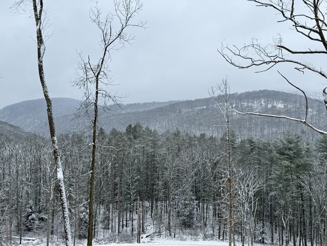
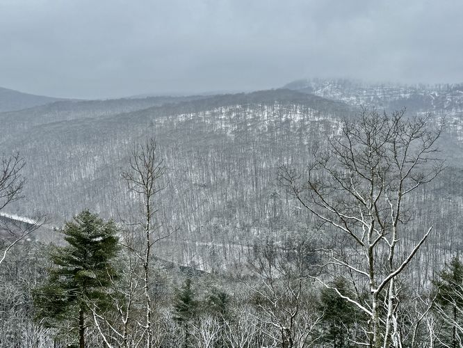
As the trail ascends, the steep grade begins to reveal views into the PA Grand Canyon, especially the recently (2025) logged slopes of the Ansonia Knob, which is another great hike in the area, the back slopes of Barbour Rock, and the steep evergreen-lined slopes of the East Rim Vista above Pinafore Run.
Steep grade: This hike follows a very steep grade as it ascends to the viewpoints. While the hike is very short, hikers should be aware of the steep slopes, loose soil, and potential slipping hazards during the winter.
This short, but difficult hike leads up to the Pine Creek Gorge View on Mt. Tom where you'll find great views of the gorge and Pine Creek.
Hike to the Pine Creek Gorge View on Mt. Tom
This hike begins along PA-362 at the coordinates provided where you'll find a logging path (new as of 2025) that leads up the slopes of the mountain from the main road. As you follow the log cut, it begins to ascend the mountain at a fairly steep grade but eventually reaches viewpoints into the Grand Canyon of Pennsylvania. During the winter, especially with snow on the ground, the logging path can be extremely slippery so ice spikes are recommended. During warmer seasons, the loose dirt from the exposed mountainside will likely a slipping hazard as well.As the trail ascends, the steep grade begins to reveal views into the PA Grand Canyon, especially the recently (2025) logged slopes of the Ansonia Knob, which is another great hike in the area, the back slopes of Barbour Rock, and the steep evergreen-lined slopes of the East Rim Vista above Pinafore Run.
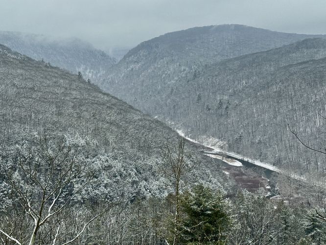
Pine Creek Gorge View - Mile 0.2
Finally, after slowly ascending the steep mountainside, the trail will lead back into the forest where the edge of the clear cut exposes the best view of Pine Creek Gorge (PA Grand Canyon). While the view will change with the seasons, during the winter, hikers and visitors have the best view of Pine Creek as it slips through the gorge below your feet. Note that during warmer months, the leaves on the trees will obstruct some views of Pine Creek from this viewpoint.Quick Hike to Parking - Mile 0.2 to 0.4
After enjoying the views, the hike leads back down the steep slopes to reach the parking for a short, but difficult 0.4 mile out-and-back hike. Watch your step on the way down the mountain!Parking
Hikers will find no designated parking lot for this hike but rather a small parking turnout located on the logging road at the coordinates provided (41.730773, -77.425399). The logging road is closed to vehicles, but pulling over at the road's entrance located right off of PA-362 should not be an issue - just ensure there's enough room for authorized vehicles to pass. The logging road turnout provides only enough room for one vehicle, so plan accordingly. Alternatively, you can likely reach this viewpoint by hiking up the Mt. Tom Service Road, skip the turn to the summit, and head south to meet up with this logging road.Pets
Dogs are allowed only if leashed and must be cleaned up after.Camping & Backpacking
Off-trail / dispersed / primitive camping is permitted in Tioga State Forest and this area falls into those rules; however, the slopes of Mt. Tom are steep here and as such there isn't a great place to set up camp without a hammock. Do not camp on the logging road itself. Please follow all rules and regulations.Warning
Timber Rattlesnakes: This area is home to the Timber Rattlesnake which can be found roaming the forest floors between April and October each year. While they're more rare to find on the northern end of the PA Grand Canyon, they could be anywhere and especially in open sunny spots where they like to bask. Be on the lookout and give any rattlers you find plenty of space.Steep grade: This hike follows a very steep grade as it ascends to the viewpoints. While the hike is very short, hikers should be aware of the steep slopes, loose soil, and potential slipping hazards during the winter.