This Mt. Nessmuk hike at Tioga State Forest near Wellsboro, Pennsylvania is a moderate 6.3-mile out-and-back trek atop Mount Nessmuk that passes the summit and leads out to a beautiful vista point above PA Route 6.
Trails
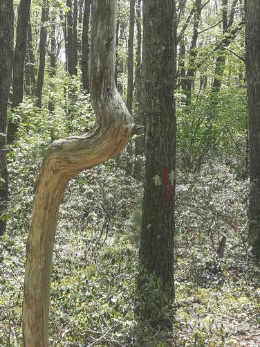
This hike follows two trails: Stone Trail (yellow blazes), unnamed trail (red blazes).
Trail Description
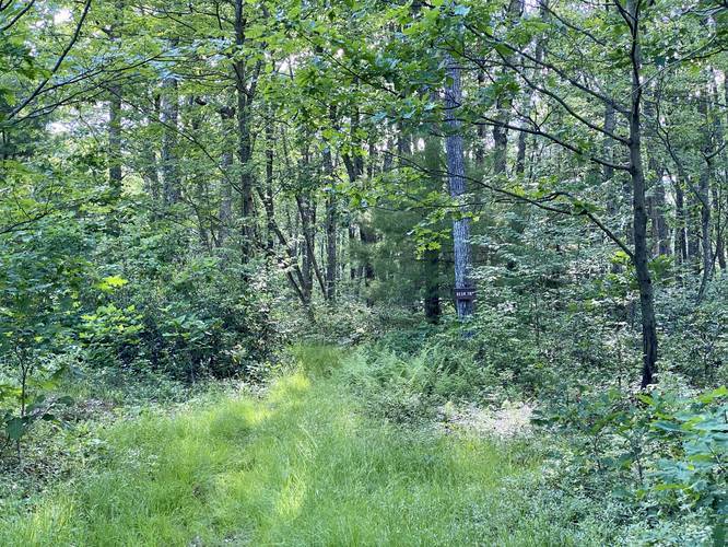
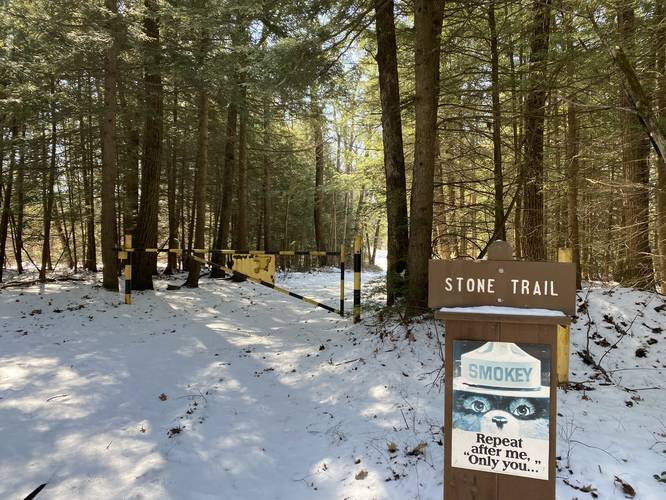
This hike begins at the trailhead for the Stone Trail at Tioga State Forest along Baldwin Run Road. The Stone Trail is a yellow blazed trail passes several other trails as it runs the length of Mt. Nessmuk.
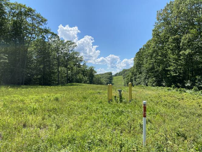
While this trail does not have much to note, hikers will pass plenty of mountain laurel, blueberry bushes, and other mountaintop low-growing bushes. The only other noteworthy point of interest along the trail is the natural gas pipeline that cuts its way across the mountain top. Hikers can get interesting views of the rolling hills along the pipeline. For those who are used to hiking around Pittsburgh, PA - this sight is familiar as most of the landscape near that area looks very similar within pipelines, powerlines, and clear-cuts areas.
During this hike, in late June, 2020, the mountain laurel were in full bloom and the blueberries were just starting to pop. The trail will undulate slightly as it runs the mountain top out to the first real trail junction that hikers must note.
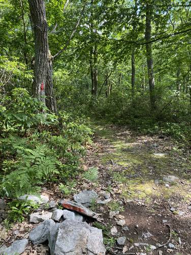
After approximately 1.9-miles of hiking down the Stone Trail, the Stone Trail takes a left-hand turn and begins following orange blazes (or orange-tinted yellow blazes). At the junction, to the right-hand side, is a red blazed trail (with no name as of June, 2020) -- hikers will want to follow this red blazed trail. From here, the hike heads a bit more downhill and again undulates for a little over 1-mile before reaching the vista point.
This part of the trail is more narrow and has plenty of rocks, roots, and small tree stumps to trip or roll your ankles on. Plenty of the trail is covered in leaves which makes spotting these uneven rocks and roots almost impossible. While this part of the trail is not terrible, it can be a bit annoying to walk through.
Mount Nessmuk Summit - Mile 2.9
Around mile 2.9, hikers will reach the Mt. Nessmuk summit. This summit has nothing noteworthy and without checking an offline GPS map, hikers would likely never know they passed the summit.
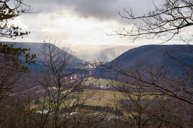
Reaching the Mt. Nessmuk Vista - Mile 3.15
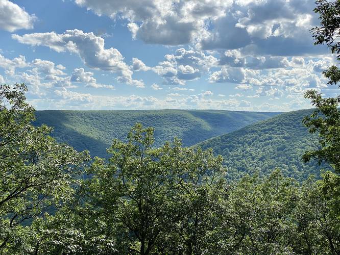
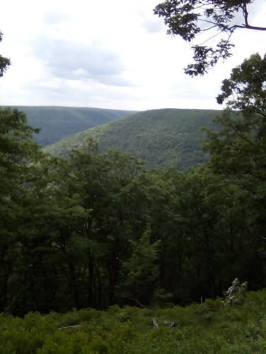
Not long after passing Mount Nessmuk summit, approximately 3.15-miles into the hike, the trail ends at a mountain top vista that faces southwest. Hikers can get a glimpse of PA Route 6 - while slightly difficult to see - and the surrounding mountains. To the right - and immediately straight ahead of the vista - is another mountain top within Tioga State Forest that boasts the Hoadley Vista. To the left are the steep slopes of Mount Tom (mostly only visible during the colder months when leaves are off of the trees), and down in the valley are the villages of Asaph and Ansonia, Pennsylvania. Note that the view during the Winter (and cold months), is more open and provides more to look at.
Trail Junctions
This trail passes several trails along the way. The mileage is based on the GPS track provided:
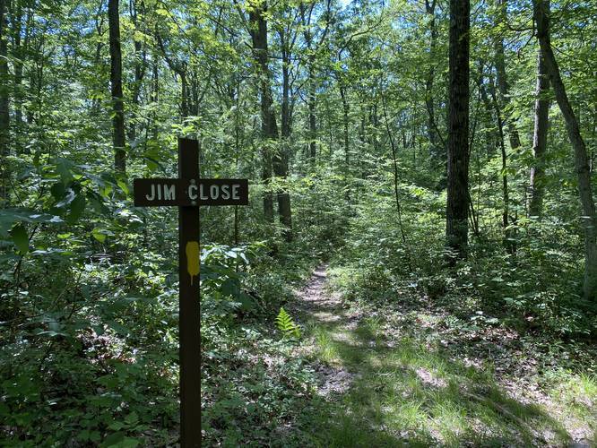
Jim Close Trail - mile 0.1
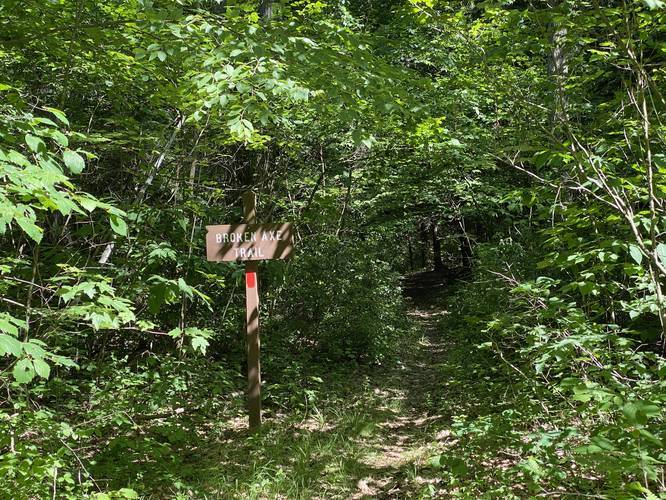
Broken Axe Trail - mile 0.35
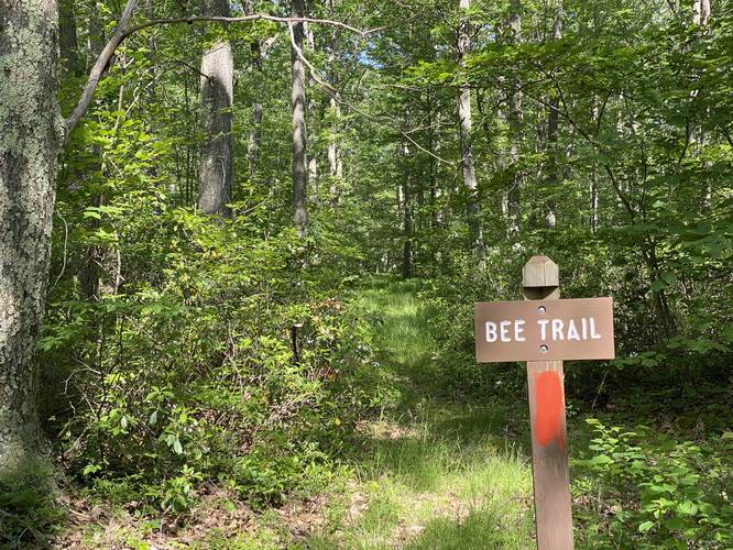
Bee Trail - mile 1.3
Deer Trail - mile 1.38
Parking
Hikers will find a small parking turnout next to the trailhead for the Stone Trail. Do not block the yellow gate.
Camping and Backpacking
While there are no designated campsites along this hike, backpackers can setup camp off of the trail if they follow the Tioga State Forest rules. If you plan to camp, please leave no trace.
Pets
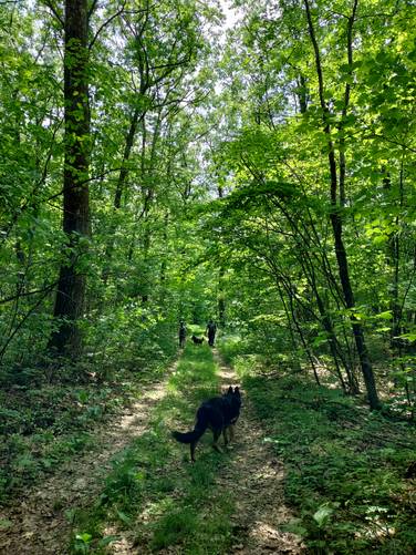
Dogs are allowed if leashed.
Warnings
Timber Rattlesnake habitat: At the end of this trail is a nice vista, but the view point likely exists to help the native Timber Rattlesnake thrive. Most of these remote vistas on mountain sides provide sunbathing spots for rattlesnakes during the day, so there's likely a den nearby as well. It's advised to avoid this area between the end of April to early October to reduce chances of encountering a rattlesnake, unless the hiker comes prepared.
Who is/was Nessmuk?
'Nessmuk' was the pen name for a George Washington Sears (1821 - 1890). Sears was a sports writer for Forest and Stream magazine during the 1800's. His self-guided canoe tours of the Adirondacks became very popular - mostly based on solo, lightweight canoe trips. Today these are known as ultralight backpacking or portage treks. Canoeing became popular during the 1860's but canoe tours required heavy canoes and a tour guide, so Nessmuk's tours became a hit among outdoor adventurers. Sears grew up in South Oxford (now Webster), Massachusetts and later in life moved to Wellsboro, Pennsylvania where he lived the rest of his life. Mount Nessmuk (this mountain), just north of Route 6 in Wellsboro Pennsylvania is named after him. For another Wellsboro Nessmuk hike, check out our Nickel Run Falls and Nessmuk's Winter Camp guide.
Pine Creek Pinnacles (PCP20)
This hike is part of the Pine Creek Pinnacles hiking challenge. For more information, details, and FAQs, please visit our Pine Creek Pinnacles (PCP20) page.
Trails
This hike follows two trails: Stone Trail (yellow blazes), unnamed trail (red blazes).
Trail Description
This hike begins at the trailhead for the Stone Trail at Tioga State Forest along Baldwin Run Road. The Stone Trail is a yellow blazed trail passes several other trails as it runs the length of Mt. Nessmuk.
While this trail does not have much to note, hikers will pass plenty of mountain laurel, blueberry bushes, and other mountaintop low-growing bushes. The only other noteworthy point of interest along the trail is the natural gas pipeline that cuts its way across the mountain top. Hikers can get interesting views of the rolling hills along the pipeline. For those who are used to hiking around Pittsburgh, PA - this sight is familiar as most of the landscape near that area looks very similar within pipelines, powerlines, and clear-cuts areas.
During this hike, in late June, 2020, the mountain laurel were in full bloom and the blueberries were just starting to pop. The trail will undulate slightly as it runs the mountain top out to the first real trail junction that hikers must note.
After approximately 1.9-miles of hiking down the Stone Trail, the Stone Trail takes a left-hand turn and begins following orange blazes (or orange-tinted yellow blazes). At the junction, to the right-hand side, is a red blazed trail (with no name as of June, 2020) -- hikers will want to follow this red blazed trail. From here, the hike heads a bit more downhill and again undulates for a little over 1-mile before reaching the vista point.
This part of the trail is more narrow and has plenty of rocks, roots, and small tree stumps to trip or roll your ankles on. Plenty of the trail is covered in leaves which makes spotting these uneven rocks and roots almost impossible. While this part of the trail is not terrible, it can be a bit annoying to walk through.
Mount Nessmuk Summit - Mile 2.9
Around mile 2.9, hikers will reach the Mt. Nessmuk summit. This summit has nothing noteworthy and without checking an offline GPS map, hikers would likely never know they passed the summit.
Reaching the Mt. Nessmuk Vista - Mile 3.15
Not long after passing Mount Nessmuk summit, approximately 3.15-miles into the hike, the trail ends at a mountain top vista that faces southwest. Hikers can get a glimpse of PA Route 6 - while slightly difficult to see - and the surrounding mountains. To the right - and immediately straight ahead of the vista - is another mountain top within Tioga State Forest that boasts the Hoadley Vista. To the left are the steep slopes of Mount Tom (mostly only visible during the colder months when leaves are off of the trees), and down in the valley are the villages of Asaph and Ansonia, Pennsylvania. Note that the view during the Winter (and cold months), is more open and provides more to look at.
Trail Junctions
This trail passes several trails along the way. The mileage is based on the GPS track provided:
Jim Close Trail - mile 0.1
Broken Axe Trail - mile 0.35
Bee Trail - mile 1.3
Deer Trail - mile 1.38
Parking
Hikers will find a small parking turnout next to the trailhead for the Stone Trail. Do not block the yellow gate.
Camping and Backpacking
While there are no designated campsites along this hike, backpackers can setup camp off of the trail if they follow the Tioga State Forest rules. If you plan to camp, please leave no trace.
Pets
Dogs are allowed if leashed.
Warnings
Timber Rattlesnake habitat: At the end of this trail is a nice vista, but the view point likely exists to help the native Timber Rattlesnake thrive. Most of these remote vistas on mountain sides provide sunbathing spots for rattlesnakes during the day, so there's likely a den nearby as well. It's advised to avoid this area between the end of April to early October to reduce chances of encountering a rattlesnake, unless the hiker comes prepared.
Who is/was Nessmuk?
'Nessmuk' was the pen name for a George Washington Sears (1821 - 1890). Sears was a sports writer for Forest and Stream magazine during the 1800's. His self-guided canoe tours of the Adirondacks became very popular - mostly based on solo, lightweight canoe trips. Today these are known as ultralight backpacking or portage treks. Canoeing became popular during the 1860's but canoe tours required heavy canoes and a tour guide, so Nessmuk's tours became a hit among outdoor adventurers. Sears grew up in South Oxford (now Webster), Massachusetts and later in life moved to Wellsboro, Pennsylvania where he lived the rest of his life. Mount Nessmuk (this mountain), just north of Route 6 in Wellsboro Pennsylvania is named after him. For another Wellsboro Nessmuk hike, check out our Nickel Run Falls and Nessmuk's Winter Camp guide.
Pine Creek Pinnacles (PCP20)
This hike is part of the Pine Creek Pinnacles hiking challenge. For more information, details, and FAQs, please visit our Pine Creek Pinnacles (PCP20) page.