The Montezuma Overlook at Mesa Verde National Park near Cortez,
Colorado is an easy 0.1-mile out-and-back trail
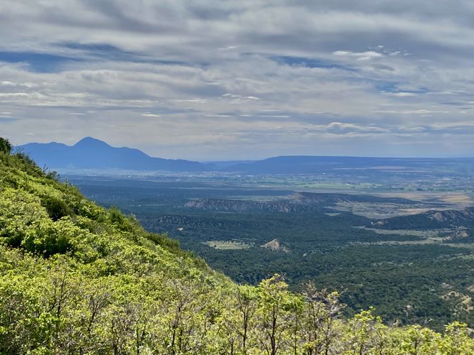
that features views of Ute Mountain in the distance, Mesa Verde's northern slopes, and leads to a dead end where the park's original road used to run.
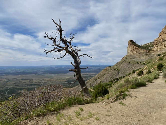
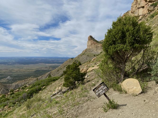
This very short walk begins at the main parking lot for the Montezuma Overlook and follows the paved sidewalk over to the main view. Visitors who need an accessible trail will find one that leads to the east and up to a viewing platform with a picnic table, as of June 2024. This route follows the dirt path that leads north along a long-lost park road -- now known as the Knife Edge Trail. For hikers looking to explore the Knife Edge, you can do so by hiking the Knife Edge Trail, located at the Morefield Campground as this section of the old road is too dangerous, hence the dead end.
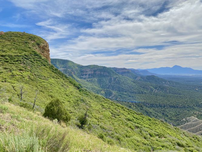
From the overlook, you'll find Ute Mountain located to the west and the green landscape of Mesa Verde's northern slopes as it extends downward into the Montezuma Valley below.
Universal Access
This trail follows a paved and universally-accessible pathway for a portion of the length. Note that to walk out further, the trail turns to a dirt path where the pavement does not connect for an accessible pathway. You can enjoy similar views from the Montezuma Overlook from the paved section of trail; however.
History of the Knife Edge Trail / Road
As translated from the historical sign on-trail: "A traveler in 1892 described a trail on the ridge before you as the Crinkly Edge Trail. In 1911, just five years after the park was established, the trail became the Knife Edge Road, a new section of the main park road. Although scenic, the road was narrow and steep, and the instability of the soil made it difficult to maintain. Two years later, the park built a bypass through Morefield and Prater Canyons. When the first automobile trip was made in 1914, vehicles used the bypass and the Knife Edge Road was soon closed. The scenic value of the Knife Edge Road prompted the park to reopen it in 1924, replacing the longer bypass. Although it continued to challenge road crews for the next 30 years, it remained in use until 1957 when the Morefield-Prater tunnel was completed."
Parking
Visitors will find a parking lot at the coordinates provided, located along the Mesa Verde entrance road. As of June 2024, the turnout is large enough to fit about a dozen vehicles.
Pets
Dogs are not allowed on this trail. Dogs are allowed on paved trails including the Park Point Trail and the Mesa Top Loop Sites including: The Navajo Canyon Overlook, Square Tower House Overlook Trail, Pithouses & Pueblos Loop, Mesa Top Sites Trail, Sun Point Pueblo, Sun Point View, Oak Tree House View, Fire Temple & New Fire House View, and the Sun Temple & Cliff Palace View.
Warning
Rattlesnakes: Mesa Verde is home to rattlesnakes that might be out basking in the sun during warm months. While encounters are rare, give any rattlers you find plenty of space.
Sun exposure: Due to the lack of trees and shade, this trail has a high exposure to the sun and weather. Plan to bring sunscreen to protect yourself against high UVs.
This very short walk begins at the main parking lot for the Montezuma Overlook and follows the paved sidewalk over to the main view. Visitors who need an accessible trail will find one that leads to the east and up to a viewing platform with a picnic table, as of June 2024. This route follows the dirt path that leads north along a long-lost park road -- now known as the Knife Edge Trail. For hikers looking to explore the Knife Edge, you can do so by hiking the Knife Edge Trail, located at the Morefield Campground as this section of the old road is too dangerous, hence the dead end.
From the overlook, you'll find Ute Mountain located to the west and the green landscape of Mesa Verde's northern slopes as it extends downward into the Montezuma Valley below.
Universal Access
This trail follows a paved and universally-accessible pathway for a portion of the length. Note that to walk out further, the trail turns to a dirt path where the pavement does not connect for an accessible pathway. You can enjoy similar views from the Montezuma Overlook from the paved section of trail; however.
History of the Knife Edge Trail / Road
As translated from the historical sign on-trail: "A traveler in 1892 described a trail on the ridge before you as the Crinkly Edge Trail. In 1911, just five years after the park was established, the trail became the Knife Edge Road, a new section of the main park road. Although scenic, the road was narrow and steep, and the instability of the soil made it difficult to maintain. Two years later, the park built a bypass through Morefield and Prater Canyons. When the first automobile trip was made in 1914, vehicles used the bypass and the Knife Edge Road was soon closed. The scenic value of the Knife Edge Road prompted the park to reopen it in 1924, replacing the longer bypass. Although it continued to challenge road crews for the next 30 years, it remained in use until 1957 when the Morefield-Prater tunnel was completed."
Parking
Visitors will find a parking lot at the coordinates provided, located along the Mesa Verde entrance road. As of June 2024, the turnout is large enough to fit about a dozen vehicles.
Pets
Dogs are not allowed on this trail. Dogs are allowed on paved trails including the Park Point Trail and the Mesa Top Loop Sites including: The Navajo Canyon Overlook, Square Tower House Overlook Trail, Pithouses & Pueblos Loop, Mesa Top Sites Trail, Sun Point Pueblo, Sun Point View, Oak Tree House View, Fire Temple & New Fire House View, and the Sun Temple & Cliff Palace View.
Warning
Rattlesnakes: Mesa Verde is home to rattlesnakes that might be out basking in the sun during warm months. While encounters are rare, give any rattlers you find plenty of space.
Sun exposure: Due to the lack of trees and shade, this trail has a high exposure to the sun and weather. Plan to bring sunscreen to protect yourself against high UVs.