2Adamswalking’s Trip Reports
Explore 7 Trip Reports (trail reviews) contributed by 2Adamswalking
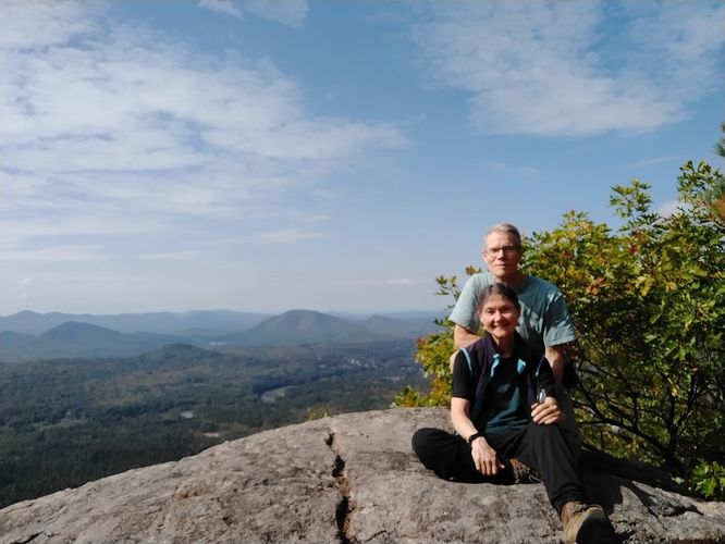
Mt. Tammany Trail
Delaware Water Gap National Recreation Area
Hardwick Township, New Jersey
Hardwick Township, New Jersey
3.6
miles
/ 5.8 km
August 26, 2025
Having hiked Mt. Minsi the day before this hike, we were excited to climb this side of the DWG & see the views of Mt. Minsi. We chose to add on 2 other trails, The Blue BlazeTrail and Appalachian Trail so that we could also check out the Dunnfield Creek Waterfalls on our descent. This addition turned the hike from an "Out and Back" hike into a "Loop" hike. We knew that this was a very popular hiking destination so we decided to hit the trail early. We thought starting early would give us more "room" on the trail, so imagine our surprise to find the parking lot almost full at 8:00am on a Thursday! We started up the trail at the wooden steps to began our ascent up the rocky trail. As expected, we had plenty of company on the trail. At the first lookout we had no less than 15 other hikers enjoying the views of the Delaware Water Gap below. After a short break to enjoy the views & snap some pictures, we continued on and up until we were at the summit. The views from the summit are spectacular and we enjoyed stopping here for pictures and a snack. The descent is steady, steep in sections and very rocky. We met several hikers heading up to the summit as we descended and several had the same question as we passed...." How much further to the top"? I think we chose the correct direction to do this loop. We made steady progress down to the Dunnfield Waterfalls and realized that this was a fairly easy section to hike and no doubt a contributing factor to the full parking lot. Lots of folks don't necessarily hike to the summit, but they do take a nice walk in the woods to the falls. The water was low at the falls, but still flowing. The trail from the falls back to the parking area is wide, mostly gravely and fairly flat, which was a welcome break after the almost constant rocky conditions of our ascent and descent of Mt.Tammany. I would highly recommend doing the hike as a loop and going in the direction we hiked for the best views and easier ascent.
Hiking
Mt. Minsi via Appalachian Trail
Delaware Water Gap National Recreation Area
Delaware Water Gap, Pennsylvania
Delaware Water Gap, Pennsylvania
4.8
miles
/ 7.7 km
August 25, 2025
We found the parking area and when we arrived, there were still plenty of spaces available. It was a beautiful day for hiking so we expected to have company on the trail. It was exciting to think we would be hiking on part of the infamous Appalachian Trail with it's white blaze guiding us on our journey.
We stopped at the trailhead kiosk to peruse the map and I was impressed that it was also in Spanish.
We headed down the trail that was as wide as a class 6 road until we passed a small pond and came to our first junction in the trail. We decided to head down the bank to the left instead of continuing up. We needed to use the rope that was installed there to assist our descent. It was easier than it looked, but it helped build my anticipation for the adventures that I was hoping for ahead.
This trail is so close to the highway at the Delaware Water Gap and we had hoped that by hiking early in the day we would have heard less traffic noise. Sadly this was not the case, we did get quite a bit of traffic noise as we hiked in the beginning, but as the trail ascended the noise was less offensive.
We got some beautiful views of the Gap below and really enjoyed being able to hike next to and through some enormous Rhododendron bushes. At home in NH they are quite small, but here they towered over us, so it was easy to imagine you were magically transformed into a being the size of a mouse as we made our way along the trail and through these tunnels of green.
We took a short detour to a rocky outcrop to rest, hydrate and take in the views of the Gap below. It was sunny and bright and we were able to watch what appeared to be turkey vultures soaring below and catching the thermocline lift that rises along the steep sides of the Gap.
Back on the trail we encountered a very large Northern Copperhead Snake crossing the trail. Although it's always fun to see wild creatures, respect and distance are the best ways to deal with an encounter.
We loved this hike.
Hiking
South River Falls Trail
Shenandoah National Park
Stanardsville, Virginia
Stanardsville, Virginia
3.4
miles
/ 5.5 km
August 21, 2025
We did this hike as a loop by adding the South Falls Fire Road to this hike. The wide steps during our descent were a nice feature and helped us make steady progress down the trail. We were able to enjoy identifying several different types of plants as we hiked after reading at the kiosk that we were in an Appalachian Rich Cove Forest. This special type of forest is only found in the Appalachian Mountains. The rich soils and shelter from the winds makes this an ideal place for a biodiverse ecosystem. We were even lucky enough to spot an Eastern Copperhead Snake sunning itself along the trail.
Hiking
Stony Man Trail
Shenandoah National Park
Luray, Virginia
Luray, Virginia
1.5
miles
/ 2.4 km
August 18, 2025
We did this hike as an easy loop hike. The trail was well marked and easy to follow. The substrate was not difficult at all and in lots of sections of the trail the path was wide and flat. It was also kind of fun to learn that we were hiking on part of the famous Appilachian Trail.During our visit it was extremely foggy. Even though the weather was not great, there were still plenty of other hikers. There's lots of parking at the trailhead and we had no trouble finding a spot. We were hoping that we would get some nice mountain views, but the fog was really so thick we could not see much at all. When we are faced with such a dilema, we do what we learned to do while scuba diving.....shift your focus. Instead of focusing on the big views, we looked for small things along the trail. What different birds where we hearing? What was that new plant? What is that insect ? What is that fungus? It's never a bad day when you get to spend part of it in nature with people who love and appreciate a beautiful outdoor space.
Hiking
Raymondskill Falls Trail
Delaware Water Gap National Recreation Area
Milford, Pennsylvania
Milford, Pennsylvania
0.6
miles
/ 1.0 km
August 16, 2025
Although this is a very short hike, the falls, when flowing, are truly spectacular and worth the time to visit as this is reported to be the tallest waterfall in Pennsylvania at 178 feet.
Hiking
Mt. Van Hoevenberg
Adirondack Park
North Elba, New York
North Elba, New York
3.6
miles
/ 5.8 km
September 23, 2024
We really enjoyed this hike. The steps have been installed along several parts of the trail making for less trip hazards. Our visit was during fall, so we didn't have to contend with any ice or snow. We enjoyed the views and even found the old abandoned outhouse!
Hiking
Putnam Loop Trail
Fisher Hill Town Forest
Francestown, New Hampshire
Francestown, New Hampshire
0.8
miles
/ 1.3 km
July 01, 2021
The Francestown Conservation Commission in the July 2021 edition of the Francestown News announced that the trail has now been officially named the "PUTNAM LOOP TRAIL". There is now an updated trail map link in the Length and Trail Information section of the original report.
Hiking
Showing 1 to 7 of 7 Trip Reports
