Mt. Minsi via Appalachian Trail at Delaware Water Gap National Recreation Area in Pennsylvania is a moderate and popular 4.7-mile loop hike that features stunning views of the Delaware Water Gap and Mt. Tammany.
Trails
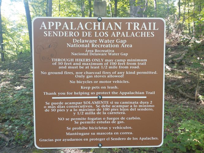
This hike follows two named trails: Appalachian Trail (white blazes), Lake Road Trail.
Hike Description
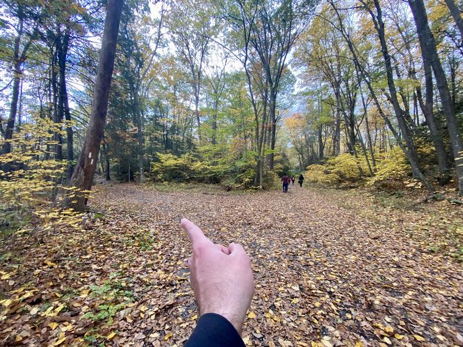
This hike begins at the main parking lot for the Appalachian Trail in Delaware Water Gap, Pennsylvania - at the parking coordinates provided - and follows the Appalachian Trail as it heads south.
Lenape Lake - Mile 0.12
Around mile 0.12, just after the hiker hops on the trail, you'll hike by the scenic Lenape Lake which provides colorful Autumn-time views of the water and foliage. After visiting Lenape Lake, hikers will continue up the Appalachian Trail as it slowly ascends to reach a left-hand turn at a trail junction with the AT and Lake Road Trail.
Left-Hand Turn to Appalachian Trail - Mile 0.35
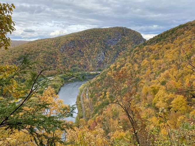
At mile 0.35, hikers will reach a left-hand turn to continue following the Appalachian Trail. Along the way, hikers will find plenty of views of the Delaware Water Gap and Mt. Tammany across the canyon.
Obstructed View - Mile 0.46
At mile 0.46 hikers will find a quick off-trail view of the Delaware Water Gap and Mt. Tammany; however, this view is a little bit obstructed by the trees, it's still worth taking a stop at (as of October 2023). Not long after this view, hikers will enter the very-old and very-tall rhododendrons which tower over the hiker as they make their way up the mountain.
Eureka Creek Falls (4-feet tall) - Mile 1.2
At mile 1.2, hikers will reach a creek crossing at Eureka Creek. Located in the creek is a very small 4-foot tall slide waterfall that trickles down over bedrock. This waterfall is likely less than a trickle during snow melt season in the Spring but during Autumn, was barely existing.
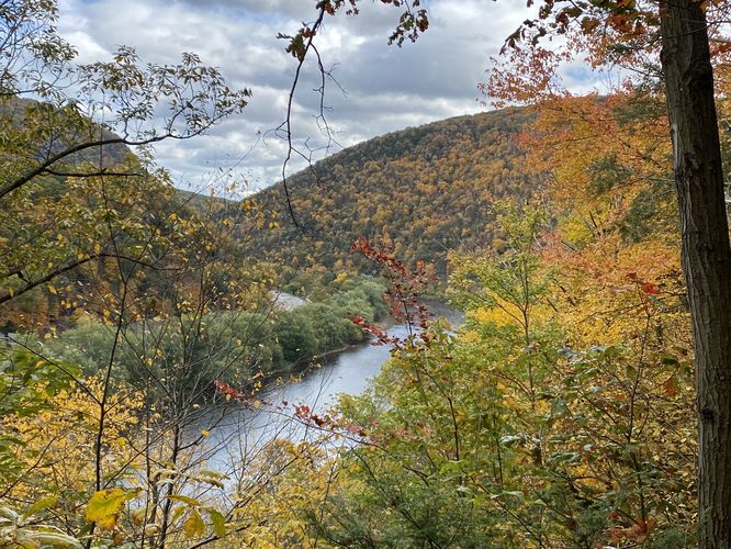
Lookout Rock - Mile 1.4
At mile 1.4, hikers will reach "Lookout Rock" which provides a stunning view of the Delaware Water Gap (Delaware River) and Mt. Tammany across the canyon. This is by far the most-popular spot for hikers to stop - it seems lots of people turn around here; however, due to the crowds (on weekends) I found that this view, while stunning, was not my favorite and thus it warranted hiking closer to the Mt. Minsi summit for more secluded views.
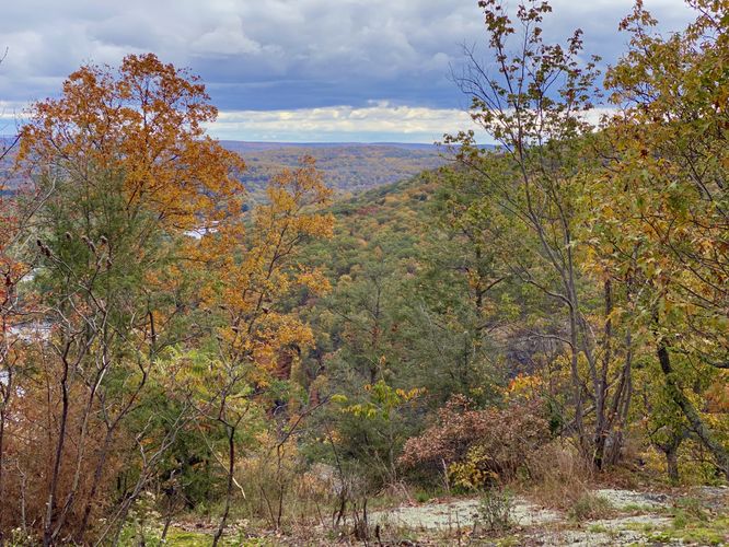
Hill View - Mile 1.5
After passing Lookout Rock, hikers will make their way up this steeper section of Mt. Minsi where you'll find more bedrock to hike up. Near the top of the flat bedrock is an obstructed but nice-to-find view of the neighboring hills; however, it gets better!
Mt. Tammany & Delaware River View - Mile 1.62
Around mile 1.62, hikers will find another view of the Delaware Water Gap and Mt. Tammany - this one is similar to the view at Lookout Rock and (during our hike) had no one standing or waiting around. This view was awesome, but is located down and off-trail slightly - watch your step as there's a steep drop-off near the edge.
Keep Right - Mile 2.1 & 2.16
Around mile 2.1, hikers will reach a junction with the Lake Road Trail - here, you can head straight or "keep right" to stay on the Appalachian Trail. Same thing at mile 2.16, just keep right to stay on the Appalachian Trail.
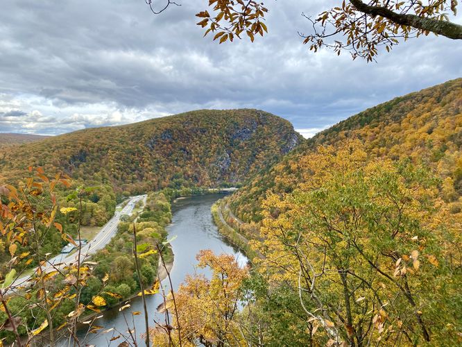
Mt. Minsi Lookout - Mile 2.3
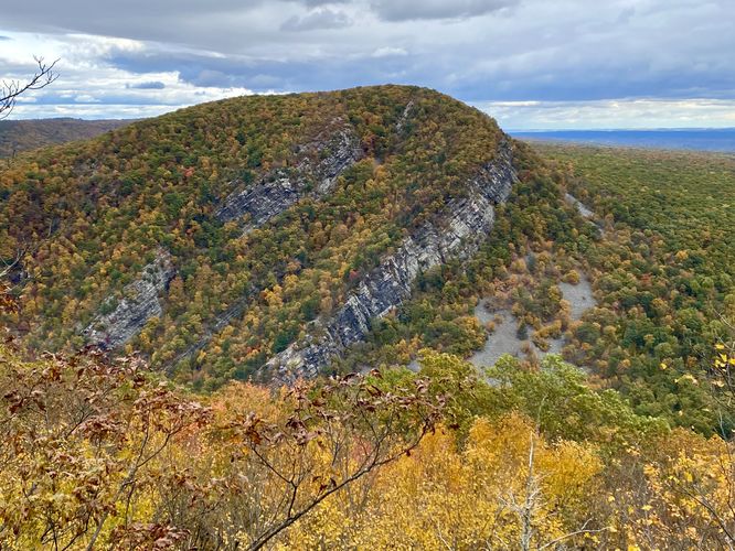
Finally, at mile 2.3, hikers will reach the Mt. Minsi Lookout, which is the turn-around point for this hike. Located slightly off-trail, hikers can head down the bedrock to get a stunning view of Mt. Tammany across the valley. The view is here is stunning and generally very quiet. Hikers can hang out here for a bit before heading back to parking, unless they wish to hike to the true summit of Mt. Minsi which is located ~1,200 feet further along the Appalachian Trail. During this hike, we didn't care to summit but rather wanted to enjoy the multitude of vistas the Mt. Minsi and the Appalachian Trail had to offer, so we turned back here to hike on the Lake Road Trail back to parking.
Lake Road Trail to Parking - Mile 2.5 to 4.7
Hikers will backtrack along the Appalachian Trail to reach the 1st Lake Road Trail junction that you hiked past earlier. Here, take a left-hand turn to follow the Lake Road Trail back to parking. The Lake Road Trail is littered with small rocks which can be pretty annoying to hike on, especially during Autumn when they're covered in leaves. Aside from the rocks, the Lake Road Trail has a plethora of large and old rhododendron which makes for nice scenery. Other than that, the trail doesn't have much to see until you reach Lake Lenape near the end of the hike. Finally, the hiker will reach parking around mile 4.7 to complete the loop.
Parking
This hike is extremely popular and thus the parking lot for this hike is generally full by noon, especially on weekends. Note that there are two main parking lots at the coordinates provided which can be accessed via a one-way road. There's also designated street parking (only where signs are laid out) along Mountain Road. Be respectful of the neighbors and private land and only park in designated locations.
Popularity
This hike is super popular and will be busy any day of the week. On weekends, it's best to show up early or show up later in the day to ensure you can find a parking spot. Mid-day parking is very difficult here.
Pets
Dogs are allowed only if leashed and must be cleaned up after.
Trails
This hike follows two named trails: Appalachian Trail (white blazes), Lake Road Trail.
Hike Description
This hike begins at the main parking lot for the Appalachian Trail in Delaware Water Gap, Pennsylvania - at the parking coordinates provided - and follows the Appalachian Trail as it heads south.
Lenape Lake - Mile 0.12
Around mile 0.12, just after the hiker hops on the trail, you'll hike by the scenic Lenape Lake which provides colorful Autumn-time views of the water and foliage. After visiting Lenape Lake, hikers will continue up the Appalachian Trail as it slowly ascends to reach a left-hand turn at a trail junction with the AT and Lake Road Trail.
Left-Hand Turn to Appalachian Trail - Mile 0.35
At mile 0.35, hikers will reach a left-hand turn to continue following the Appalachian Trail. Along the way, hikers will find plenty of views of the Delaware Water Gap and Mt. Tammany across the canyon.
Obstructed View - Mile 0.46
At mile 0.46 hikers will find a quick off-trail view of the Delaware Water Gap and Mt. Tammany; however, this view is a little bit obstructed by the trees, it's still worth taking a stop at (as of October 2023). Not long after this view, hikers will enter the very-old and very-tall rhododendrons which tower over the hiker as they make their way up the mountain.
Eureka Creek Falls (4-feet tall) - Mile 1.2
At mile 1.2, hikers will reach a creek crossing at Eureka Creek. Located in the creek is a very small 4-foot tall slide waterfall that trickles down over bedrock. This waterfall is likely less than a trickle during snow melt season in the Spring but during Autumn, was barely existing.
Lookout Rock - Mile 1.4
At mile 1.4, hikers will reach "Lookout Rock" which provides a stunning view of the Delaware Water Gap (Delaware River) and Mt. Tammany across the canyon. This is by far the most-popular spot for hikers to stop - it seems lots of people turn around here; however, due to the crowds (on weekends) I found that this view, while stunning, was not my favorite and thus it warranted hiking closer to the Mt. Minsi summit for more secluded views.
Hill View - Mile 1.5
After passing Lookout Rock, hikers will make their way up this steeper section of Mt. Minsi where you'll find more bedrock to hike up. Near the top of the flat bedrock is an obstructed but nice-to-find view of the neighboring hills; however, it gets better!
Mt. Tammany & Delaware River View - Mile 1.62
Around mile 1.62, hikers will find another view of the Delaware Water Gap and Mt. Tammany - this one is similar to the view at Lookout Rock and (during our hike) had no one standing or waiting around. This view was awesome, but is located down and off-trail slightly - watch your step as there's a steep drop-off near the edge.
Keep Right - Mile 2.1 & 2.16
Around mile 2.1, hikers will reach a junction with the Lake Road Trail - here, you can head straight or "keep right" to stay on the Appalachian Trail. Same thing at mile 2.16, just keep right to stay on the Appalachian Trail.
Mt. Minsi Lookout - Mile 2.3
Finally, at mile 2.3, hikers will reach the Mt. Minsi Lookout, which is the turn-around point for this hike. Located slightly off-trail, hikers can head down the bedrock to get a stunning view of Mt. Tammany across the valley. The view is here is stunning and generally very quiet. Hikers can hang out here for a bit before heading back to parking, unless they wish to hike to the true summit of Mt. Minsi which is located ~1,200 feet further along the Appalachian Trail. During this hike, we didn't care to summit but rather wanted to enjoy the multitude of vistas the Mt. Minsi and the Appalachian Trail had to offer, so we turned back here to hike on the Lake Road Trail back to parking.
Lake Road Trail to Parking - Mile 2.5 to 4.7
Hikers will backtrack along the Appalachian Trail to reach the 1st Lake Road Trail junction that you hiked past earlier. Here, take a left-hand turn to follow the Lake Road Trail back to parking. The Lake Road Trail is littered with small rocks which can be pretty annoying to hike on, especially during Autumn when they're covered in leaves. Aside from the rocks, the Lake Road Trail has a plethora of large and old rhododendron which makes for nice scenery. Other than that, the trail doesn't have much to see until you reach Lake Lenape near the end of the hike. Finally, the hiker will reach parking around mile 4.7 to complete the loop.
Parking
This hike is extremely popular and thus the parking lot for this hike is generally full by noon, especially on weekends. Note that there are two main parking lots at the coordinates provided which can be accessed via a one-way road. There's also designated street parking (only where signs are laid out) along Mountain Road. Be respectful of the neighbors and private land and only park in designated locations.
Popularity
This hike is super popular and will be busy any day of the week. On weekends, it's best to show up early or show up later in the day to ensure you can find a parking spot. Mid-day parking is very difficult here.
Pets
Dogs are allowed only if leashed and must be cleaned up after.