Loading...

WINTER SALE! 50% OFF Supporter Accounts — now through January 31st. Learn More.

South River Falls Trail

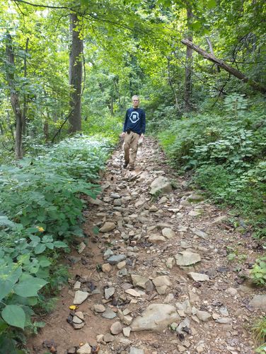
This is a great trail in Shenandoah National Park, but is pretty difficult given the change in elevation. It's at least 2.8 miles out-and-back if you take the same trail. Or you can extend the hike to 3.3 miles by taking the South River Fire Rd Trail back (recommended).

The trail has a fairly steep grade downhill for the first 0.7 miles (including switchbacks). Once you get to the bottom of the switchbacks, the trail runs along the South River for about 0.7 miles until you reach the waterfall overlook.

I suggest taking the South River Fire Rd Trail back to the parking area (2 miles one-way) since it's less steep than this one on; however, it's a slightly longer journey.

Bring lots of water and plan to hike at least 2.8 miles out-and-back.
Explore 71 trails near Stanardsville, VA

Know Before You Go

  • South River Falls Trail in Shenandoah National Park is a challenging hike due to significant elevation changes.
  • The recommended route is 3.3 miles, combining the South River Falls Trail to the waterfall and the South River Fire Rd Trail back to the parking area.
  • Be prepared for a steep downhill descent initially and bring plenty of water for the hike.
Interactive topographic map for South River Falls Trail located in Stanardsville, VA. Click the "View Map" button to load GPS coordinates and trail markers.
Get directions
Distance
1.4 mi
Difficulty
Hard
Type
One-Way
Est. Time
42 min
Elev. Gain
17'
Rating
5.0
Added
April 29, 2017
Updated
January 31, 2019

Weather Forecast

Loading...
Total Change
795'
Ascent
17'
Descent
805'
Loading...

Download the GPX Data for Offline Use

Supporters get exclusive access to download trail routes to the MyHikes app for offline use. Stay prepared on your adventure, even without an internet connection! Become a Supporter today to unlock this feature and hike with confidence.

Download South River Falls Trail GPX Data to the MyHikes Mobile App

Features

Vista / Lookout Point
Dogs
Waterfalls
Camping

Points of interest

  1. Parking

    38.381098, -78.517009
  2. Main Trailhead

    38.381207, -78.517044

Safety information

For your own safety: plan ahead, let someone know where you'll be, and hike at your own risk.

Markers

Blaze Color

Blue

Availability

Spring

Surface type

Dirt

Trip Reports (Reviews)

Rated 5.0 out of 5 based on 1 rating.

Ready to help fellow hikers? Add a trip report to share your experience and provide valuable insights for other hikers!

3.4 miles / 5.5 km
August 21, 2025
We did this hike as a loop by adding the South Falls Fire Road to this hike. The wide steps during our descent were a nice feature and helped us make steady progress down the trail. We were able to enjoy identifying several different types of plants as we hiked after reading at the kiosk that we were in an Appalachian Rich Cove Forest. This special type of forest is only found in the Appalachian Mountains. The rich soils and shelter from the winds makes this an ideal place for a biodiverse ecosystem. We were even lucky enough to spot an Eastern Copperhead Snake sunning itself along the trail.
Hiking
1.4 miles / 2.3 km
April 30, 2017
Hiking

Explore other routes for this Trail guide, added by the MyHikes' community via Trip Reports (Reviews). To add your own hike as a Community Route for this Trail guide, leave a Trip Report and attached your GPX file!

Popular categories

Scenic mountain view representing vista trails
Vista trails
Scenic gorge of cascades representing waterfall trails
Waterfall hikes
Rugged mountain terrain representing summit trails
Summit trails
Scenic mountain view representing dog-friendly trails
Dog-friendly
Scenic campsite with a view representing camping trails
Camping trails
Appalachian Trail logo representing A.T. hikes
A.T. hikes

You May Also Like

25 Best Day Hikes in North Carolina - Discover the top 25 best day hikes in North Carolina, from breathtaking waterfalls to mountain peaks. Explore hidden gems, scenic views, and trails suitable for all skill levels, perfect for your next outdoor adventure.
Explore

25 Best Day Hikes in North Carolina

Discover the top 25 best day hikes in North Carolina, from breathtaking waterfalls to mountain peaks. Explore hidden gems, scenic views, and trails suitable for all skill levels, perfect for your next outdoor adventure.

Read
🍪 We use cookies to learn about site usage and to serve map tiles. You may block cookies manually in the browser. By continuing you agree. Learn more