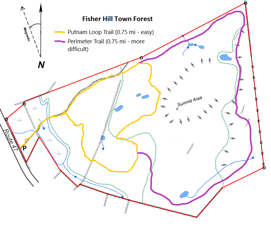
The Putnam Loop Trail at Fisher Hill Forest in Francestown, New Hampshire is an easy 0.8-mile loop trail that features a peaceful walk through the woods that features an old stone wall and seasonal vernal pools.
Trail name: Putnam Loop Trail (official name as of July 2021), used to be listed as Fisher Hill Forest Loop.
Location: Rte. 47, Fisher Hill Town Forest, Francestown NH
Allowed activities: Hiking, Biking, Nature Study, Show Shoe, Cross Country Skiing, Hunting
Forbidden activities: No ATV’s
Hours: No posted hours
Fees and Parking: There is no fee to park or use the trail.
Pets: There are no postings forbidding pets. Local leash laws should be followed while visiting.
Accessibility: The trail is not wheel chair accessible
Sanitation: There is no restroom or trash bin at the trailhead or on the trail. Please carry out what you carry in.
Length and Trail information: This hike is an easy hike, approximately .8 of a mile long: done as a loop hike. There is no kiosk or information board at the parking area. Parking is limited at the trailhead and plowing is not guaranteed in winter. The trail begins right off of the parking area just beyond a double wooden gate. There is a sign on the gate prohibiting ATV’s from using the trail and there is also a sign posted on a tree adjacent to the trail that lets visitors know that the area is multi use and hunters could be present. This is a brand new trail that at the time of this report is unnamed (Spring 2021). Currently there are no markers or blazes to mark the trail, but the path is quite evident as it winds its way through the forest. Hikers may download and print a map of the trail by following the link below:
fh-trail-map_v1_0.png (877×730) (francestownnh.org)
There are lots of switch backs and one could easily imagine someone
on a mountain bike having some fun with the way the trail has been laid
out. Occasionally orange marker tape can
be seen along the trail, but as of yet there is no “official” marker or blaze. The trail substrate is uneven and has protruding
rocks here and there, but for the most part is easily navigated by hikers of
all skill levels. Several vernal pools
were observed not far from the trail hinting at the possibility that the trail
might be wet in places in early spring or after heavy rains.


