The Twin Mountain Vista Hike at State Game Lands 68 near Cedar Run, Pennsylvania is a moderate 2.9-mile out-and-back seasonal hike that leads to a stunning vista of the PA Grand Canyon at the top of an unnamed mountain, the Twin Mountain Vista.
Seasonal Hike (April - November)
As stated in the warnings and parking notes, this is a seasonal hike between late April and the end of November because the road is not maintained during the winter. Ice tends to build up in mid-November and usually disappears by late April at these altitudes.
Trails
This hike follows one service road and one named trail, the Hillborn Trail (yellow blazes).
Hike Description
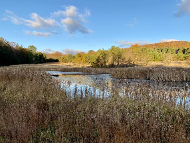
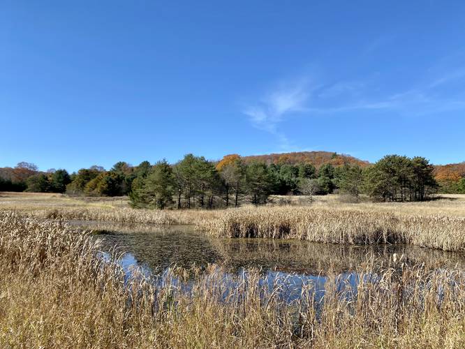
This hike begins at the main parking lot for State Game Lands 68 (SGL 68) and heads south from the parking lot, through the field, to reach a service road that continues west. Along the way, hikers will find stands of evergreen trees - a mixed variety of spruce and pine, in addition to a small pond. Hikers will stay on this service road, heading west, for approximately 0.4-miles from the parking lot. Note that you hike past several off-shoot trails along the way, but continue hiking west until you reach a "T"-shaped junction.
Right-Hand Turn - Mile 0.43
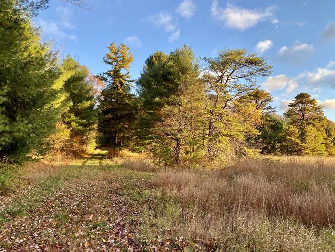
Around mile 0.43, hikers will reach a "T"-shaped trail junction where you may notice large purple blazes to the west and south - this is where the State Game Land meets a corner with private property (hence, the purple blazes indicating private land). By taking a right-hand turn at this junction, you'll stay on the service road as it meanders its way up the mountain to reach the Hillborn Trail.
Right-Hand Turn to Hillborn Trail - Mile 1.2
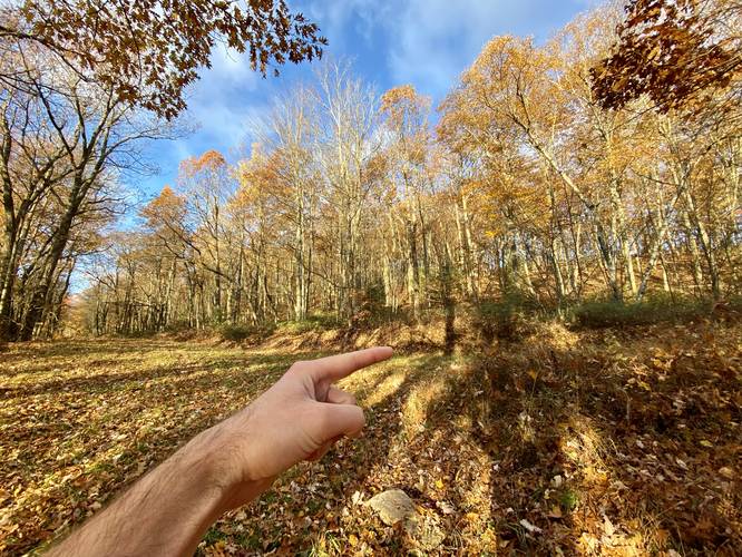
At mile 1.2, hikers will reach another junction, but this time it's a sharp right-hand turn. This turn leads hikers onto the eastern-most trailhead for the Hillborn Trail (yellow blazes). Note that during this hike in late October, 2022, there were no yellow blazes on this portion of the Hillborn Trail.
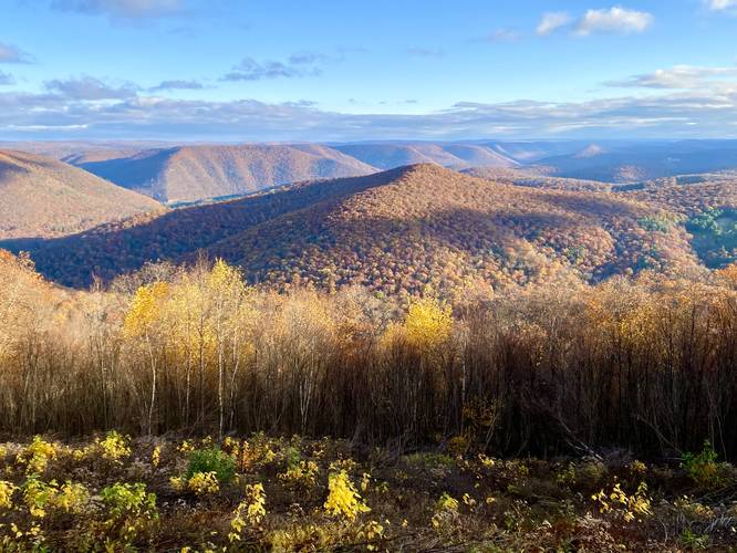
Twin Mountain Vista - Mile 1.44
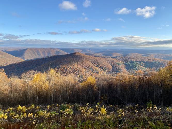
Just up the hill after turning onto the Hillborn Trail lies the Twin Mountain Vista, which is a massive north-facing sweeping view that includes Pine Creek Gorge (PA Grand Canyon), Tioga State Forest's southern Cedar Mountain's rugged slopes (i.e. Chimney Rock Vista area), and Gillespie Point, just to name a few. On very clear days, hikers may be able to spot the steep slopes of Armenia Mountain to the northeast and potentially Tioga County's tallest mountain, Cedar Mountain (i.e. Grand View) due-north.
Hiking Out
The hike back is just the opposite hike in and since you're headed downhill almost the whole way, it's pretty easy. The overall difficulty should be considered moderate, however, because of the overall elevation gain.
Parking (No Winter Access)
Hikers will find a large parking lot at the coordinates provided. It's large enough to fit over a dozen vehicles. The road that leads up to this parking lot is not maintained during the winter, thus this hike is only available from late April through late November, as the ice tends to build up on the roads around mid-November and melts around late April at these altitudes.
Warning
Timber Rattlesnakes: This area is known to inhabit the Timber Rattlesnake and while there were no signs of rattles in late October, they tend to roam around the forest or sun themselves in clear cut areas (like this one) between the months of late April and early October. Be on the lookout for rattlers and give them plenty of space.
Hunting: This hike follows state game lands the entire time, so hunting is allowed here. It's smart to wear blaze orange if hiking through during hunting season.
No winter access: The road that leads up to this parking lot is not maintained during the winter, thus this hike is only available from late April through late November, as the ice tends to build up on the roads around mid-November and melts around late April at these altitudes.
Seasonal Hike (April - November)
As stated in the warnings and parking notes, this is a seasonal hike between late April and the end of November because the road is not maintained during the winter. Ice tends to build up in mid-November and usually disappears by late April at these altitudes.
Trails
This hike follows one service road and one named trail, the Hillborn Trail (yellow blazes).
Hike Description
This hike begins at the main parking lot for State Game Lands 68 (SGL 68) and heads south from the parking lot, through the field, to reach a service road that continues west. Along the way, hikers will find stands of evergreen trees - a mixed variety of spruce and pine, in addition to a small pond. Hikers will stay on this service road, heading west, for approximately 0.4-miles from the parking lot. Note that you hike past several off-shoot trails along the way, but continue hiking west until you reach a "T"-shaped junction.
Right-Hand Turn - Mile 0.43
Around mile 0.43, hikers will reach a "T"-shaped trail junction where you may notice large purple blazes to the west and south - this is where the State Game Land meets a corner with private property (hence, the purple blazes indicating private land). By taking a right-hand turn at this junction, you'll stay on the service road as it meanders its way up the mountain to reach the Hillborn Trail.
Right-Hand Turn to Hillborn Trail - Mile 1.2
At mile 1.2, hikers will reach another junction, but this time it's a sharp right-hand turn. This turn leads hikers onto the eastern-most trailhead for the Hillborn Trail (yellow blazes). Note that during this hike in late October, 2022, there were no yellow blazes on this portion of the Hillborn Trail.
Twin Mountain Vista - Mile 1.44
Just up the hill after turning onto the Hillborn Trail lies the Twin Mountain Vista, which is a massive north-facing sweeping view that includes Pine Creek Gorge (PA Grand Canyon), Tioga State Forest's southern Cedar Mountain's rugged slopes (i.e. Chimney Rock Vista area), and Gillespie Point, just to name a few. On very clear days, hikers may be able to spot the steep slopes of Armenia Mountain to the northeast and potentially Tioga County's tallest mountain, Cedar Mountain (i.e. Grand View) due-north.
Hiking Out
The hike back is just the opposite hike in and since you're headed downhill almost the whole way, it's pretty easy. The overall difficulty should be considered moderate, however, because of the overall elevation gain.
Parking (No Winter Access)
Hikers will find a large parking lot at the coordinates provided. It's large enough to fit over a dozen vehicles. The road that leads up to this parking lot is not maintained during the winter, thus this hike is only available from late April through late November, as the ice tends to build up on the roads around mid-November and melts around late April at these altitudes.
Warning
Timber Rattlesnakes: This area is known to inhabit the Timber Rattlesnake and while there were no signs of rattles in late October, they tend to roam around the forest or sun themselves in clear cut areas (like this one) between the months of late April and early October. Be on the lookout for rattlers and give them plenty of space.
Hunting: This hike follows state game lands the entire time, so hunting is allowed here. It's smart to wear blaze orange if hiking through during hunting season.
No winter access: The road that leads up to this parking lot is not maintained during the winter, thus this hike is only available from late April through late November, as the ice tends to build up on the roads around mid-November and melts around late April at these altitudes.