Loading...

🍁 Fall is here! Check out our foliage map to plan your autumn hikes! Learn more.

Ramsey Vista (Dead End Vista 3)

Directions
Map
Pictures
Send to App
Distance:
0.2 Miles / 0.3 km
Type:
Out-and-Back
Difficulty:
Easy
Time to Hike:
~6 minutes
Features:
PA Wilds
Surface Type:
Dirt
Park:
Tiadaghton State Forest
Town:
Ramsey, Pennsylvania
Get Directions:
41.270572, -77.347945
Added:
August 20, 2023
Updated:
August 23, 2023
Copy Trail Link Hiking this trail? Send a friend or family member a link to this trail guide for your own safety. Hike at your own risk (disclaimer)
Loading...
Loading...
28'

Total Change
44'

Ascent
45'

Descent

Download the Trail Route for Offline Use

Supporters get exclusive access to download trail routes to the MyHikes app for offline use. Stay prepared on your adventure, even without an internet connection! Become a Supporter today to unlock this feature and hike with confidence.

Send to App

Key Takeaways

  • Ramsey Vista, also known as Dead End Vista #3, offers easily accessible scenic views of the PA Grand Canyon and surrounding landmarks near Ramsey, PA, reachable by car or a short walk on dirt roads.
  • The vista is located within Tiadaghton State Forest, which permits camping, with established fire rings available, subject to state forest regulations.
  • Dogs are allowed at Ramsey Vista, provided they are leashed and owners clean up after them.

Ramsey Vista (Dead End Vista 3)

The Ramsey Vista at Tiadaghton State Forest near Ramsey, Pennsylvania is an easy 0.2-mile out-and-back drive-able walk that features stunning views of the southern end of the PA Grand Canyon, located high above Ramsey.

Names
This vista has no official name, hence "Ramsey Vista". Other folks might refer to this as Dead End Vista #3 or Bull Run Dead End Vista #3.

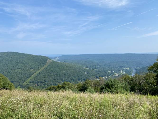
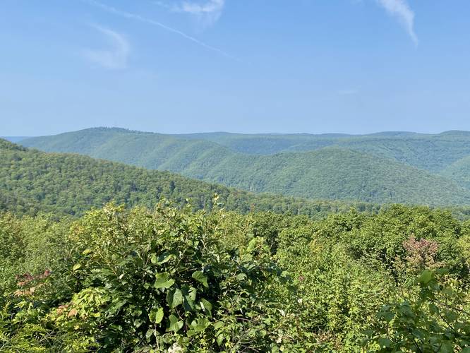
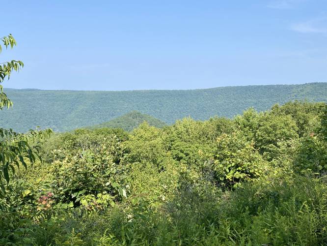
This is not a hike but rather a walk that visitors can also drive. For folks who do not wish to or cannot walk, this is a great drive-up vista; however, you'll have to fare dirt roads to reach it. The Ramsey Vista provides views of the stunning Houselander Mountain with its exposed pipeline slopes (private land), Pine Creek, the mountain top of the Stone Cutter Vista, the hamlet of Ramsey, PA, and the mountain ridge that's home to Hanging Rock Overlook and the historic Balanced Rock Vista.

Camping
Note that camping is permitted at Tiadaghton State Forest and there are a couple of fire rings at the end of this road. Camping is likely allowed here, but please follow all state forest rules and regulations.

Parking
Visitors will find parking at the dead-end of Dead End Road #3, at the coordinates provided.

Pets
Dogs are allowed if leashed and should be cleaned up after.
Explore 168 trails near Ramsey, PA
  1. Parking

    41.270572, -77.347945
  2. Main Trailhead

    41.270561, -77.347837
  3. Houselander Mountain and Pine Creek view

    41.270508, -77.347756
    Houselander Mountain and Pine Creek view
  4. Mountain Ridge view

    41.271106, -77.347183
    Mountain Ridge view
  5. Stone Cutter Mountain view

    41.271114, -77.347236
    Stone Cutter Mountain view
Explore other routes for this Trail guide, added by the MyHikes' community via Trip Reports (reviews). To add your own hike as a Community Route for this Trail guide, leave a Trip Report with an attached GPX file.

Hazards

Ticks - Lyme Disease More Info (CDC)
Snakes
Poison Ivy/Oak

Seasons

Spring, Summer, Fall

Photo Albums

+ Add Photo Album

Upload your photos from the trail to help others know what to expect.

Preview of the MyHikes mobile app interface

Track, Log, and Explore Hikes with the MyHikes App

Explore Autumn Foliage

No Change
Some Color
Low Color
Moderate Color
High Color
Peak Color
Past Peak
Sept 1 Sept 8 Sept 15 Sept 22 Sept 29 Oct 6 Oct 13 Oct 20 Oct 27 Nov 3 Nov 10 Nov 17 Nov 24
Shop Landscape Prints
Shop our landscape prints from the Grand Canyon of Pennsylvania

Trip Reports (Reviews)

Ready to help fellow hikers? Add a trip report to share your experience and provide valuable insights for those planning their next hike. Your review makes the trail better for everyone.

Your opinion matters! Be the first to rate this trail.
16.8 miles / 27.0 km
August 26, 2023
Excellent vista - really neat that you get such a wide viewing point as you walk along, including Houselander Mtn (which I hiked shortly after this). Included this as part of bigger loop hike starting with Stone Cutter, and then also the other Bull Run Rd dead-end vista & MST down to Gamble Run.
Hiking
0.2 miles / 0.3 km
August 20, 2023
Dogs Hiking

Weather Forecast

In Ramsey, PA

Explore Hiking Trails

You May Also Like

Colorado's Million Dollar Highway - Plan a day's drive adventure along the iconic Million Dollar Highway in Colorado. Explore the best short trails, roadside stops, waterfalls, vistas, ghost towns, and hot springs within a ~6 hour road trip.
Explore

Colorado's Million Dollar Highway

Plan a day's drive adventure along the iconic Million Dollar Highway in Colorado. Explore the best short trails, roadside stops, waterfalls, vistas, ghost towns, and hot springs within a ~6 hour road trip.

Read
New York's Best Waterfalls - Whether you're planning a day hike, roadside stop, or a leisurely short walk, this guide provides hikers, travelers, and locals alike with 63 different locations to over 100 scenic waterfalls to help plan your next adventure!
Explore

New York's Best Waterfalls

Whether you're planning a day hike, roadside stop, or a leisurely short walk, this guide provides hikers, travelers, and locals alike with 63 different locations to over 100 scenic waterfalls to help plan your next adventure!

Read

Before you boogie...

Find our trail guides useful? Consider becoming a Supporter to unlock perks!

MyHikes is an indie platform that makes exploring public trails easier for everyone. The platform has no investors, no ads, and is owned and operated by one person, Dave Miller. Dave has personally mapped and written over 1,800 trail guides on MyHikes for the public to explore. MyHikes has helped millions outdoor enthusiasts plan their next adventure.

But it takes a lot of time 🕦, money 💰, work, and espresso shots ☕ to run MyHikes, including hiking , mapping , writing , and publishing new trails with high-quality (accurate) information... along with software engineering (coding) the platform like building new features, website and mobile app development (iOS and Android), site maintainance . and much much more.

Supporters unlock website and mobile app perks with an annual one-time payment of $25 (you renew) 😎👍. Or you can simply make a Donation of your choice. Otherwise, you can support us by telling your friends about MyHikes - both quick and free 🎉

Admin user profile picture

Dave Miller
MyHikes Founder