The Stone Cutter Vista Loop at Tiadaghton State Forest in the village of Ramsey, Pennsylvania is a difficult 3.7-mile loop hike that leads up to a stunning vista point along a mountain ridge within Pine Creek Gorge (PA Grand Canyon) with almost-180-degree views.
Trails
This hike follows several named trails in order: Pine Creek Trail, Stone Cutter Trail (blue blazes), Tiadaghton Trail (yellow blazes), Turkey Vulture Trail (red blazes).
Hike Description
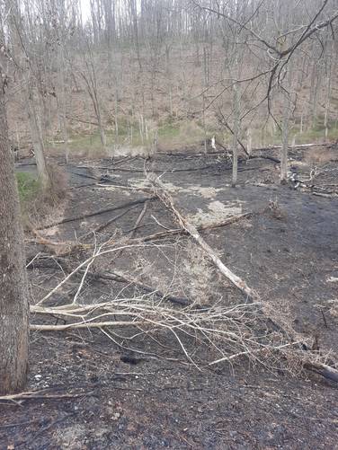
This hike begins at the Ramsey Bridge Access Parking lot for the Pine Creek Trail (note this lot only fits 3 vehicles as of January 2022) and follows the Pine Creek Trail heading south. Along the way is a beautiful old railroad bridge that the trail uses to cross over Pine Creek - here are some amazing views of the neighboring mountains.
Stone Cutter Trail - Mile 0.4
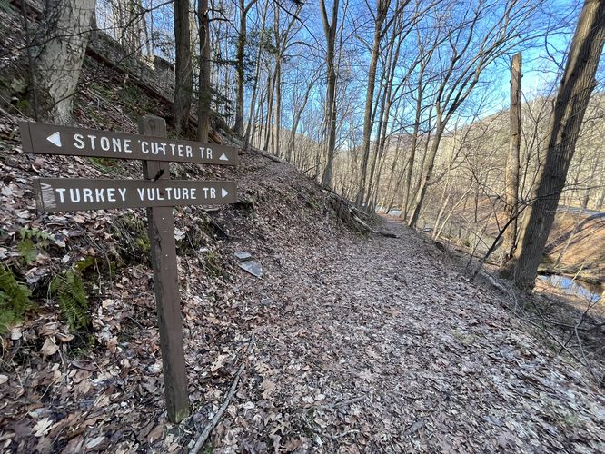
Around mile 0.4, hikers will reach an unmarked trail that leads uphill - this is the Stone Cutter Trail. Take a right-hand turn here to reach a junction with the Turkey Vulture Trail and the Stone Cutter Trail, but continue straight - heading up the mountain. Along the way, hikers will reach two junctions - first, with the Tiadaghton Trail, and second, with the Catamount Trail. Note that when the Stone Cutter Trail (blue blazes) reaches the Tiadaghton Trail (yellow blazes), both blaze markers can be found along this section of the mountain ridge, even beyond the junction with the Turkey Vulture Trail.
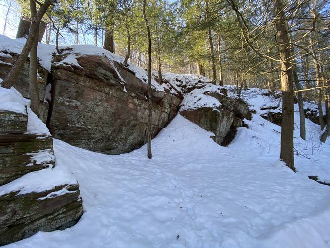
Obstructed Vista - Mile 0.95
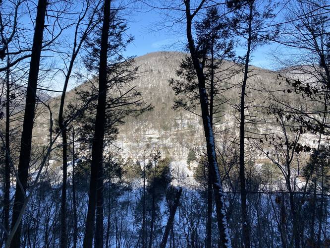
The hike up this mountain is not very easy, hence the 'Hard' difficulty; however, hikers may think they reached the first vista - around mile 0.95 - when they see a large rocky outcropping up the trail. This, however, is not the final destination, but rather an obstructed vista that gives hikers a decent view during the winter months at least.
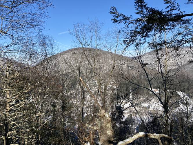
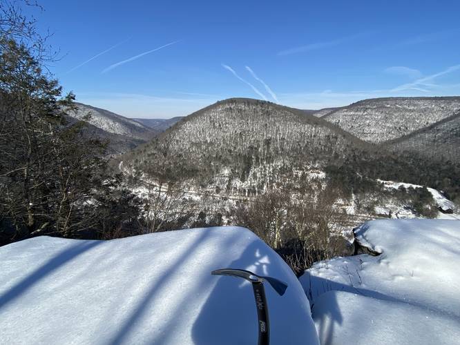
Stone Cutter Vista - Mile 1.1
After visiting the obstructed vista, the hike continues up a steep grade to reach the actual Stone Cutter Vista, which sits along both the Stone Cutter Trail and Tiadaghton Trail. Be careful as 3 sides of this rock outcropping have drop-offs. The Stone Cutter Vista (at least in the winter) gives hikers a view that spans about 180-degrees viewing north and south into Pine Creek (PA Grand Canyon). Since the outcropping point sits about 60% of the way up most of the surrounding mountains, it makes for a stunning view as the mountains feel like they tower over you just a little bit - while also feeling like you're on top of the world. Note that this name is unofficial - there's no sign or label for this vista; however, the Stone Cutter Trail follows the same path as the Tiadaghton Trail - passing this vista - so, hence the name.
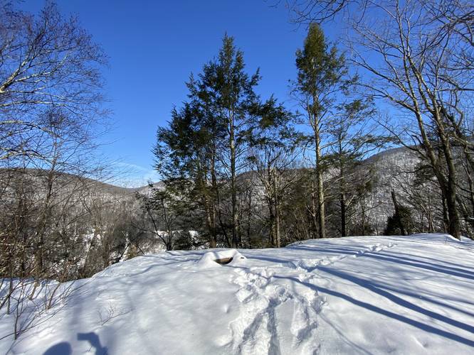
Reaching the Turkey Vulture Trail
After visiting the Stone Cutter Vista, hikers can choose to follow this loop and head toward the Turkey Vulture Trail (red blazes) whose junction can be found around mile 1.8. Along the way, during the winter, are obstructed views of the surrounding mountains which makes for additional scenery.
Turkey Vulture Trail to Pine Creek Trail
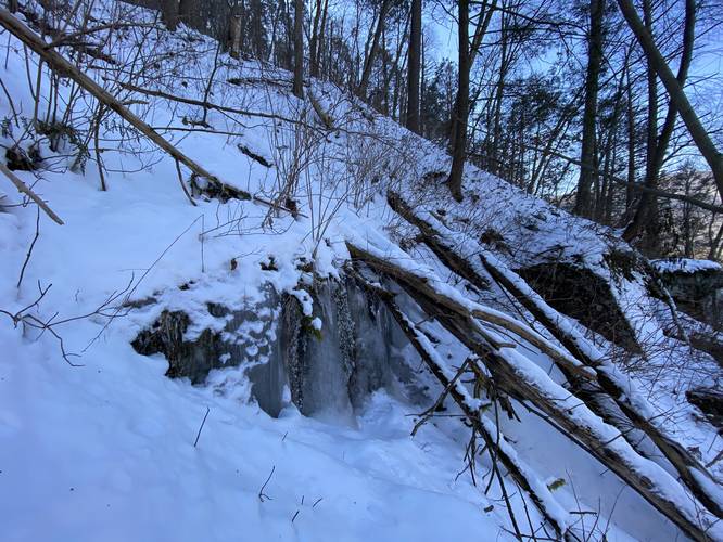
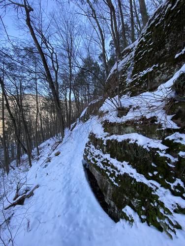
The Turkey Vulture Trail has a very steep elevation grade along the mountain side and follows many switchbacks before it straightens out and continues along a gradual slope. Watch your footing along the rocks, roots, and small uphill sections that this trail has to offer, especially because of the very steep slope. There are a couple of small vistas along this trail as well (between miles 2.5 and 2.65), which are labeled on the map. Additionally, there's a large rock outcropping - likely good for climbers - located along this trail, with a POI labeled on the map (mile 2.8). Last, there's even a small 4-foot waterfall located on this trail as well (mile 2.79).
Eventually the Turkey Vulture Trail will lead the hiker back to the first trail junction. Hop on the Pine Creek Trail and hike back to parking to complete this 3.7-mile loop hike.
Parking
Hikers will find parking at the coordinates provided; however, there's only enough space for 3 vehicles. Please respect the "no parking" signs where applicable and do not overcrowd the lot.
Pets
Dogs are allowed if leashed and their waste should be carried out by the hiker.
Warnings
Rattlesnakes: This trail follows many rock outcroppings which the Timber Rattlesnake calls home. Between the months of late-April and early-October, hikers may find these snakes on the trail or just off-trail. Watch your step and give any snakes you find plenty of space.
Steep terrain: This hike follows some very steep terrain and requires the proper footwear and gear including trekking poles and/or an ice axe and crampons for winter months. If planning to hike this in the winter, it may be smart to use an ice axe for the steeper slope sections in case of the rare need during self-arrest and crampons are a must-have.
Pine Creek Pinnacles (PCP20)
This hike is part of the Pine Creek Pinnacles hiking challenge. For more information, details, and FAQs, please visit our Pine Creek Pinnacles (PCP20) page.
Trails
This hike follows several named trails in order: Pine Creek Trail, Stone Cutter Trail (blue blazes), Tiadaghton Trail (yellow blazes), Turkey Vulture Trail (red blazes).
Hike Description
This hike begins at the Ramsey Bridge Access Parking lot for the Pine Creek Trail (note this lot only fits 3 vehicles as of January 2022) and follows the Pine Creek Trail heading south. Along the way is a beautiful old railroad bridge that the trail uses to cross over Pine Creek - here are some amazing views of the neighboring mountains.
Stone Cutter Trail - Mile 0.4
Around mile 0.4, hikers will reach an unmarked trail that leads uphill - this is the Stone Cutter Trail. Take a right-hand turn here to reach a junction with the Turkey Vulture Trail and the Stone Cutter Trail, but continue straight - heading up the mountain. Along the way, hikers will reach two junctions - first, with the Tiadaghton Trail, and second, with the Catamount Trail. Note that when the Stone Cutter Trail (blue blazes) reaches the Tiadaghton Trail (yellow blazes), both blaze markers can be found along this section of the mountain ridge, even beyond the junction with the Turkey Vulture Trail.
Obstructed Vista - Mile 0.95
The hike up this mountain is not very easy, hence the 'Hard' difficulty; however, hikers may think they reached the first vista - around mile 0.95 - when they see a large rocky outcropping up the trail. This, however, is not the final destination, but rather an obstructed vista that gives hikers a decent view during the winter months at least.
Stone Cutter Vista - Mile 1.1
After visiting the obstructed vista, the hike continues up a steep grade to reach the actual Stone Cutter Vista, which sits along both the Stone Cutter Trail and Tiadaghton Trail. Be careful as 3 sides of this rock outcropping have drop-offs. The Stone Cutter Vista (at least in the winter) gives hikers a view that spans about 180-degrees viewing north and south into Pine Creek (PA Grand Canyon). Since the outcropping point sits about 60% of the way up most of the surrounding mountains, it makes for a stunning view as the mountains feel like they tower over you just a little bit - while also feeling like you're on top of the world. Note that this name is unofficial - there's no sign or label for this vista; however, the Stone Cutter Trail follows the same path as the Tiadaghton Trail - passing this vista - so, hence the name.
Reaching the Turkey Vulture Trail
After visiting the Stone Cutter Vista, hikers can choose to follow this loop and head toward the Turkey Vulture Trail (red blazes) whose junction can be found around mile 1.8. Along the way, during the winter, are obstructed views of the surrounding mountains which makes for additional scenery.
Turkey Vulture Trail to Pine Creek Trail
The Turkey Vulture Trail has a very steep elevation grade along the mountain side and follows many switchbacks before it straightens out and continues along a gradual slope. Watch your footing along the rocks, roots, and small uphill sections that this trail has to offer, especially because of the very steep slope. There are a couple of small vistas along this trail as well (between miles 2.5 and 2.65), which are labeled on the map. Additionally, there's a large rock outcropping - likely good for climbers - located along this trail, with a POI labeled on the map (mile 2.8). Last, there's even a small 4-foot waterfall located on this trail as well (mile 2.79).
Eventually the Turkey Vulture Trail will lead the hiker back to the first trail junction. Hop on the Pine Creek Trail and hike back to parking to complete this 3.7-mile loop hike.
Parking
Hikers will find parking at the coordinates provided; however, there's only enough space for 3 vehicles. Please respect the "no parking" signs where applicable and do not overcrowd the lot.
Pets
Dogs are allowed if leashed and their waste should be carried out by the hiker.
Warnings
Rattlesnakes: This trail follows many rock outcroppings which the Timber Rattlesnake calls home. Between the months of late-April and early-October, hikers may find these snakes on the trail or just off-trail. Watch your step and give any snakes you find plenty of space.
Steep terrain: This hike follows some very steep terrain and requires the proper footwear and gear including trekking poles and/or an ice axe and crampons for winter months. If planning to hike this in the winter, it may be smart to use an ice axe for the steeper slope sections in case of the rare need during self-arrest and crampons are a must-have.
Pine Creek Pinnacles (PCP20)
This hike is part of the Pine Creek Pinnacles hiking challenge. For more information, details, and FAQs, please visit our Pine Creek Pinnacles (PCP20) page.