Pine Cliff Vista via Bob Webber Trail at Tiadaghton State Forest near Cammal, Pennsylvania is a difficult 1.7-mile out-and-back hike that leads to a stunning views of the PA Grand Canyon. The Pine Cliff Vista provides views of Pine Creek, PA Half Dome (Half Dome Mtn), and Hemlock Mountain.
Trails
This hike follows two name trails: Bob Webber Trail (yellow blazes), Pine Cliff Trail (blue blazes).
Hike Description
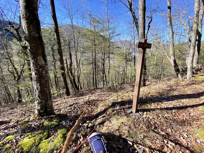
This hike begins at the trailhead for the Bob Webber Trail and follows the yellow blazes of that trail uphill for about 0.7-miles before hikers will reach a junction with the Pine Cliff Trail. Note that along the way, hikers will face some steep uphill sections, so trekking poles are recommended on this hike as the downhill can be slippery in spots.
Pine Cliff Trail - Mile 0.7
Around mile 0.7, hikers will reach a junction with the Pine Cliff Trail. This trail is difficult to see - the path is very very skinny covered in leaves. The trail initially plummets off of the Bob Webber Trail and then quickly "levels out" slightly as it heads downhill. That "leveling out" does not last long as this section of the Pine Cliff Trail becomes very very steep and slippery. Trekking poles help tremendously here as you follow the skinny path down the mountain to reach the cliff vista. Note that to reach the vista, simply stay "left" along the main path on your way down - do not take any sharp turns, just continue going down straight because the Pine Cliff Trail does make a sharp right-hand turn to continue to reach Wolf Run below (see the Pine Cliff Trail & Waterfalls write-up for that section)
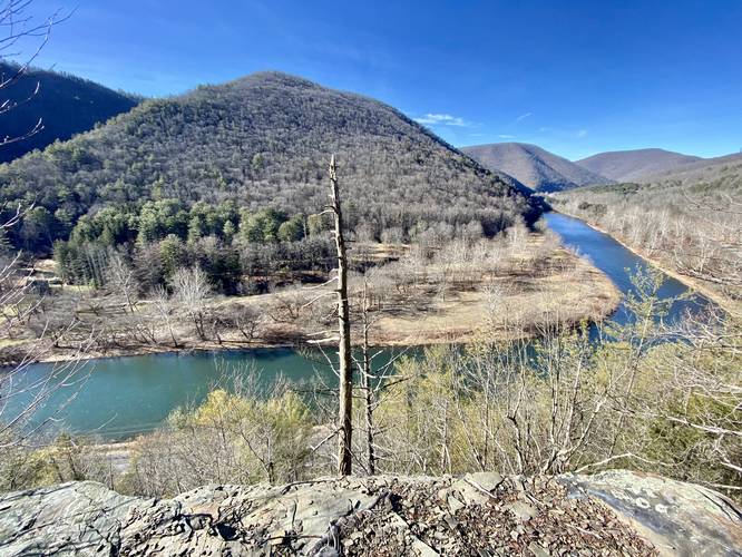
Pine Cliff Vista - Mile 0.85
Finally, just before the hiker reaches the main vista for Pine Cliff, they'll reach an overgrowth of pine trees at a rocky outcropping. Between the rocks and the trees is a nice view as you approach. Hike beyond the rocky outcropping to find a large flat rocky cliff with stunning views of the PA Grand Canyon. From the Pine Cliff Vista, hikers get views of Pine Creek below as it winds its way through the canyon. In the distance lies Half Dome Mountain (aka PA Half Dome) and Hemlock Mountain located to the right of PA Half Dome. As someone who's hiked both mountains (with PA Half Dome twice now) this vista is quite the reward to stare back at your accomplishments.
Hiking Back
Note that the hike back to parking is not easy. First, the hike up from the Pine Cliff Vista is short, but very steep, so take your time. Last, the hike down on the Bob Webber Trail from the Pine Cliff Trail can be a bit steep in sections too, so trekking poles will help along the way.
Parking
Hikers will find parking at the coordinates provided at the Ross Run Access Area along the Pine Creek Trail.
Pets
Dogs are allowed if leashed and their waste should be carried out by the hiker.
Difficulty
This trail is rated as 'Hard' because of the difficult elevation grade.
Trails
This hike follows two name trails: Bob Webber Trail (yellow blazes), Pine Cliff Trail (blue blazes).
Hike Description
This hike begins at the trailhead for the Bob Webber Trail and follows the yellow blazes of that trail uphill for about 0.7-miles before hikers will reach a junction with the Pine Cliff Trail. Note that along the way, hikers will face some steep uphill sections, so trekking poles are recommended on this hike as the downhill can be slippery in spots.
Pine Cliff Trail - Mile 0.7
Around mile 0.7, hikers will reach a junction with the Pine Cliff Trail. This trail is difficult to see - the path is very very skinny covered in leaves. The trail initially plummets off of the Bob Webber Trail and then quickly "levels out" slightly as it heads downhill. That "leveling out" does not last long as this section of the Pine Cliff Trail becomes very very steep and slippery. Trekking poles help tremendously here as you follow the skinny path down the mountain to reach the cliff vista. Note that to reach the vista, simply stay "left" along the main path on your way down - do not take any sharp turns, just continue going down straight because the Pine Cliff Trail does make a sharp right-hand turn to continue to reach Wolf Run below (see the Pine Cliff Trail & Waterfalls write-up for that section)
Pine Cliff Vista - Mile 0.85
Finally, just before the hiker reaches the main vista for Pine Cliff, they'll reach an overgrowth of pine trees at a rocky outcropping. Between the rocks and the trees is a nice view as you approach. Hike beyond the rocky outcropping to find a large flat rocky cliff with stunning views of the PA Grand Canyon. From the Pine Cliff Vista, hikers get views of Pine Creek below as it winds its way through the canyon. In the distance lies Half Dome Mountain (aka PA Half Dome) and Hemlock Mountain located to the right of PA Half Dome. As someone who's hiked both mountains (with PA Half Dome twice now) this vista is quite the reward to stare back at your accomplishments.
Hiking Back
Note that the hike back to parking is not easy. First, the hike up from the Pine Cliff Vista is short, but very steep, so take your time. Last, the hike down on the Bob Webber Trail from the Pine Cliff Trail can be a bit steep in sections too, so trekking poles will help along the way.
Parking
Hikers will find parking at the coordinates provided at the Ross Run Access Area along the Pine Creek Trail.
Pets
Dogs are allowed if leashed and their waste should be carried out by the hiker.
Difficulty
This trail is rated as 'Hard' because of the difficult elevation grade.